30 Most Crowded Cities in the World
July 24, 2017 by Joseph GedeonBy 2050, 66% of the world’s population will live in urban areas. But what drives someone to leave a rural region to move to the big city? Most people choose to migrate for economic reasons, access to health care, technological advancements, and to be part of modern urban life.
But the dreams of a better life and the reality of migration don’t always align. Slums, traffic congestion, poor health, and overcrowding is usually the result of mass urbanization to cities that aren’t prepared to deal with a population influx. In fact, urbanization may be partially causing one city on this list to literally sink.
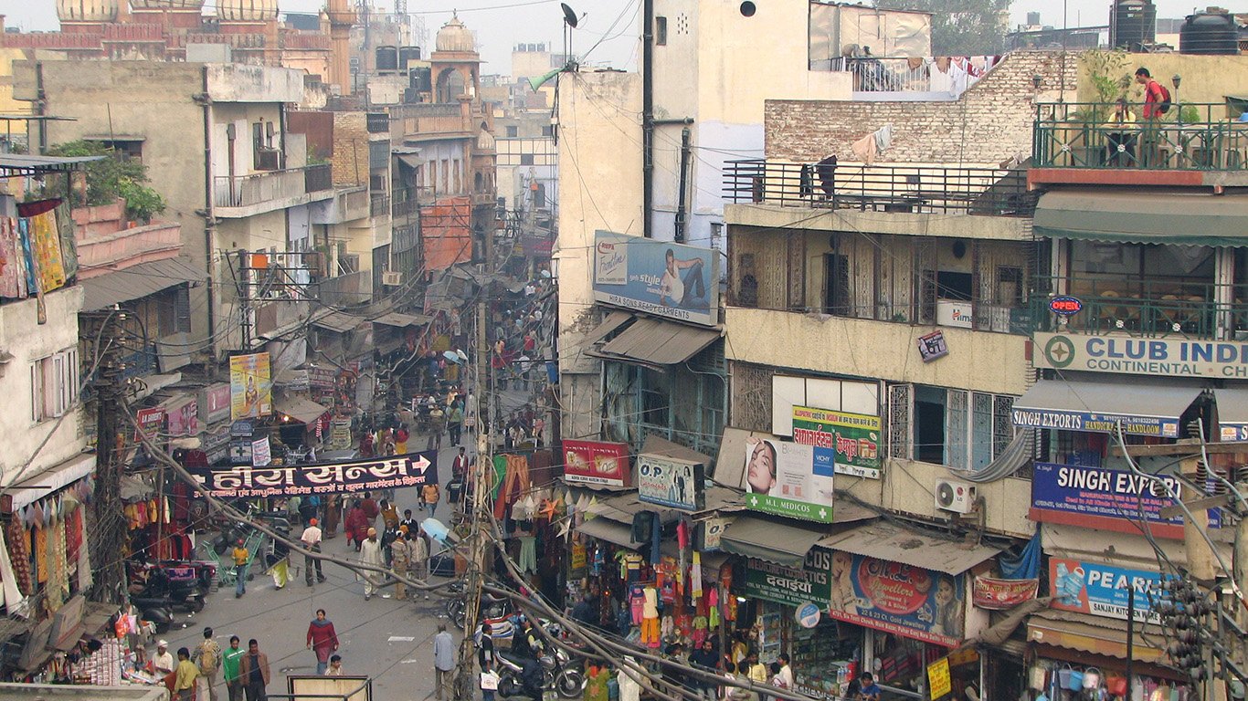
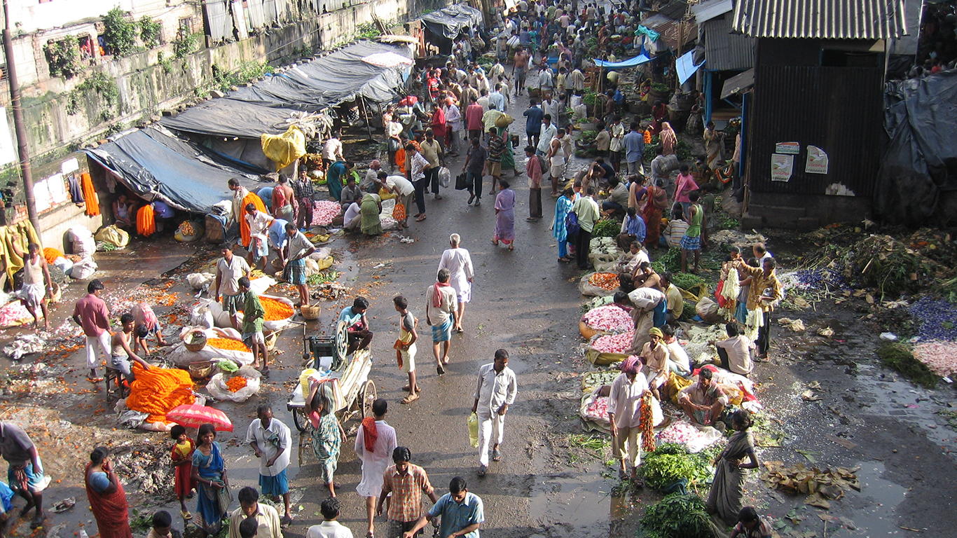
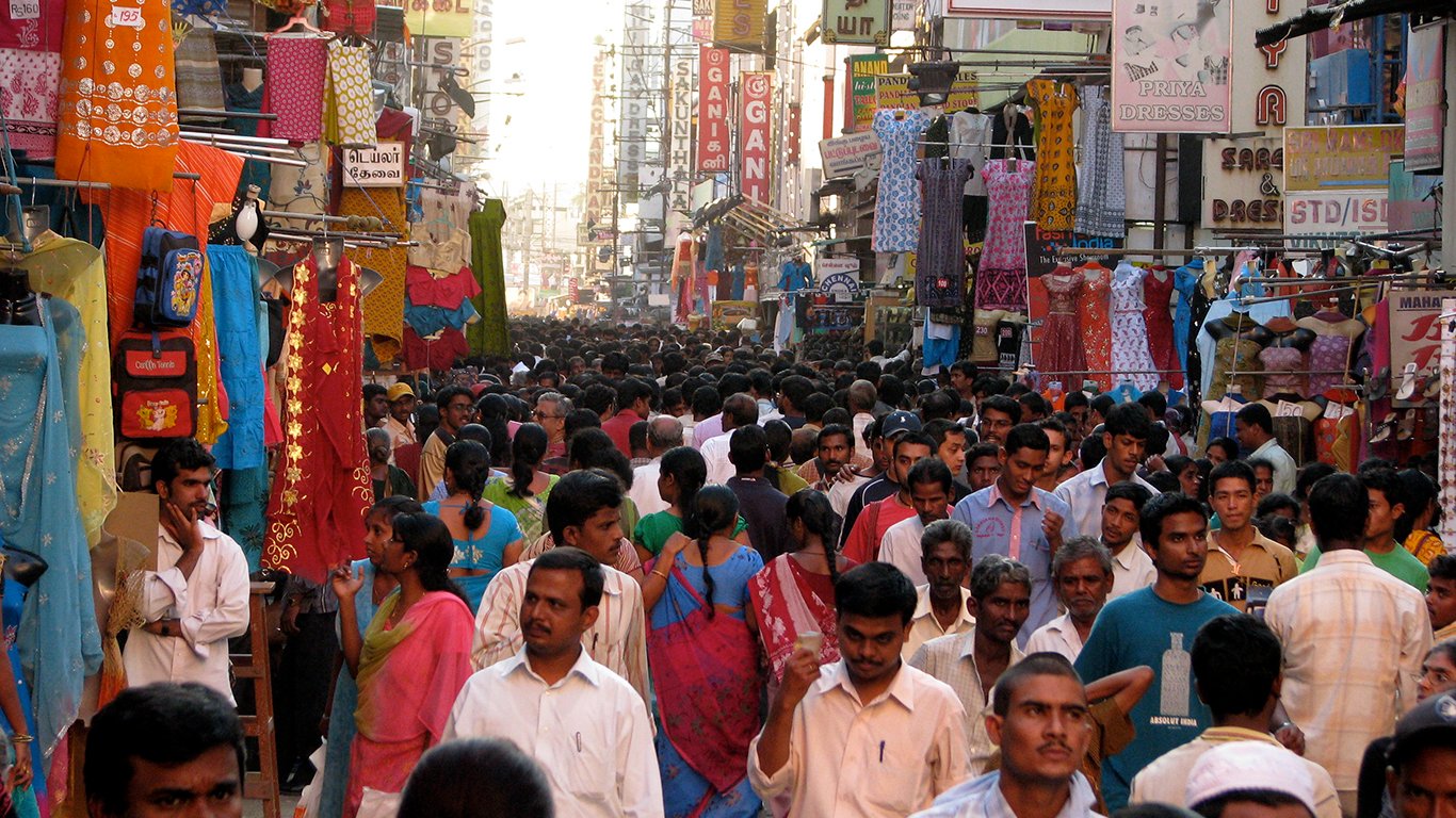
India, the most common country to make the list, has a population density of 171.9 people per square mile. In comparison, the United States’ population density is 13.5 people per square mile. Over 85% of this list consists of Asian cities.
While two European cities made the list — Paris and Barcelona — only one U.S. city did. Can you guess which one?
Click here to see the 30 most crowded cities in the world.
Click here to see our methodology.
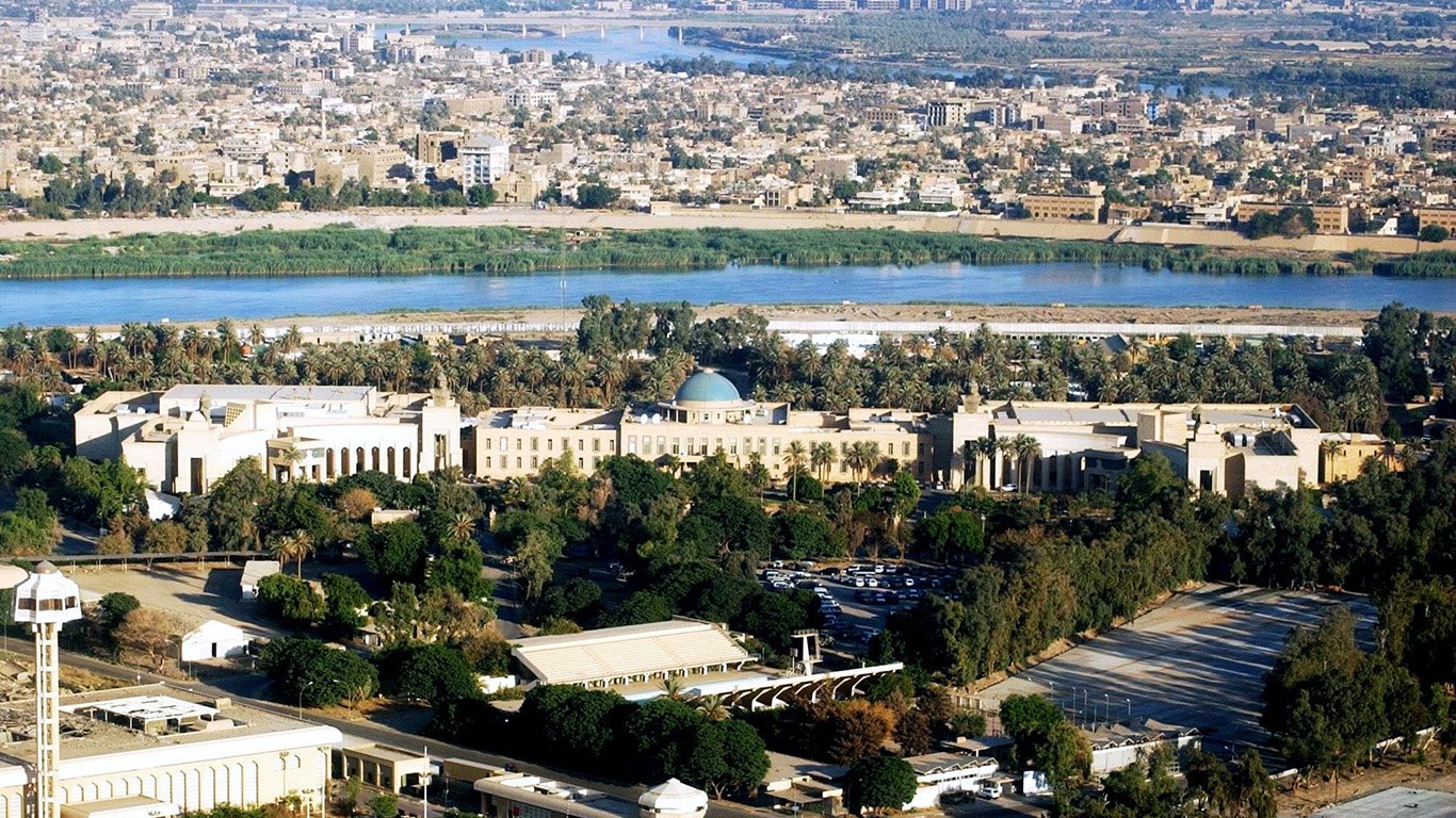
30. Baghdad, Iraq
> People per square mile: 28,278
> Population: 1.2 million
> Land area: 42.86 square miles
> Population change, 2005-2015: 24.7%
After being ravaged by war, the population of Baghdad — one of the largest cities in the region — has grown tremendously over the past decade. According to estimates by the UN, Baghdad’s population grew despite constant fighting.
[in-text-ad]
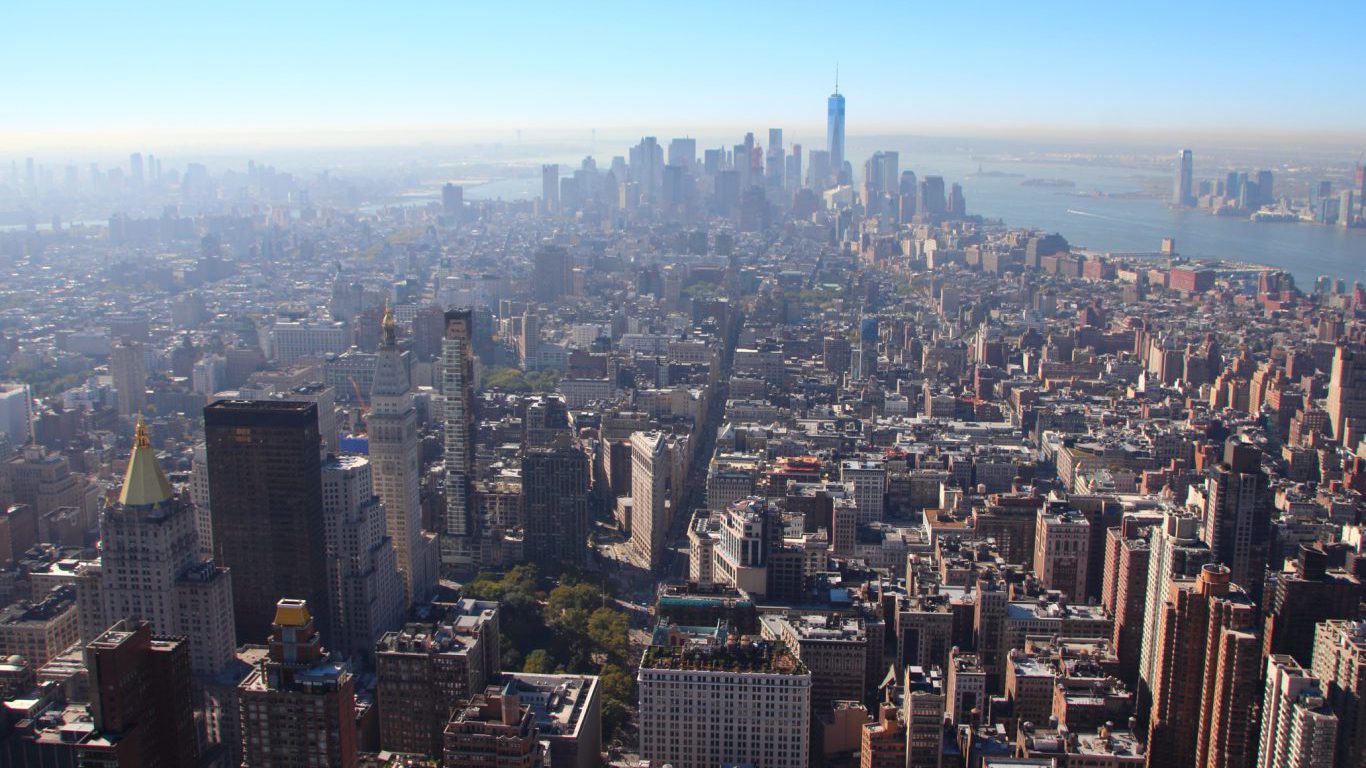
29. New York, United States of America
> People per square mile: 28,363
> Population: 8.6 million
> Land area: 301.47 square miles
> Population change, 2005-2015: 2.8%
The densest city in America and a world financial center, New York’s population has continued to grow even though it is now completely unaffordable for the typical American household. The city’s most crowded neighborhood is the Upper East Side, with nearly 210,000 people. The Big Apple is home to over 700 skyscrapers and the sixth-tallest building in the world, One World Trade Center, which stands at 1,776 feet.
 24/7 Wall St.
28. Indore, India
> People per square mile: 29,347
> Population: 1.5 million
> Land area: 50.26 square miles
> Population change, 2005-2015: 31.9%
The largest city in the Indian state of Madhya Pradesh, Indore is one of many Indian cities among the most densely populated in the world. The densest parts of Indore are in the central part of the city in Wards 24, 18, and 15.
27. Kalyan, India
> People per square mile: 29,561
> Population: 1.2 million
> Land area: 40.37 square miles
> Population change, 2005-2015: N/A
With a highly regarded road and rail system, the west Indian city of Kalyan specializes in the manufacturing and trade of chemicals, synthetics, and electrical equipment as part of India’s Greater Mumbai urban agglomeration. An area of 2,054 acres in Kalyan West has been prioritized for development in response to the massive urban density. This project will focus on affordable housing, waterfront development, improving transit, and more.
[in-text-ad-2]
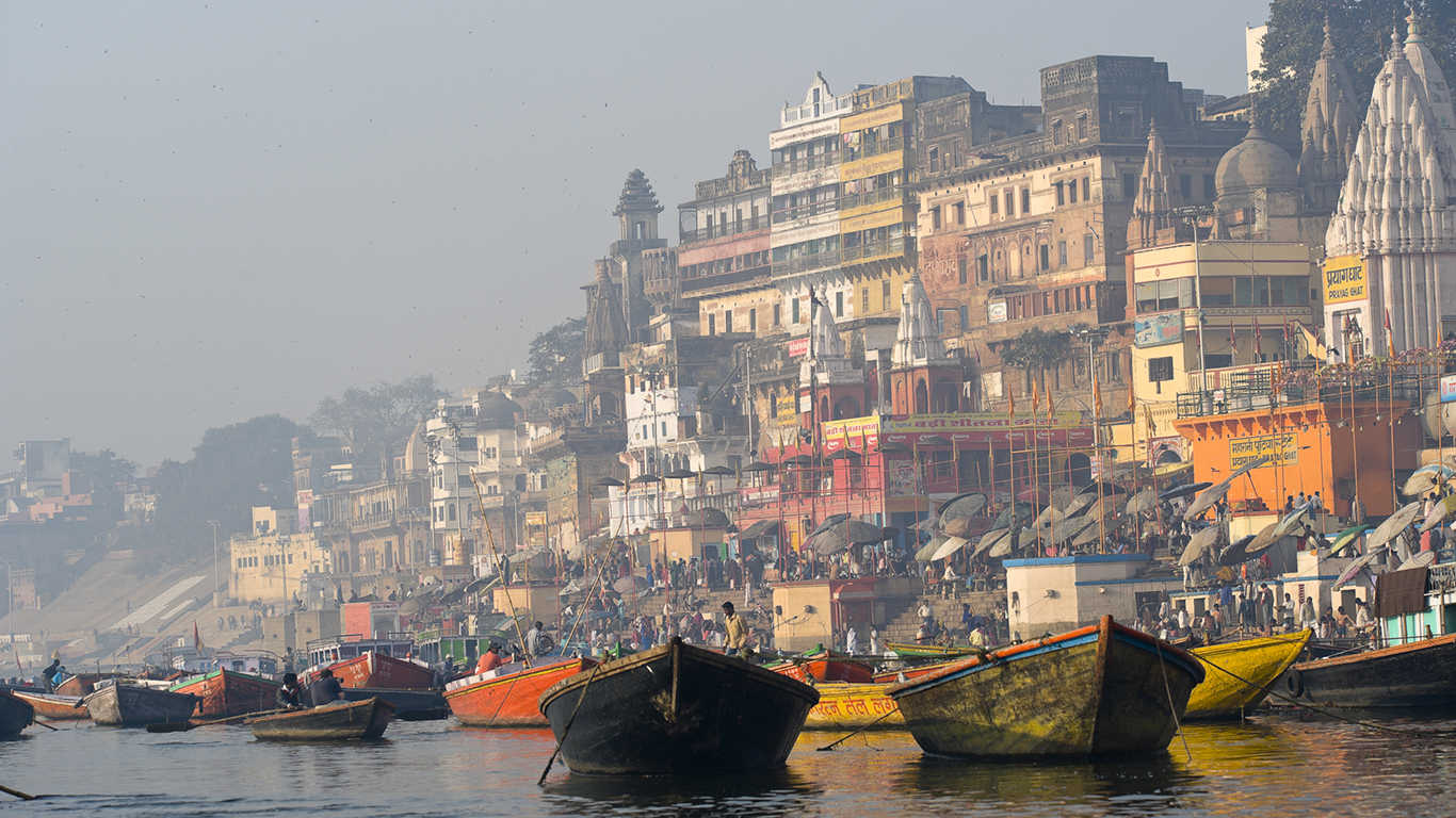
26. Varanasi, India
> People per square mile: 30,773
> Population: 1.1 million
> Land area: 35.48 square miles
> Population change, 2005-2015: 18.2%
Varanasi is a city in the Indian state of Uttar Pradesh of approximately 1.1 million residents. In addition to the city’s large local population, Varanasi is home to a number of holy sites, which help attract an estimated 2.8 million foreign tourists to the city each year. To accommodate the city’s expanding population and large tourism industry, Varanasi is constructing a rapid transit metro system that will span 18 miles across 26 stations, to be completed by 2020.
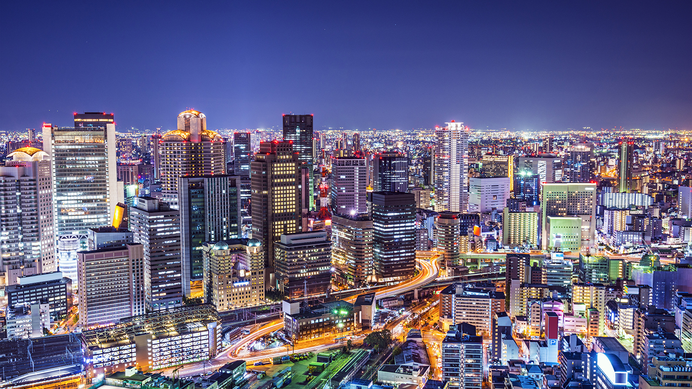
25. Osaka, Japan
> People per square mile: 31,029
> Population: 2.7 million
> Land area: 85.90 square miles
> Population change, 2005-2015: 7.9%
Osaka, along with Kyoto and Kobe, is the center of the Keihanshin Industrial Zone — the second largest urban and industrial agglomeration in Japan. This includes being home to numerous universities and colleges. With over 2.5 million people living within 86 square miles, the grid-like coastal city acts as a hub for the national railway network and has two major airports.
[in-text-ad]
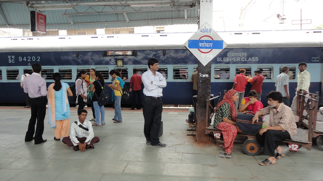
24. Vadodara, India
> People per square mile: 31,250
> Population: 1.3 million
> Land area: 41.80 square miles
> Population change, 2005-2015: 21.5%
The population of the historic western Indian city of Vadodara has grown considerably in recent years. The nucleus of the city was built in the 15th century, boasting palaces, avenues, and parks. The city is also home to the Maharaja Sayajirao University of Baroda, which consistently ranks as one of India’s best universities. To address present-day urban growth, the Vadodara Urban Development Authority constructed almost 4,000 houses and 50 shops in the economically weaker section of the city.
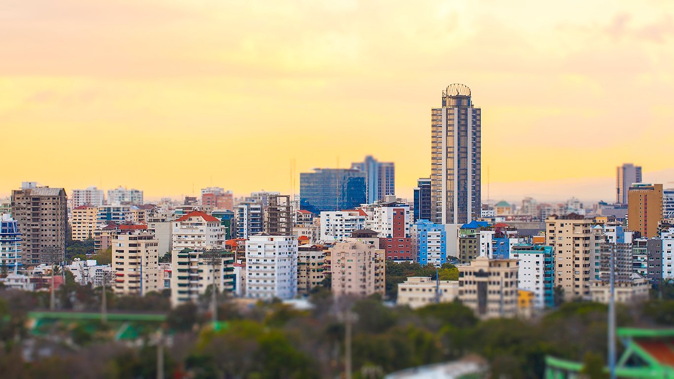
23. Santo Domingo, Dominican Republic
> People per square mile: 32,056
> Population: 1.1 million
> Land area: 35.14 square miles
> Population change, 2005-2015: 28.2%
Santo Domingo is the largest city in the Dominican Republic and the Caribbean as a whole. As the country’s main commercial center, much of the increased economic activity in the Dominican Republic is reflected in Santo Domingo’s recent construction boom. The 521 ft Torre Anacaona 27, the tallest building in the city, was completed in August 2016. While Santo Domingo has facilitated sustainable, high-density development in recent years, the city has an extensive slum population that remains a challenge for the city’s well-being.
22. Tangerang, Indonesia
> People per square mile: 34,444
> Population: 2.0 million
> Land area: 59.43 square miles
> Population change, 2005-2015: N/A
Just outside Jakarta, the capital of Indonesia lies Tangerang, a city that’s attracted migrants because of its recent economic growth. The city has become increasingly appealing for real estate investment, with one developer launching a project to accommodate 18,000 workers and low-income citizens through 6,000 units.
[in-text-ad-2]
21. Patna, India
> People per square mile: 35,586
> Population: 1.4 million
> Land area: 38.40 square miles
> Population change, 2005-2015: 19.6%
Patna is the largest city in Bihar, a state in the northern part of India along the border with Nepal. Patna is also Bihar’s capital. With a population of 1.4 million people, Patna isn’t even among the 10 largest cities in India, but it is one of the more densely populated ones.
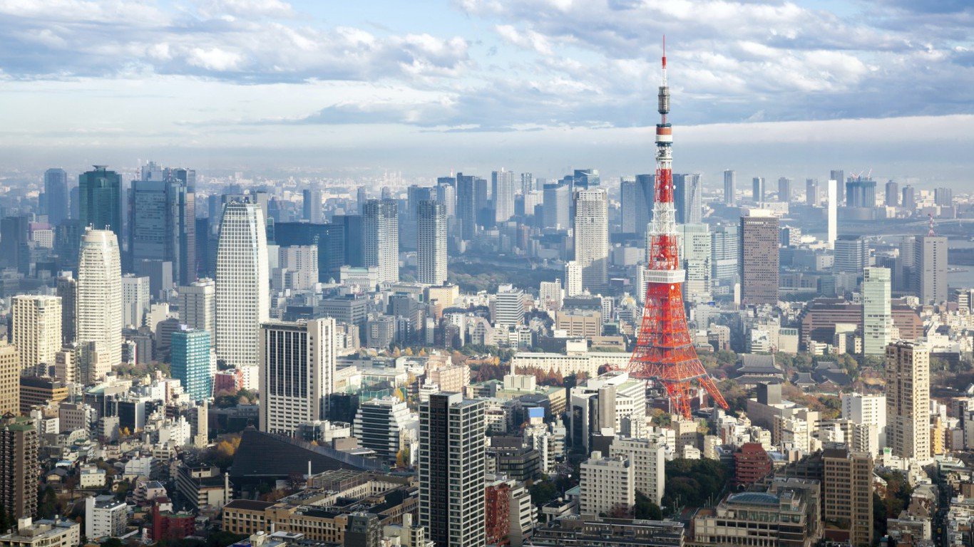
20. Tokyo, Japan
> People per square mile: 37,260
> Population: 8.9 million
> Land area: 240.09 square miles
> Population change, 2005-2015: 6.7%
One of the largest cities in the world, Tokyo’s population continues to grow despite the average family size shrinking. According to Japan’s most recent national census, the continuing population growth may be due to the number of elderly people increasing by 3.7% over five years, accounting for 22.9% of Tokyo’s population. The metropolitan area is the largest industrial, commercial, and financial center in Japan, with many international corporations headquartered in the city center.
[in-text-ad]
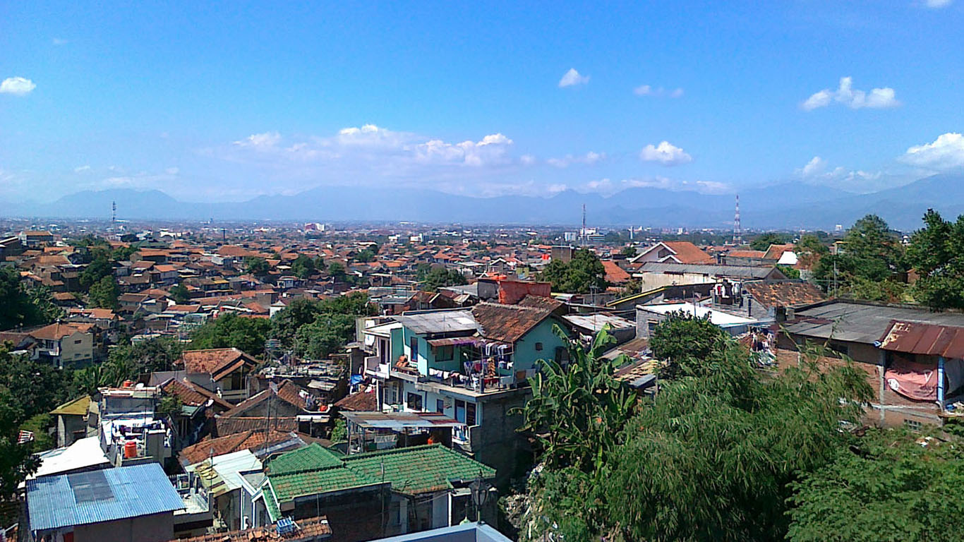
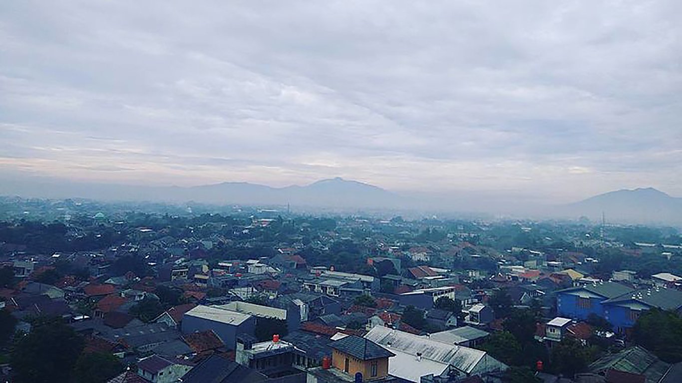
19. Bandung, Indonesia
> People per square mile: 38,204
> Population: 2.5 million
> Land area: 64.95 square miles
> Population change, 2005-2015: 12.3%
Bandung – Indonesia’s third-largest city — is one of the many highly populated areas in Southeast Asia. Located close to the metropolis and capital city of Jakarta and with a population of 2.5 million, Bandung has about the same population of the metropolitan area of Denver but is packed into an area one-128th the size.
Bandung is one of the most creative, highly-educated Indonesian cities. According to UNESCO, 56% of the city’s economic activity is related to design in some way.
 24/7 Wall St.
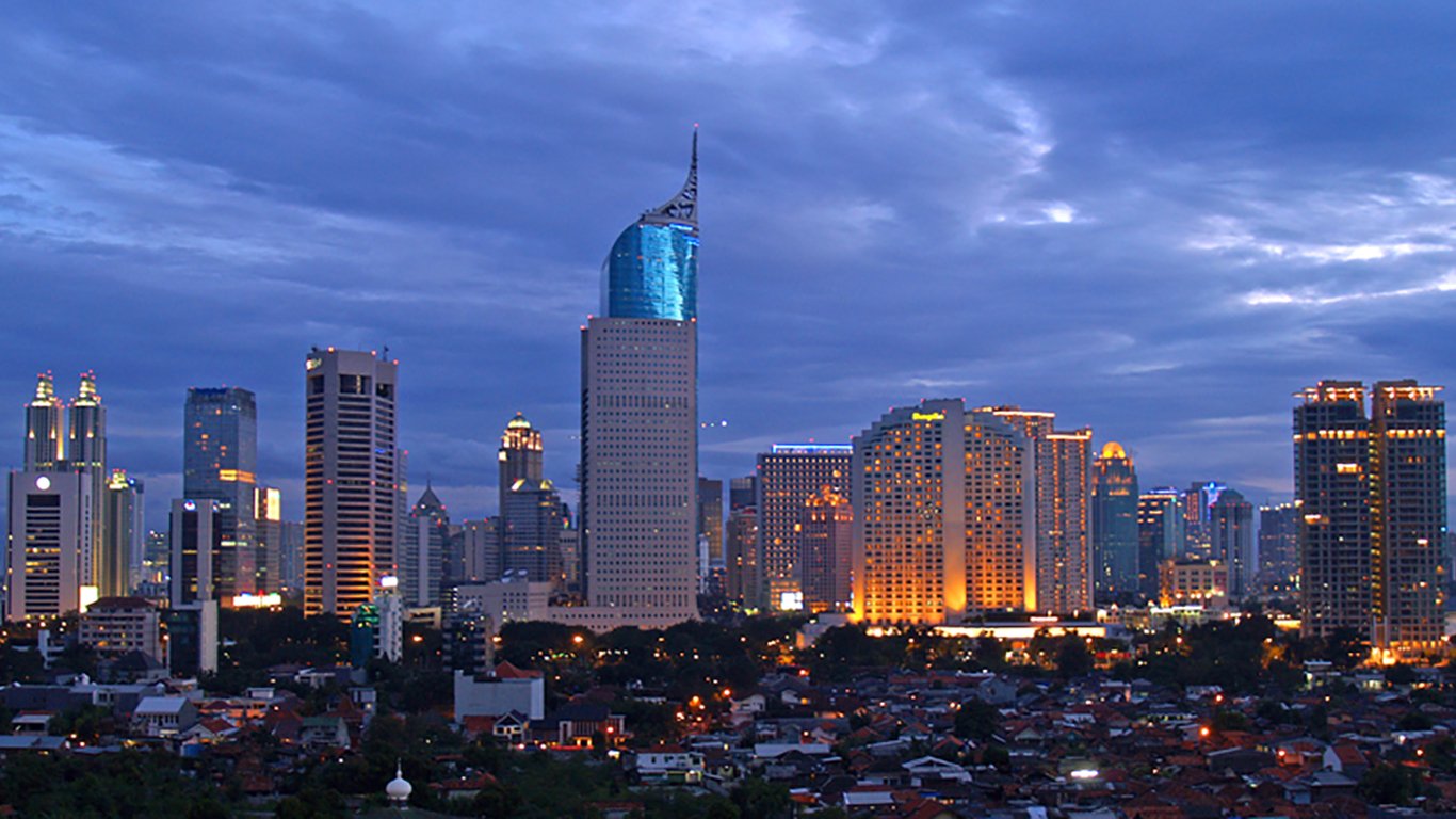
18. Jakarta, Indonesia
> People per square mile: 40,237
> Population: 10.2 million
> Land area: 252.37 square miles
> Population change, 2005-2015: 14.8%
Jakarta — one of the most densely-populated cities in the world — may be losing its status as Indonesia’s capital. Located on the world’s most populated island of Java, Jakarta is already 40% below sea level with areas north of the city sinking at up to 20 cm a year. The city has decided to combat this by building a 15-mile seawall, refurbishing the crumbling flood canal system and constructing new islands for shopping.
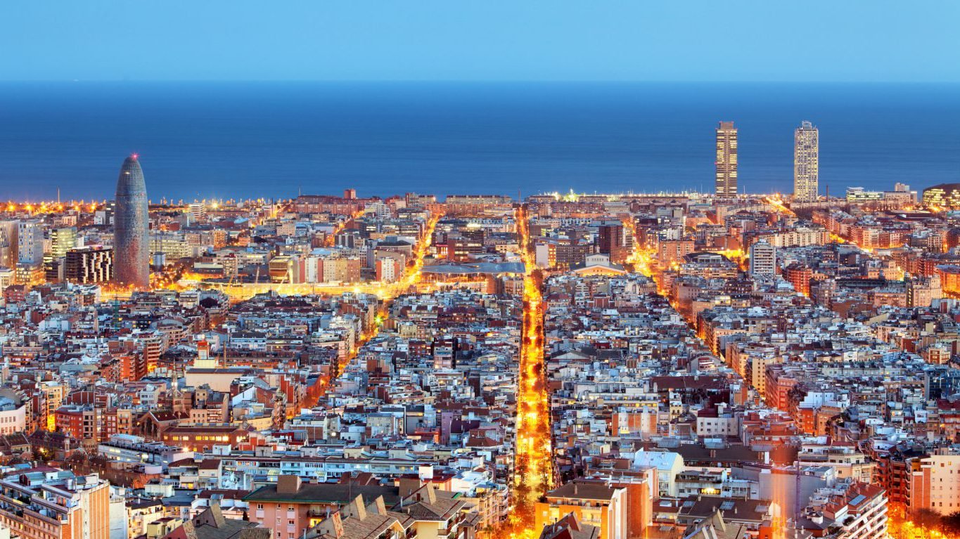
17. Barcelona, Spain
> People per square mile: 40,506
> Population: 1.6 million
> Land area: 39.68 square miles
> Population change, 2005-2015: 14.0%
The historic city of Barcelona is a world-leading sport, arts, science, fashion, and commerce center. Barcelona recently rolled out a re-greening program called “Plan of the Green and Biodiversity Barcelona 2020” that will deliver 108 acres of new green space in the city by 2019 and over 400 acres by 2020. The plan will give each citizen nearly 11 square feet of extra green space on average.
[in-text-ad-2]
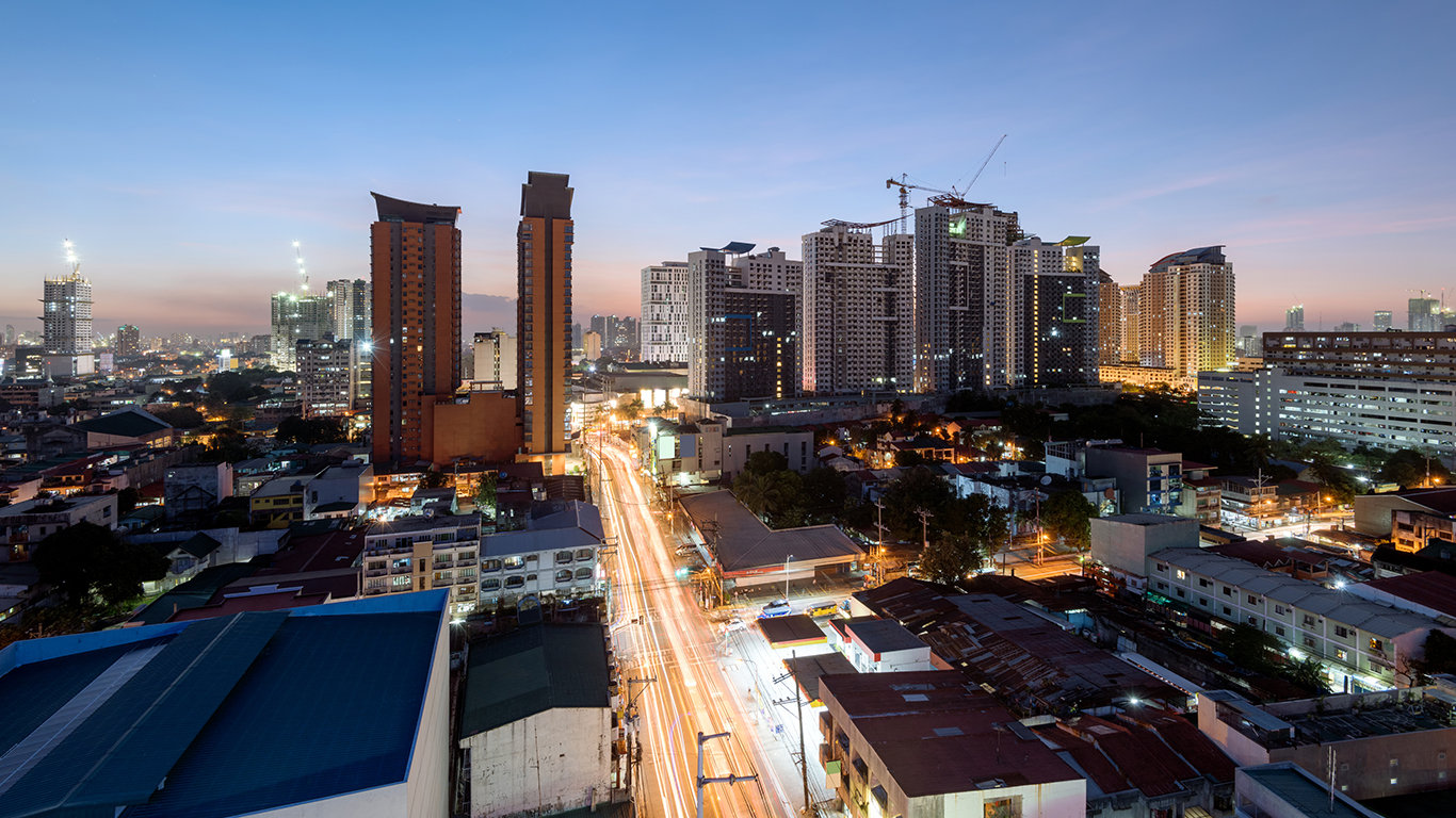
16. Quezon City, Philippines
> People per square mile: 41,656
> Population: 2.8 million
> Land area: 66.30 square miles
> Population change, 2005-2015: N/A
Quezon City, the most populous city in the Philippines, is a highly dense urbanized area that faces environmental issues due to insufficient waste management for its large population. In fact, Quezon City generates about 2,000 to 3,000 tons of garbage daily. Across the country, an estimated 20% of all generated waste goes uncollected.
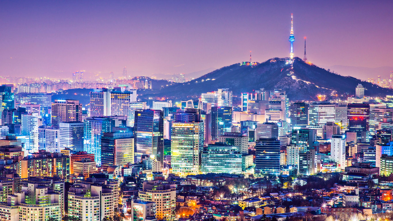
15. Seoul, Republic of Korea
> People per square mile: 42,198
> Population: 9.9 million
> Land area: 233.67 square miles
> Population change, 2005-2015: -0.5%
With almost 10 million people living in a city the size of Chicago, Seoul’s housing shortage is a serious problem. As a result of the shortage, many residential houses have been built in the suburban areas of the city. To deal with the city’s changing landscape, Seoul has implemented the 2030 Seoul Plan, which establishes 140 neighborhood zones and divides the main city center into three parts — an historic district, a business district, and a financial district.
[in-text-ad]
14. Delhi, India
> People per square mile: 46,180
> Population: 9.9 million
> Land area: 213.93 square miles
> Population change, 2005-2015: 37.7%
Delhi is the territory spanning Old Delhi and New Delhi, India’s capital to the south. Delhi’s layout is a mixture of old, narrow, winding roads and newer, wider roads that can better accommodate the city’s increasing automobile traffic. In response to the rising population density and transportation demand, the National Highways Authority of India recently granted approval for the construction of a rapid transit system worth an estimated $8.6 billion.
 24/7 Wall St.
13. Ahmedabad, India
> People per square mile: 47,773
> Population: 3.5 million
> Land area: 73.68 square miles
> Population change, 2005-2015: 40.2%
Ahmedabad is an old city that has been given new life as its population increased by over 40% since 2005. The 600 year-old city, which is most notable as the origin of Mahatma Gandhi’s freedom struggle, today is home to substantial Hindu, Muslim, and Jain populations. Because of its architecture and historical importance, Ahmedabad was recently declared India’s first UNESCO World Heritage City.
12. Howrah, India
> People per square mile: 50,435
> Population: 1.0 million
> Land area: 19.98 square miles
> Population change, 2005-2015: N/A
Howrah is Calcutta’s largest satellite city and the second largest metropolis in the Indian state of West Bengal. One of the largest problems facing Howrah is rampant air pollution, which affects an estimated 63% of the city’s population. Particle air pollution in Howrah is five times worse than it is in the San Jose-San Francisco-Oakland region — one of the most polluted areas in the United States.
[in-text-ad-2]
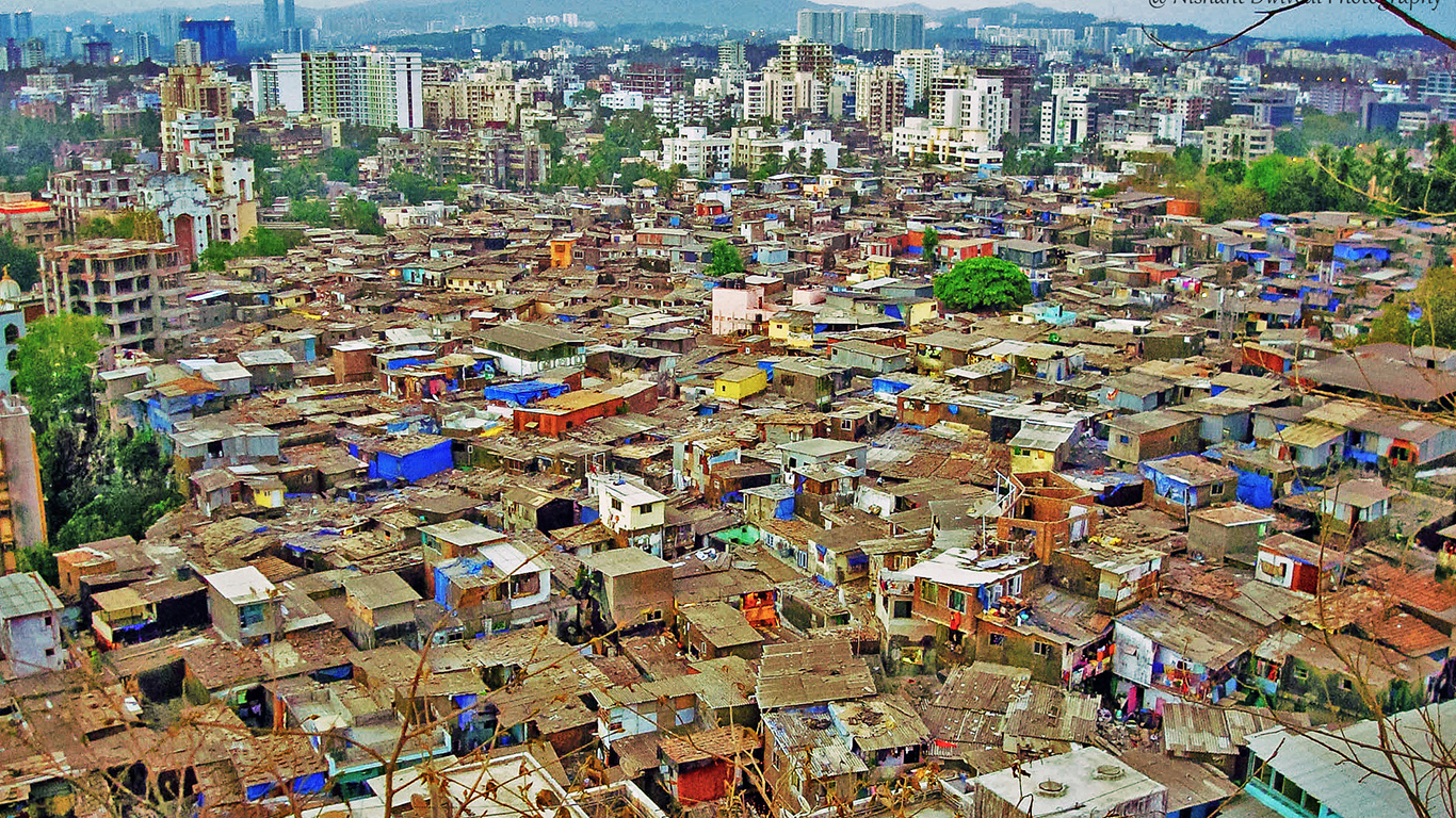
11. Mumbai, India
> People per square mile: 51,449
> Population: 12.0 million
> Land area: 232.82 square miles
> Population change, 2005-2015: 17.6%
Mumbai’s high population density is primarily due to the city’s large slum population. Nearly half of the population of Mumbai lives in overcrowded and unsanitary slum neighborhoods that comprise just 8% of the city’s total geographic area. As the city’s poor population increases and the stock of middle-income housing is increasingly diminished, businesses have found it more difficult to attract skilled, mid-level employees. To stop the flow of incoming unskilled labor to the city, planners have banned the development and expansion of industrial units inside the city, but with little success.
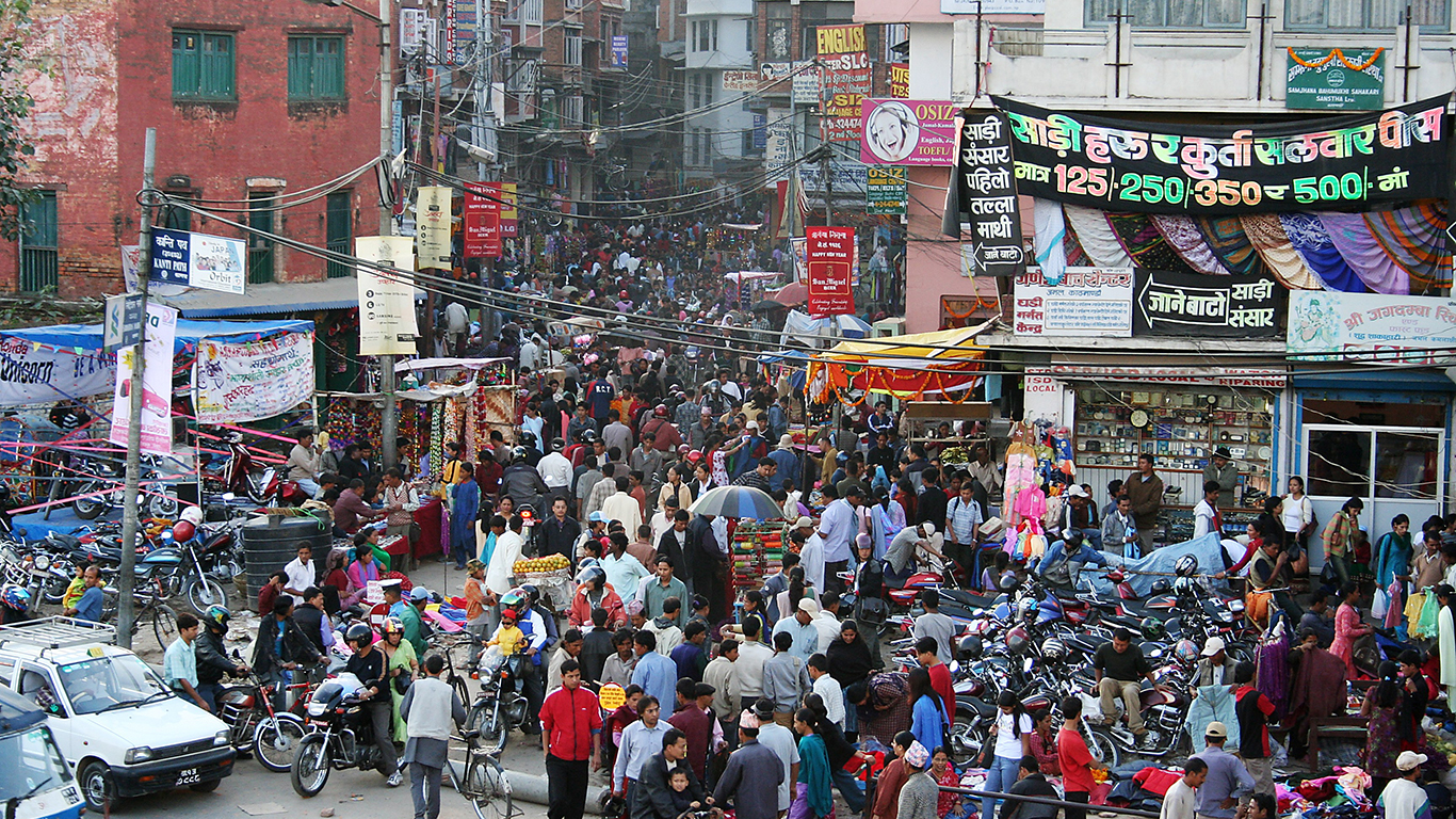
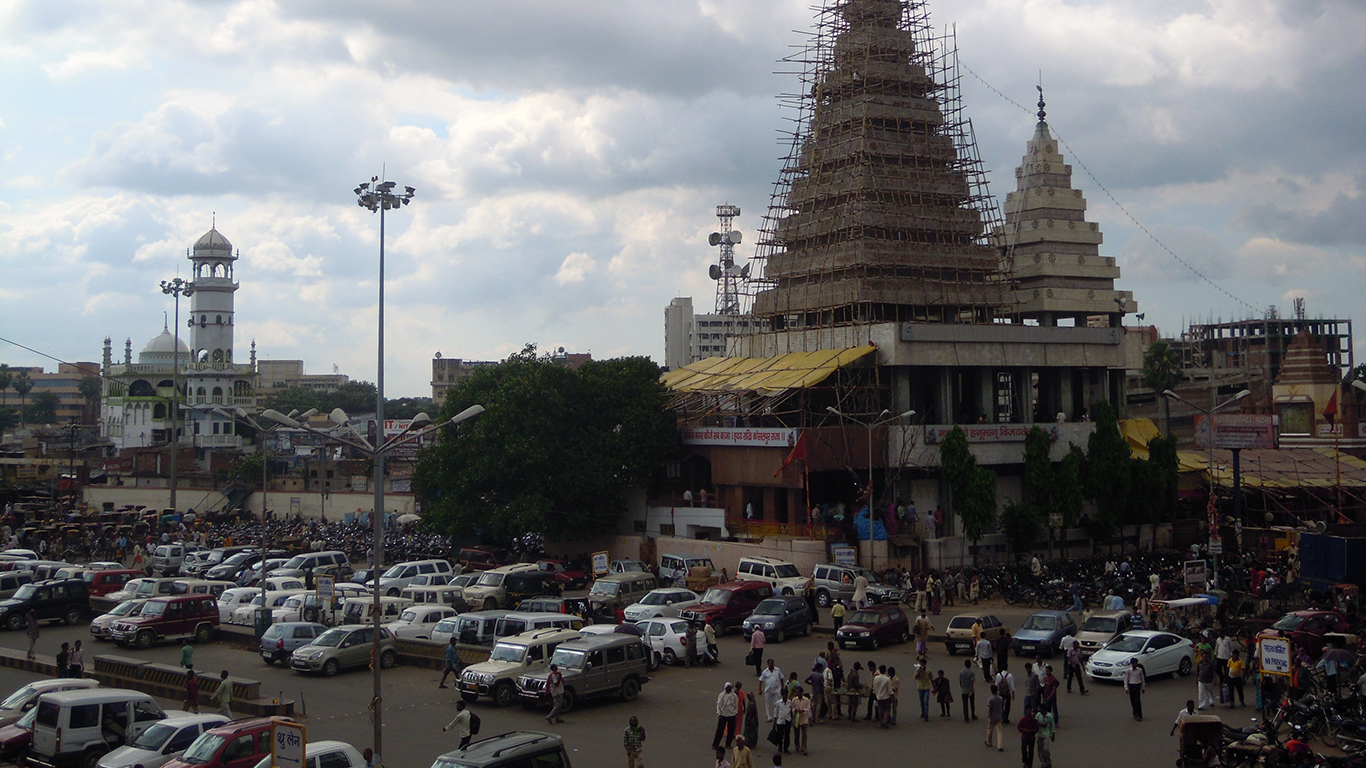
10. Kathmandu, Nepal
> People per square mile: 53,031
> Population: 1.0 million
> Land area: 18.92 square miles
> Population change, 2005-2015: 49.1%
Due to its unique, authentic architecture and cultural heritage, UNESCO designated the Kathmandu Valley a World Heritage site in 1979. Only 24 years later, however, Nepal’s hilly capital was placed on the List of World Heritage in Danger because of uncontrolled urban development. This trend hasn’t slowed down as the rapidly growing population — a 49.1% increase since 2005 — necessitates massive urbanization. While the Kathmandu Valley was removed from the List of World Heritage in Danger in 2007, the city’s slow recovery from the damage caused by the 2015 Nepal earthquake has prompted UNESCO officials to recommend placing Kathmandu on the list again.
[in-text-ad]
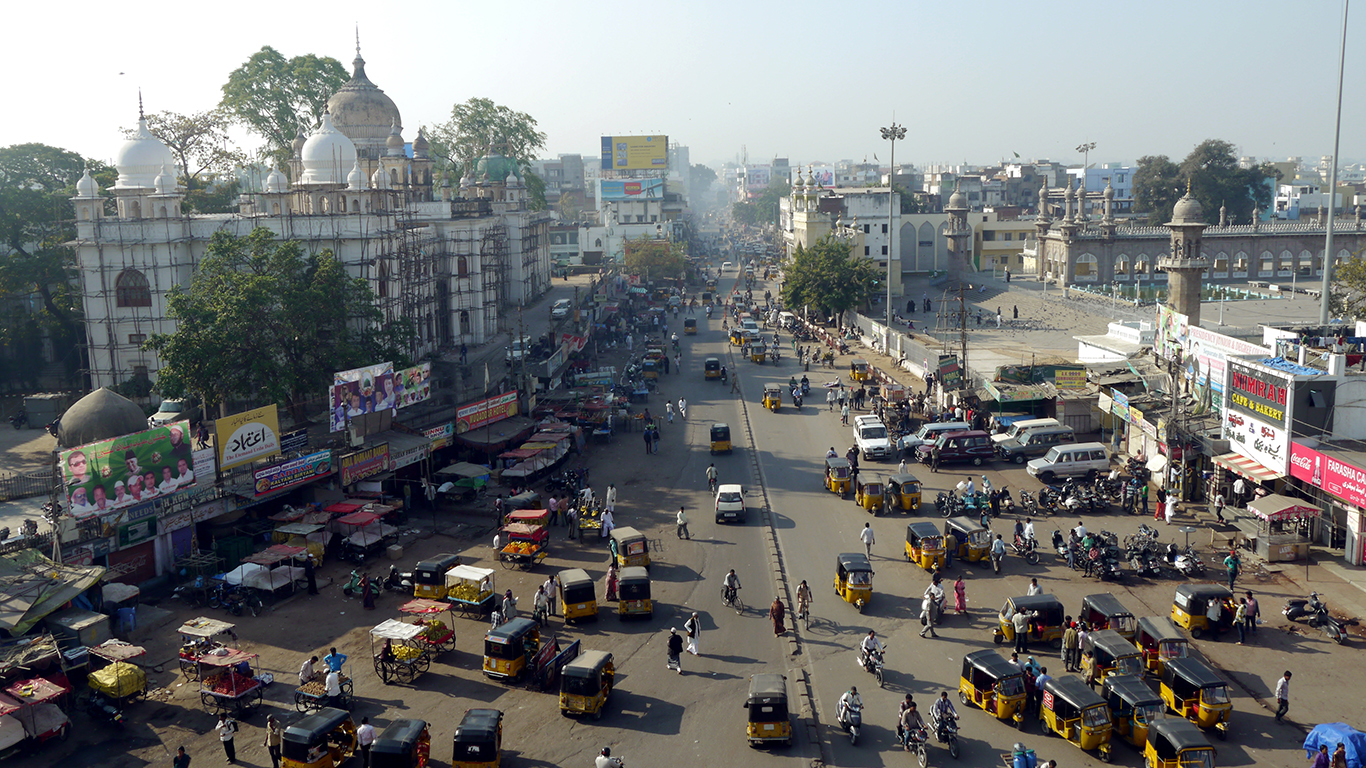
9. Hyderabad, India
> People per square mile: 54,558
> Population: 3.6 million
> Land area: 66.67 square miles
> Population change, 2005-2015: 39.7%
Hyderabad is the largest and most-populous city in the south-central state of Telengana, India. As a result of its size, diverse culture, and flourishing high-tech industry, it attracts a heavy migrant population. However, alongside the rapid urban growth and high-tech development came an increase in the city’s poor population. Today, 23% of the Hyderabad population lives below the poverty line, the most of any city in India other than Mumbai. Many of the poor live in the city’s 775 urban slums.
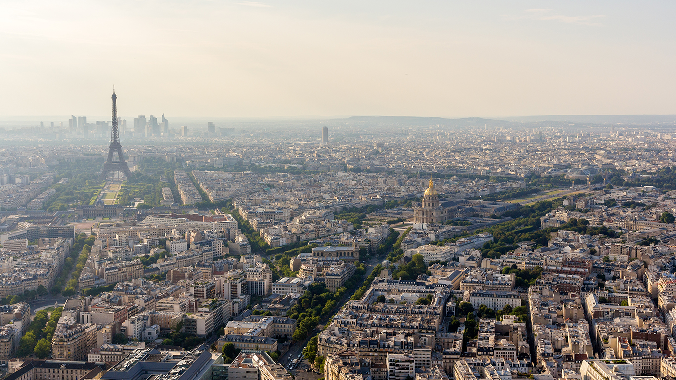
8. Paris, France
> People per square mile: 55,138
> Population: 2.2 million
> Land area: 40.70 square miles
> Population change, 2005-2015: 7.4%
The population of Paris increased 7.4% between 2005 and 2015. Due to the small size of the French capital’s inner city — the boundaries of the city proper lie within a 6 mile radius of Notre-Dame Cathedral — many new residents have settled in the suburbs. In fact, about 4 out of 5 Parisians are suburbanites. While suburban development has slightly reduced the city’s population density, Paris remains the most densely populated city with more than 1 million residents in Europe.
7. Surat, India
> People per square mile: 56,142
> Population: 2.4 million
> Land area: 43.35 square miles
> Population change, 2005-2015: 62.6%
The over 500-year old city of Surat located on India’s western coast is the fastest growing city on the list. While Surat’s population plateaued in the mid-19th century at roughly 80,000 people, the city grew immensely with the opening of India’s railways. Today, the city proper is home to 2.4 million people, and is the third densest city in India.
[in-text-ad-2]
6. Calcutta, India
> People per square mile: 64,020
> Population: 4.6 million
> Land area: 71.43 square miles
> Population change, 2005-2015: 8.5%
Calcutta’s high population density has led to intolerable conditions for many of the city’s poorer residents. The high density is largely a result of a massive population increase over the past century. War in neighboring Bangladesh in the 1970s helped propel the inbound migration to Calcutta, as millions of Hindu refugees fled to India to escape mass killings and lootings. Today, there are large refugee colonies in the city’s northern and southern suburbs.
5. Chennai, India
> People per square mile: 64,655
> Population: 4.3 million
> Land area: 67.18 square miles
> Population change, 2005-2015: 35.0%
While Chennai currently has the fifth highest population density of any major city in the world, a new regional plan may expand the southern Indian city’s boundaries and reduce overcrowding in the urban area. The state’s Housing and Urban Development Department confirmed that the Chennai metropolitan area will be expanded to cover 3,428 square miles. The master plan will combine the Chennai metropolitan area with a number of neighboring cities, such as Kancheepuram, Tiruvallur, Chengalpattu and Mamallapuram, to create the Chennai Mega Region.
[in-text-ad]
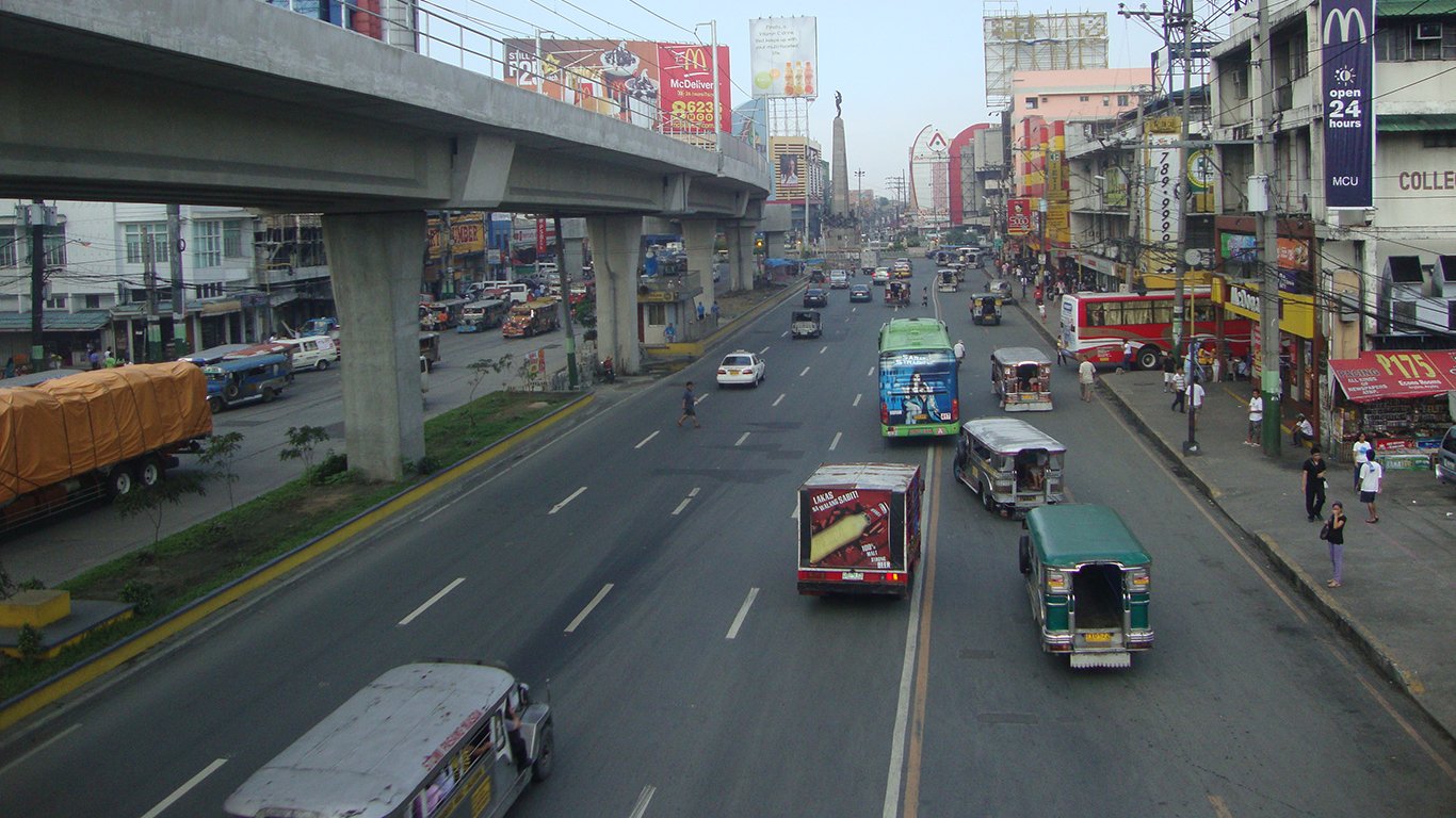
4. Caloocan, Philippines
> People per square mile: 69,115
> Population: 1.5 million
> Land area: 21.54 square miles
> Population change, 2005-2015: N/A
With a population roughly the size of Philadelphia living in a space of 22 square miles, Caloocan is one of the densest cities in the world. In late 2015, Mayor Oscar Malapitan announced that he will focus his time in office on a long-term city development plan. The 15-year project, titled “Caloocan 2030: The Livable City Development Plan”, will put an emphasis on reliable transportation, inclusive growth, technology-driven anti-crime measures, and greening the city.
3. Manila, Philippines
> People per square mile: 171,301
> Population: 1.7 million
> Land area: 9.64 square miles
> Population change, 2005-2015: 19.0%
Manila, the capital of the Philippines, has a population of 1.7 million, which is roughly equivalent to the population of the broader Austin, Texas metropolitan area. However, while the Austin metro area consists of six counties at over 4,200 square miles, Manila spans less than 10 square miles. The average life expectancy in the Philippines is just 68 years, 11 years less than that of the United States. However, the Southeast Asian nation’s population is growing by more than double the U.S. rate.
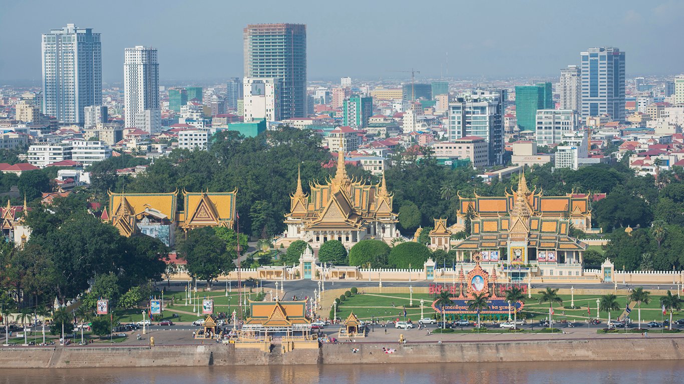
2. Phnom Penh, Cambodia
> People per square mile: 193,730
> Population: 1.6 million
> Land area: 8.11 square miles
> Population change, 2005-2015: 31.5%
To deal with Phnom Penh’s massive population increase in the mid-20th century, the king of Cambodia commissioned an inexpensive housing complex, known as the Municipal Apartments, commonly referred to as the “White Building.” The symbolic apartment complex was demolished this month, never really addressing the city’s population growth. Already the second most crowded city in the world, Cambodia’s minister of land management, urban planning and construction told a housing forum the city would require 800,000 new living spaces by 2030.
[in-text-ad-2]
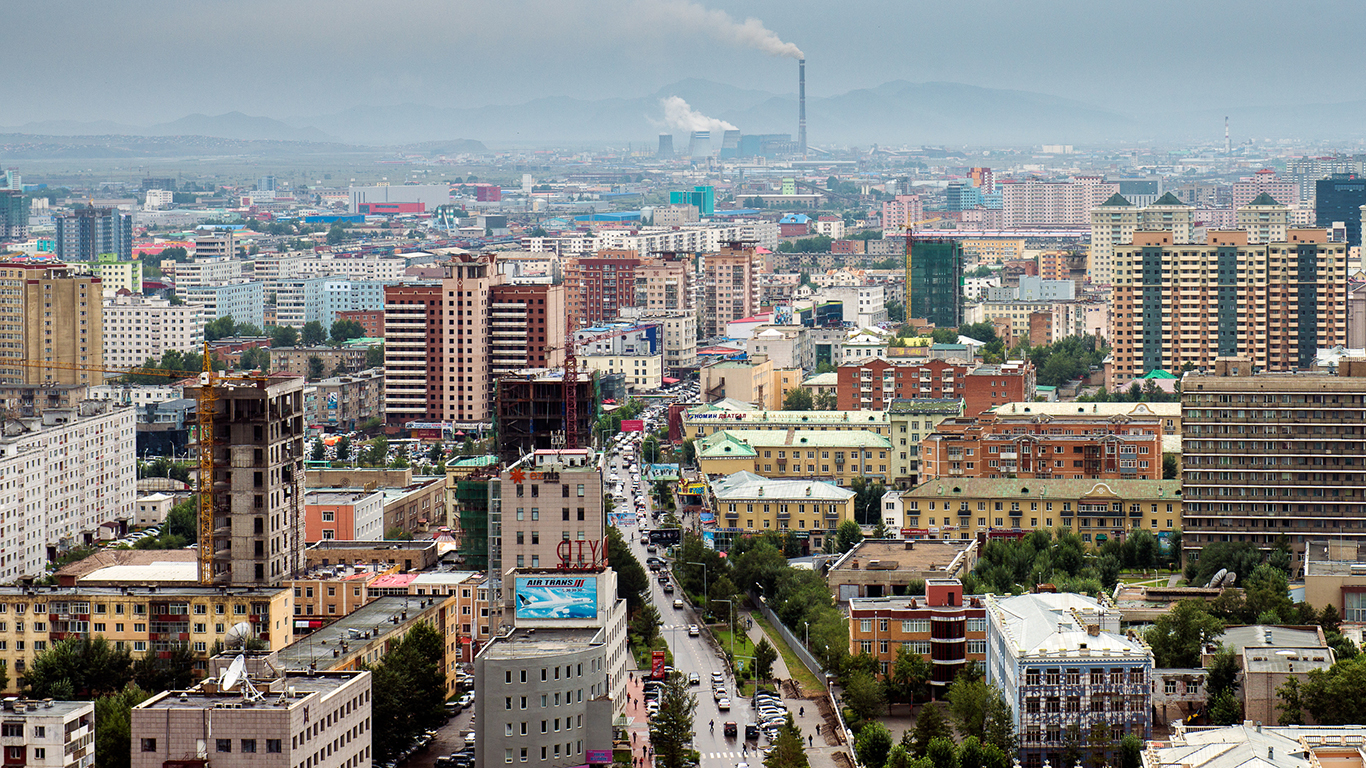
1. Ulaanbaatar, Mongolia
> People per square mile: 760,261
> Population: 1.4 million
> Land area: 1,618 square miles
> Population change, 2005-2015: 47.6%
Mongolia, and its capital city Ulaanbaatar in particular, are dealing with the consequences of urbanization as more Mongolians migrate to cities. In Ulaanbaatar, the influx of new residents resulted in in unplanned neighborhoods known as “ger” areas to spring up. These neighborhoods are estimated to be home to 60% of Ulaanbaatar’s total population, despite being vulnerable to natural disasters. Ger areas also often lack water and sewage services as well as electricity. In response to the overcrowded conditions in the city, the mayor passed a decree to restrict migration to the city until 2018.
Methodology:
To identify the most crowded cities in the world, 24/7 Wall St. reviewed population and land area estimates for the city proper with data from the United Nations’ 2015 Demographic Yearbook. The UN defines the city proper as a locality with legally fixed boundaries and an administratively recognized urban status. Because the definition of city boundaries varies from country to country, the UN also provides data for the urban agglomeration of a city, a measure of population and land area that includes the city or town proper as well as the suburban fringe or densely populated territories adjacent to the city boundaries. Because city centers tend to be the most crowded parts of an urban area, the population and land area measures for the city proper were used in the calculation of density. Because new residents often move to the outlying suburbs when migrating to a new city, the urban agglomeration definition of a city boundaries were used in the calculation of population change between 2005 and 2015. Data on the population by urban agglomerations came from the UN’s World Cities 2016 report.
Sponsored: Want to Retire Early? Here’s a Great First Step
Want retirement to come a few years earlier than you’d planned? Or are you ready to retire now, but want an extra set of eyes on your finances?
Now you can speak with up to 3 financial experts in your area for FREE. By simply clicking here you can begin to match with financial professionals who can help you build your plan to retire early. And the best part? The first conversation with them is free.
Click here to match with up to 3 financial pros who would be excited to help you make financial decisions.