Special Report
15 Places Most Vulnerable to Sea Level Rise
Published:
Last Updated:
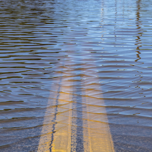
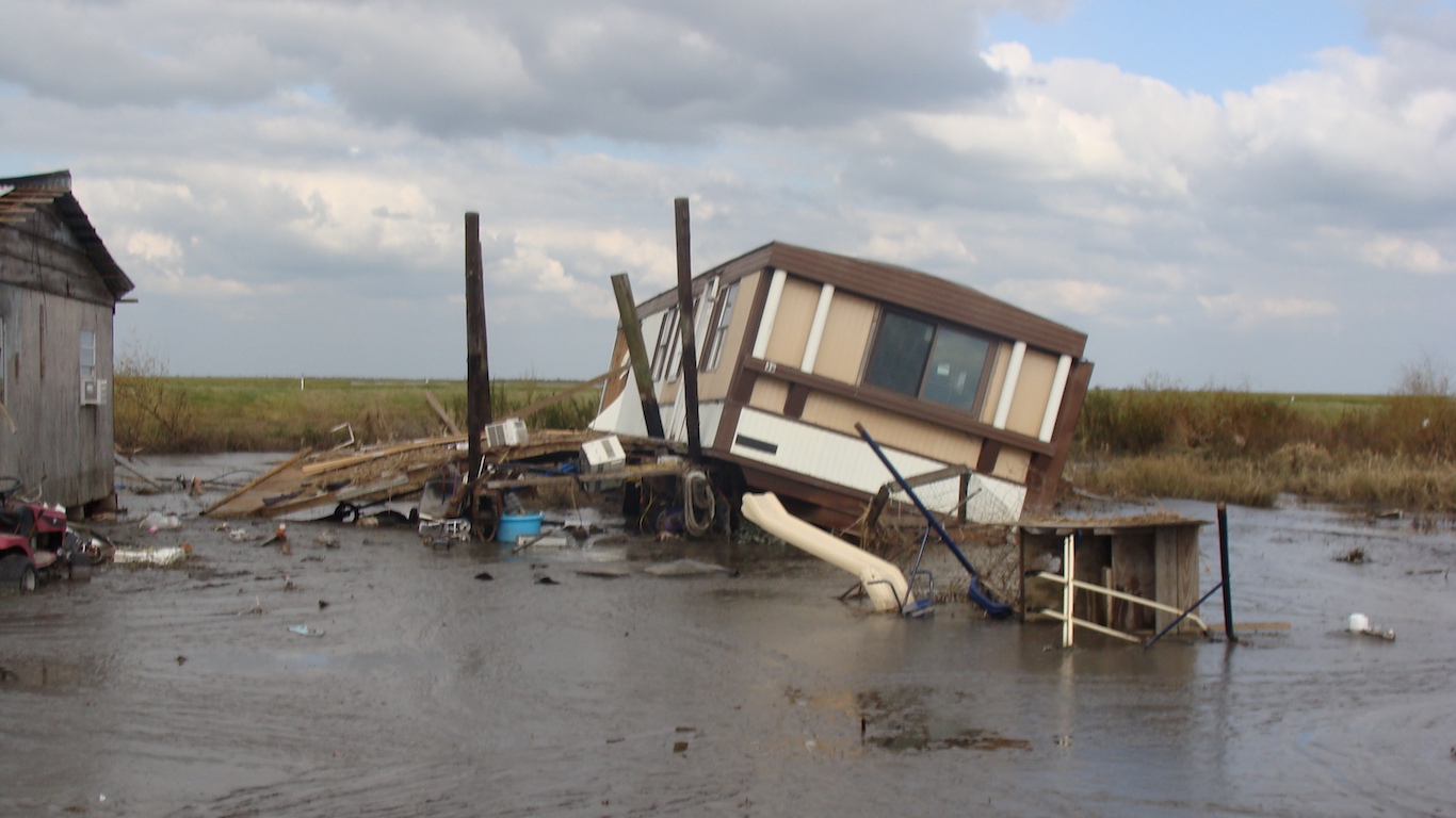
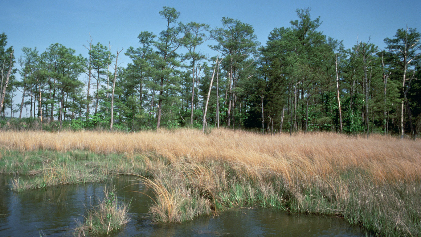
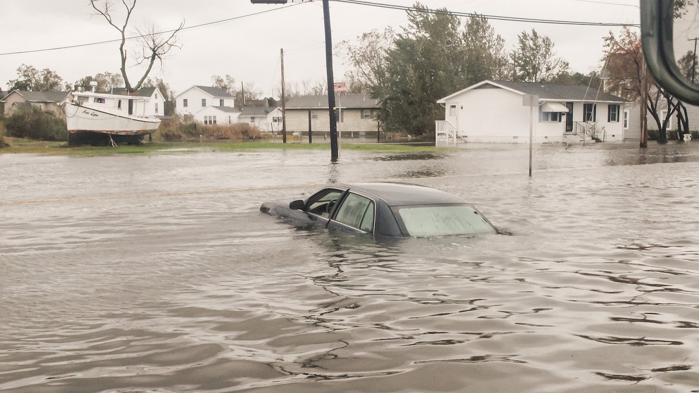
Over the next 100 years, rapid sea level rise will change the landscape of the U.S. and increase the risk of severe flooding for thousands of households. According to the worst-case scenario in a new report by the Union of Concerned Scientists, about 180 U.S. communities will face chronic flooding by 2035.
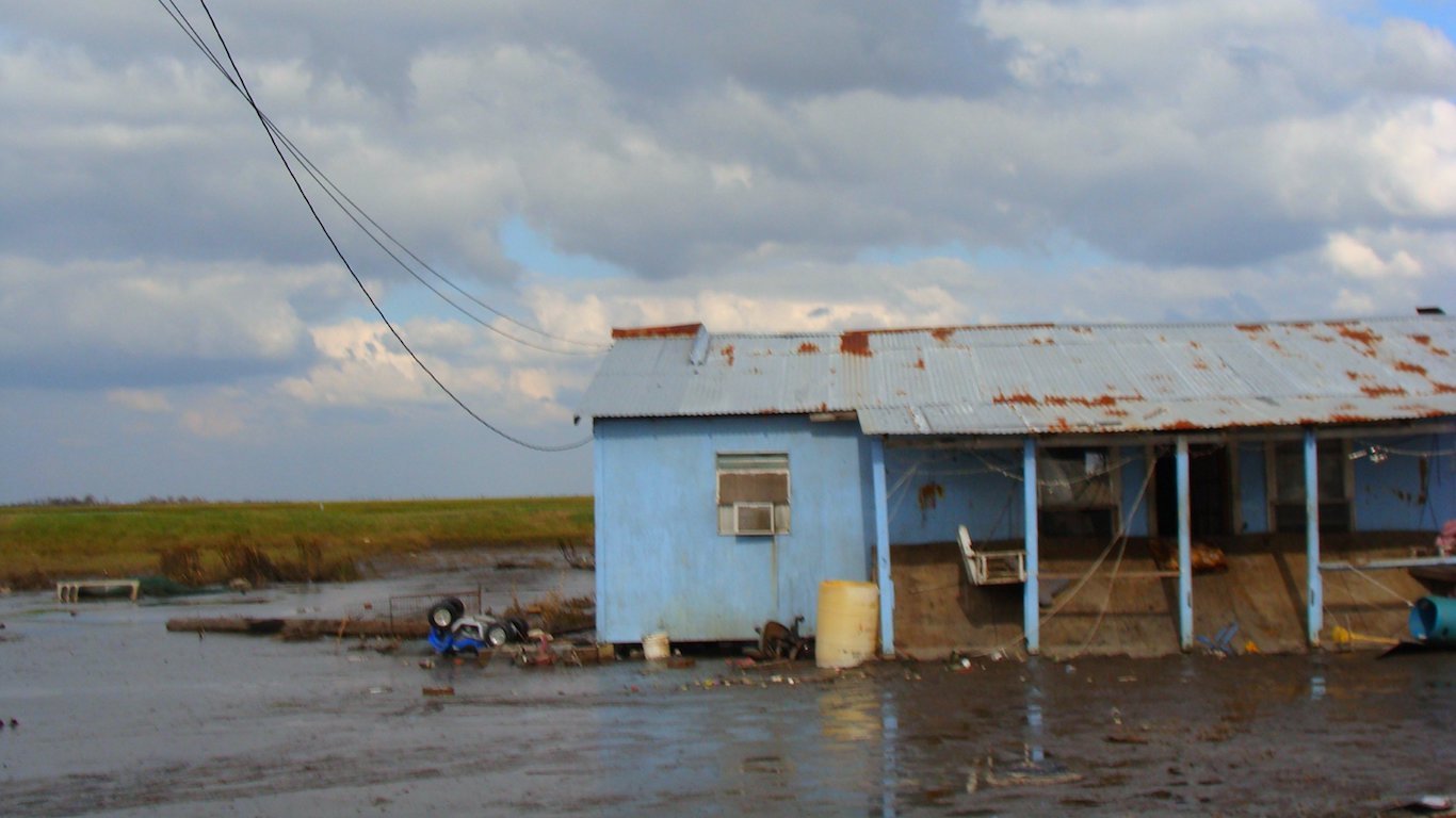
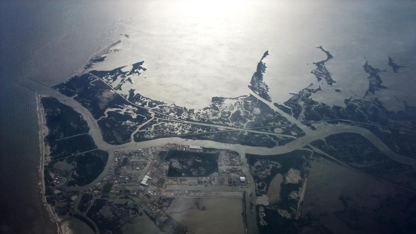
Louisiana and Maryland will be home to 70% of these areas. In these states, land subsidence, which is the loss of elevation due to movements below the surface, is adding to the rapid rates of an increase in sea levels, according to the report, “When Rising Seas Hit Home: Hard Choices Ahead for Hundreds of US Coastal Communities.’’ More than half of the affected communities are home to one or more socioeconomically vulnerable neighborhoods.
According to the report, low land elevation and high rates of land subsidence are the two common features in most of these communities.
Chronic inundation is defined as flooding that occurs 26 times per year or more. Communities where more than 10% of usable land exceeds this threshold are considered chronically inundated.
The worst-case scenario assumes rising carbon emissions and rapid ice sheet loss over the 21st century, leading to a global average rise of 6.6 feet above 1992 levels by the end of the 21st century.
In the report, the UCS intend to highlight what is at stake in regard to addressing sea level rise and global warming. How much the sea level rises this century depends on past and future emissions of heat-trapping gases as well as how the Earth and the atmosphere respond to those emissions.
Click here to see the 15 places most vulnerable to sea level rise.
Click here to read our methodology.
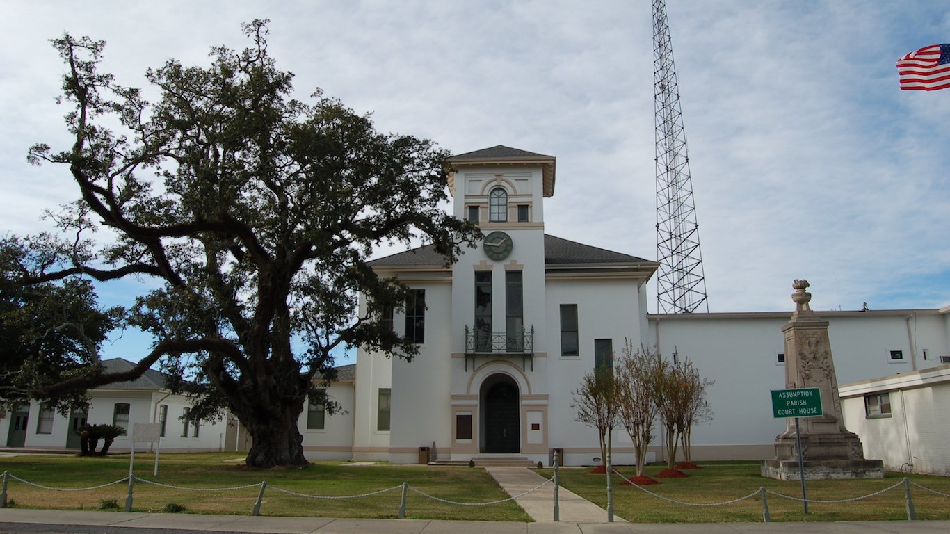
15. District 3, Assumption, Louisiana
> Chg. in land area at risk of chronic flooding, 2017-2030: 36.0 ppt.
> Land at risk of chronic flooding today: 19.5%
> Estimated land at risk of chronic flooding in 2030: 55.5%
> Current population: 3,043
[in-text-ad]
14. District 7, Terrebonne, Louisiana
> Chg. in land area at risk of chronic flooding, 2017-2030: 36.6 ppt.
> Land at risk of chronic flooding today: 29.2%
> Estimated land at risk of chronic flooding in 2030: 65.8%
> Current population: 14,076
13. District 8, Lafourche, Louisiana
> Chg. in land area at risk of chronic flooding, 2017-2030: 38.2 ppt.
> Land at risk of chronic flooding today: 50.6%
> Estimated land at risk of chronic flooding in 2030: 88.8%
> Current population: 11,021
12. Taylors Island, Maryland
> Chg. in land area at risk of chronic flooding, 2017-2030: 38.4 ppt.
> Land at risk of chronic flooding today: 21.9%
> Estimated land at risk of chronic flooding in 2030: 60.3%
> Current population: 299
[in-text-ad]
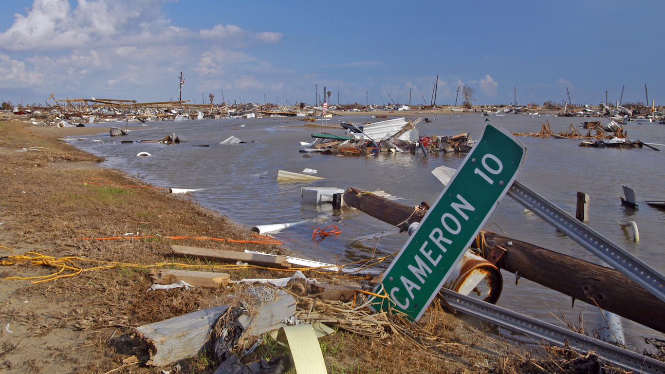
11. District 5, Cameron, Louisiana
> Chg. in land area at risk of chronic flooding, 2017-2030: 38.5 ppt.
> Land at risk of chronic flooding today: 37.6%
> Estimated land at risk of chronic flooding in 2030: 76.1%
> Current population: 454
10. District 9, Terrebonne, Louisiana
> Chg. in pct. of land at risk of flooding, 2017-2030-: 38.6 ppt.
> Land at risk of chronic flooding today: 13.8%
> Estimated land at risk of chronic flooding in 2030: 52.4%
> Current population: 12,484
9. District 9, Lafourche, Louisiana
> Chg. in land area at risk of chronic flooding, 2017-2030: 38.8 ppt.
> Land at risk of chronic flooding today: 97.8%
> Estimated land at risk of chronic flooding in 2030: 136.6%
> Current population: 10,193
[in-text-ad]
8. Lake Landing, North Carolina
> Chg. in land area at risk of chronic flooding, 2017-2030: 39.7 ppt.
> Land at risk of chronic flooding today: 41.4%
> Estimated land at risk of chronic flooding in 2030: 81.1%
> Current population: 2,345
7. Hoopers Island, Maryland
> Chg. in land area at risk of chronic flooding, 2017-2030: 40.2 ppt.
> Land at risk of chronic flooding today: 14.3%
> Estimated land at risk of chronic flooding in 2030: 54.5%
> Current population: 463
6. District 2, Terrebonne, Louisiana
> Chg. in land area at risk of chronic flooding, 2017-2030: 40.5 ppt.
> Land at risk of chronic flooding today: 24.8%
> Estimated land at risk of chronic flooding in 2030: 65.3%
> Current population: 11,098
[in-text-ad]

5. District 3, Lafourche, Louisiana
> Chg. in land area at risk of chronic flooding, 2017-2030: 40.7 ppt.
> Land at risk of chronic flooding today: 36.9%
> Estimated land at risk of chronic flooding in 2030: 77.6%
> Current population: 12,585
4. District 2, Lafourche, Louisiana
> Chg. in land area at risk of chronic flooding, 2017-2030: 47.9 ppt.
> Land at risk of chronic flooding today: 23.8%
> Estimated land at risk of chronic flooding in 2030: 71.7%
> Current population: 10,479
3. Crisfield, Maryland
> Chg. in land area at risk of chronic flooding, 2017-2030: 51.7 ppt.
> Land at risk of chronic flooding today: 10.3%
> Estimated land at risk of chronic flooding in 2030: 62.0%
> Current population: 2,890
[in-text-ad]
2. Asbury, Maryland
> Chg. in land area at risk of chronic flooding, 2017-2030: 53.1 ppt.
> Land at risk of chronic flooding today: 27.1%
> Estimated land at risk of chronic flooding in 2030: 80.2%
> Current population: 837
1. Madison, Maryland
> Chg. in land area at risk of chronic flooding, 2017-2030: 57.6 ppt.
> Land at risk of chronic flooding today: 23.0%
> Estimated land at risk of chronic flooding in 2030: 80.6%
> Current population: 648
Methodology
To determine the communities that face the greatest risk of chronic flooding, 24/7 Wall St. reviewed data on chronic inundation from the Union of Concerned Scientists’ 2017 report, “When Rising Seas Hit Home: Hard Choices Ahead for Hundreds of US Coastal Communities.’’ Communities were ranked based on the change in the share of land that will be chronically inundated with floods between today and projections for the year 2030. Only communities where more than 10% of land is currently chronically inundated were considered.
The UCS defines chronic inundation as areas where flooding occurs at least 26 times per year. Projections for the year 2030 were developed for the 2014 National Climate Assessment, and are modeled on the assumption that sea levels will rise an average of 6.6 feet across the globe between 1992 and 2100 — the second most extreme climate change scenario modeled in the NCA.
Because wetlands are particularly susceptible to flooding and are not developable areas, land classified as wetlands was excluded from the calculation of chronic inundation zones. The calculation of chronic inundation zones also excluded areas protected by federal levees, which provide protection to areas that are particularly prone to flooding.
Community boundaries are defined by the U.S. Census Bureau county divisions. Population data came from the Census Bureau’s American Community Survey and are based on five-year estimates for the years 2011 to 2015.
Want retirement to come a few years earlier than you’d planned? Or are you ready to retire now, but want an extra set of eyes on your finances?
Now you can speak with up to 3 financial experts in your area for FREE. By simply clicking here you can begin to match with financial professionals who can help you build your plan to retire early. And the best part? The first conversation with them is free.
Click here to match with up to 3 financial pros who would be excited to help you make financial decisions.
Thank you for reading! Have some feedback for us?
Contact the 24/7 Wall St. editorial team.


 24/7 Wall St.