Comprising 26 climate zones and 25 physically unique regions, the United States is one of the most geographically diverse nations in the world. Measured by the distance from base to summit, the U.S. is home to both the tallest land-based mountain — Denali in Alaska — and the eighth lowest place — Death Valley in California — on Earth.
In general, the tallest mountains are in the West. The nation’s 15 tallest peaks are all west of the 100th Meridian, or the 100° W longitude line that marks the eastern boundary of the Great Plains.
States with higher elevations often generate more revenue from outdoor tourism, when adjusted for population, and have greater access to opportunities for physical activity. All 10 of the states with the highest average elevations generate more revenue per capita from outdoor recreation tourism than the national average.
According to the trade organization Outdoor Industry Association, the outdoor recreation economy generates $887 billion in consumer spending annually and directly supports 7.6 million jobs.
To determine the highest point in every state, 24/7 Tempo used data from the U.S. Census Bureau’s Statistical Abstract of the United States. The highest peaks range in elevation from just 345 feet in Florida to 20,320 feet in Alaska. Outdoor recreation consumer spending figures came from the Bureau of Economic Analysis and are for 2017. Conventional outdoor recreation activities (such as camping, hiking, boating, and hunting); other core activities.
Click here to see the highest point in every state
Click here to see our detailed findings and methodology
Source: Public Domain / Wikimedia Commons
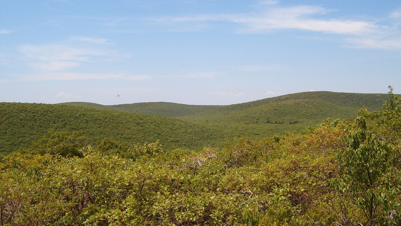
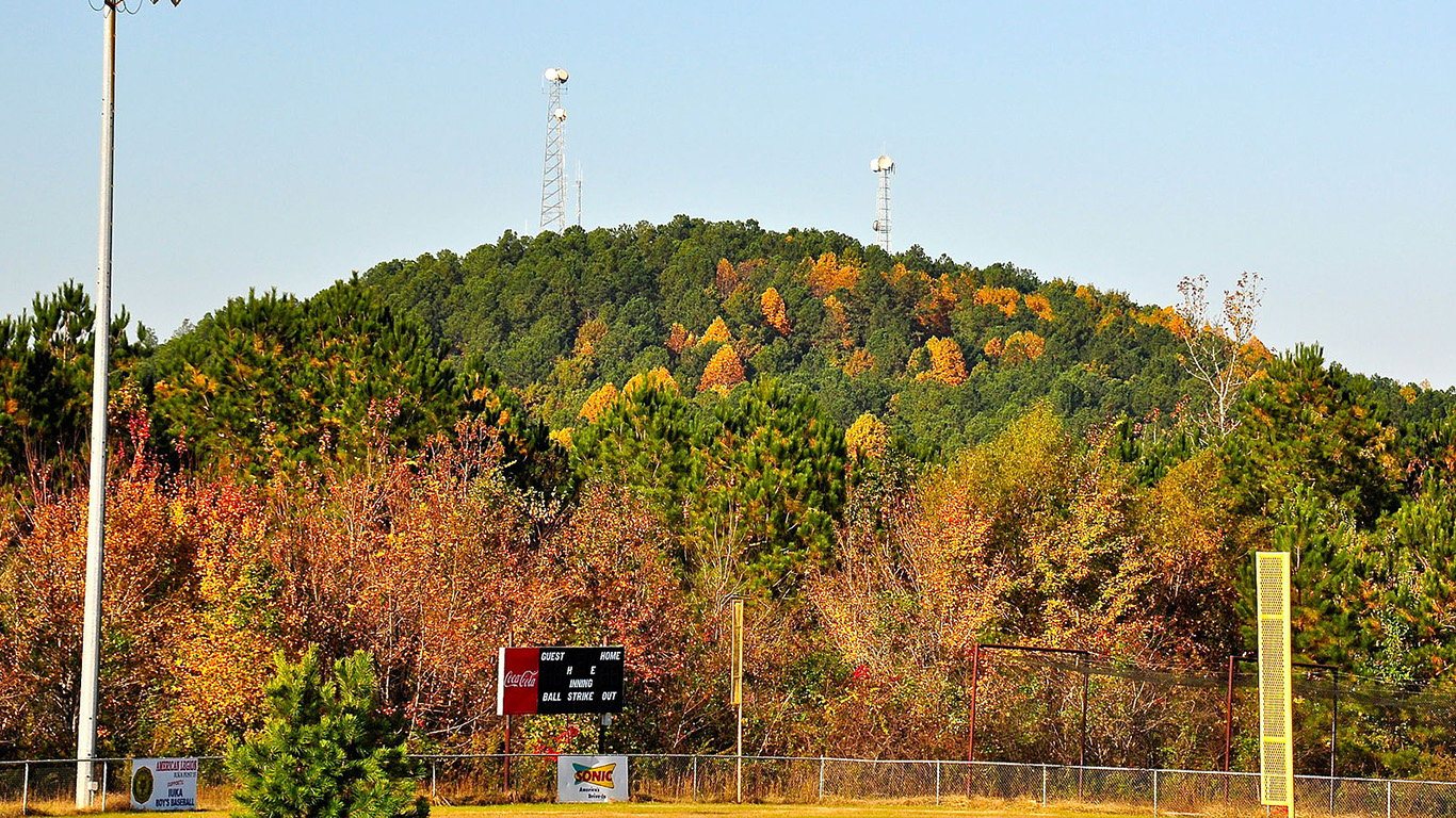
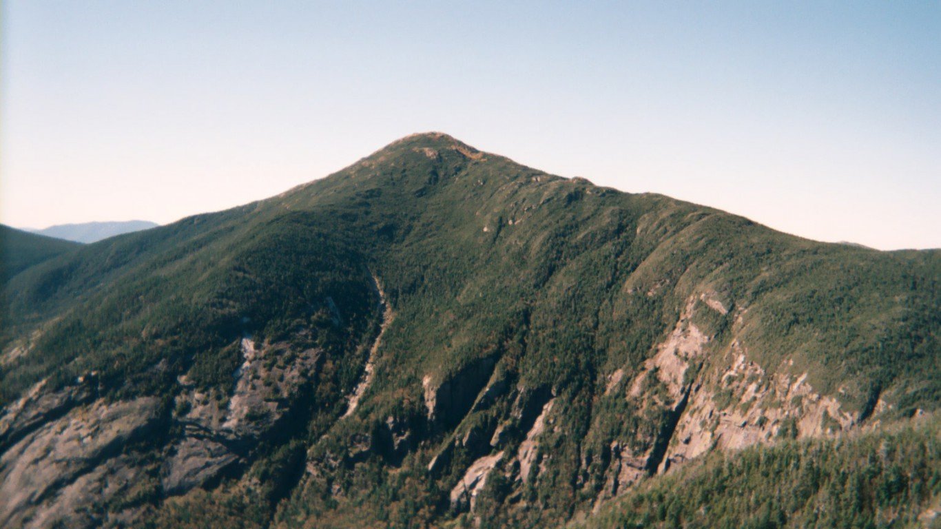
1. Alabama
> Highest peak: Cheaha Mountain
> Elevation above sea level: 2,407 ft.
> Coordinates: 33.5° N, 85.8° W
> Value added in 2017 camping, hiking, boating, and hunting: $1.51 billion
> 2018 population: 4,887,871
The name “Cheaha” comes from the Muskogee word “chaha,” which translates to “high place.”
[in-text-ad]
Source: Derek Ramsey (Ram-Man) / Wikimedia Commons
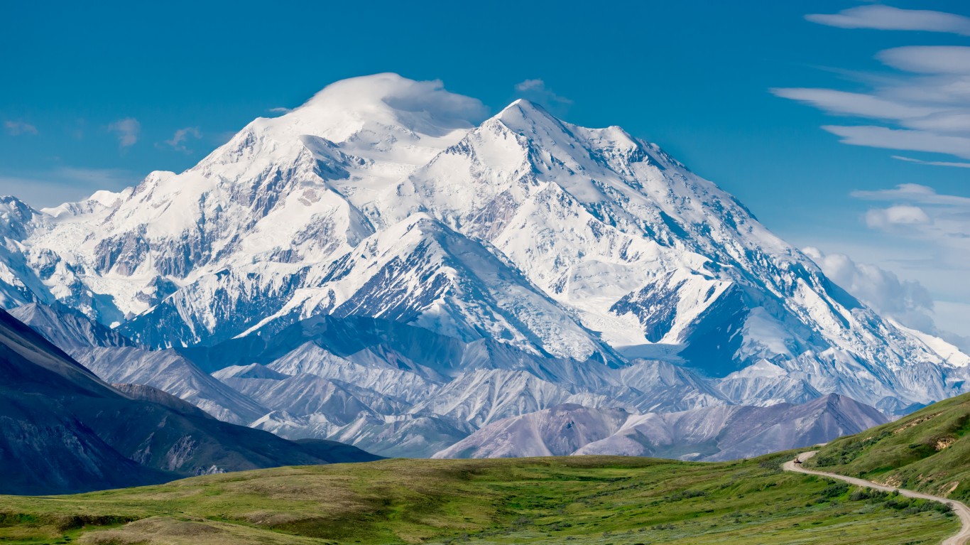
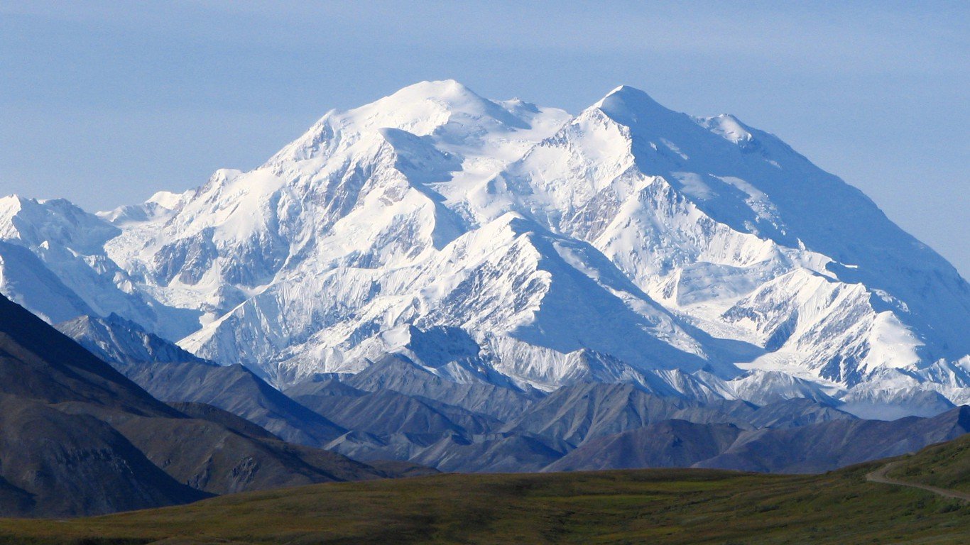
2. Alaska
> Highest peak: Denali
> Elevation above sea level: 20,320 ft.
> Coordinates: 63.1° N, 151.0° W
> Value added in 2017 camping, hiking, boating, and hunting: $1.51 billion
> 2018 population: 737,438
For over a century, Denali was known as Mount McKinley, but the moniker was returned to the original Native Alaskan name in 2015.
 24/7 Wall St.
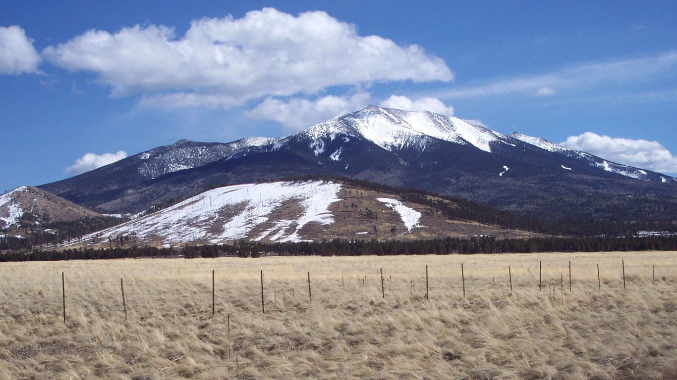
Source: Adbar / Wikimedia Commons
3. Arizona
> Highest peak: Humphreys Peak
> Elevation above sea level: 12,633 ft.
> Coordinates: 35.3° N, 111.7° W
> Value added in 2017 camping, hiking, boating, and hunting: $2.20 billion
> 2018 population: 7,171,646
Though it was named Humphreys Peak around 1870, the mountain was also named San Francisco Peak due to a General Land Office error. It wasn’t fixed until 1933.
Source: Fredlyfish4 / Wikimedia Commons
4. Arkansas
> Highest peak: Magazine Mountain
> Elevation above sea level: 2,753 ft.
> Coordinates: 35.2° N, 93.6° W
> Value added in 2017 camping, hiking, boating, and hunting: $1.17 billion
> 2018 population: 3,013,825
Mount Magazine got its peculiar name when French explorers heard a landslide and mistook the loud sound for an exploding ammunition magazine.
[in-text-ad-2]
Source: Geographer / Wikimedia Commons
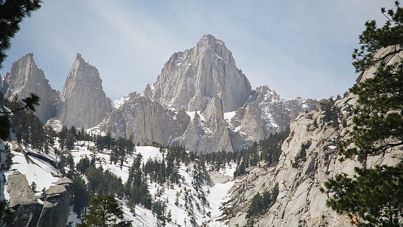
5. California
> Highest peak: Mount Whitney
> Elevation above sea level: 14,494 ft.
> Coordinates: 36.6° N, 118.3° W
> Value added in 2017 camping, hiking, boating, and hunting: $14.90 billion
> 2018 population: 39,557,045
The tallest mountain in the lower 48 states, Mount Whitney is such a popular climbing destination that hikers need a permit to climb it to minimize the ecological impact.
Source: Rick Kimpel / Wikimedia Commons
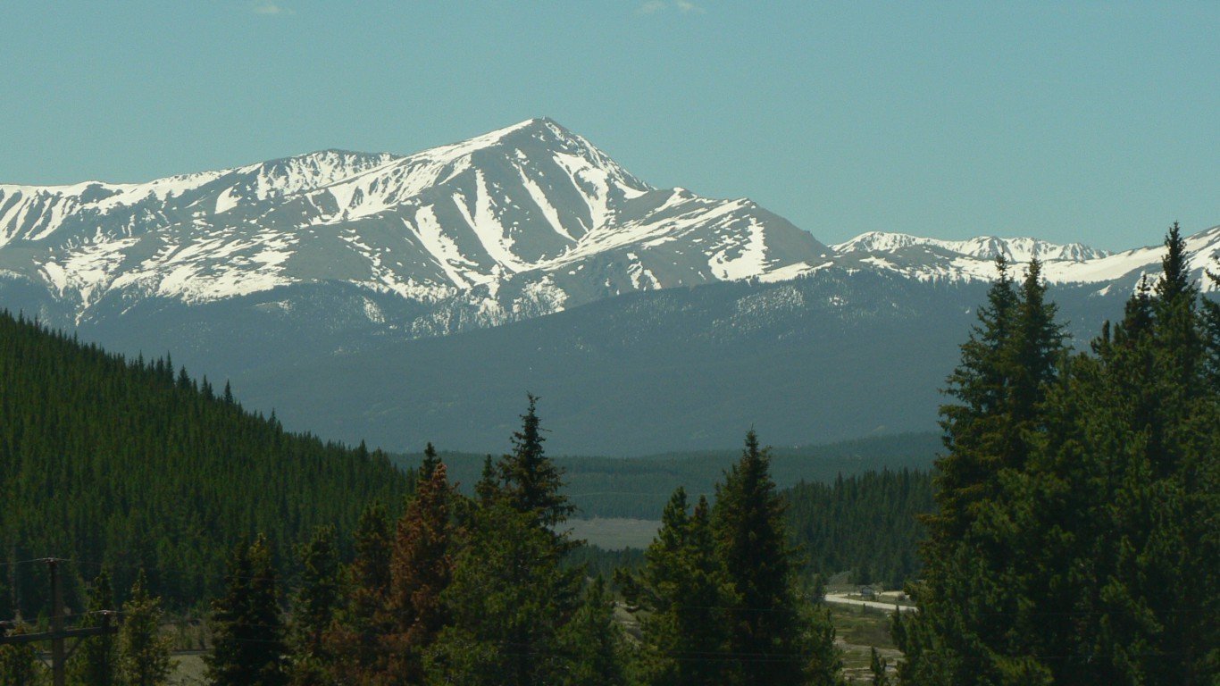
6. Colorado
> Highest peak: Mount Elbert
> Elevation above sea level: 14,433 ft.
> Coordinates: 39.1° N, 106.4° W
> Value added in 2017 camping, hiking, boating, and hunting: $3.78 billion
> 2018 population: 5,695,564
Even though Mount Elbert is the tallest peak in Colorado at 14,433 feet, it is one of the easier “14ers” to climb. Many hikers call it the “gentle giant” of the Rocky Mountains.
[in-text-ad]
Source: Wikimedia Commons
7. Connecticut
> Highest peak: Mount Frissell
> Elevation above sea level: 2,380 ft.
> Coordinates: 42.0° N, 73.5° W
> Value added in 2017 camping, hiking, boating, and hunting: $1.47 billion
> 2018 population: 3,572,665
Though part of Mount Frissell is the highest point in Connecticut, the peak is actually in Massachusetts. This makes Connecticut the only state whose highest point isn’t a true peak.
Source: Photo by and (c)2006 Derek Ramsey (Ram-Man) / Wikimedia Commons
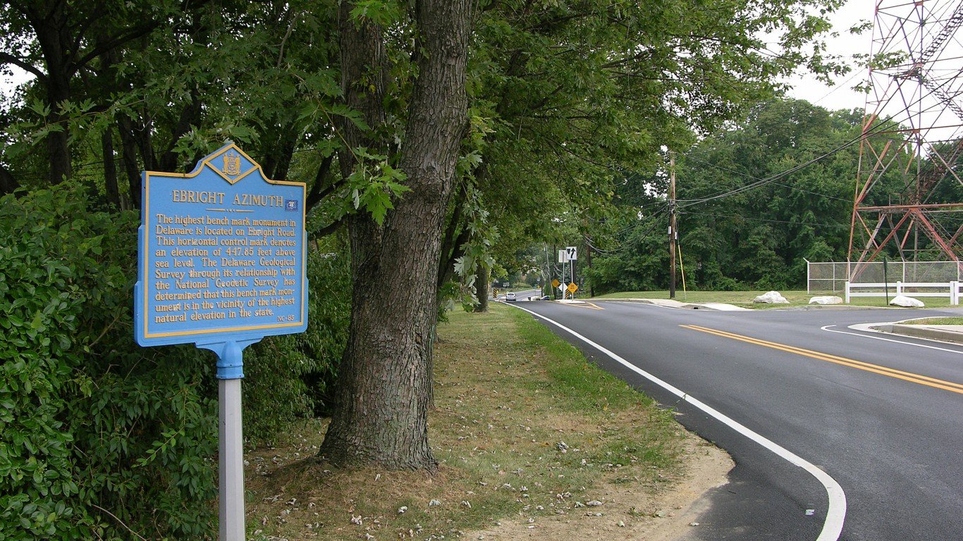
8. Delaware
> Highest peak: Ebright Road
> Elevation above sea level: 448 ft.
> Coordinates: 39.8° N, 75.5° W
> Value added in 2017 camping, hiking, boating, and hunting: $316.2 million
> 2018 population: 967,171
Delaware has no mountains or peaks so its highest point, the Ebright Azimuth, is marked by a sign on a road in Centerville near the Pennsylvania border.
Source: Ebyabe / Wikimedia Commons
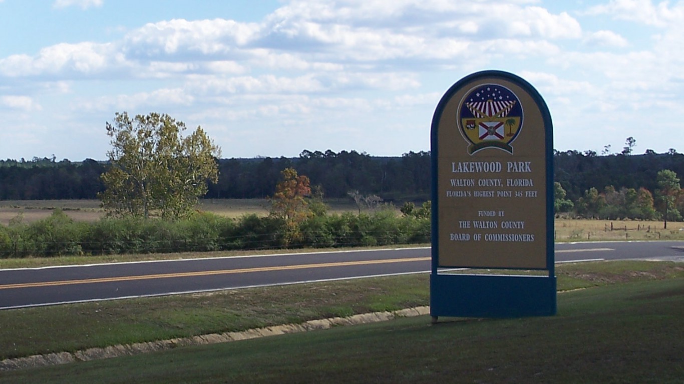
9. Florida
> Highest peak: Britton Hill
> Elevation above sea level: 345 ft.
> Coordinates: 31.0° N, 86.3° W
> Value added in 2017 camping, hiking, boating, and hunting: $8.82 billion
> 2018 population: 21,299,325
At just 345 feet, Britton Hill is the lowest high point of any state. Florida’s tourism website says the surrounding park is a great place for a family picnic and “your grandmother can get to the top without breaking a sweat.”
[in-text-ad-2]
Source: Thomson200 / Wikimedia Commons
10. Georgia
> Highest peak: Brasstown Bald
> Elevation above sea level: 4,784 ft.
> Coordinates: 34.9° N, 83.8° W
> Value added in 2017 camping, hiking, boating, and hunting: $3.57 billion
> 2018 population: 10,519,475
If you climb Brasstown Bald, located in the northeastern corner of Georgia, you can reportedly see North Carolina, South Carolina, and Tennessee on a clear day.
Source: Alan L / Wikimedia Commons
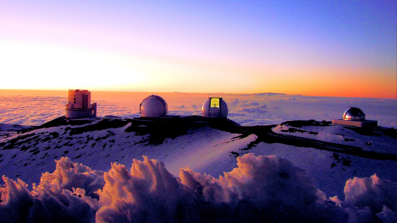
11. Hawaii
> Highest peak: Mauna Kea
> Elevation above sea level: 13,796 ft.
> Coordinates: 19.8° N, 155.5° W
> Value added in 2017 camping, hiking, boating, and hunting: $567.8 million
> 2018 population: 1,420,491
Mauna Kea is 13,796 feet above sea level, but most of the mountain is under water. From base to tip, Mauna Kea is actually 33,500 feet tall — more than 4,000 feet taller than Mount Everest.
[in-text-ad]
Source: Public Domain
12. Idaho
> Highest peak: Borah Peak
> Elevation above sea level: 12,662 ft.
> Coordinates: 44.1° N, 113.8° W
> Value added in 2017 camping, hiking, boating, and hunting: $891.4 million
> 2018 population: 1,754,208
Borah Peak can make for a difficult climb, particularly near the peak. The top of the mountain is so treacherous that it has gained the nickname “Chickenout Ridge.”
 24/7 Wall St.
Source: TheCatalyst31 / Wikimedia Commons
13. Illinois
> Highest peak: Charles Mound
> Elevation above sea level: 1,235 ft.
> Coordinates: 42.5° N, 90.2° W
> Value added in 2017 camping, hiking, boating, and hunting: $4.06 billion
> 2018 population: 12,741,080
Unlike most state high points, Charles Mound in Illinois actually sits on private property. The owners, however, are reportedly welcoming to people who hope to stand on Illinois’ highest point.
Source: Hyrum Wright / Wikimedia Commons
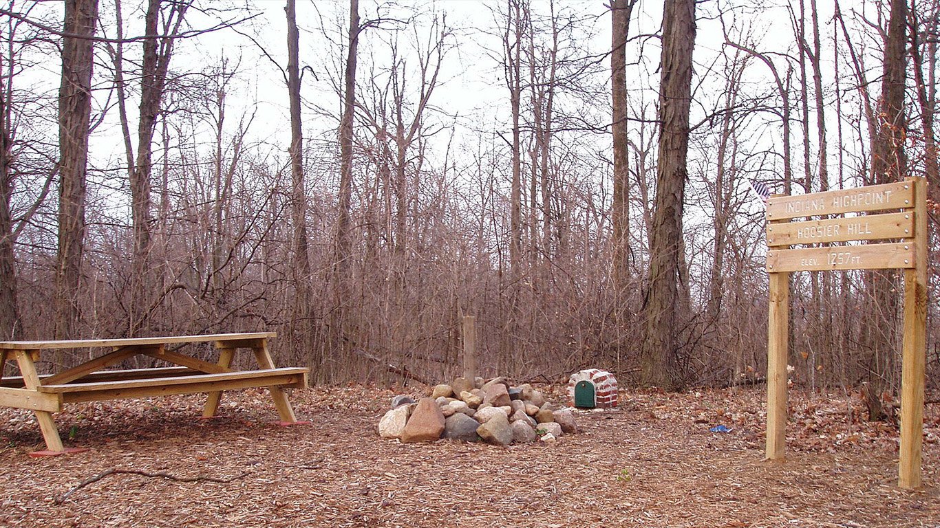
14. Indiana
> Highest peak: Hoosier Hill
> Elevation above sea level: 1,257 ft.
> Coordinates: 40.0° N, 84.9° W
> Value added in 2017 camping, hiking, boating, and hunting: $5.19 billion
> 2018 population: 6,691,878
Indiana’s highest point, Hoosier Hill, is a nondescript area in the woods of Wayne County. Perhaps the hill’s biggest claim to fame is that it was the last place Arthur H. Marshall visited in his quest to visit the highest point in the lower 48 states. Marshall is believed to be the first person to visit all 48 sites, making him the first known “highpointer”.
[in-text-ad-2]
Source: Wikimedia Commons
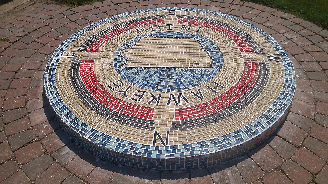
15. Iowa
> Highest peak: Hawkeye Point
> Elevation above sea level: 1,670 ft.
> Coordinates: 43.5° N, 95.7° W
> Value added in 2017 camping, hiking, boating, and hunting: $1.39 billion
> 2018 population: 3,156,145
Hawkeye Point only rises slightly above the surrounding farmland in Osceola, Iowa. The point sits on private land, but the owners have created a marker and make it accessible to the public.
Source: Fredlyfish4 / Wikimedia Commons
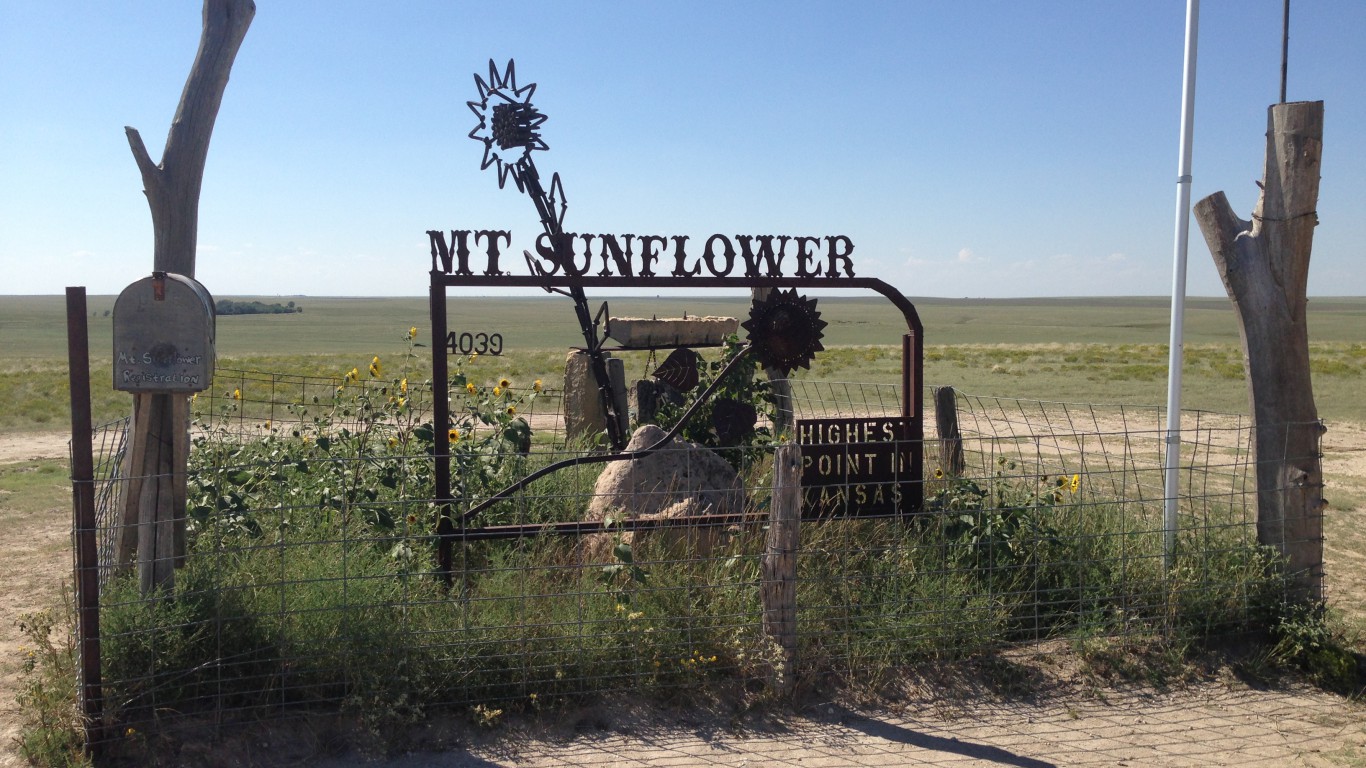
16. Kansas
> Highest peak: Mount Sunflower
> Elevation above sea level: 4,039 ft.
> Coordinates: 39.0° N, 102.0° W
> Value added in 2017 camping, hiking, boating, and hunting: $1.02 billion
> 2018 population: 2,911,510
The state of Kansas is scientifically flatter than a pancake, so its highest point is barely distinguishable from the rest of the state. The name Mount Sunflower is tongue in cheek. The owners of the land, apparently in on the joke, put a plaque at Kansas’ highest point reading “Nothing happened here in 1897.”
[in-text-ad]
Source: LongLiveRock / Wikimedia Commons
17. Kentucky
> Highest peak: Black Mountain
> Elevation above sea level: 4,145 ft.
> Coordinates: 36.9° N, 82.9° W
> Value added in 2017 camping, hiking, boating, and hunting: $1.42 billion
> 2018 population: 4,468,402
Black Mountain has been a huge source of coal in Kentucky for decades. The mining has left the mountain in such precarious shape that would-be climbers must sign a waiver before summiting.
Source: Fredlyfish4 / Wikimedia Commons
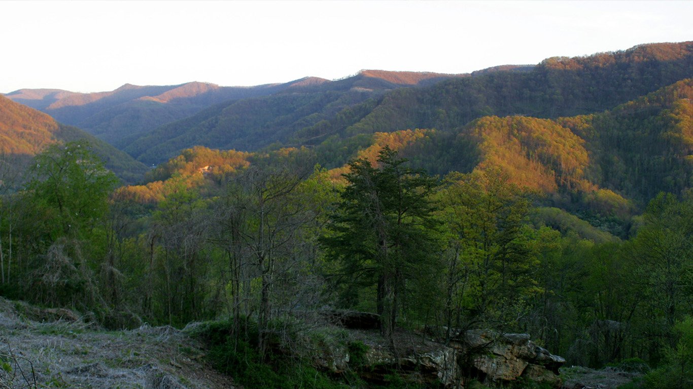
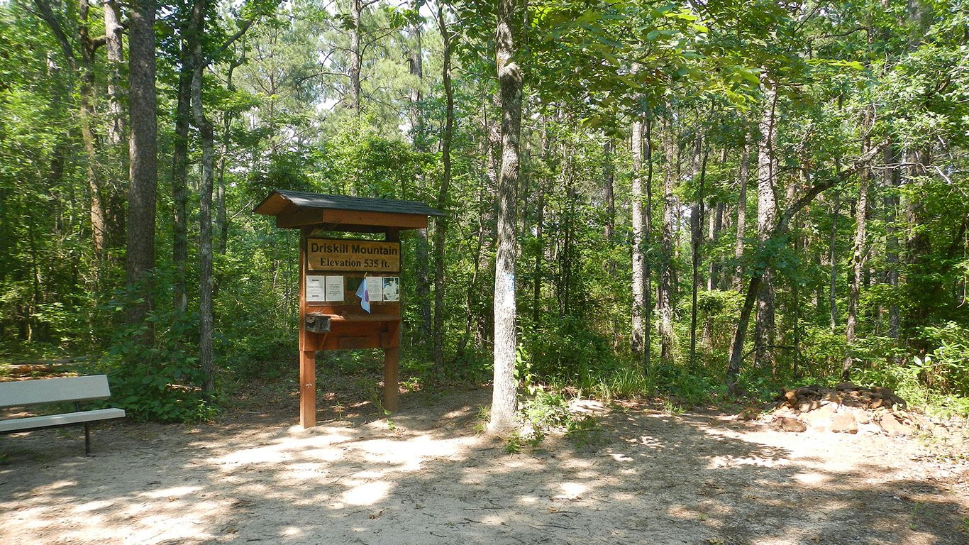
18. Louisiana
> Highest peak: Driskill Mountain
> Elevation above sea level: 535 ft.
> Coordinates: 32.4° N, 92.9° W
> Value added in 2017 camping, hiking, boating, and hunting: 1.73 billion
> 2018 population: 4,659,978
Louisiana sits partially below sea level and its highest point doesn’t rise too much higher than that. Driskill Mountain, located in the northern part of the state, is just 535 feet above sea level.
Source: Wikimedia Commons
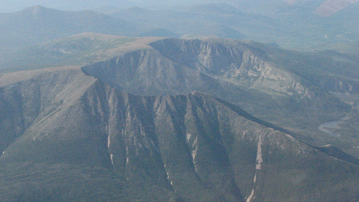
19. Maine
> Highest peak: Mount Katahdin
> Elevation above sea level: 5,268 ft.
> Coordinates: 45.9° N, 68.9° W
> Value added in 2017 camping, hiking, boating, and hunting: $905.5 million
> 2018 population: 1,338,404
Mount Katahdin derives its name from the Penobscot tribe. In the Penobscot language, “Katahdin” roughly translates to “greatest mountain.” The mountain is the northernmost point on the Appalachian Trail.
[in-text-ad-2]
Source: Brian M. Powell / Wikimedia Commons
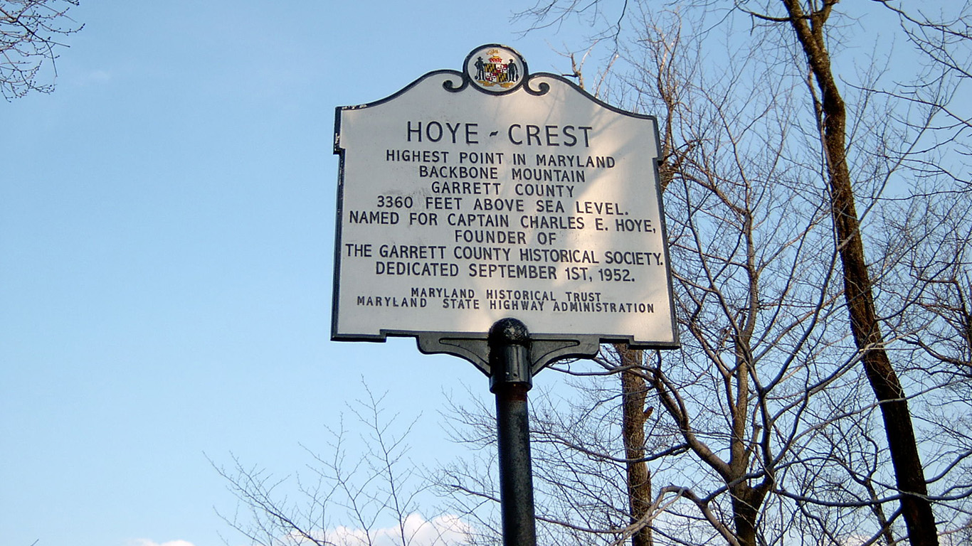
20. Maryland
> Highest peak: Hoye Crest
> Elevation above sea level: 3,360 ft.
> Coordinates: 39.2° N, 79.5° W
> Value added in 2017 camping, hiking, boating, and hunting: $1.93 billion
> 2018 population: 6,042,718
Backbone Mountain, along with other parts of the Allegheny Mountains, make up part of the Eastern Continental Divide. The mountains help to naturally sort the water into the Chesapeake Bay before the water finally flows into the Gulf of Mexico.
Source: Protophobic / Wikimedia Commons
21. Massachusetts
> Highest peak: Mount Greylock
> Elevation above sea level: 3,491 ft.
> Coordinates: 42.6° N, 73.2° W
> Value added in 2017 camping, hiking, boating, and hunting: $2.86 billion
> 2018 population: 6,902,149
Mount Greylock has a unique place in literary history. It has reportedly inspired writers like Herman Melville and Oliver Wendell Holmes, who was also a jurist. The mountain even serves as the school for American witches and wizards in J.K. Rowling’s original “Fantastic Beasts and Where to Find Them.”
[in-text-ad]
Source: RomanKahler / Wikimedia Commons
22. Michigan
> Highest peak: Mount Arvon
> Elevation above sea level: 1,979 ft.
> Coordinates: 46.8° N, 88.2° W
> Value added in 2017 camping, hiking, boating, and hunting: $3.27 billion
> 2018 population: 9,995,915
Mount Arvon only recently claimed the title as the highest place in Michigan. For years, Mount Curwood was believed to be Michigan’s highest point, but a 1982 survey revealed that Arvon edged out Curwood by just under 1 foot.
 24/7 Wall St.
Source: Yinan Chen / Wikimedia Commons
23. Minnesota
> Highest peak: Eagle Mountain
> Elevation above sea level: 2,301 ft.
> Coordinates: 47.9° N, 90.6° W
> Value added in 2017 camping, hiking, boating, and hunting: $3.64 billion
> 2018 population: 5,611,179
If you’re going to try to summit Eagle Mountain in Minnesota, be sure to double check your map before you go. There is another Eagle Mountain in Lutsen, Minnesota that is much shorter.
Source: Skye Marthaler / Wikimedia Commons
24. Mississippi
> Highest peak: Woodall Mountain
> Elevation above sea level: 806 ft.
> Coordinates: 34.8° N, 88.2° W
> Value added in 2017 camping, hiking, boating, and hunting: $891.8 million
> 2018 population: 2,986,530
During the Civil War, Woodall Mountain provided Union forces with a huge tactical advantage. Soldiers used the mountain, then called Yow Hill, in the Battle of Iuka to rain down artillery on Confederate soldiers and drive them out of town.
[in-text-ad-2]
Source: Westhoff / iStock
25. Missouri
> Highest peak: Taum Sauk Mountain
> Elevation above sea level: 1,772 ft.
> Coordinates: 37.6° N, 90.7° W
> Value added in 2017 camping, hiking, boating, and hunting: $2.28 billion
> 2018 population: 6,126,452
Taum Sauk Mountain State Park crosses paths with the Ozark Trail. It also features Mina Sauk Falls, which is the largest waterfall in Missouri as well.
Source: jfisher2167 / Wikimedia Commons
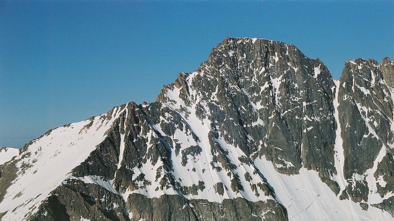
26. Montana
> Highest peak: Granite Peak
> Elevation above sea level: 12,799 ft.
> Coordinates: 45.2° N, 109.8° W
> Value added in 2017 camping, hiking, boating, and hunting: $753.8 million
> 2018 population: 1,062,305
Granite Peak is one of the most dangerous state high points to get to because of its strenuous hiking trails and challenging rock climbing. It’s believed that no one made it to the summit until 1923.
[in-text-ad]
Source: Ammodramus / Wikimedia Commons
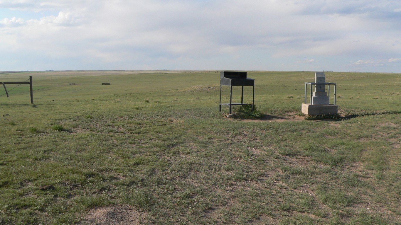
27. Nebraska
> Highest peak: Panorama Point
> Elevation above sea level: 5,424 ft.
> Coordinates: 41.0° N, 104.0° W
> Value added in 2017 camping, hiking, boating, and hunting: $889.0 million
> 2018 population: 1,929,268
Panorama Point is just slightly higher than its surrounding areas and may be tough to tell apart were it not for a marker placed there. Still, Panorama Point provides an excellent view of the Nebraska plains.
 24/7 Wall St.
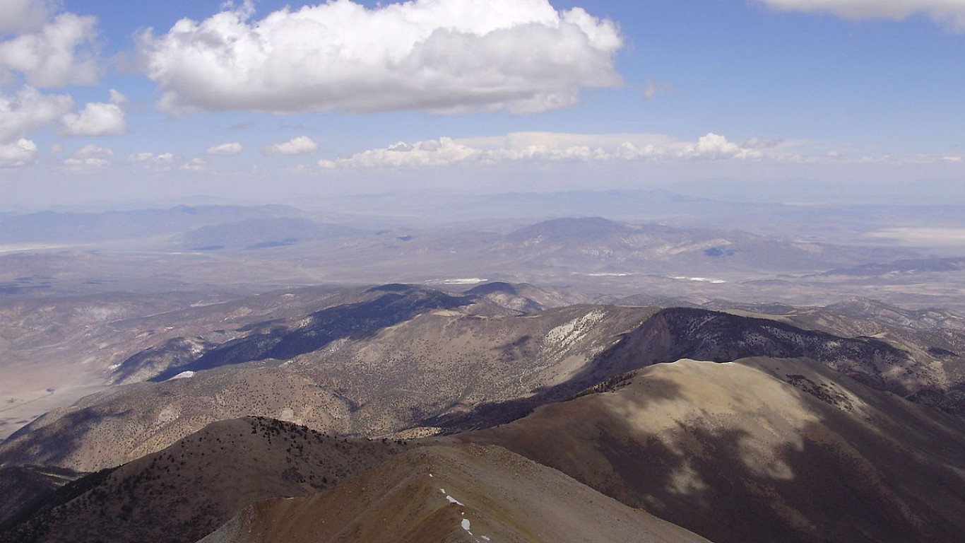
Source: Famartin / Wikimedia Commons
28. Nevada
> Highest peak: Boundary Peak
> Elevation above sea level: 13,140 ft.
> Coordinates: 37.8° N, 118.4° W
> Value added in 2017 camping, hiking, boating, and hunting: $1.11 billion
> 2018 population: 3,034,392
Boundary Peak is appropriately named because of its proximity to California. Boundary Peak is about 200 feet shorter than its twin, Montgomery Peak, but Montgomery sits within California’s state borders.
Source: DenisTangneyJr / Getty Images
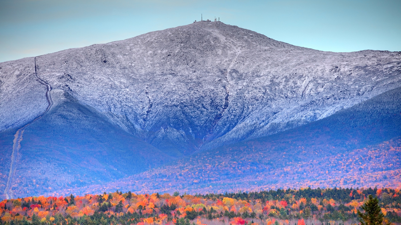
29. New Hampshire
> Highest peak: Mount Washington
> Elevation above sea level: 6,288 ft.
> Coordinates: 44.3° N, 71.3° W
> Value added in 2017 camping, hiking, boating, and hunting: $1.02 billion
> 2018 population: 1,356,458
Mount Washington is known more for its volatile weather than its height. The mountain is home to an observatory that recorded temperatures of -100 degrees with windchill in early January. The fastest gust of wind ever, at 231 miles per hour, also was recorded there in 1934. The record stood until 1996, when it was replaced by a typhoon in Australia.
[in-text-ad-2]
Source: Famartin / Wikimedia Commons
30. New Jersey
> Highest peak: High Point
> Elevation above sea level: 1,803 ft.
> Coordinates: 41.3° N, 74.7° W
> Value added in 2017 camping, hiking, boating, and hunting: $3.25 billion
> 2018 population: 8,908,520
The appropriately named High Point peaks out above the rest of the Kittatinny Mountains in New Jersey. As if it’s not tall enough, an obelisk at the peak adds another 220 feet to the top of High Point. It was placed there in 1930 as a war veteran memorial.
Source: JordanListon / iStock
31. New Mexico
> Highest peak: Wheeler Peak
> Elevation above sea level: 13,161 ft.
> Coordinates: 36.6° N, 105.4° W
> Value added in 2017 camping, hiking, boating, and hunting: $634.5 million
> 2018 population: 2,095,428
For much of its history, Wheeler Peak was named Taos Peak. The name was changed in 1950 in honor of George Montague Wheeler, who led the effort to survey New Mexico and other areas in the Southwest.
[in-text-ad]
Source: Public Domain / Wikimedia Commons
32. New York
> Highest peak: Mount Marcy
> Elevation above sea level: 5,344 ft.
> Coordinates: 44.1° N, 73.9° W
> Value added in 2017 camping, hiking, boating, and hunting: $8.51 billion
> 2018 population: 19,542,209
New York is known for its tall buildings, but its tallest natural peak reaches just over 1 mile above sea level. Mount Marcy sits in the Adirondack Mountains in upstate New York. As far as mountains go, Marcy is fairly isolated, providing spectacular views of the surrounding area.
Source: Brian Stansberry / Wikimedia Commons
33. North Carolina
> Highest peak: Mount Mitchell
> Elevation above sea level: 6,684 ft.
> Coordinates: 35.8° N, 82.3° W
> Value added in 2017 camping, hiking, boating, and hunting: $3.33 billion
> 2018 population: 10,383,620
Mount Mitchell is named for Elisha Mitchell, the professor who determined that the mountain was in fact the tallest in the eastern U.S. Tragically, Mitchell died after his findings were challenged. When he went back to prove his claim, he fell to his death at a nearby waterfall.
Source: Courtesy of Good Free Photos
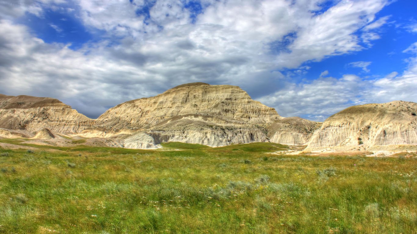
34. North Dakota
> Highest peak: White Butte
> Elevation above sea level: 3,506 ft.
> Coordinates: 46.4° N, 103.3° W
> Value added in 2017 camping, hiking, boating, and hunting: $414.0 million
> 2018 population: 760,077
White Butte resides in the Little Missouri National Grasslands, but it is noticeable because of its chalky white color. The source of the color is from the bentonite clay that makes up the butte, which was formed by a glacier that covered the area thousands of years earlier.
[in-text-ad-2]
Source: Courtesy of Good Free Photos
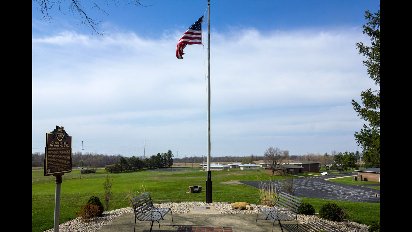
35. Ohio
> Highest peak: Campbell Hill
> Elevation above sea level: 1,550 ft.
> Coordinates: 40.4° N, 83.7° W
> Value added in 2017 camping, hiking, boating, and hunting: $3.51 billion
> 2018 population: 11,689,442
Campbell Hill in Ohio is just the high point of a gentle slope near some farmland. The hill was once home to an Air Force base, but that has since moved. A vocational school now sits in its place.
Source: Chris M / Wikimedia Commons
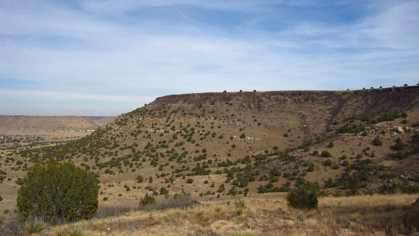
36. Oklahoma
> Highest peak: Black Mesa
> Elevation above sea level: 4,973 ft.
> Coordinates: 36.9° N, 103.0° W
> Value added in 2017 camping, hiking, boating, and hunting: $1.26 billion
> 2018 population: 3,943,079
Oklahoma’s Black Mesa was once outside the jurisdiction of law enforcement, making it an ideal place for outlaws such as Black Jack Ketchum and William Coe to avoid authorities. More recently, some Oklahomans have claimed they were abducted by aliens near the Black Mesa area.
[in-text-ad]
Source: Public Domain / Wikimedia Commons
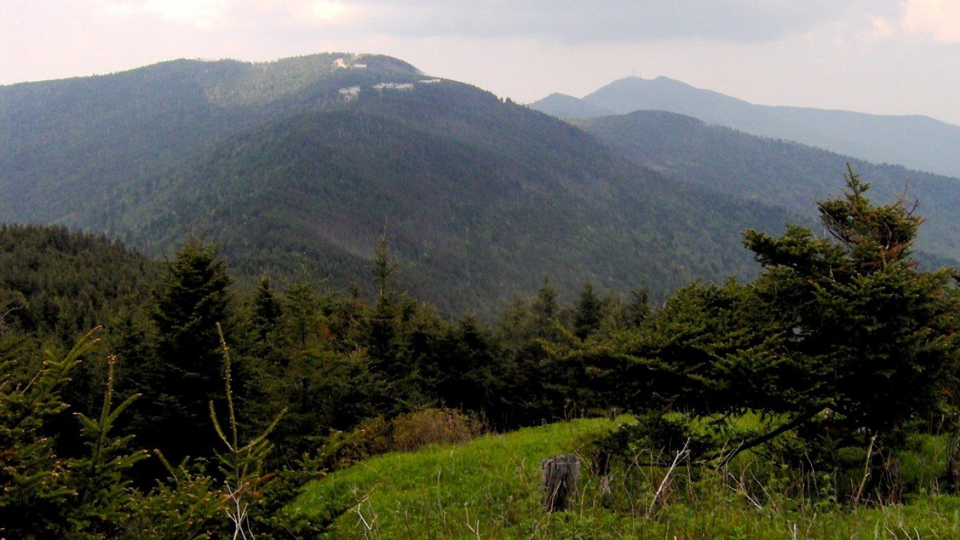
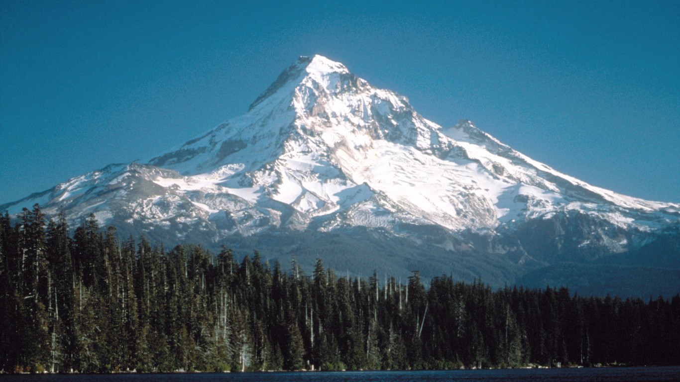
37. Oregon
> Highest peak: Mount Hood
> Elevation above sea level: 11,239 ft.
> Coordinates: 45.4° N, 121.7° W
> Value added in 2017 camping, hiking, boating, and hunting: $2.47 billion
> 2018 population: 4,190,713
The volcano Mount Hood hasn’t erupted in well over a century, and the U.S. Geological Survey believes the chances of an imminent eruption are very slim. The peak of Mount Hood is covered with 11 different glaciers.
 24/7 Wall St.
Source: Jarek Tuszyński / Wikimedia Commons
38. Pennsylvania
> Highest peak: Mount Davis
> Elevation above sea level: 3,213 ft.
> Coordinates: 39.8° N, 79.2° W
> Value added in 2017 camping, hiking, boating, and hunting: $4.30 billion
> 2018 population: 12,807,060
Though Mount Davis towers over the rest of Pennsylvania, the peak is relatively flat. This means it can be hard to see much of the surrounding area like the base of the mountain.
Source: Fredlyfish4 / Wikimedia Commons
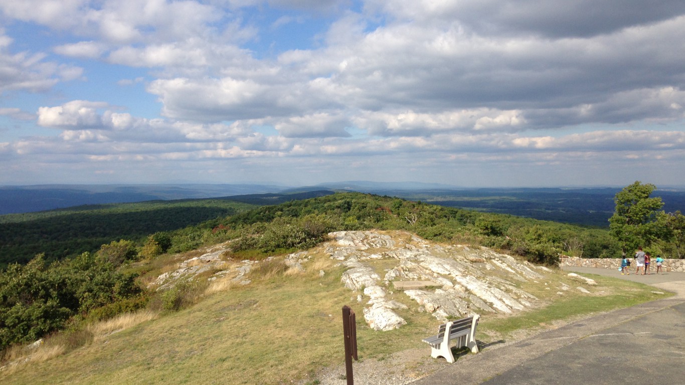
39. Rhode Island
> Highest peak: Jerimoth Hill
> Elevation above sea level: 812 ft.
> Coordinates: 41.9° N, 71.8° W
> Value added in 2017 camping, hiking, boating, and hunting: $365.2 million
> 2018 population: 1,057,315
Despite its low elevation, Jerimoth Hill used to be one of the most difficult state high points to reach. The hike wasn’t difficult, but the man who owned the land was notoriously unfriendly to those wanting to summit the hill. Eventually, he relented and sold the land, which is now open to hikers.
[in-text-ad-2]
Source: DXR / Wikimedia Commons
40. South Carolina
> Highest peak: Sassafras Mountain
> Elevation above sea level: 3,560 ft.
> Coordinates: 35.1° N, 82.8° W
> Value added in 2017 camping, hiking, boating, and hunting: $2.16 billion
> 2018 population: 5,084,127
Sassafras Mountain is dwarfed by many nearby mountains in the Blue Ridge Mountain Range. It may have been largely unnoticed, except that it falls just on the South Carolina side of the border with North Carolina, making it the tallest in its state.
Source: Vocaro / Wikimedia Commons
41. South Dakota
> Highest peak: Black Elk Peak
> Elevation above sea level: 7,242 ft.
> Coordinates: 43.9° N, 103.5° W
> Value added in 2017 camping, hiking, boating, and hunting: $457.2 million
> 2018 population: 882,235
Until 2016, Black Elk Peak was named Harney Peak. There was a significant effort from Native American groups to change the name as Gen. William Harney gained notoriety for fighting Natives during the U.S. westward expansion, whereas Black Elk was a revered spiritual leader.
[in-text-ad]
Source: SeanPavonePhoto / iStock
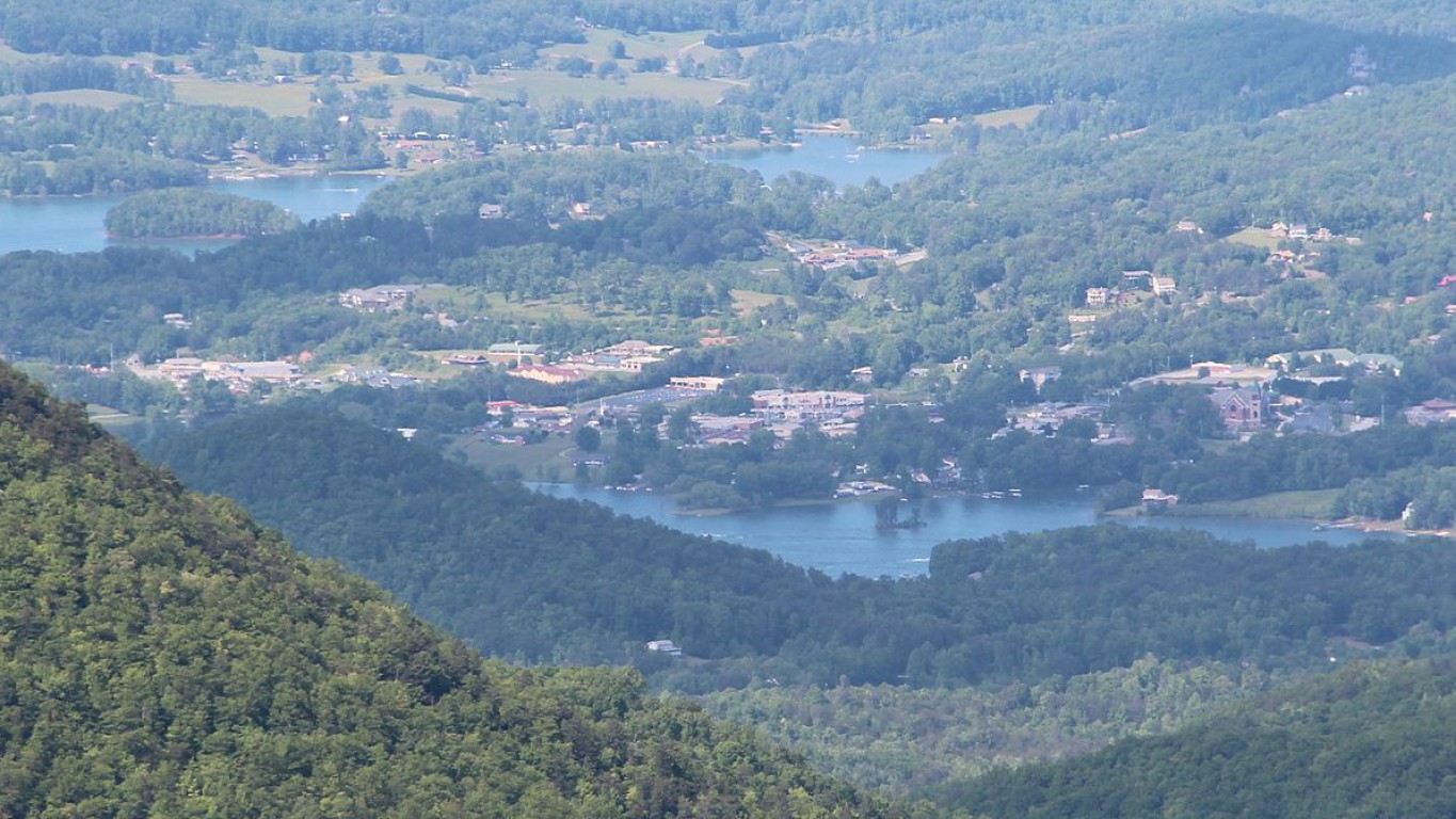
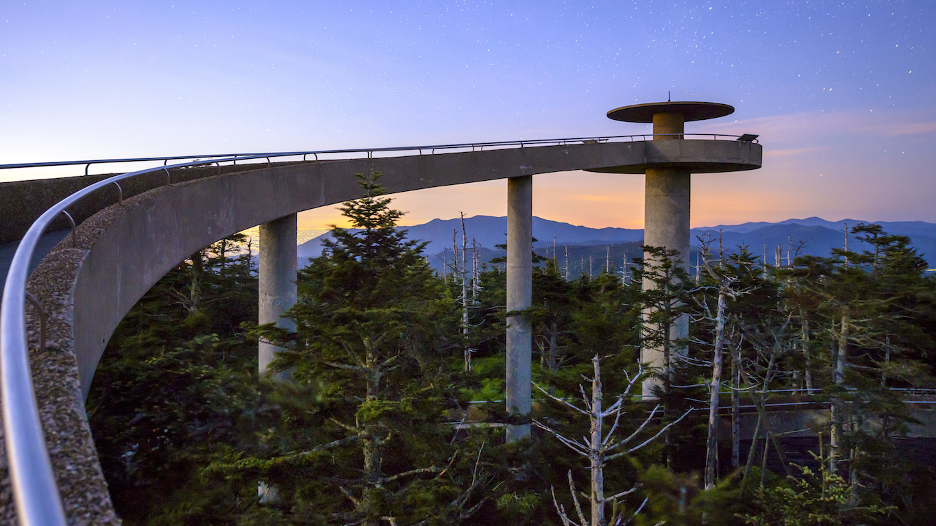
42. Tennessee
> Highest peak: Clingmans Dome
> Elevation above sea level: 6,643 ft.
> Coordinates: 35.6° N, 83.5° W
> Value added in 2017 camping, hiking, boating, and hunting: $2.47 billion
> 2018 population: 6,770,010
Clingmans Dome in the Great Smoky Mountains National Park is so tall that it is one of the few spots that can offer both hiking and skiing. The road up to the peak is closed from December through March to cars, but cross-country skiers can still get around.
Source: Leaflet / Wikimedia Commons
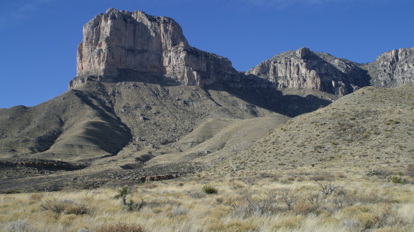
43. Texas
> Highest peak: Guadalupe Peak
> Elevation above sea level: 8,749 ft.
> Coordinates: 31.9° N, 104.9° W
> Value added in 2017 camping, hiking, boating, and hunting: $11.19 billion
> 2018 population: 28,701,845
Guadalupe Peak is a challenge to hike, but those who can muster the six- to eight-hour round trip journey will be rewarded with an unparalleled view of the American Southwest. American Airlines placed a steel monument at the top of the peak in 1958 to honor stagecoach drivers who delivered mail to remote areas in the 1800s.
Source: Hyrum K. Wright / Wikimedia Commons
44. Utah
> Highest peak: Kings Peak
> Elevation above sea level: 13,528 ft.
> Coordinates: 40.8° N, 110.4° W
> Value added in 2017 camping, hiking, boating, and hunting: $1.84 billion
> 2018 population: 3,161,105
Despite its regal views, Kings Peak wasn’t named after a monarch. The name comes from Clarence King, the The United States Geological Survey’s first director. Anyone hoping to summit Kings Peak should carve out at least two days for the trip as the standard hiking trip is nearly 30 miles round trip.
[in-text-ad-2]
Source: Michlaovic / Wikimedia Commons
45. Vermont
> Highest peak: Mount Mansfield
> Elevation above sea level: 4,393 ft.
> Coordinates: 44.5° N, 72.8° W
> Value added in 2017 camping, hiking, boating, and hunting: $475.7 million
> 2018 population: 626,299
Many tall mountain peaks could be described as beautiful, but Mount Mansfield may be the only one that might be considered handsome. When viewed from the east, the mountain resembles a man’s face in profile. Parts of the mountain have gained anatomical nicknames, including Adams Apple, Chin, Nose, and Forehead.
Source: BramReusen / iStock
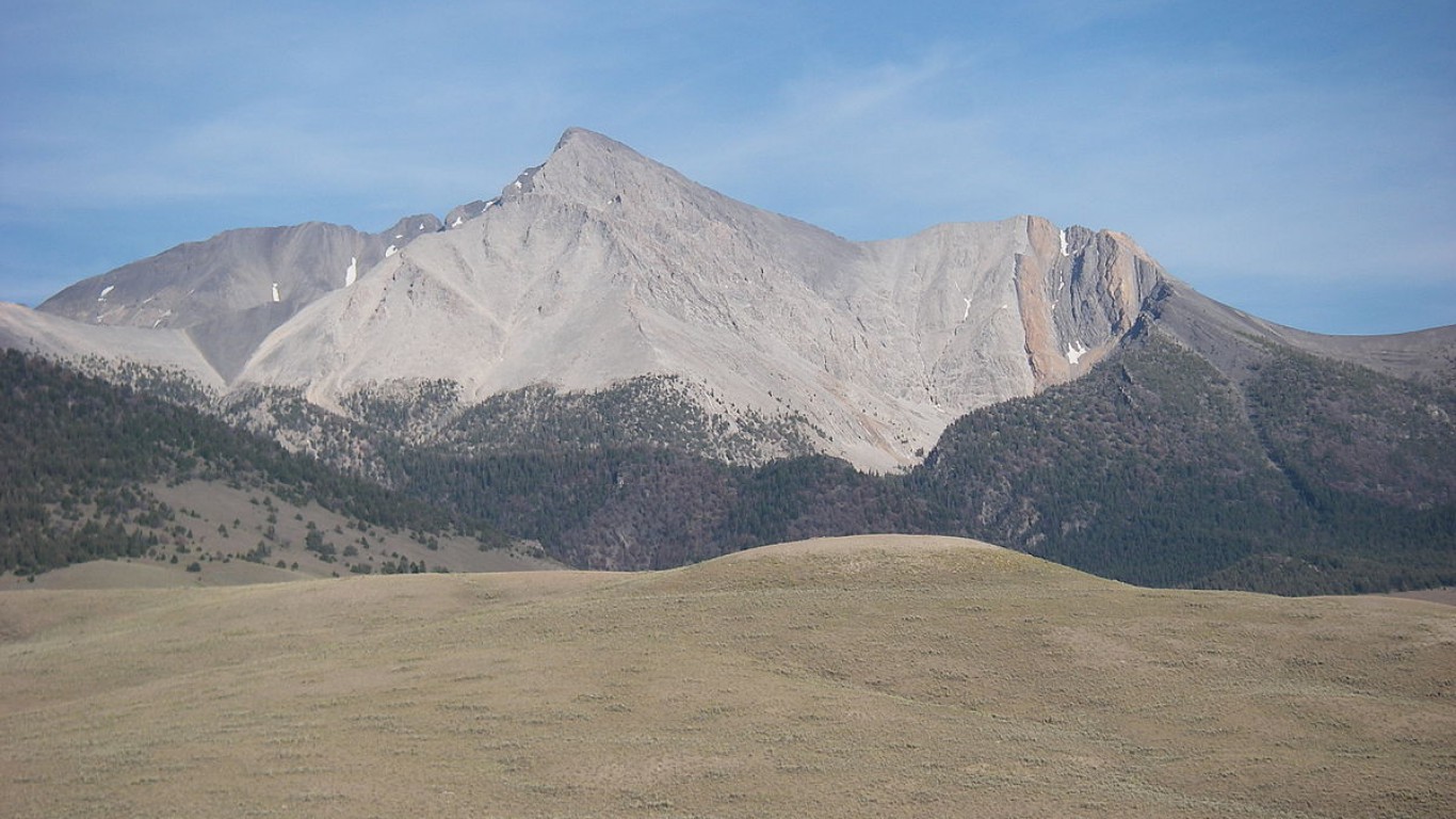
46. Virginia
> Highest peak: Mount Rogers
> Elevation above sea level: 5,729 ft.
> Coordinates: 36.7° N, 81.5° W
> Value added in 2017 camping, hiking, boating, and hunting: $2.39 billion
> 2018 population: 8,517,685
Mount Rogers is a popular tourist destination, offering numerous different outdoor activities. Visitors can hike, swim, ride horses, and even cross-country ski during the winter. The area has 500 miles of trails and welcomes over 1 million visitors annually.
[in-text-ad]
Source: Tobi 87 / Wikimedia Commons
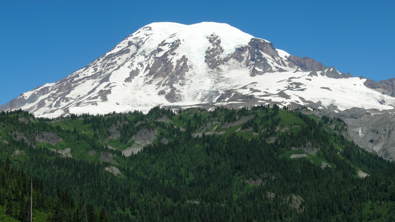
47. Washington
> Highest peak: Mount Rainier
> Elevation above sea level: 14,411 ft.
> Coordinates: 46.9° N, 121.8° W
> Value added in 2017 camping, hiking, boating, and hunting: $3.46 billion
> 2018 population: 7,535,591
Though it may be enticing to climbers and hikers in the Pacific Northwest, Mount Rainier should be viewed with some caution. The United States Geological Survey reports that Rainier is one of the most dangerous volcanoes in the country, and it may go off with little or no warning.
 24/7 Wall St.
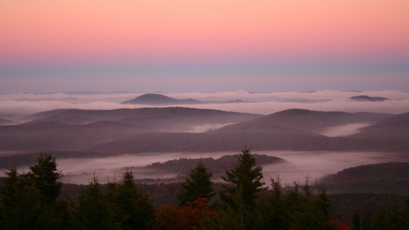
Source: ForestWander / Wikimedia Commons
48. West Virginia
> Highest peak: Spruce Knob
> Elevation above sea level: 4,863 ft.
> Coordinates: 38.7° N, 79.5° W
> Value added in 2017 camping, hiking, boating, and hunting: $451.0 million
> 2018 population: 1,805,832
Spruce Knob towers over the rest of West Virginia and the entire Allegheny Mountain range. There is an observation deck at the top of the mountain, offering a full view of the surrounding area.
Source: Skye Marthaler / Wikimedia Commons
49. Wisconsin
> Highest peak: Timms Hill
> Elevation above sea level: 1,951 ft.
> Coordinates: 45.5° N, 90.2° W
> Value added in 2017 camping, hiking, boating, and hunting: $3.42 billion
> 2018 population: 5,813,568
Timms Hill sits between Timms Lake and Bass Lake, making it an optimal fishing destination. During the colder months, the hill is still accessible by snowmobile and offers a place for cross-country skiing and snowshoeing.
[in-text-ad-2]
Source: U.S. Forest Service / Wikimedia Commons
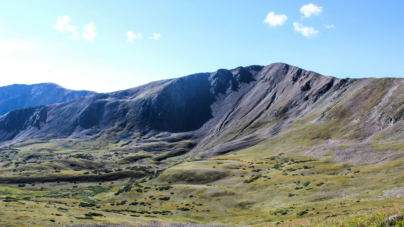
50. Wyoming
> Highest peak: Gannett Peak
> Elevation above sea level: 13,804 ft.
> Coordinates: 43.2° N, 109.7° W
> Value added in 2017 camping, hiking, boating, and hunting: $335.7 million
> 2018 population: 577,737
Gannett Peak in Wyoming is reserved for only the most experienced mountaineers and climbers. The tallest of the Wind River mountain range is extremely remote and challenging to climb. Most people need several days to get to the top.
Detailed Findings & Methodology
The states with the tallest mountains are not necessarily the highest states above sea level. While the summit of Washington’s Mount Rainier reaches 14,411 feet, the fourth highest peak of any state, the average elevation of the state is 1,700 feet, approximately 70% of the national average elevation of 2,500 feet. The state with the highest average elevation is Colorado, which stands at 6,800 feet above sea level.
Some states also have more topographic diversity than others. While California has the second highest peak of any state, it also has the lowest elevation in the country. Situated 282 feet below sea level, Death Valley is the lowest point in both California and the United States. The difference between California’s 14,494-foot peak atop Mount Whitney and its Death Valley trough is nearly 3 miles. Meanwhile, in flatter states such as Florida and Delaware, the difference between the highest and lowest point is less than 500 feet.
Mountainous states provide residents with access to recreational opportunities, which may ultimately contribute to positive health outcomes. In states like California, Colorado, and Washington, which have the second, third, and fourth highest peaks in the country, approximately 90% of residents have adequate access to locations for physical activity such as parks and recreational centers — much greater than the 84% national average.
Residents of higher-elevation states tend to have healthier behaviors overall. According to County Health Rankings & Roadmaps, a Robert Wood Johnson Foundation and University of Wisconsin Population Health Institute joint program, the shares of adults who do not regularly exercise in California, Colorado, and Washington are, respectively, 17.4%, 17.1%, and 14.4% — the fifth lowest, fourth lowest, and lowest inactivity rates in the nation.
To determine the highest point in every state, 24/7 Wall St. used data from the U.S. Census Bureau’s 2012 Statistical Abstract of the United States. Outdoor recreation consumer spending figures came from the Bureau of Economic Analysis and are for 2017. Conventional outdoor recreation activities (such as camping, hiking, boating, and hunting); other core activities.
Sponsored: Want to Retire Early? Here’s a Great First Step
Want retirement to come a few years earlier than you’d planned? Or are you ready to retire now, but want an extra set of eyes on your finances?
Now you can speak with up to 3 financial experts in your area for FREE. By simply clicking here you can begin to match with financial professionals who can help you build your plan to retire early. And the best part? The first conversation with them is free.
Click here to match with up to 3 financial pros who would be excited to help you make financial decisions.
Thank you for reading! Have some feedback for us?
Contact the 24/7 Wall St. editorial team.
Editors' Picks