There are 57.3 million square miles of land on Earth, yet 95% of the planet’s human population inhabits only 10% of that land, according to the World Bank.
To identify the least densely populated countries on Earth, 24/7 Tempo reviewed population density data from the World Bank for about 270 countries. Information on land area came from the Food and Agriculture Organization of the United Nations.
Climate and geography play a significant role in population density. The most sparsely populated areas on Earth tend to be those with limited access to fresh water, including deserts and arctic zones, as well as those with dense impassable rain forest, rugged mountains, or those isolated from continental zones by miles of ocean.
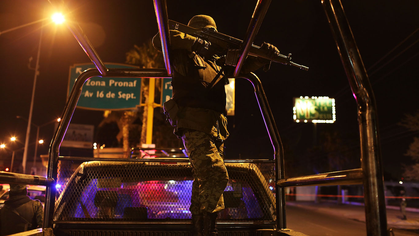
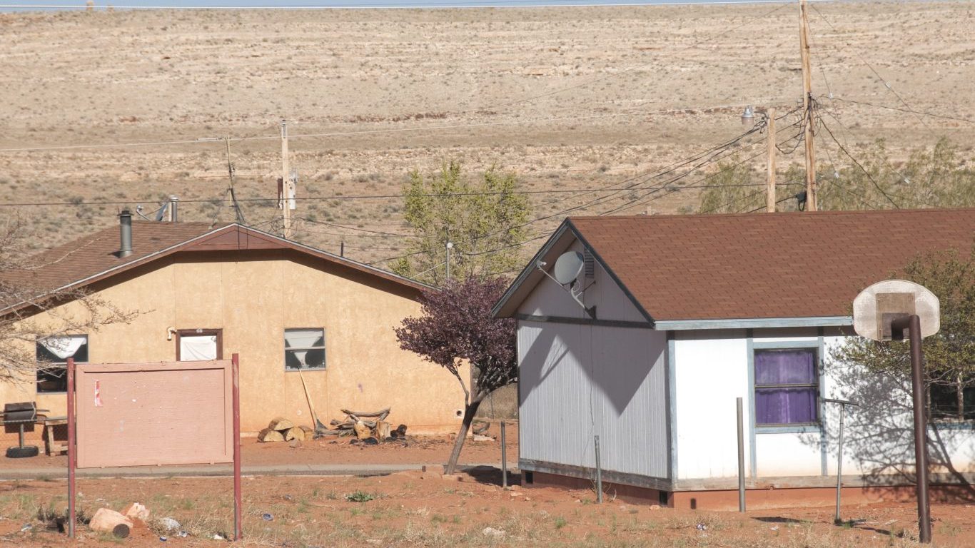
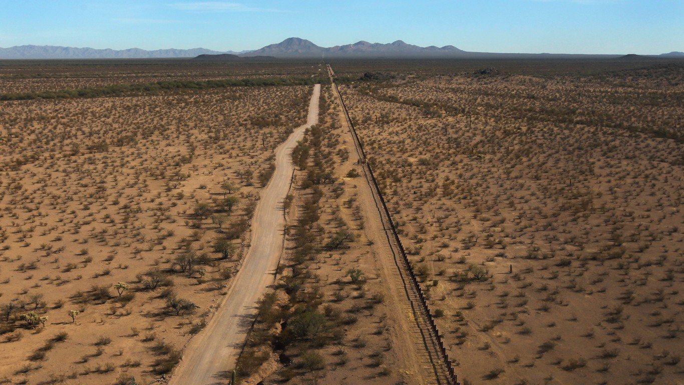
The United States is among the largest countries in the world by land area as well as among the most populous. But because of its size, it’s in the top 55 least densely populated countries. Population density varies greatly nationwide, with higher density along the East and West Coasts and lower density in rural areas in the middle of the country. Here is how every state’s population has changed since 2010.
Click here to see the least densely populated countries in the world
Source: Norimoto / Getty Images
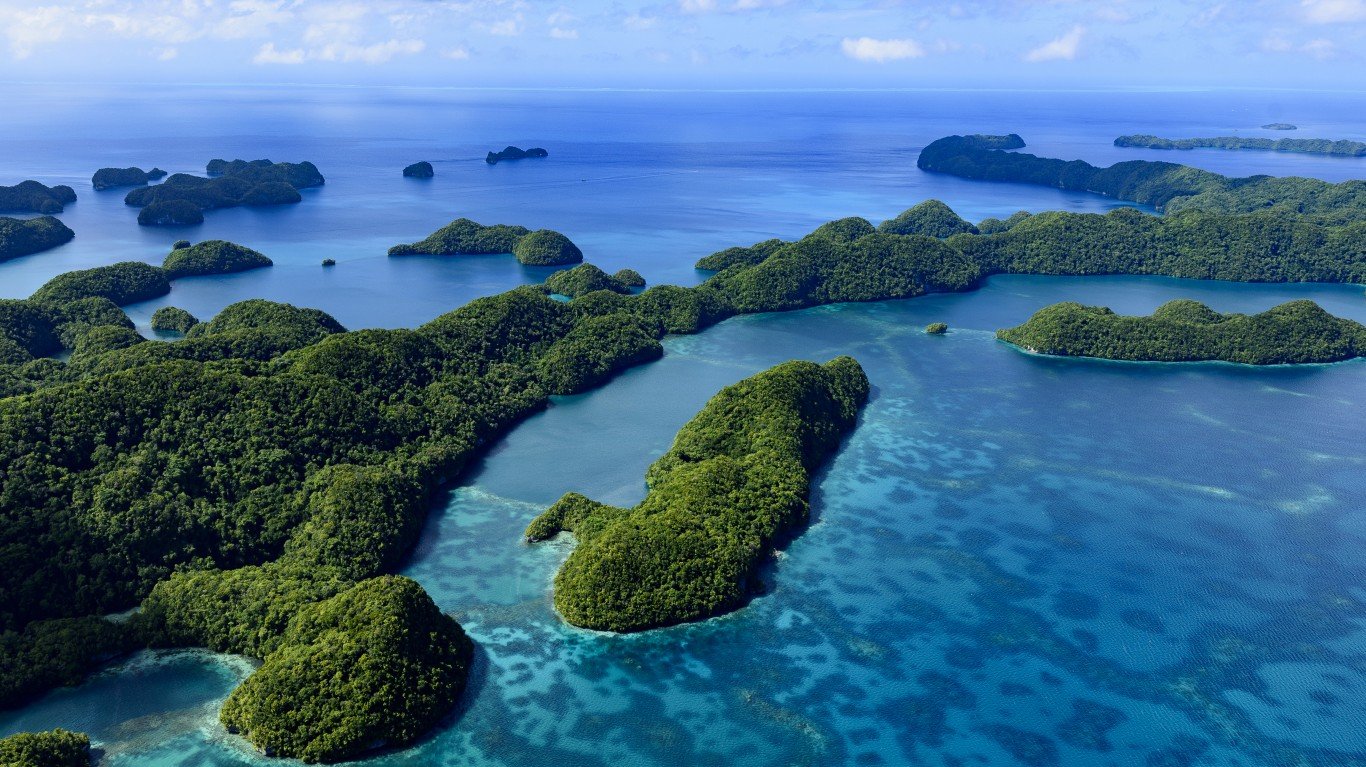
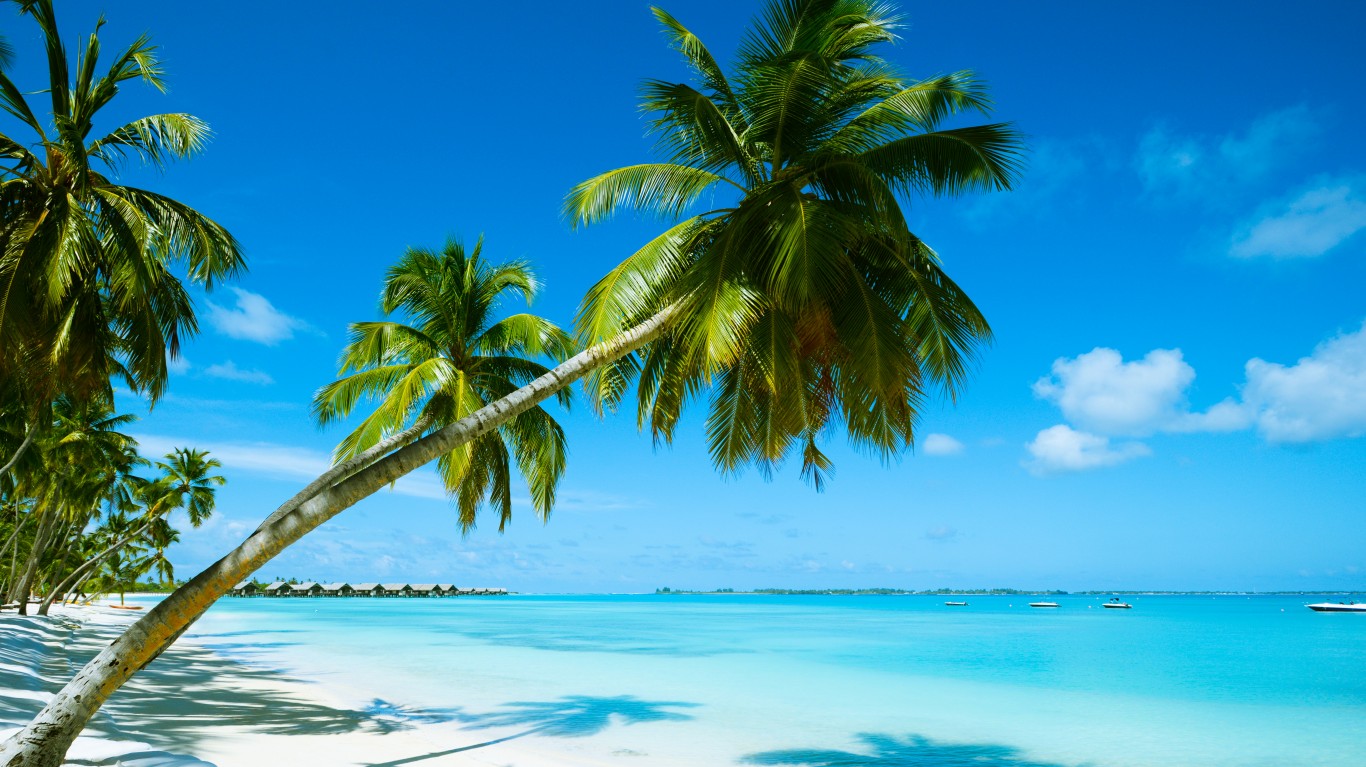
55. Palau
> Population density: 102 people per square mile
> Est. population 2020: 18,092 — #214 out of 217 countries
> Land area: 178 square miles — #189 out of 217 countries
> Population growth, 2015-2020: 2.4%
Palau is a tropical archipelago in the Western Pacific consisting of about 340 coral and volcanic islands. The most populated city is Koror where about 11,000 people live. Koror was the country’s capital until 2006.
[in-text-ad]
Source: PhotoTalk / Getty Images
54. The Bahamas
> Population density: 102 people per square mile
> Est. population 2020: 393,248 — #174 out of 217 countries
> Land area: 3,865 square miles — #163 out of 217 countries
> Population growth, 2015-2020: 5.1%
Located in the Atlantic Ocean, the Bahamas consists of about 700 islands, but people actually live only on 30 of them. The most populous island is New Providence, which is home to the Bahamas’ capital — Nassau. About two-thirds of the country’s population lives on New Providence.
Source: Tamer_Desouky / Getty Images
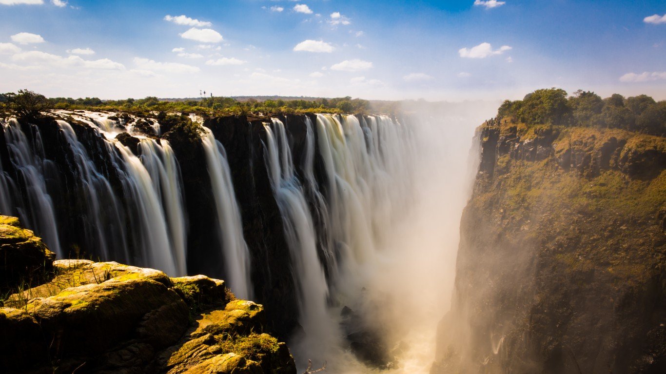
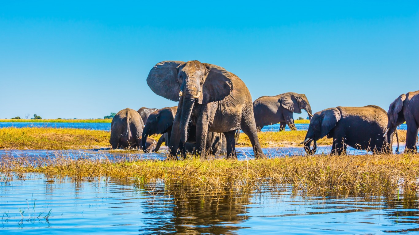
53. Zimbabwe
> Population density: 100 people per square mile
> Est. population 2020: 14,862,927 — #73 out of 217 countries
> Land area: 149,364 square miles — #61 out of 217 countries
> Population growth, 2015-2020: 7.6%
Zimbabwe, a landlocked country in southern Africa, best known for its diverse wildlife and safari areas, is about the size of Montana. The relatively high birth rate has kept the country’s population young with a median age of nearly 19 years old.
Source: GCShutter / Getty Images
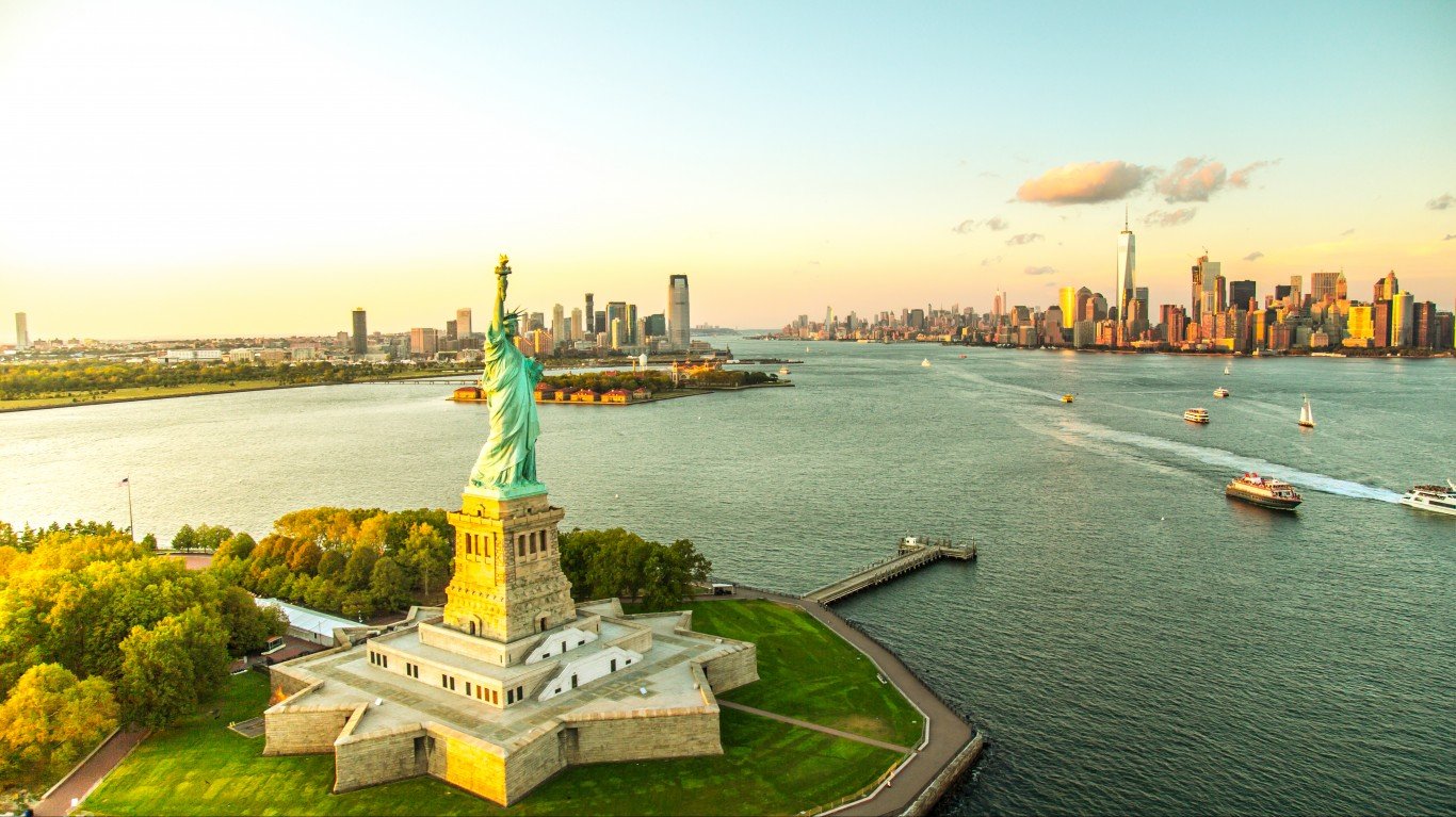
52. United States
> Population density: 93 people per square mile
> Est. population 2020: 329,484,123 — #3 out of 217 countries
> Land area: 3,531,837 square miles — #3 out of 217 countries
> Population growth, 2015-2020: 2.7%
The United States is the third largest country in the world by land area as well as the third largest in terms of population. The relatively high population growth has kept the country’s population young with a median age of nearly 19 years old.
[in-text-ad-2]
Source: stone973 / Getty Images
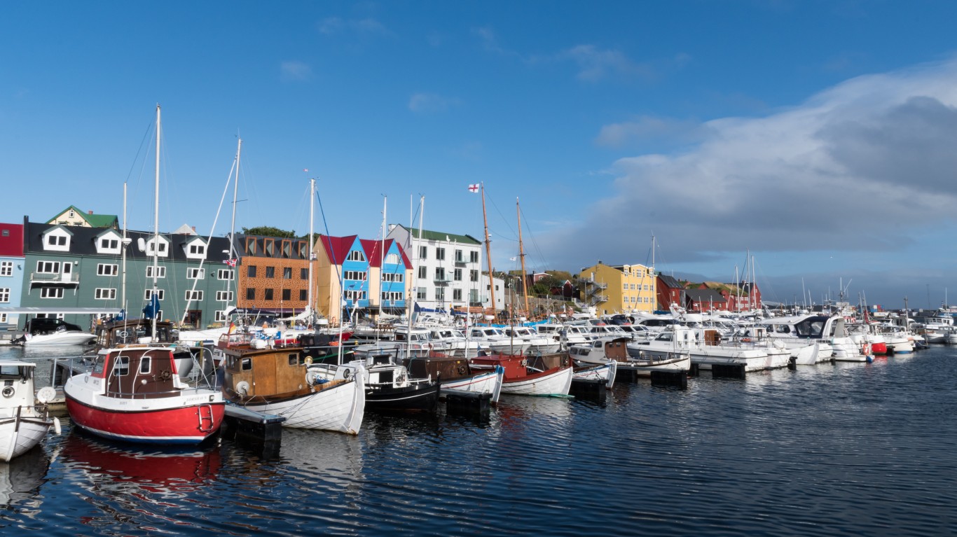
51. Faroe Islands
> Population density: 91 people per square mile
> Est. population 2020: 48,865 — #205 out of 217 countries
> Land area: 539 square miles — #175 out of 217 countries
> Population growth, 2015-2020: 1.7%
Faroe Islands, measuring about the size of Rhode Island, comprises 18 islands in the North Atlantic Ocean between Iceland and the Shetland Islands, north of the U.K. Faroe Islands are a self-governing territory officially part of the Kingdom of Denmark.
Source: LUKASZ-NOWAK1 / iStock via Getty Images
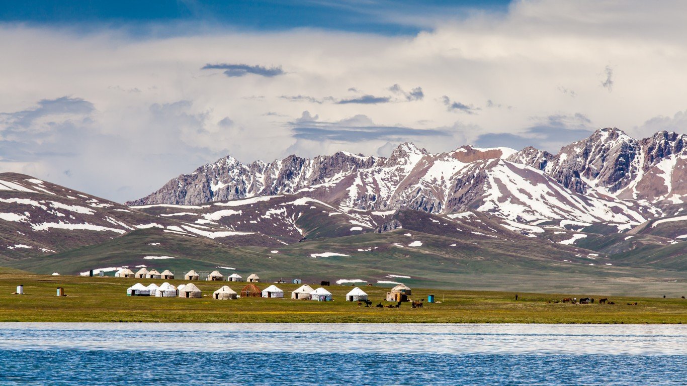
50. Kyrgyzstan
> Population density: 89 people per square mile
> Est. population 2020: 6,591,600 — #110 out of 217 countries
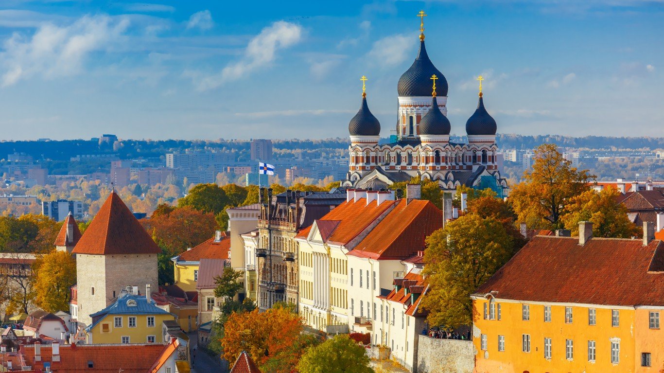
> Land area: 74,054 square miles — #87 out of 217 countries
> Population growth, 2015-2020: 10.7%
Officially the Kyrgyz Republic, but commonly known as Kyrgyzstan, the Central Asian, landlocked country consists of mostly mountainous terrain. The capital of Bishkek is the most populous city, around than 1 million inhabitants.
[in-text-ad]
Source: DouglasOlivares / Getty Images
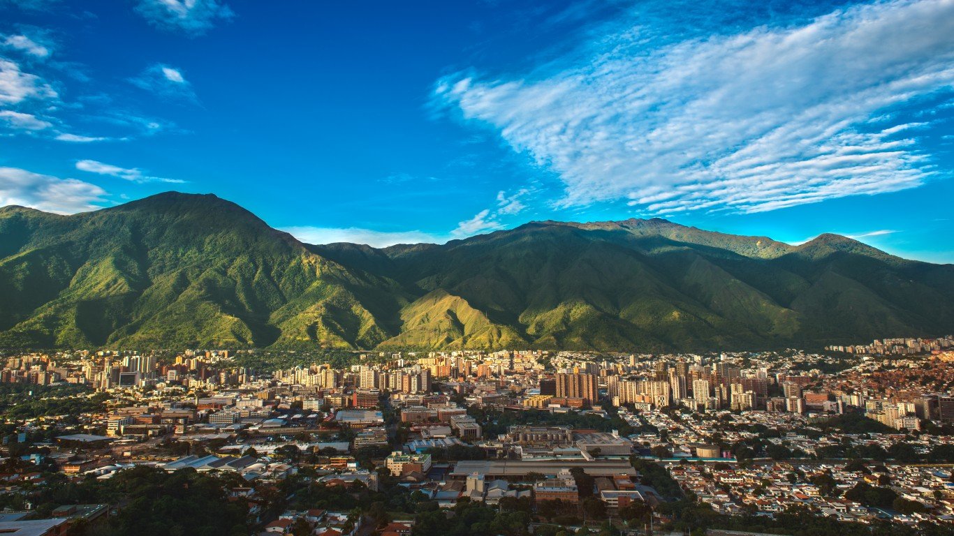
49. Venezuela
> Population density: 83 people per square mile
> Est. population 2020: 28,435,943 — #50 out of 217 countries
> Land area: 340,561 square miles — #32 out of 217 countries
> Population growth, 2015-2020: -5.5%
Venezuela is a geographically diverse country and includes mountains, tropical jungles, river plains, and arid coastal areas. The country’s population has declined by more than 5% as many have fled due to an economic and political crisis, more specifically hyperinflation, food and medicine shortages, as well as violence.
Source: fbxx / iStock via Getty Images
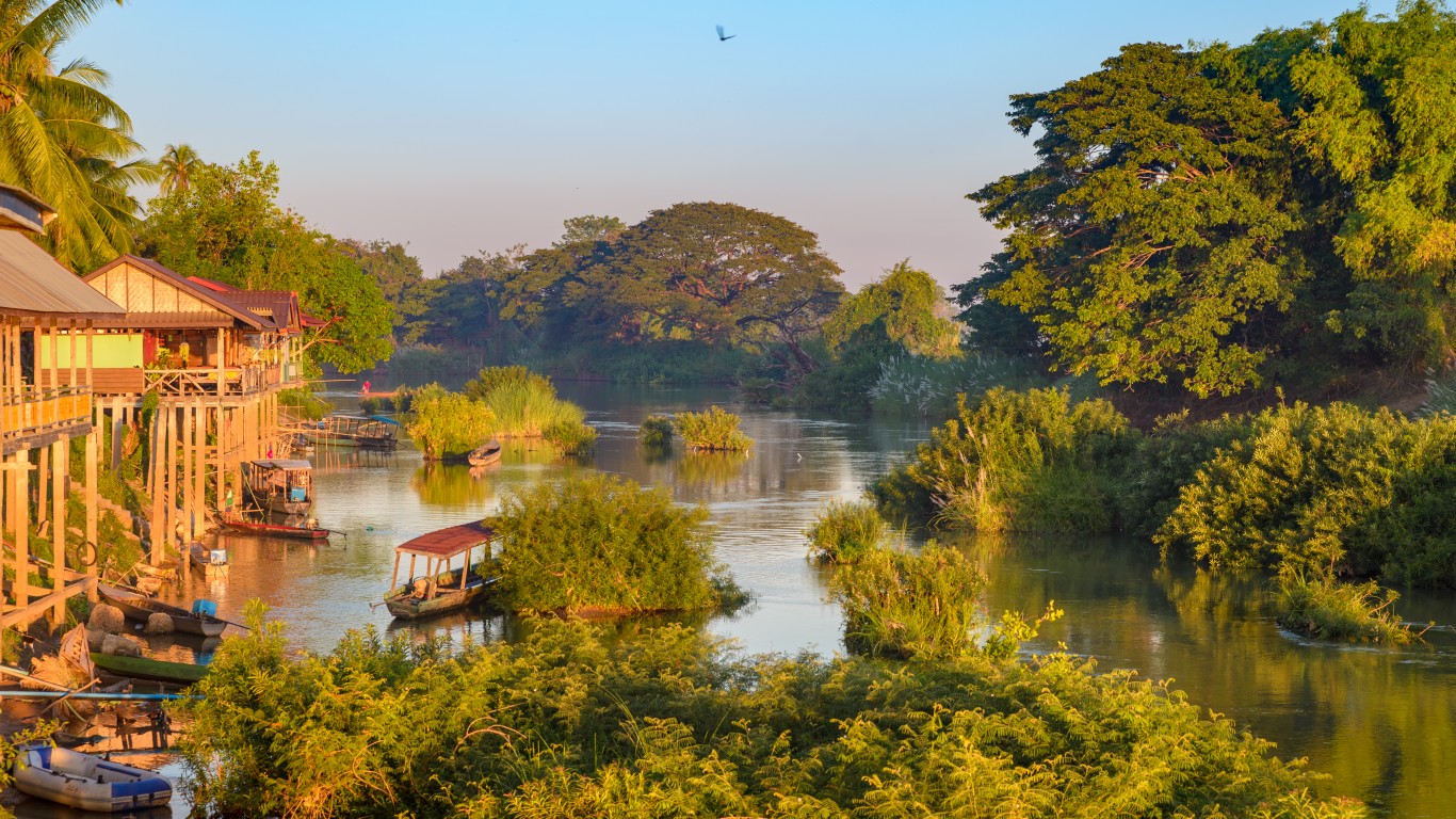
48. Laos
> Population density: 82 people per square mile
> Est. population 2020: 7,275,556 — #103 out of 217 countries
> Land area: 89,112 square miles — #80 out of 217 countries
> Population growth, 2015-2020: 7.9%
Officially the Lao People’s Democratic Republic, Laos is the only landlocked country in Southeast Asia. Laos has mostly mountainous and forested terrain. The country’s working-age population has been growing rapidly, but the country is also facing a decline in mortality as well as in fertility.
Source: KavalenkavaVolha / Getty Images
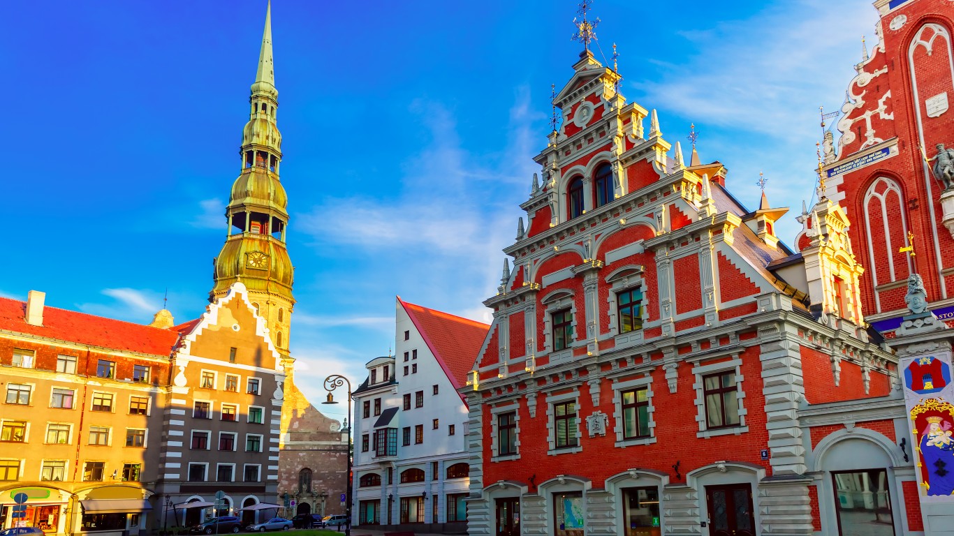
47. Latvia
> Population density: 79 people per square mile
> Est. population 2020: 1,901,548 — #149 out of 217 countries
> Land area: 23,973 square miles — #122 out of 217 countries
> Population growth, 2015-2020: -3.8%
Located on the eatern shore of the Baltic Sea, Latvia is only slightly larger than West Virginia. The most populous city is the capital, Riga, where more than 627,000 people — about a third of the country’s entire population — live.
[in-text-ad-2]
Source: KavalenkavaVolha / Getty Images
46. Estonia
> Population density: 79 people per square mile
> Est. population 2020: 1,331,057 — #154 out of 217 countries
> Land area: 16,784 square miles — #130 out of 217 countries
> Population growth, 2015-2020: 1.2%
One of three Baltic states, Estonia is one of the smallest countries in Europe. It’s a lowland country where the highest point — the Suur Munamägi hill — is just over 1,000 feet above sea level. The country’s population is mostly urban. About half of Estonia’s area is covered in forests.
Source: AdemarRangel / Getty Images
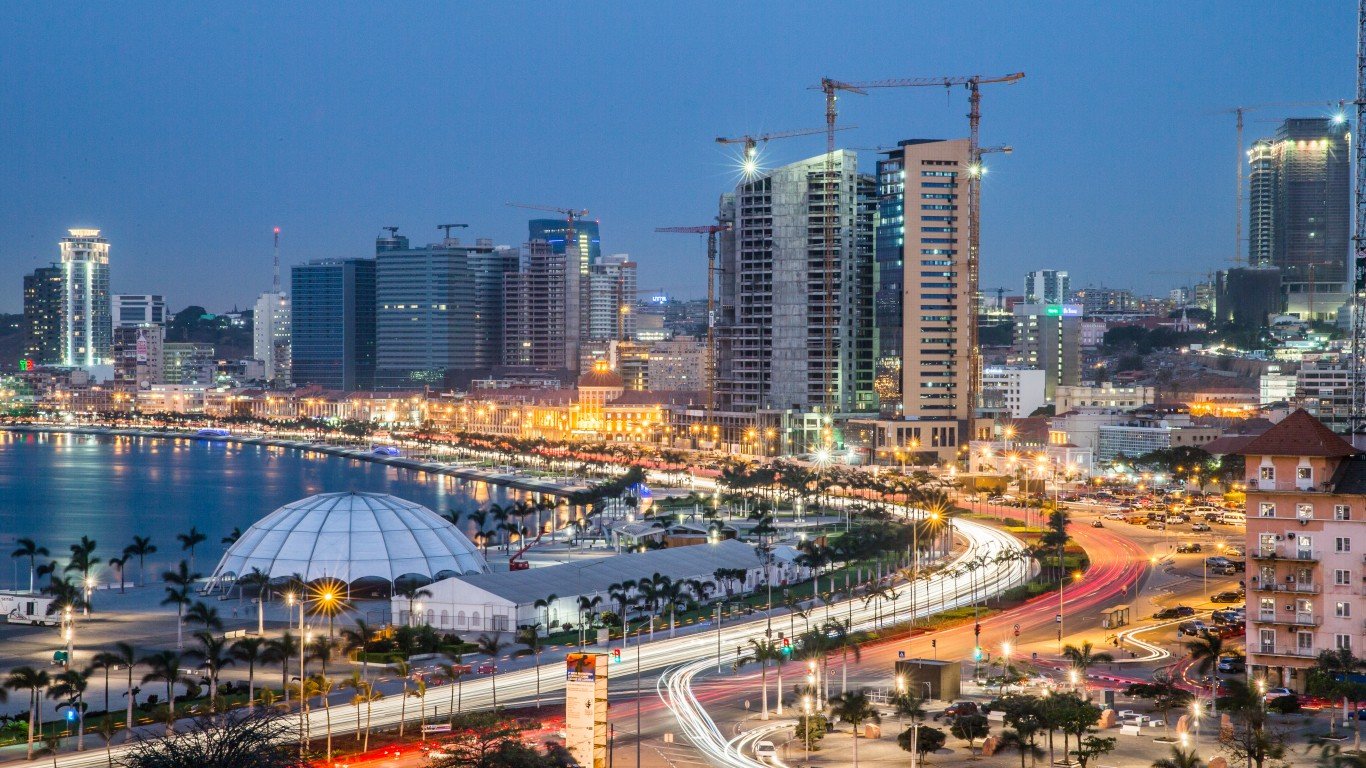
45. Angola
> Population density: 68 people per square mile
> Est. population 2020: 32,866,268 — #44 out of 217 countries
> Land area: 481,353 square miles — #22 out of 217 countries
> Population growth, 2015-2020: 17.9%
Located in southwestern Africa, Angola, which is about half the size of Texas, is a vast but sparsely-populated country. About 67% of the population lives in urban areas. Most of the rural population lives in the highlands.
[in-text-ad]
Source: antorti / iStock via Getty Images
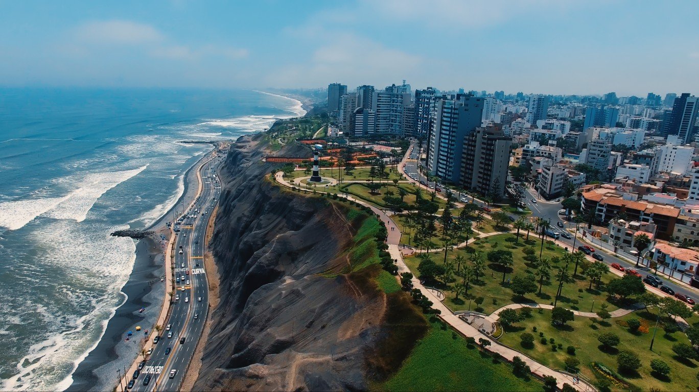
44. Peru
> Population density: 67 people per square mile
> Est. population 2020: 32,971,846 — #43 out of 217 countries
> Land area: 494,211 square miles — #19 out of 217 countries
> Population growth, 2015-2020: 8.2%
Peru is the third largest country in South America, after Brazil and Argentina. More than half of the population lives along the coastal desert, which covers just about 10% of the country. Half of Peru is covered by the Amazon rainforest.
 24/7 Wall St.
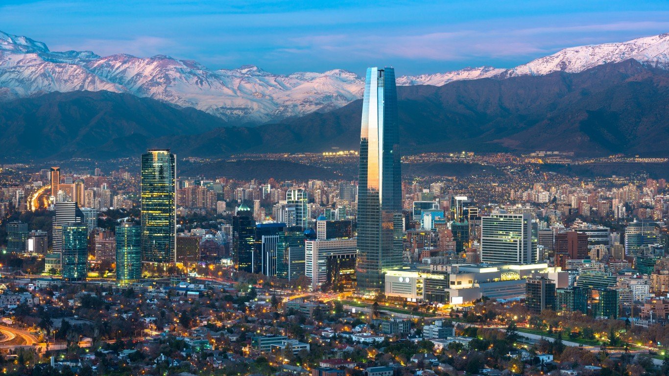
Source: tifonimages / Getty Images
43. Chile
> Population density: 67 people per square mile
> Est. population 2020: 19,116,209 — #62 out of 217 countries
> Land area: 287,079 square miles — #37 out of 217 countries
> Population growth, 2015-2020: 6.4%
A long and narrow country, Chile is located along the western seaboard of South America. A large section of the northern part of the country is an uninhabited desert. Most of the population is concentrated in larger cities in Central Chile, including the capital Santiago.
Source: Yuri de Mesquita Bar / Getty Images
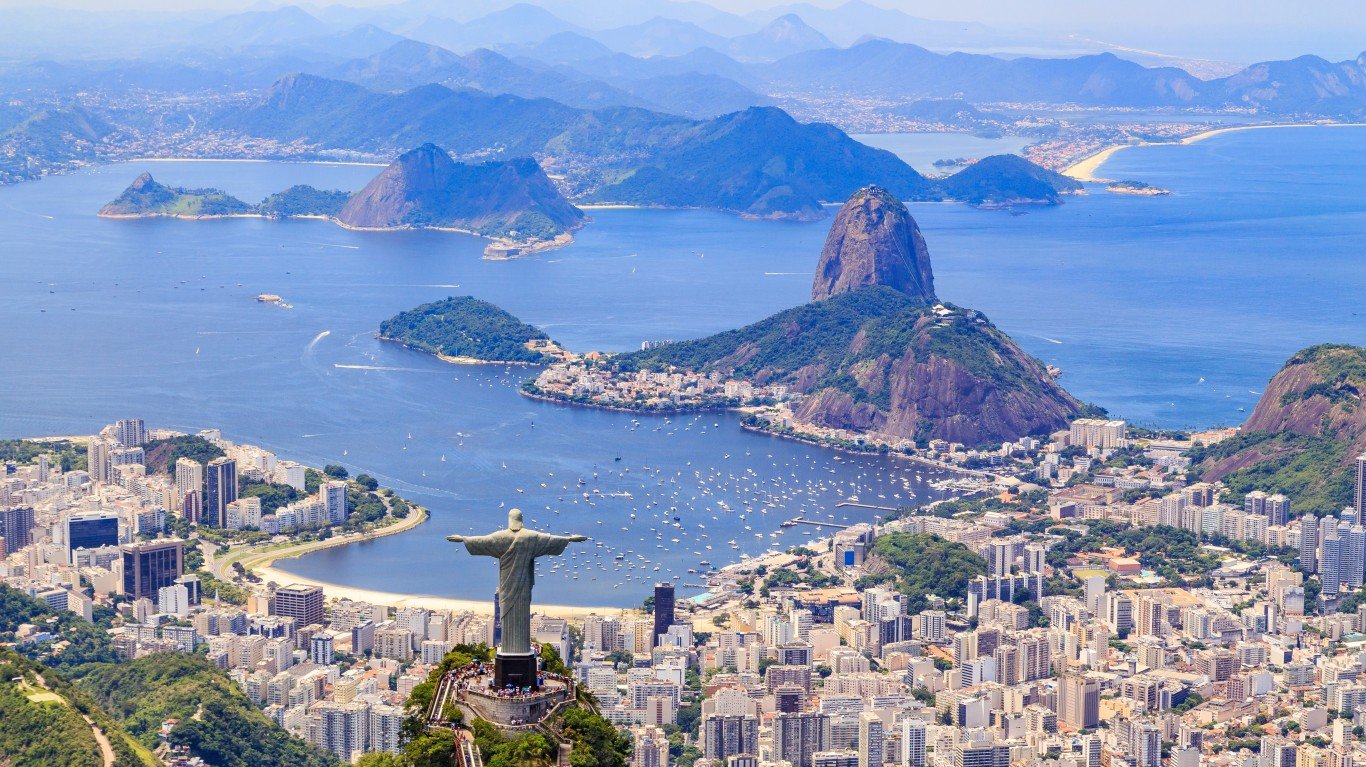
42. Brazil
> Population density: 66 people per square mile
> Est. population 2020: 212,559,409 — #6 out of 217 countries
> Land area: 3,227,095 square miles — #5 out of 217 countries
> Population growth, 2015-2020: 4.0%
At more than 3.2 square miles and over 2012 million people, Brazil is the world’s fifth largest country by total area and sixth most populous. The country makes up about half of South America’s land mass.
[in-text-ad-2]
Source: scanrail / Getty Images
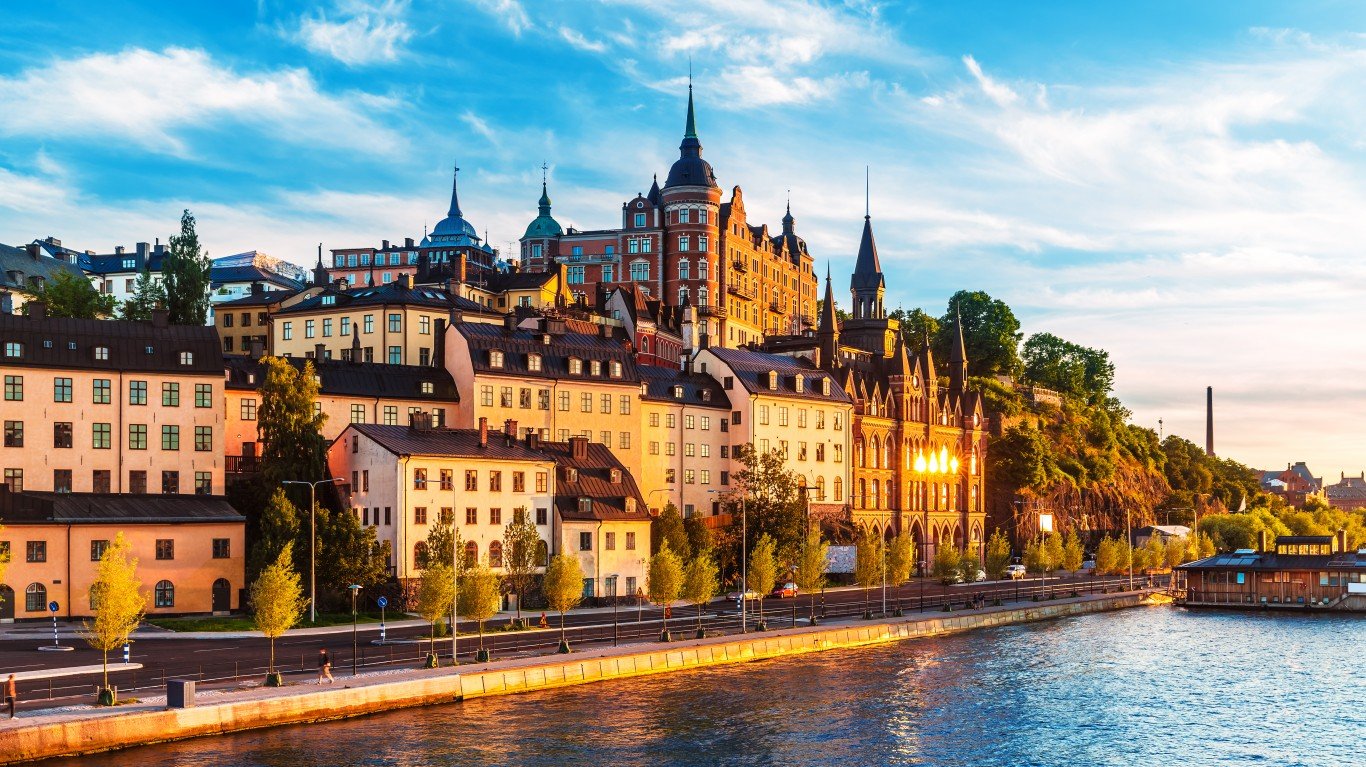
41. Sweden
> Population density: 66 people per square mile
> Est. population 2020: 10,353,442 — #87 out of 217 countries
> Land area: 157,263 square miles — #59 out of 217 countries
> Population growth, 2015-2020: 5.7%
Sweden is known for its mountains, but the mountainous region in the northern part of the country is considerably less populated than Sweden’s southern and central parts. Norrland, which is in the north, covers three-fifths of the country, but the region is largely mountainous and covered in forests.
Source: HomoCosmicos / Getty Images
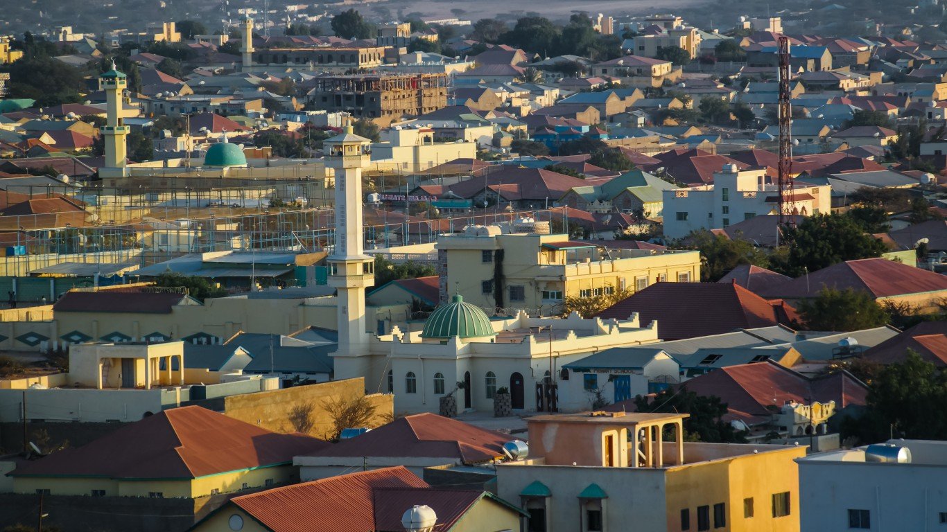
40. Somalia
> Population density: 66 people per square mile
> Est. population 2020: 15,893,219 — #72 out of 217 countries
> Land area: 242,217 square miles — #42 out of 217 countries
> Population growth, 2015-2020: 15.2%
The coastal nation of Somalia is located in eastern Africa at the Horn of Africa. An estimated 60% of the country’s population lives a nomadic lifestyle. Another 25% is thought to be made up of farmers, and the rest of the Somali population lives in urban cities. Somalia’s population is projected to rapidly increase and reach 75 million by the end of the century.
[in-text-ad]
Source: PietroPazzi / Getty Images
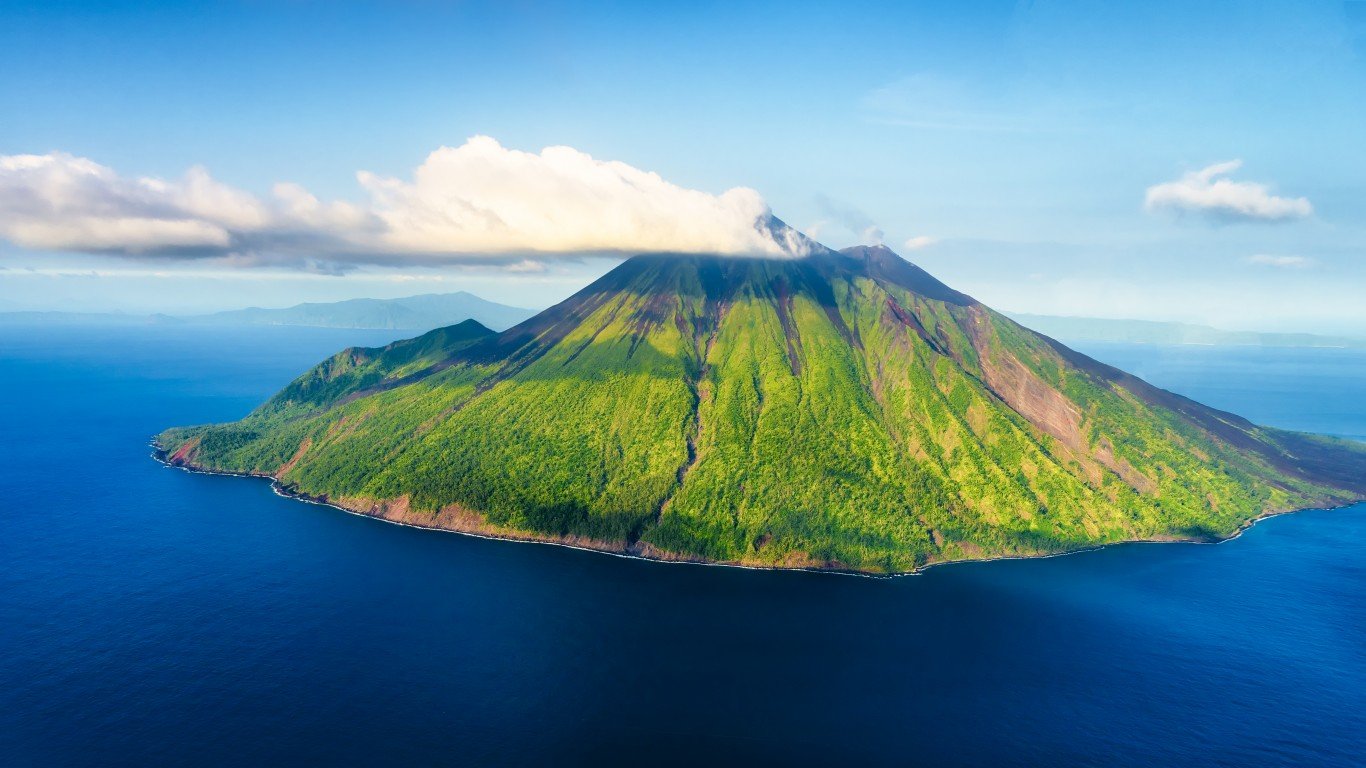
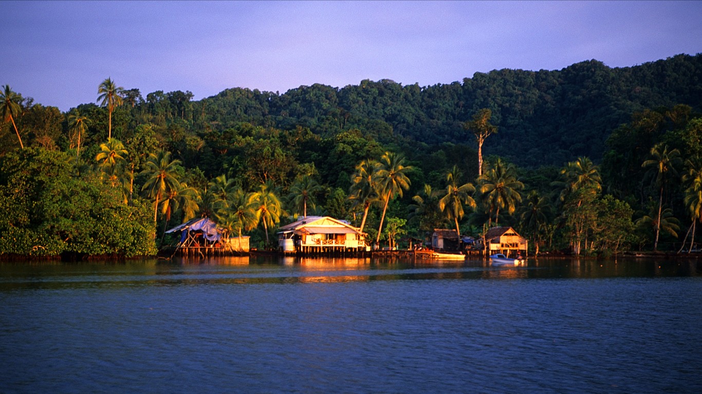
39. Vanuatu
> Population density: 65 people per square mile
> Est. population 2020: 307,150 — #176 out of 217 countries
> Land area: 4,707 square miles — #158 out of 217 countries
> Population growth, 2015-2020: 13.3%
Vanuatu consists of a group of 83 islands in the South Pacific Ocean, between Fiji and New Caledonia. There are three official languages — English, French, and Melanesian pidgin — though more than 100 local languages and dialects are spoken.
 24/7 Wall St.
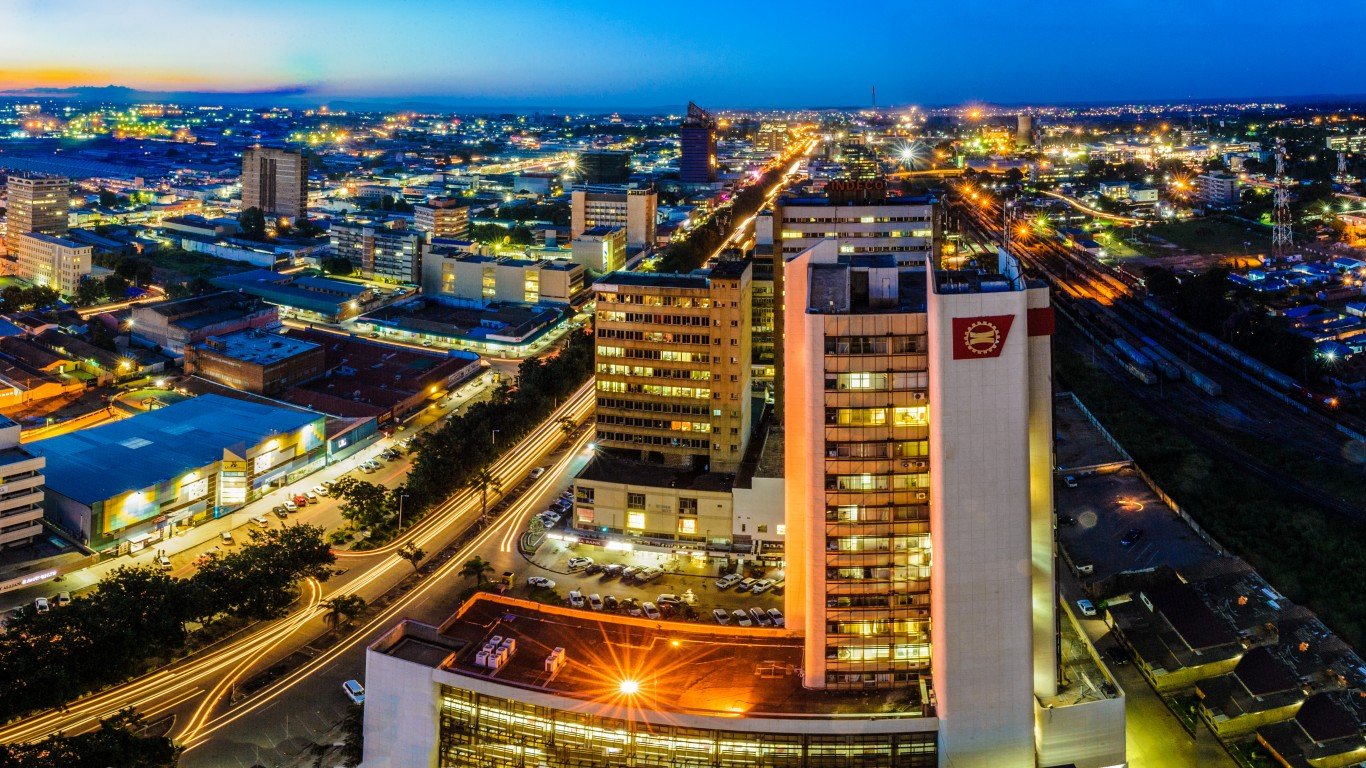
Source: Jason J Mulikita / Getty Images
38. Zambia
> Population density: 64 people per square mile
> Est. population 2020: 18,383,956 — #64 out of 217 countries
> Land area: 287,024 square miles — #38 out of 217 countries
> Population growth, 2015-2020: 15.8%
Much of the population of the landlocked country in Southern Africa lives in Zimbabwe’s most developed region, which is known as the Line of Rail. The area links the capital city, Lusaka in central Zambia with Copperbelt, a mining region. Zambia has one of the world’s fastest growing populations. The U.N. is projecting that its population will triple by 2050.
Source: HenrikAMeyer / Getty Images
37. Solomon Islands
> Population density: 64 people per square mile
> Est. population 2020: 686,878 — #164 out of 217 countries
> Land area: 10,807 square miles — #141 out of 217 countries
> Population growth, 2015-2020: 13.9%
The Solomon Islands, a nation made up of islands in the South Pacific, is slightly larger than Maryland. The country has lost five reef islands because of sea level rise and erosion caused by climate change, according to a 2016 study published in Environmental Research Letters.
[in-text-ad-2]
Source: Mina_Fouad / Getty Images
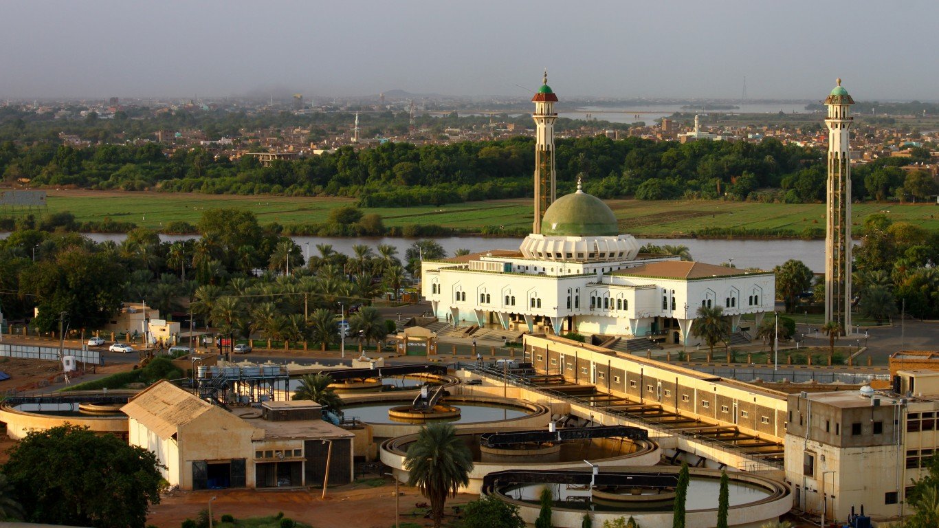
36. Sudan
> Population density: 61 people per square mile
> Est. population 2020: 43,849,269 — #35 out of 217 countries
> Land area: 713,993 square miles — #15 out of 217 countries
> Population growth, 2015-2020: 12.7%
Located in Northeast Africa at the southern edge of the Sahara desert, Sudan is the continent’s largest county by total area. Sudan’s population is sparse and unevenly distributed, largely due to the large amount of uninhabitable desert covering the country. Much of the population lives in large cities along the Nile River.
Source: narvikk / Getty Images
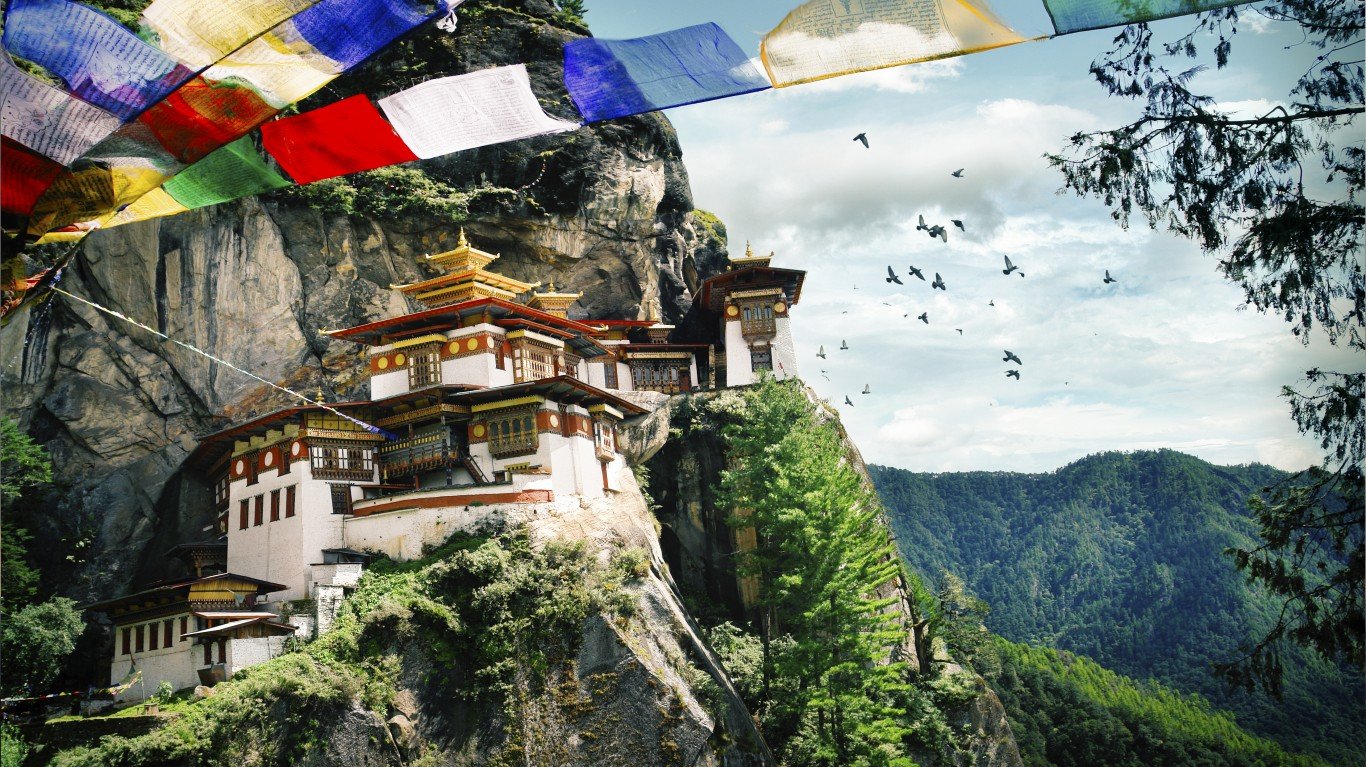
35. Bhutan
> Population density: 52 people per square mile
> Est. population 2020: 771,612 — #163 out of 217 countries
> Land area: 14,726 square miles — #133 out of 217 countries
> Population growth, 2015-2020: 6.0%
The landlocked Himalayan country of Bhutan is roughly the size of Massachusetts and Connecticut combined. Bhutan has imposed self-isolation for centuries and even though it has been opening up slowly since the ’70s, it remains relatively isolated.
[in-text-ad]
Source: LuckyViks / iStock via Getty Images
34. Uruguay
> Population density: 51 people per square mile
> Est. population 2020: 3,473,727 — #131 out of 217 countries
> Land area: 67,576 square miles — #90 out of 217 countries
> Population growth, 2015-2020: 1.8%
Uruguay is South America’s second-smallest country by total area, bordered by Brazil and Argentina to its west through the northeast and the Atlantic Ocean to its southeast. Uruguay’s capital city, Montevideo, located along the Montevideo Bay, is the country’s most populous. About 1.3 million people live there.
 24/7 Wall St.
Source: Tammy616 / Getty Images
33. Papua New Guinea
> Population density: 51 people per square mile
> Est. population 2020: 8,947,027 — #97 out of 217 countries
> Land area: 174,850 square miles — #54 out of 217 countries
> Population growth, 2015-2020: 10.4%
Papua New Guinea is an island country in the southwestern Pacific Ocean, just north of Australia. The western half of the island is part of Indonesia. Though the country has a population of nearly 9 million people, there are no cities with more than 300,000 inhabitants. The largest city is the capital, Port Moresby, where just under 284,000 people live.

Source: Robert CHG / Getty Images
32. New Zealand
> Population density: 50 people per square mile
> Est. population 2020: 5,084,300 — #121 out of 217 countries
> Land area: 101,665 square miles — #75 out of 217 countries
> Population growth, 2015-2020: 10.3%
New Zealand is an island country in the South Pacific Ocean. The country is made up of two major islands — South and North. More people live in Auckland, the country’s capital located in the North, than in the entire South Island — 1.5 million compared to 1.0 million.
[in-text-ad-2]
Source: HomoCosmicos / Getty Images
31. Niger
> Population density: 49 people per square mile
> Est. population 2020: 24,206,636 — #56 out of 217 countries
> Land area: 489,075 square miles — #20 out of 217 countries
> Population growth, 2015-2020: 21.0%
Niger is a landlocked country in West Africa. Much of the country, however, is uninhabitable because of its location in the southern Sahara and the lack of rainfall. About 85% of Niger’s population of 24 million people lives in cities along the southern border with Nigeria, Benin, and Burkina Faso.
Source: Leonid Andronov / Getty Images
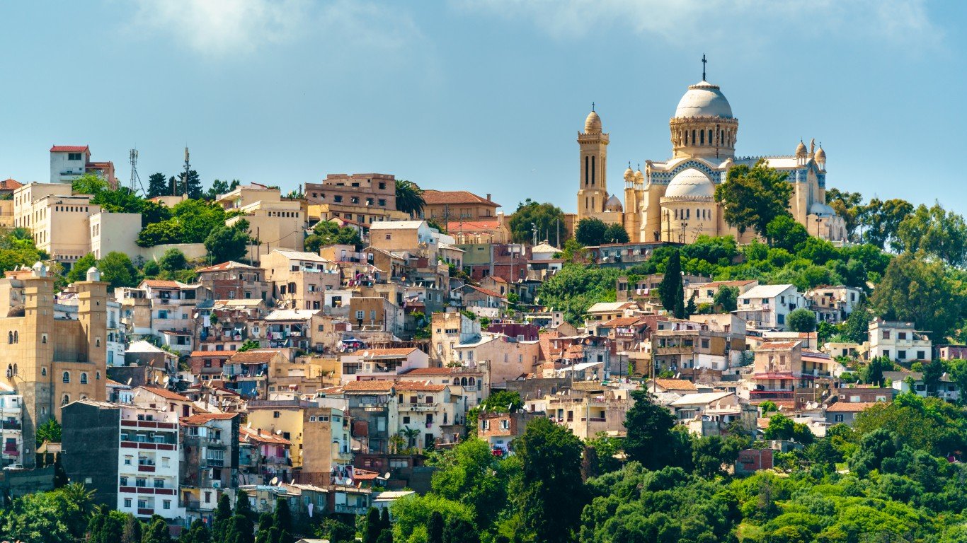
30. Algeria
> Population density: 48 people per square mile
> Est. population 2020: 43,851,043 — #34 out of 217 countries
> Land area: 919,595 square miles — #10 out of 217 countries
> Population growth, 2015-2020: 10.4%
Algeria is the largest country in Africa by total area. But the vast majority of it is located in Western Sahara, the largest hot desert in the world, and is uninhabitable. As a result, most of the country’s population lives along the Mediterranean coast.
[in-text-ad]
Source: scanrail / Getty Images
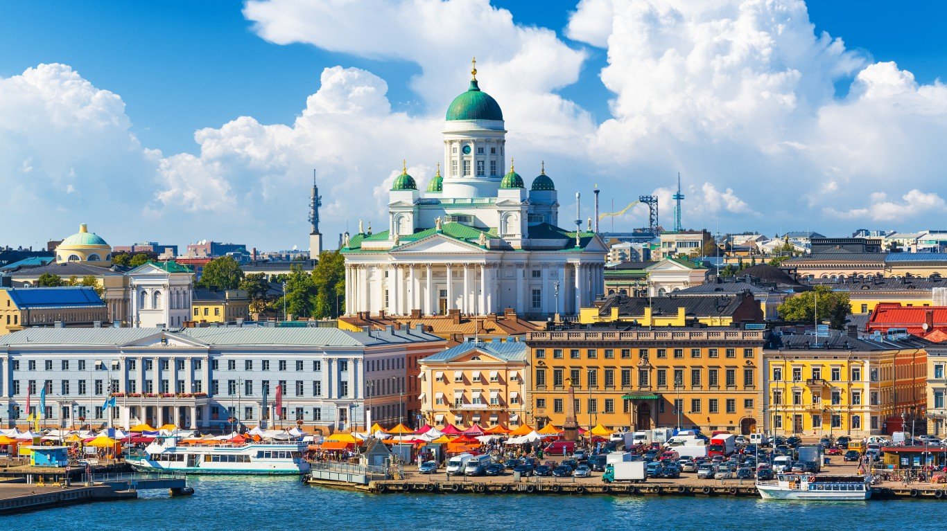
29. Finland
> Population density: 47 people per square mile
> Est. population 2020: 5,530,719 — #115 out of 217 countries
> Land area: 117,344 square miles — #71 out of 217 countries
> Population growth, 2015-2020: 0.9%
Finland is the most sparsely populated country in the European Union. It is the eighth largest country in Europe, but the 23rd most populous. About 86% of the Scandinavian country’s population lives in urban areas, and much of the population lives in the south. The most populous city is the capital, Helsinki, located in southern Finland, on the shore of the Gulf of Finland, with more than 650,000 residents.
Source: Donyanedomam / Getty Images
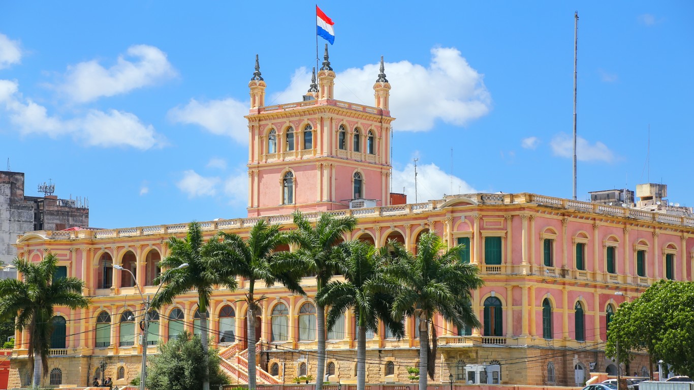
28. Paraguay
> Population density: 46 people per square mile
> Est. population 2020: 7,132,530 — #104 out of 217 countries
> Land area: 153,398 square miles — #60 out of 217 countries
> Population growth, 2015-2020: 6.6%
Landlocked Paraguay is located in the heart of South America. The country’s population is largely concentrated in the southern regions. Paraguay has only a handful of cities with a population of over 100,000. The metro area in which the capital, Asuncion, is located, is home to some 2.2 million people.
Source: SimplyCreativePhotography / Getty Images
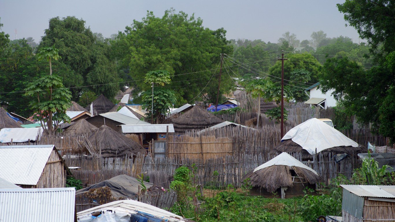
27. South Sudan
> Population density: 46 people per square mile
> Est. population 2020: 11,193,729 — #83 out of 217 countries
> Land area: 243,989 square miles — #41 out of 217 countries
> Population growth, 2015-2020: 4.5%
The newest country in the world, South Sudan declared independence from Sudan after years of civil war and was internationally recognized in 2011. Much of the country’s population is concentrated along the Nile rivers and their streams. The vast majority of the people live in rural areas and settlements.
[in-text-ad-2]
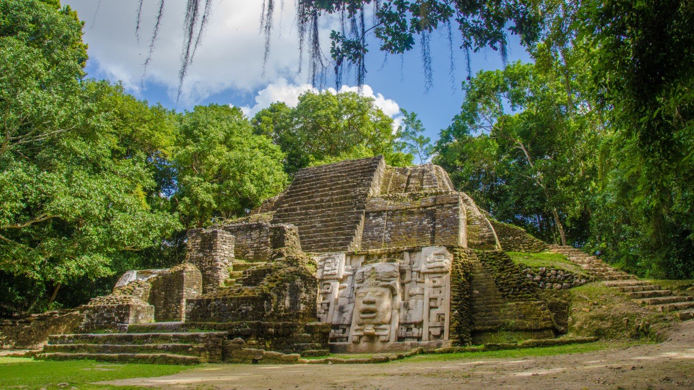
Source: SimonDannhauer / Getty Images
26. Belize
> Population density: 45 people per square mile
> Est. population 2020: 397,621 — #173 out of 217 countries
> Land area: 8,807 square miles — #148 out of 217 countries
> Population growth, 2015-2020: 10.2%
Belize is located on the eastern coast of Central America, south of Mexico. The country’s capital, Belmopan, which was built inland after a hurricane destroyed the previous capital in 1961, is the most populous city in Belize.
Source: dutourdumonde / Getty Images
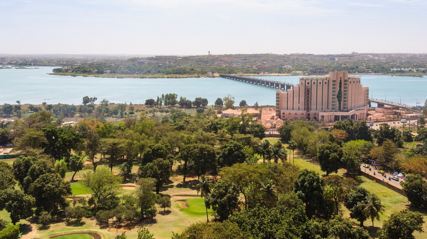
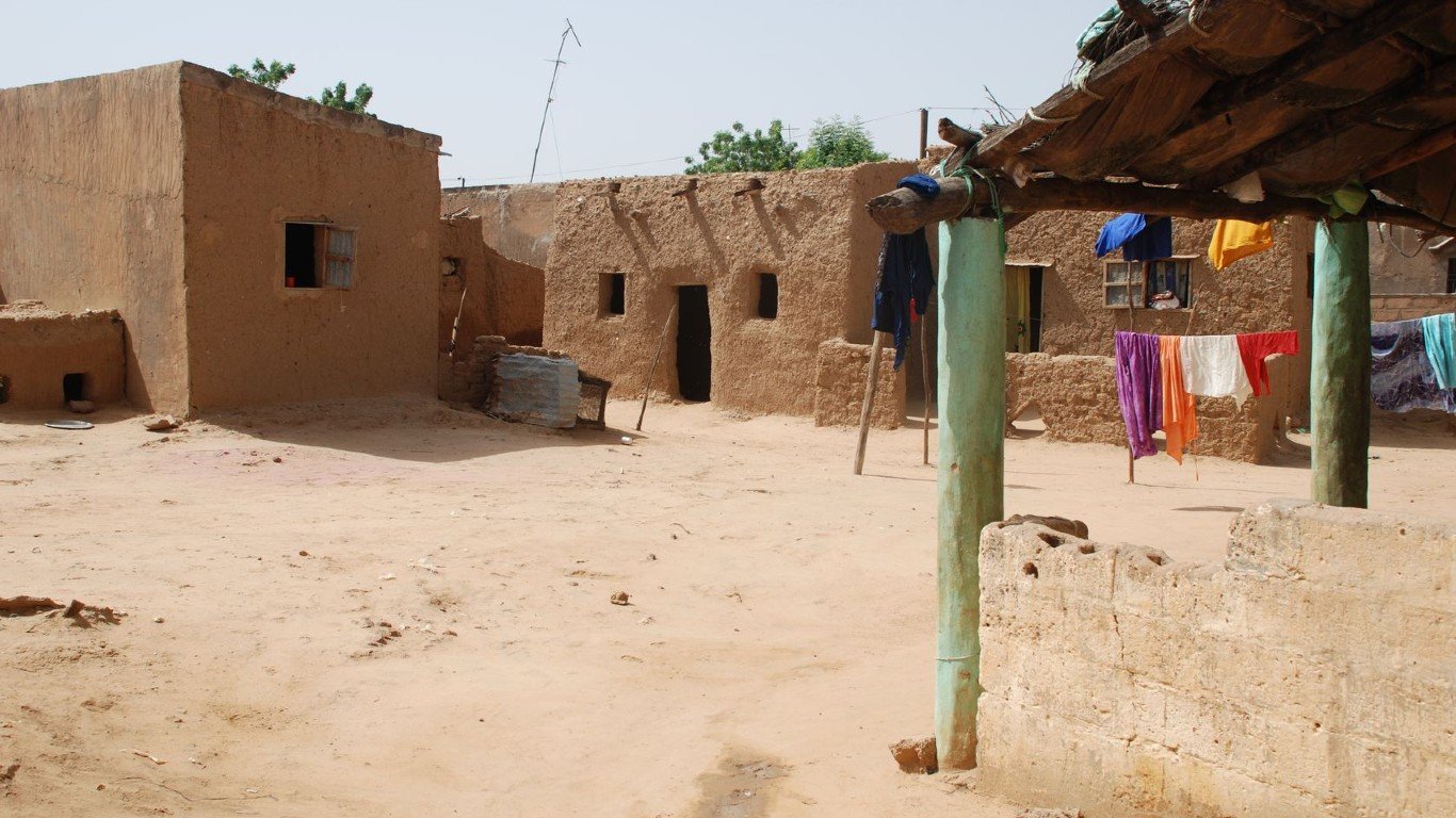
25. Mali
> Population density: 43 people per square mile
> Est. population 2020: 20,250,834 — #59 out of 217 countries
> Land area: 471,118 square miles — #23 out of 217 countries
> Population growth, 2015-2020: 16.1%
While the northern regions of Mali are sandy and arid, the south contains two main rivers, and holds 90% of the country’s population. A significant portion of Mali’s population lives in rural areas, with 5% to 10% of them being nomadic.
[in-text-ad]
Source: Grafissimo / Getty Images
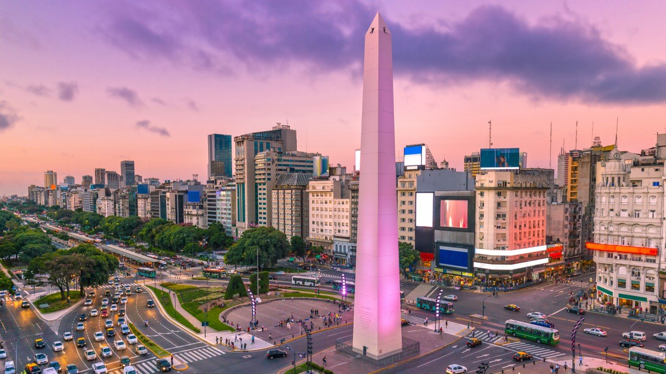
24. Argentina
> Population density: 43 people per square mile
> Est. population 2020: 45,376,763 — #32 out of 217 countries
> Land area: 1,056,641 square miles — #8 out of 217 countries
> Population growth, 2015-2020: 5.2%
The second-largest country in South America by land, Argentina has a diverse landscape including the high peaks of the Andes, sub-antarctic plateaus in the south, and plains in the north. Over 90% of the population lives in urban areas, with about 30% of those people residing in the capital city of Buenos Aires. The colder southern region is the most sparsely populated.
 24/7 Wall St.
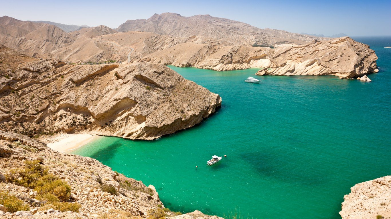
Source: Mlenny / Getty Images
23. Oman
> Population density: 43 people per square mile
> Est. population 2020: 5,106,622 — #119 out of 217 countries
> Land area: 119,499 square miles — #69 out of 217 countries
> Population growth, 2015-2020: 19.7%
The terrain in Oman consists of harsh desert and rugged mountains. Most of the country has limited water and is very sparsely populated, while the largest population centers are around the northern mountains and the southern city of Salalah. Immigrants make up about 45% of the country’s population.
Source: swisshippo / Getty Images
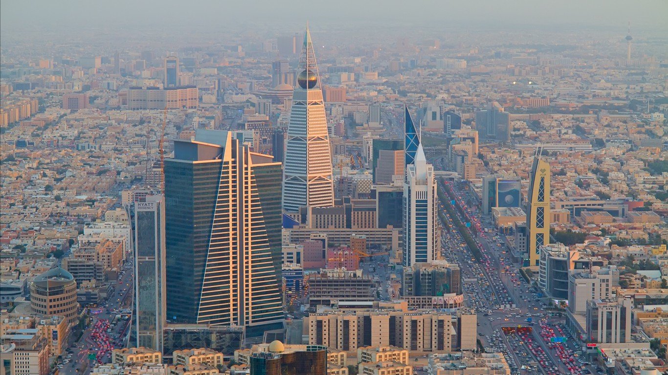
22. Saudi Arabia
> Population density: 42 people per square mile
> Est. population 2020: 34,813,867 — #41 out of 217 countries
> Land area: 830,000 square miles — #12 out of 217 countries
> Population growth, 2015-2020: 9.8%
Saudi Arabia takes up most of the Arabian peninsula, and is the largest country in the world that has no rivers. It’s almost completely a sandy, harsh desert. The population historically consisted of nomadic peoples, but now over 80% live in urban areas, with over 6 million residing in the capital city of Riyadh.
[in-text-ad-2]
Source: USO / Getty Images
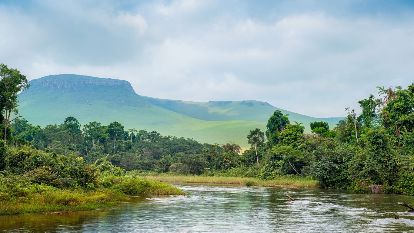
21. Republic of the Congo
> Population density: 42 people per square mile
> Est. population 2020: 5,518,092 — #116 out of 217 countries
> Land area: 131,854 square miles — #65 out of 217 countries
> Population growth, 2015-2020: 13.6%
The Republic of the Congo is roughly the size of Montana, with over 60% being densely forested and largely uninhabited. About 70% of the population lives in the capital city of Brazzaville, the city of Pointe Noire, or in smaller cities along the stretch of railroad that runs between the two urban centers.
Source: cachou44 / Getty Images
20. New Caledonia
> Population density: 39 people per square mile
> Est. population 2020: 271,960 — #179 out of 217 countries
> Land area: 7,058 square miles — #152 out of 217 countries
> Population growth, 2015-2020: 1.2%
An island nation in Oceania, New Caledonia is no larger than New Jersey. The interior of the main island is heavily forested, so the population is densest on the coastal plains, particularly the southern coast in and around the capital city of Noumea.
[in-text-ad]
Source: cookelma / Getty Images
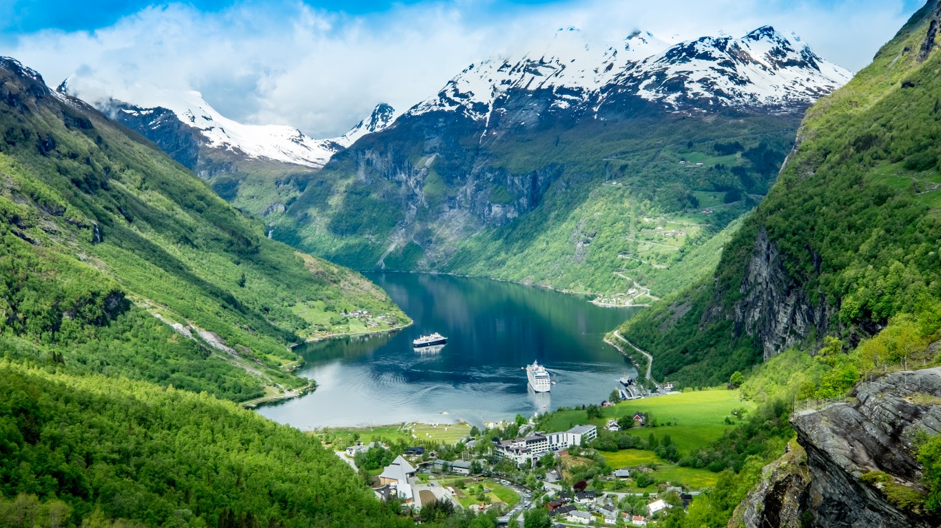
19. Norway
> Population density: 38 people per square mile
> Est. population 2020: 5,379,475 — #118 out of 217 countries
> Land area: 140,969 square miles — #62 out of 217 countries
> Population growth, 2015-2020: 3.7%
Norway’s terrain is largely glaciated, with rugged mountains and plateaus, and arctic tundra in the northern part of the country. The inhabitants are mostly based in the southern part of the country, where the climate is more temperate, with population centers scattered along the coast.
Source: giancarlo salvador / Getty Images
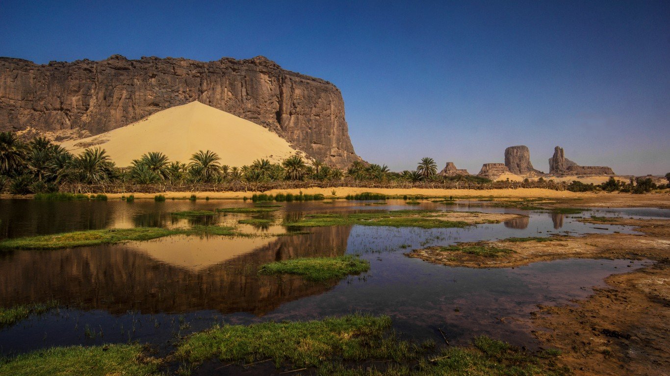
18. Chad
> Population density: 34 people per square mile
> Est. population 2020: 16,425,859 — #71 out of 217 countries
> Land area: 486,180 square miles — #21 out of 217 countries
> Population growth, 2015-2020: 16.4%
The largest landlocked country in Africa, Chad’s landscape and climate vary from desert in the north, to plains in the interior, tropical lowlands in the south and mountains in the northwest. The northern deserts are the least populated, while the southwestern region near Lake Chad is the most populous. Chad has some of the highest infant and maternal mortality rates in the world, due to lack of obstetric care.
Source: Velirina / Getty Images
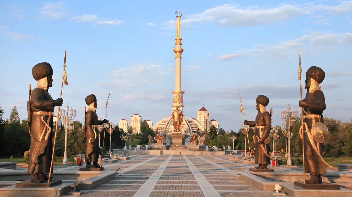
17. Turkmenistan
> Population density: 33 people per square mile
> Est. population 2020: 6,031,187 — #112 out of 217 countries
> Land area: 181,441 square miles — #53 out of 217 countries
> Population growth, 2015-2020: 8.4%
Turkmenistan, a country roughly the size of California, consists largely of desert and mountains. About half the population lives in and around the capital of Ashgabat, and most of the population centers lie in the oasis of the eastern plateau. The western and central regions of the country are taken up by the Garagun Desert.
[in-text-ad-2]
Source: StreetFlash / Getty Images
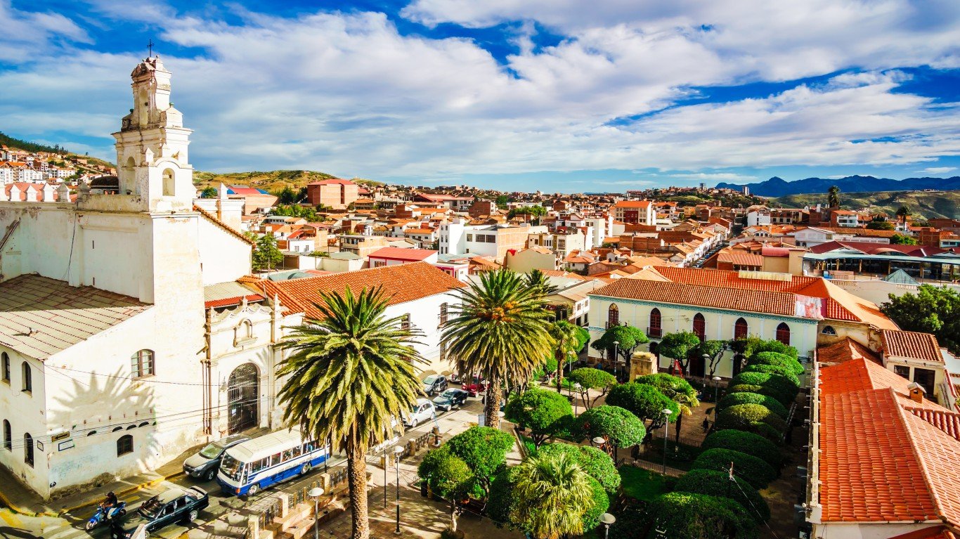
16. Bolivia
> Population density: 28 people per square mile
> Est. population 2020: 11,673,029 — #79 out of 217 countries
> Land area: 418,264 square miles — #27 out of 217 countries
> Population growth, 2015-2020: 7.4%
Bolivia’s climate varies from tropical to cold and arid depending on altitude, and much of the country consists of the rugged Andes mountains and dense forest. About 70% of the country’s population lives in the urban centers of La Paz, Santa Cruz, and Cochabamba.
Source: Mordolff / Getty Images
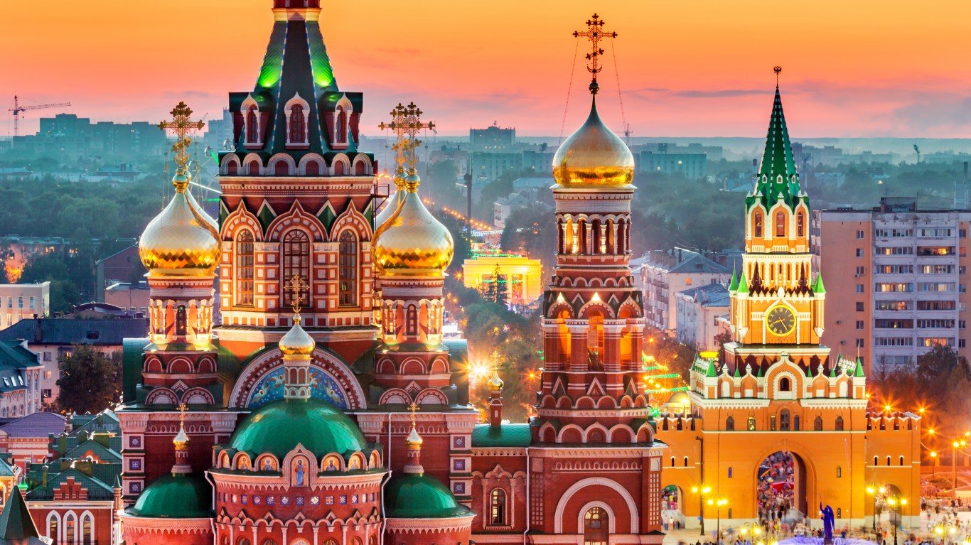
15. Russia
> Population density: 23 people per square mile
> Est. population 2020: 144,104,080 — #9 out of 217 countries
> Land area: 6,323,142 square miles — #1 out of 217 countries
> Population growth, 2015-2020: 0.0%
The largest country on Earth, Russia, encompasses over 6.3 million square miles. Much of the northern forests are cold enough to be uninhabitable, and most of the population is gathered in the western and southern parts of the country. One major blow to the population of the country was World War II, when the Soviet Union lost an estimated 26.6 million people. The echo of this generation gap circles back around every 25 years or so, when the descendants of those who survived don’t reproduce enough to keep the population stable.
[in-text-ad]
Source: mtcurado / Getty Images
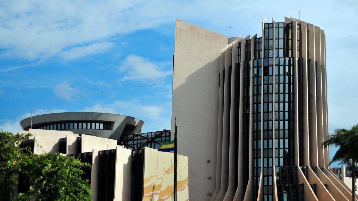
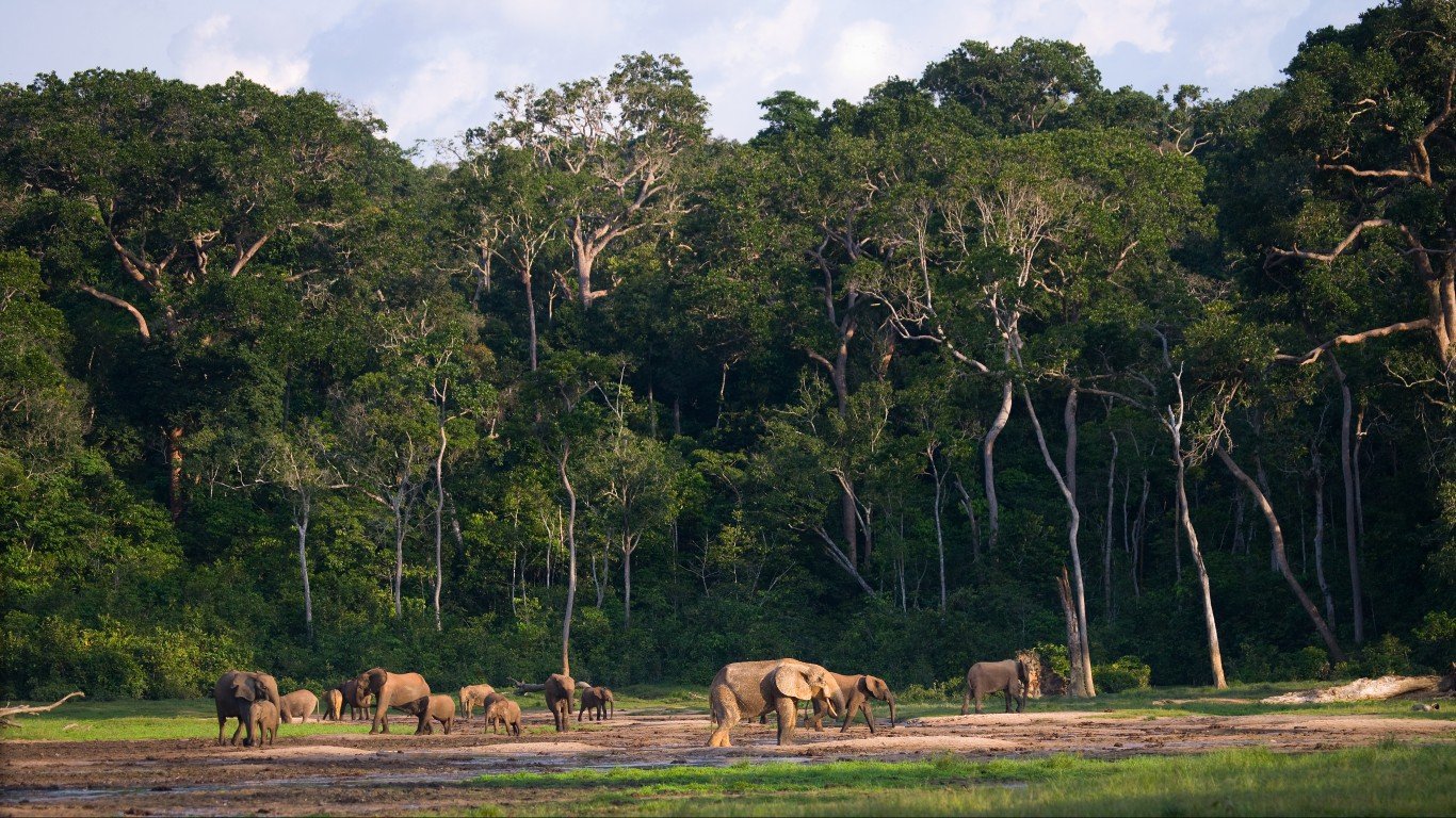
14. Gabon
> Population density: 22 people per square mile
> Est. population 2020: 2,225,728 — #144 out of 217 countries
> Land area: 99,487 square miles — #76 out of 217 countries
> Population growth, 2015-2020: 14.3%
This coastal African country roughly the size of Colorado is over 80% rainforest, and nearly 90% of its population lives in urban centers — half of those in the capital city of Libreville. The rest live in small rural villages.
Source: ANDREYGUDKOV / Getty Images
13. Central African Republic
> Population density: 20 people per square mile
> Est. population 2020: 4,829,764 — #124 out of 217 countries
> Land area: 240,534 square miles — #43 out of 217 countries
> Population growth, 2015-2020: 7.5%
The Central African Republic is a landlocked country nearly the size of Texas. Its population has quadrupled since the 1960s. Deaths from treatable diseases reflect the rampant poverty and lack of health care infrastructure in many areas, especially the diamond-mining region.

Source: Ozbalci / Getty Images
12. Kazakhstan
> Population density: 18 people per square mile
> Est. population 2020: 18,754,440 — #63 out of 217 countries
> Land area: 1,042,360 square miles — #9 out of 217 countries
> Population growth, 2015-2020: 6.9%
The world’s largest landlocked country, Kazakhstan, is largely arid and semi-arid steppe. Many areas of the country are radioactive or toxic due to a history of Soviet arms testing. The population centers are clustered around urban areas in the north and south, as the interior of the country is the most arid.
[in-text-ad-2]
Source: Bertramz / Wikimedia Commons
11. Mauritania
> Population density: 12 people per square mile
> Est. population 2020: 4,649,660 — #126 out of 217 countries
> Land area: 397,955 square miles — #28 out of 217 countries
> Population growth, 2015-2020: 14.9%
A coastal country in western Africa, Mauritania is largely a barren desert. As much of the country is uninhabitable, half of Mauritania’s population resides in the capital city of Nouakchott on the coast, with the other population centers lying along the southern border. Long periods of drought are causing the desert to expand, forcing many nomadic peoples and farmers into urban areas.
Source: diegograndi / Getty Images
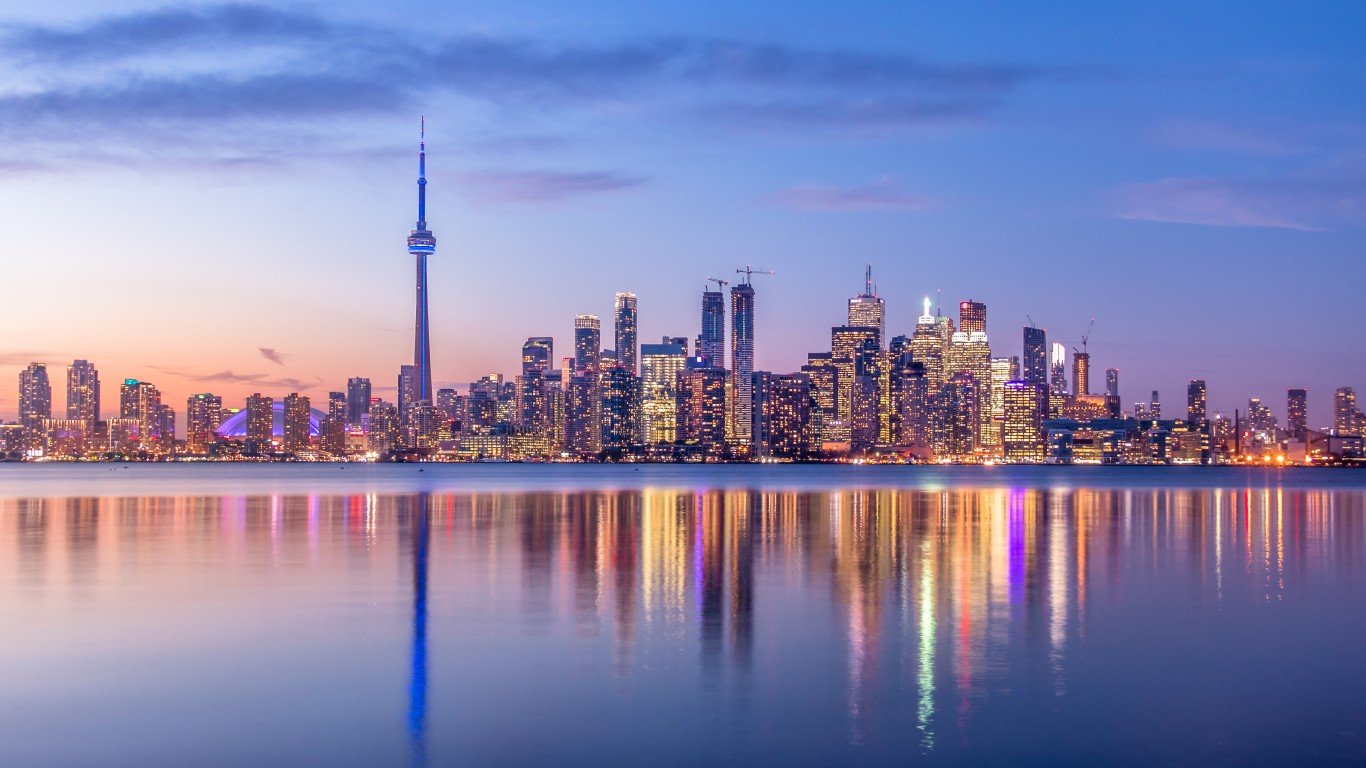
10. Canada
> Population density: 11 people per square mile
> Est. population 2020: 38,005,238 — #38 out of 217 countries
> Land area: 3,461,632 square miles — #4 out of 217 countries
> Population growth, 2015-2020: 6.4%
The second largest country in the world by area, Canada is largely too cold and inhospitable to host a big population. Its inhabitants are primarily spread along the country’s southern border with the United States, where the climate is milder and agriculture is possible. The country’s population growth is stoked mostly by immigration.
[in-text-ad]
Source: kavram / Getty Images
9. Botswana
> Population density: 11 people per square mile
> Est. population 2020: 2,351,625 — #143 out of 217 countries
> Land area: 218,816 square miles — #47 out of 217 countries
> Population growth, 2015-2020: 10.9%
Some of Africa’s largest wilderness areas are in Botswana. The population is largely concentrated in the eastern cities of Gaborone and Francistown, with low concentrations in the Kalahari desert to the southwest. Although Botswana used to have one of the highest HIV/AIDS infection rates in the world, it now has one of the best treatment programs in Africa.
Source: D-Arnaud / Getty Images
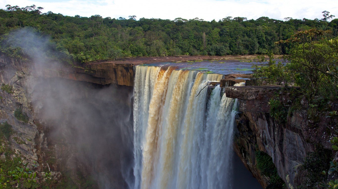
8. Guyana
> Population density: 10 people per square mile
> Est. population 2020: 786,559 — #162 out of 217 countries
> Land area: 76,004 square miles — #85 out of 217 countries
> Population growth, 2015-2020: 2.5%
A small country on the north coast of South America, Guyana’s interior is heavily forested and uninhabited. About 90% of the population lives along the coast, which accounts for 10% of the country’s land area, and nearly half of those people reside in the capital city of Georgetown and the surrounding metro area.
Source: batuhanozdel / Getty Images
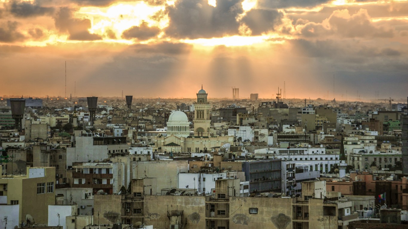
7. Libya
> Population density: 10 people per square mile
> Est. population 2020: 6,871,287 — #107 out of 217 countries
> Land area: 679,362 square miles — #16 out of 217 countries
> Population growth, 2015-2020: 7.1%
A country slightly larger than Alaska, Libya’s climate and landscape are Mediterranean along the coast but largely barren desert in the interior. Most of the population lives in coastal cities, as the desert is uninhabitable.
[in-text-ad-2]
Source: atosan / Getty Images
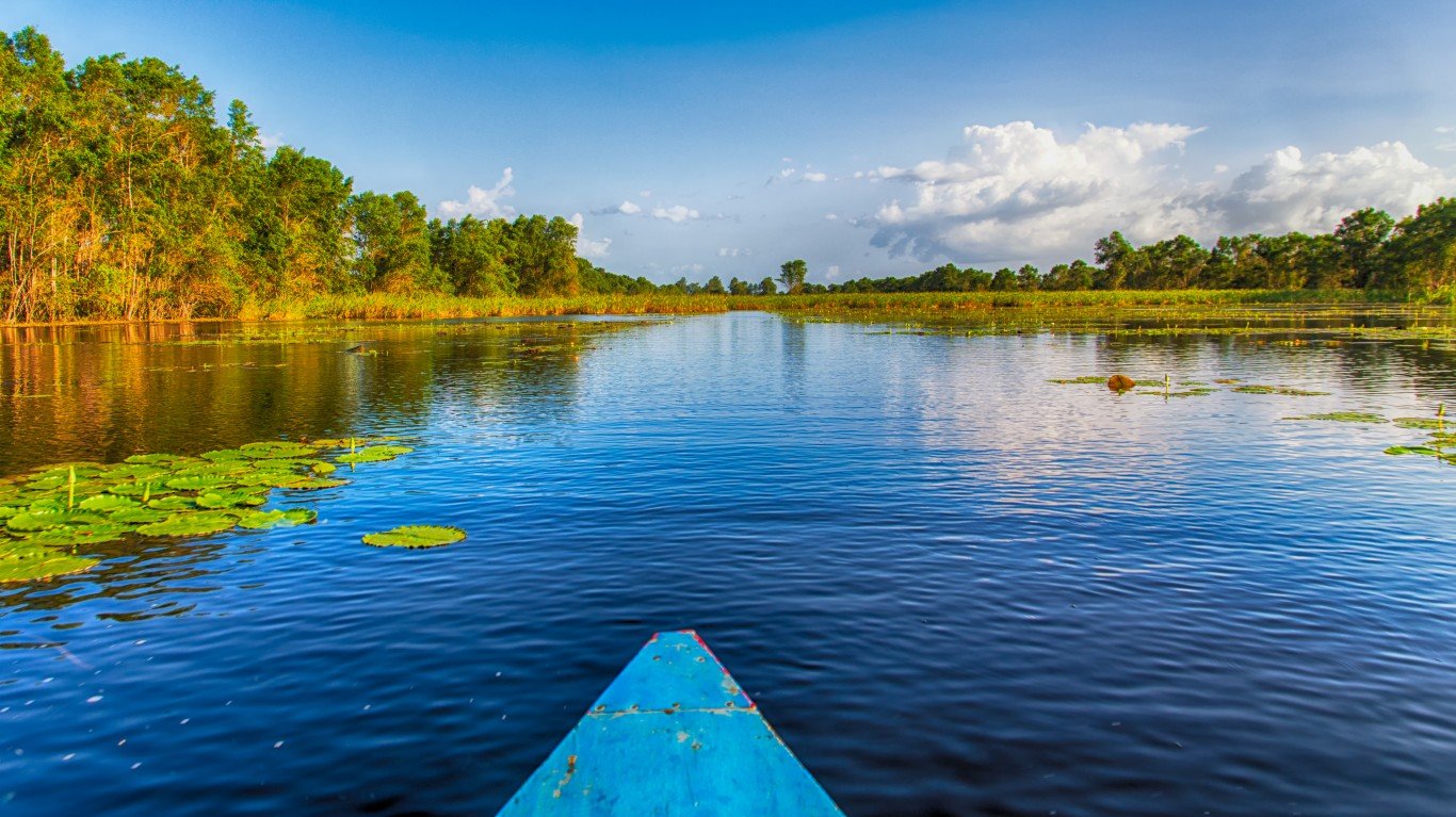
6. Suriname
> Population density: 10 people per square mile
> Est. population 2020: 586,634 — #168 out of 217 countries
> Land area: 60,232 square miles — #91 out of 217 countries
> Population growth, 2015-2020: 4.9%
Suriname is one of the smallest countries in South America. About 90% of the population lives in Paramaribo, the capital city on the Atlantic Coast, or on the coast. Suriname is largely covered in sparsely populated dense tropical rainforest.
Source: patpongs / Getty Images
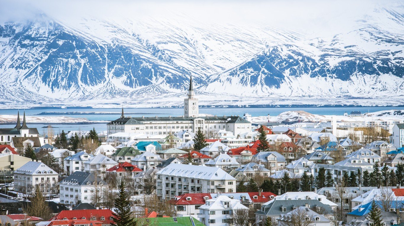
5. Iceland
> Population density: 9 people per square mile
> Est. population 2020: 366,425 — #175 out of 217 countries
> Land area: 38,931 square miles — #105 out of 217 countries
> Population growth, 2015-2020: 10.8%
Iceland, the second-largest island in Europe, is relatively isolated in the Atlantic Ocean, sitting just outside the Arctic Circle between Greenland and Scotland. The interior of the island has a harsh arctic climate, with the coastal areas being milder and more populated. Over 95% of Iceland’s population lives in urban areas along the coast.
[in-text-ad]
Source: africanpix / Getty Images
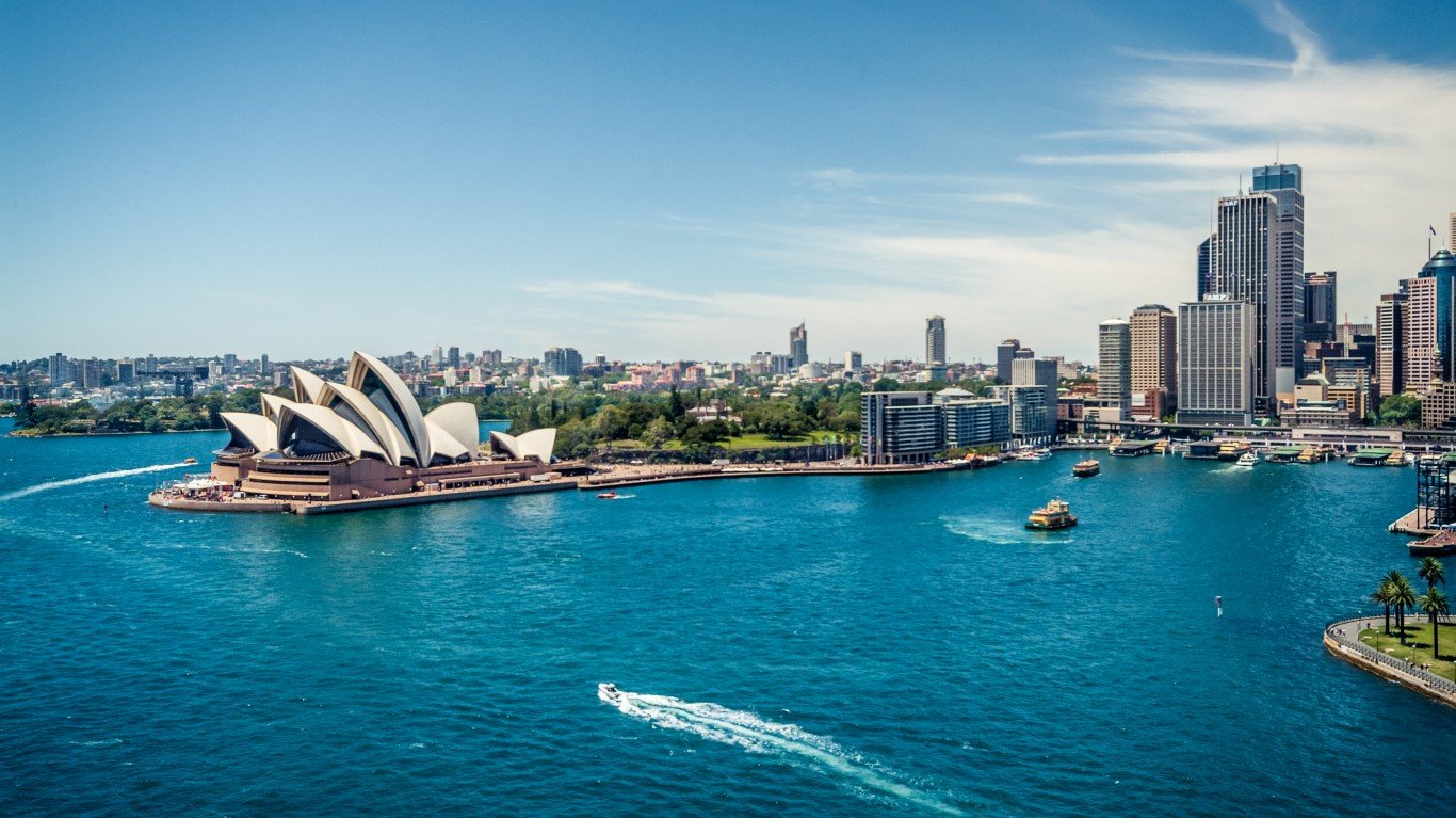
4. Australia
> Population density: 9 people per square mile
> Est. population 2020: 25,687,041 — #55 out of 217 countries
> Land area: 2,969,904 square miles — #6 out of 217 countries
> Population growth, 2015-2020: 7.9%
Australia is the sixth-largest country in the world, encompassing an area nearly the size of the 48 contiguous United States. The population is most dense in coastal regions, as the arid center of the country experiences prolonged periods of drought, deadly heat waves, and wildfires. Rising temperatures, a result of climate change, are worsening these conditions.
Source: Tiago_Fernandez / Getty Images
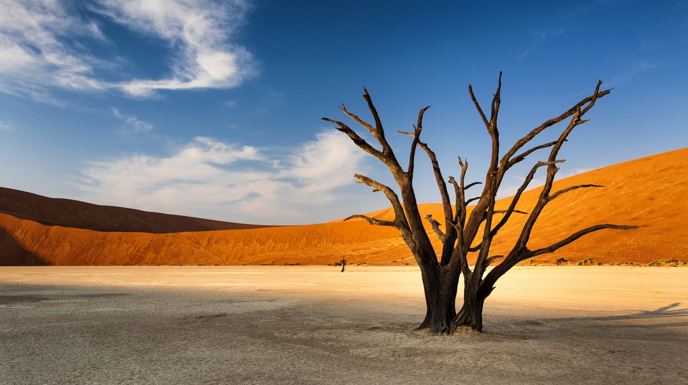
3. Namibia
> Population density: 8 people per square mile
> Est. population 2020: 2,540,916 — #141 out of 217 countries
> Land area: 317,874 square miles — #33 out of 217 countries
> Population growth, 2015-2020: 9.8%
A desert area rich in minerals but with little arable land, Namibia suffers from long periods of drought. About 55% of the population lives rurally, mostly along the northern and northeast border where water is more accessible. Population growth decreased in the 1990s due to the AIDS epidemic.
Source: muha04 / Getty Images
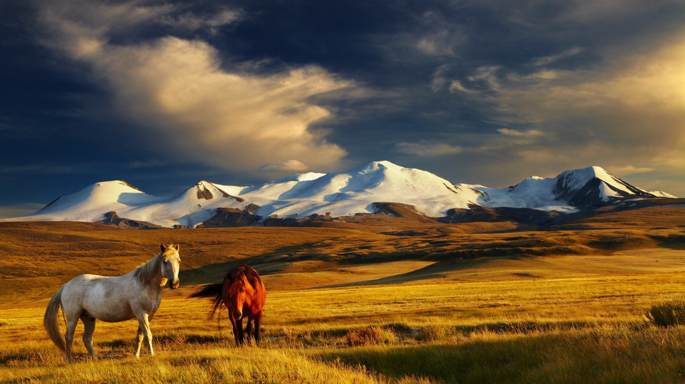
2. Mongolia
> Population density: 5 people per square mile
> Est. population 2020: 3,278,292 — #133 out of 217 countries
> Land area: 601,259 square miles — #18 out of 217 countries
> Population growth, 2015-2020: 9.3%
Mongolia’s landscape is largely steppe, desert, and semidesert, and 75% of the land is used for livestock grazing. About 45% of the population lives in the capital of Ulaanbaatar, the coldest capital city in the world.
[in-text-ad-2]
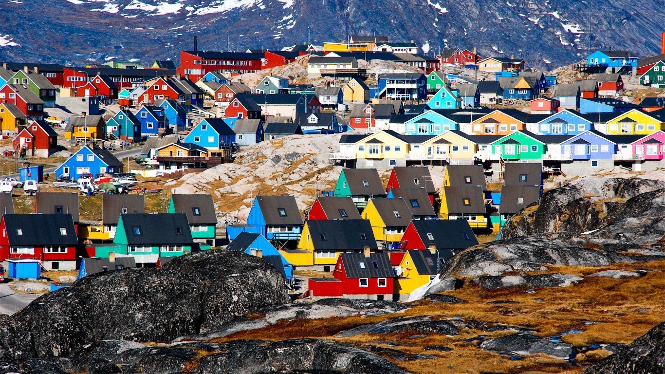
Source: enriquejggarcia / Getty Images
1. Greenland
> Population density: 0 people per square mile
> Est. population 2020: 56,367 — #202 out of 217 countries
> Land area: 158,476 square miles — #58 out of 217 countries
> Population growth, 2015-2020: 0.5%
About 80% of the island nation of Greenland is covered by a massive glacier. The country’s arctic and subarctic temperatures range from the 30’s to the 50’s in the summer and are consistently below zero in the winter. Most of the population are Kalaallit (an Inuit people) and over 80% live on the southwest coast, which has the mildest climate.
Take This Retirement Quiz To Get Matched With An Advisor Now (Sponsored)
Are you ready for retirement? Planning for retirement can be overwhelming, that’s why it could be a good idea to speak to a fiduciary financial advisor about your goals today.
Start by taking this retirement quiz right here from SmartAsset that will match you with up to 3 financial advisors that serve your area and beyond in 5 minutes. Smart Asset is now matching over 50,000 people a month.
Click here now to get started.
Thank you for reading! Have some feedback for us?
Contact the 24/7 Wall St. editorial team.
Editors' Picks