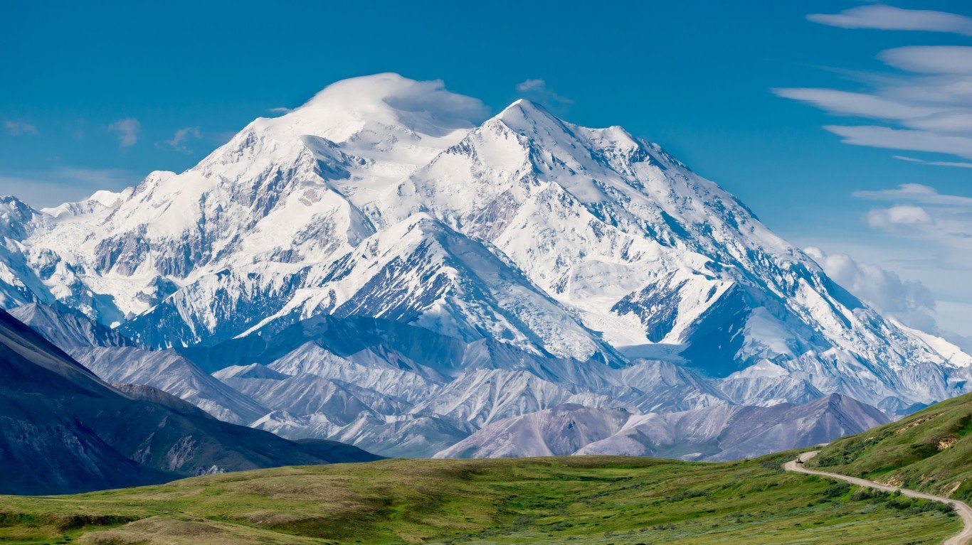
Many Americans have spent a good part of the last two and a half years stuck in the same house with their loved ones. At this point, some might be fantasizing about to getting away from it all and finding some peace and quiet.
With virtually every inch of the Earth mapped and cataloged, and with ongoing population growth, it’s harder nowadays to traverse unspoiled terrain in the United States. The population density of the United States today is 20 times what it was in 1790. In high income nations like the United States, 90% of the population lives within one hour of a city. (Here are the 50 most densely populated cities in the world.)
While living near urban centers tends to bring area residents social and economic benefits, the adventurous among us may be pleased to learn there are still some corners of our country that remain extremely remote — places referred to fondly (or not) as the “middle of nowhere.”
24/7 Wall St. identified the location in each state with the longest estimated travel time to the nearest city using data published Jan. 10, 2018 in Nature. Travel times take into account all forms of travel, as well as the quality of transportation infrastructure.
Click here to see the middle of nowhere in every state
Click here to see our detailed findings and methodology
Source: Courtesy of Google Maps 2018
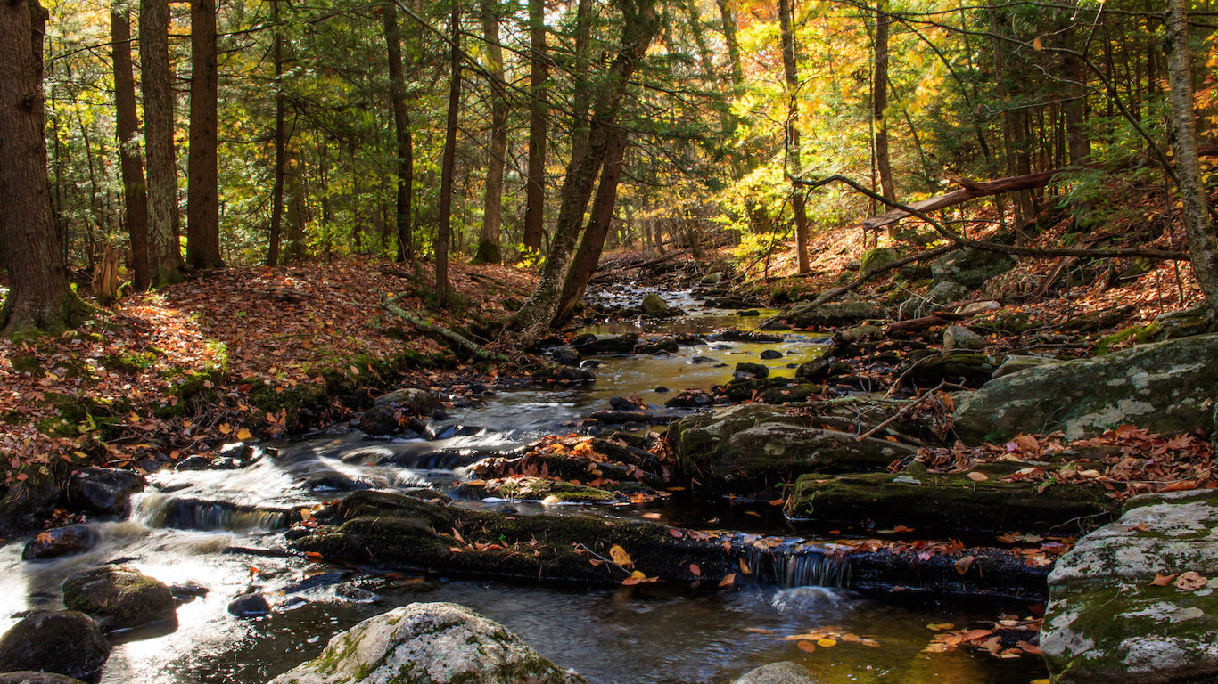
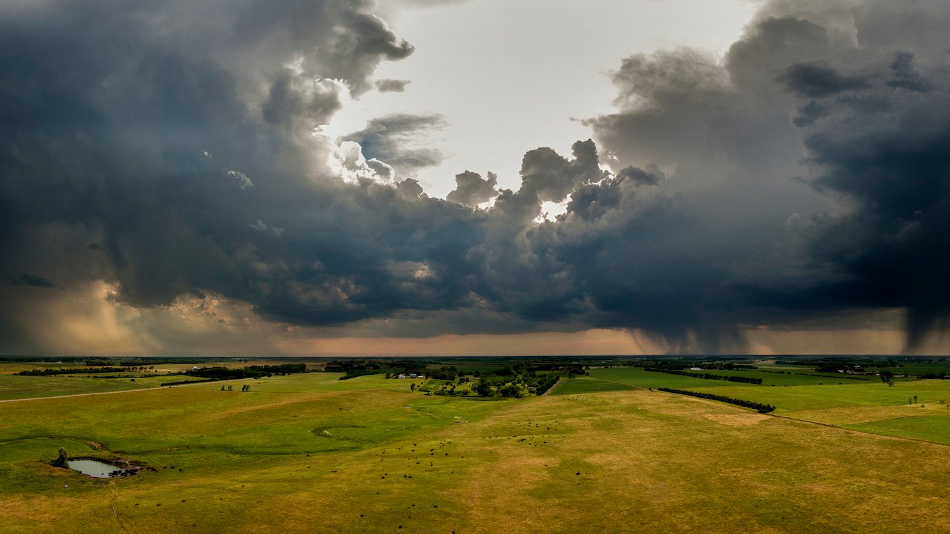
1. Alabama
> Middle of nowhere: Terminus of Carmichael Creek
> Time to nearest city: 2 hours, 48 minutes
> GPS coordinates: 32°06’15″N, 88°23’45″W
[in-text-ad]
Source: D. Sikes / Wikimedia Commons
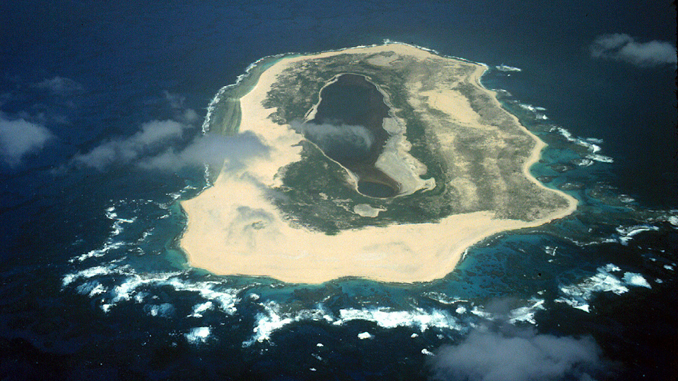
2. Alaska
> Middle of nowhere: Amatignak Island, Aleutian Islands
> Time to nearest city: 84 hours, 37 minutes
> GPS coordinates: 51°13’15″N, 179°07’15″W
 24/7 Wall St.
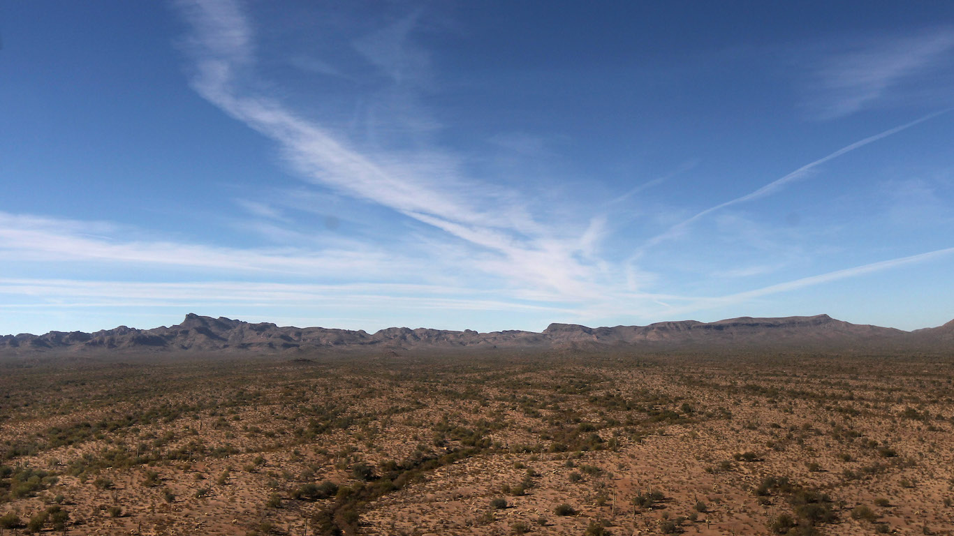
Source: John Moore / Getty Images
3. Arizona
> Middle of nowhere: Navajo Nation, near Utah border
> Time to nearest city: 11 hours, 32 minutes
> GPS coordinates: 36°59’15″N, 111°04’45″W
Source: Flickr
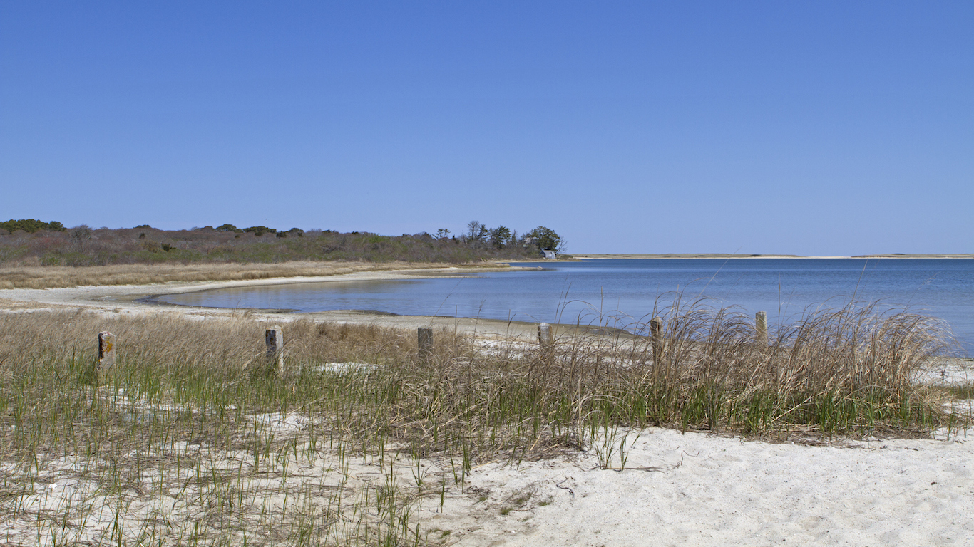
4. Arkansas
> Middle of nowhere: Southeast corner of state
> Time to nearest city: 3 hours, 29 minutes
> GPS coordinates: 33°02’15″N, 91°08’45″W
[in-text-ad-2]
Source: thomas.prichard / Wikimedia Commons
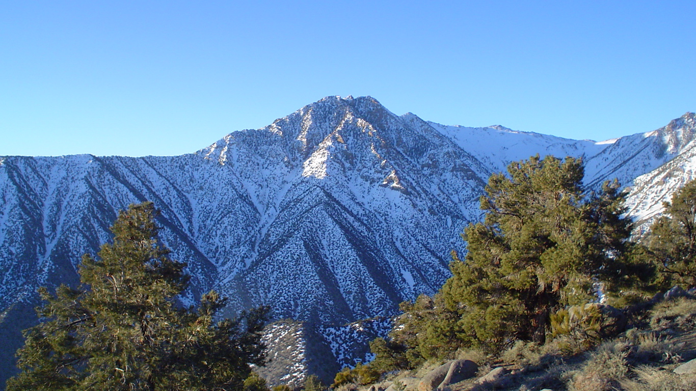
5. California
> Middle of nowhere: 1.5 miles northeast of Keynot Peak
> Time to nearest city: 10 hours, 42 minutes
> GPS coordinates: 36°43’45″N, 117°56’45″W
Source: Shutter Runner / Flickr
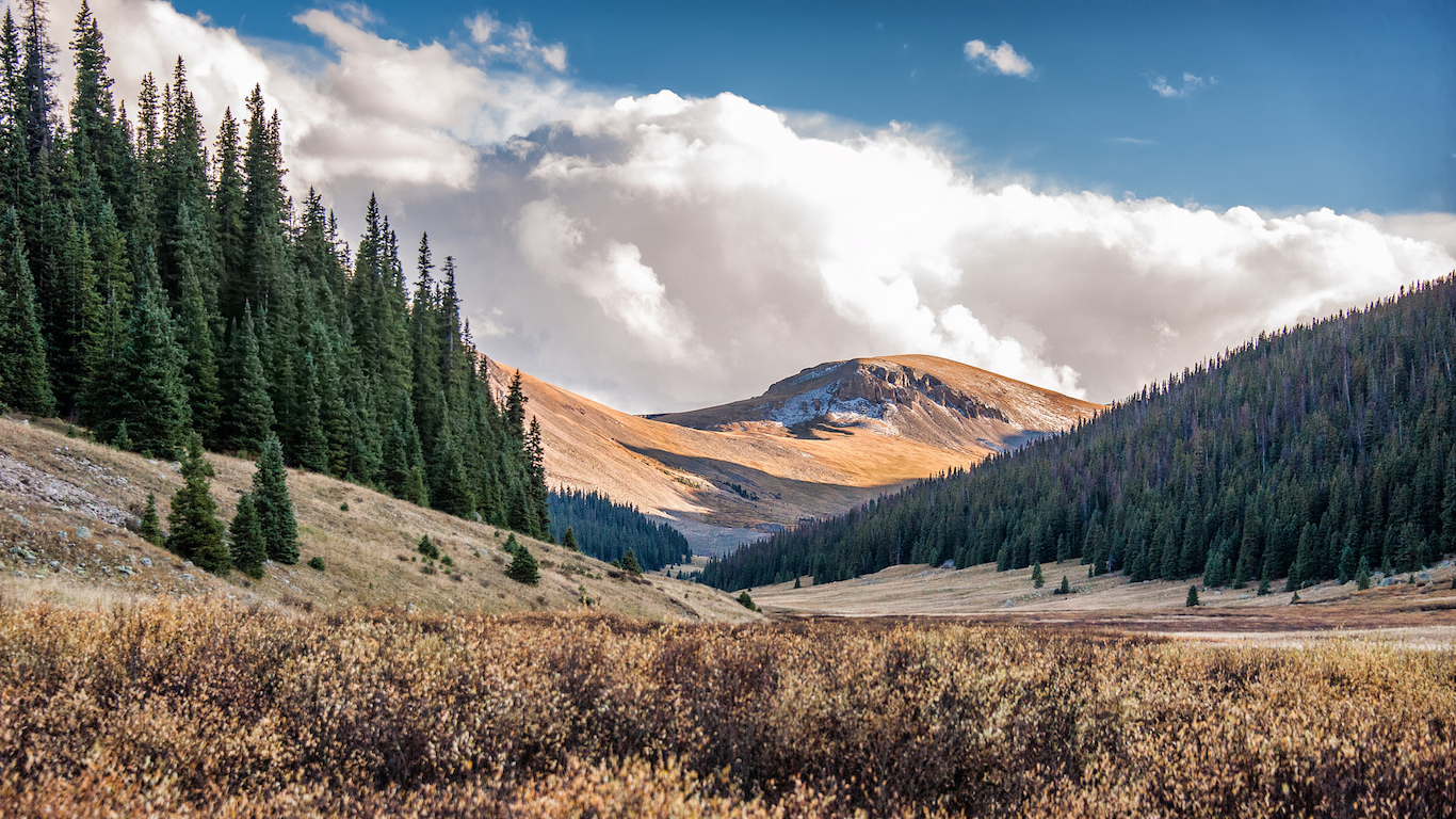
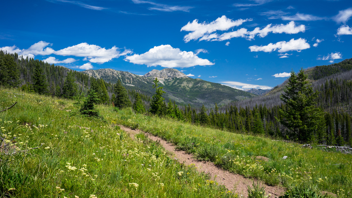
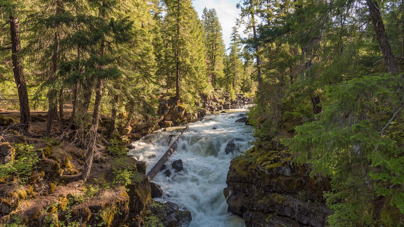
6. Colorado
> Middle of nowhere: Willow Creek, San Juan National Forest
> Time to nearest city: 9 hours, 56 minutes
> GPS coordinates: 37°31’45″N, 107°24’45″W
[in-text-ad]
Source: Jennifer Yakey-Ault / iStock
7. Connecticut
> Middle of nowhere: Between McDuffee and Burton brooks
> Time to nearest city: 0 hours, 52 minutes
> GPS coordinates: 41°59’15″N, 73°28’45″W
 24/7 Wall St.
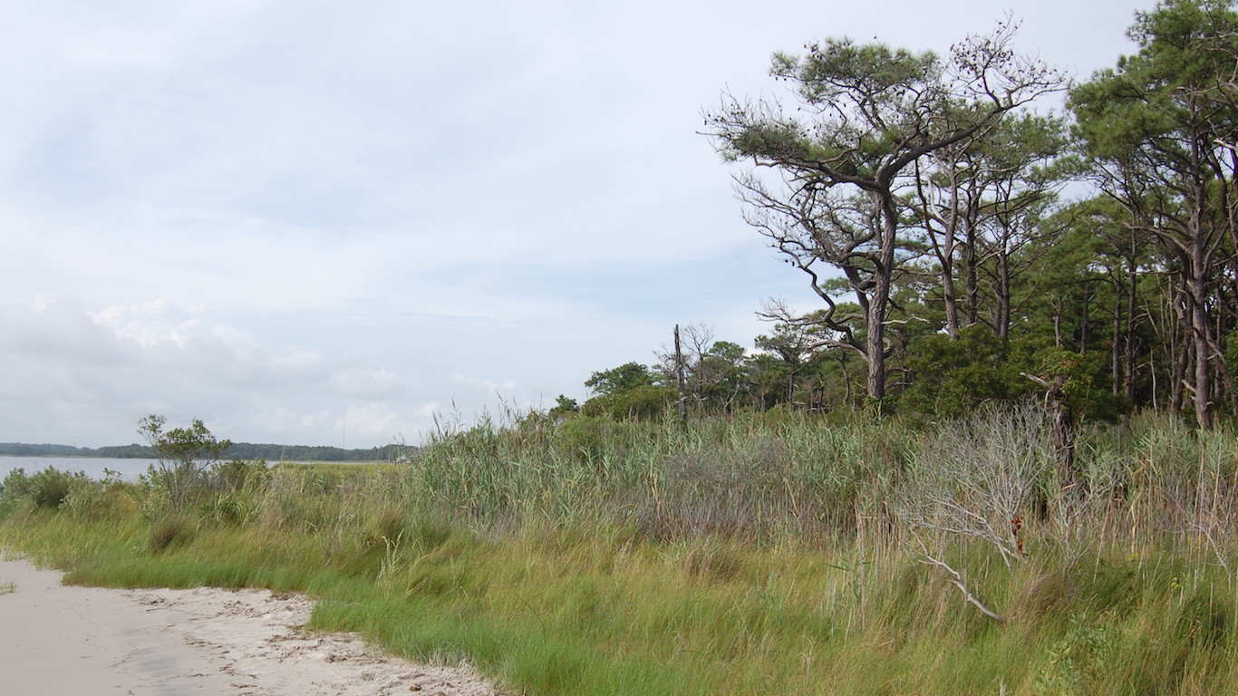
Source: clio1789 / Flickr
8. Delaware
> Middle of nowhere: Bennett Point, Assawoman Wildlife Area
> Time to nearest city: 1 hours, 56 minutes
> GPS coordinates: 38°28’45″N, 75°04’15″W
Source: Rauluminate / iStock
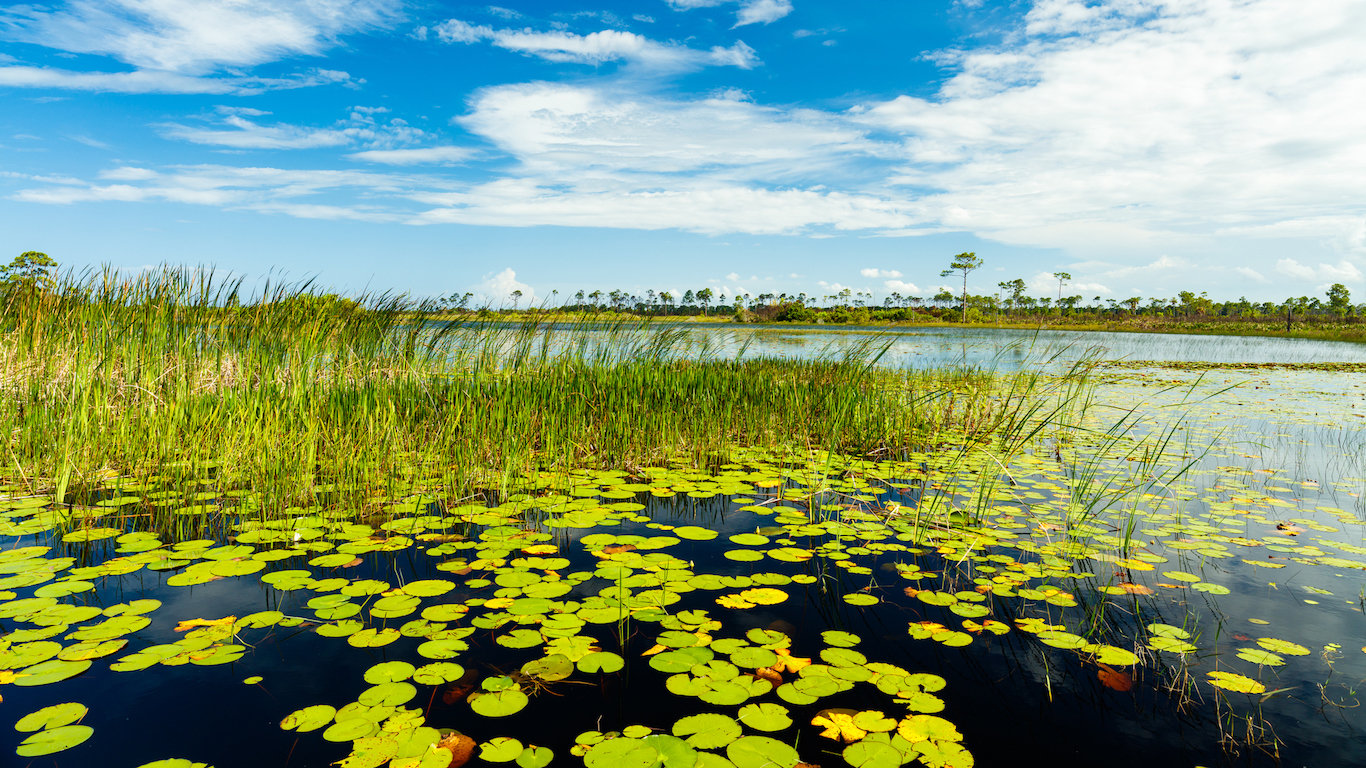
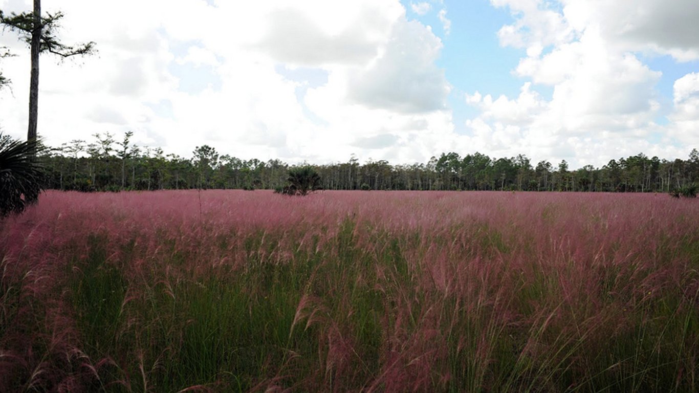
9. Florida
> Middle of nowhere: East of Miccosukee Reservation, The Everglades
> Time to nearest city: 7 hours, 39 minutes
> GPS coordinates: 25°58’45″N, 80°42’15″W
[in-text-ad-2]
Source: Jaimie Tuchman / iStock
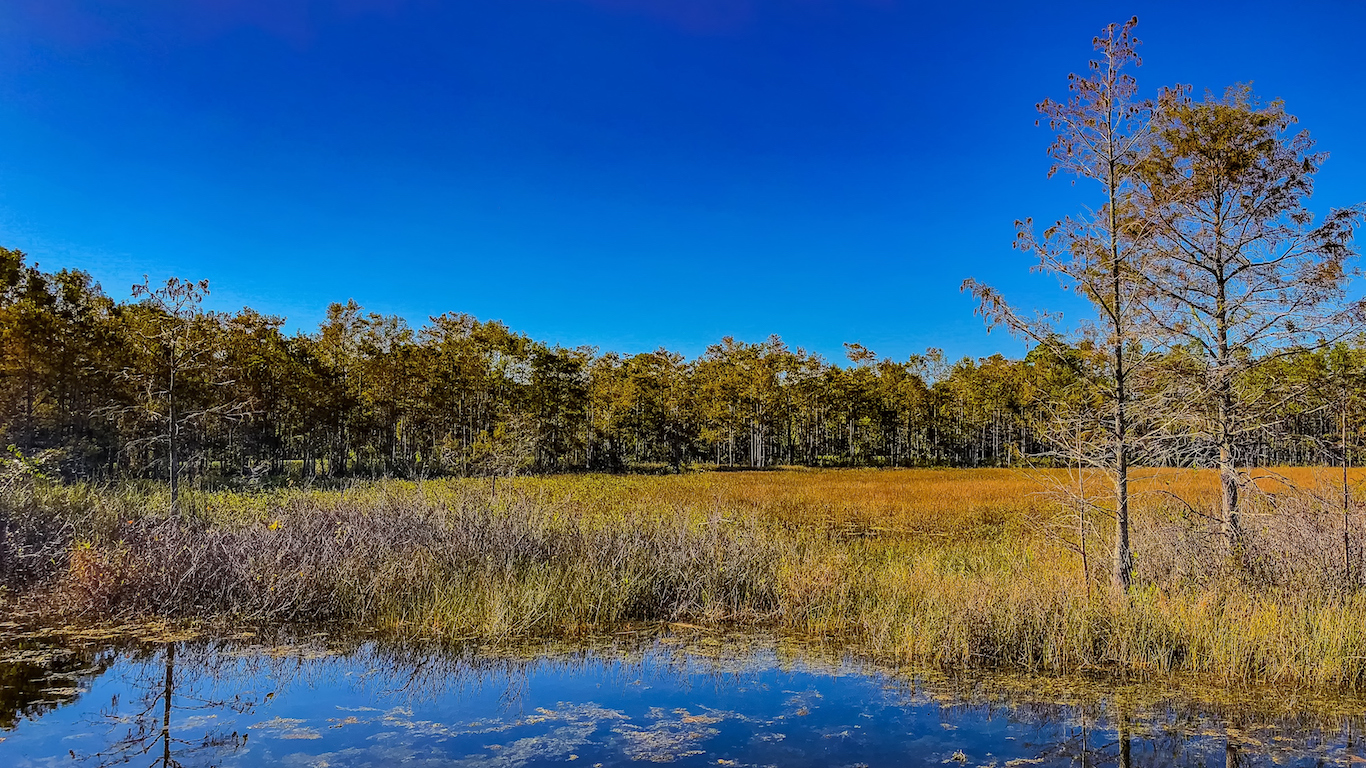
10. Georgia
> Middle of nowhere: Center of Okefenokee National Wildlife Refuge
> Time to nearest city: 5 hours, 23 minutes
> GPS coordinates: 30°42’45″N, 82°17’45″W
Source: Robert J. Shallenberger, U.S. Fish and Wildlife Service / Wikimedia Commons
11. Hawaii
> Middle of nowhere: Laysan Island
> Time to nearest city: 80 hours, 50 minutes
> GPS coordinates: 25°45’15″N, 171°43’45″W
[in-text-ad]
Source: mattalberts / iStock
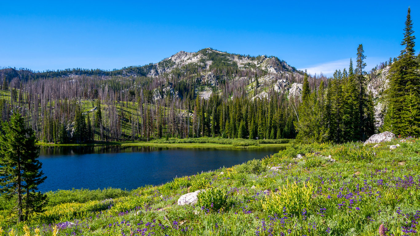
12. Idaho
> Middle of nowhere: Near Cottonwood Butte, Payette National Forest
> Time to nearest city: 16 hours, 11 minutes
> GPS coordinates: 45°18’15″N, 114°49’15″W
Source: dndavis / iStock
13. Illinois
> Middle of nowhere: North of Mound City, on the Ohio River
> Time to nearest city: 2 hours, 45 minutes
> GPS coordinates: 37°06’20.0″N 89°07’57.3″W
Source: LouisvilleUSACE / Flickr
14. Indiana
> Middle of nowhere: Patoka Lake, Hoosier National Forest
> Time to nearest city: 1 hours, 39 minutes
> GPS coordinates: 38°25’45″N, 86°40’15″W
[in-text-ad-2]

Source: LarryLindell / iStock
15. Iowa
> Middle of nowhere: 3 miles west of Titonka
> Time to nearest city: 2 hours, 43 minutes
> GPS coordinates: 43°13’15″N, 94°05’45″W
Source: Carolyn / iStock
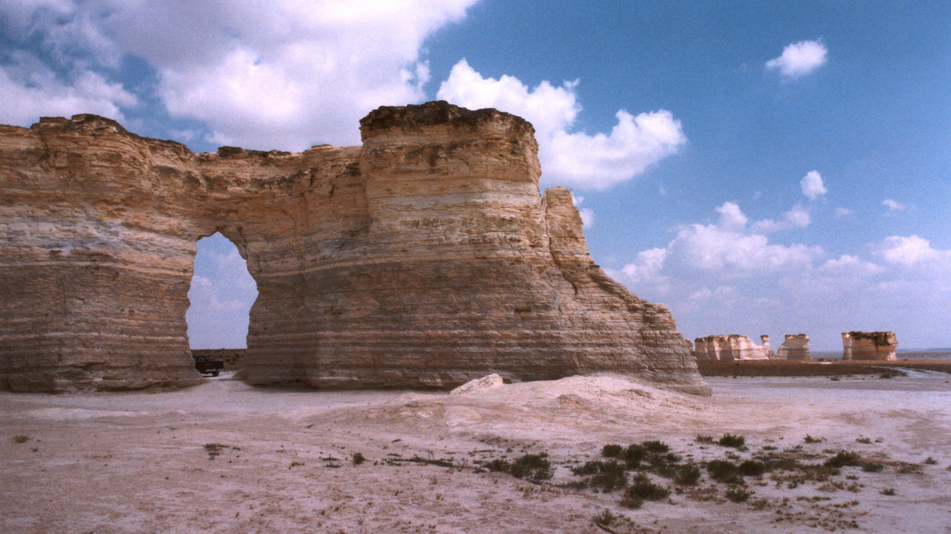
16. Kansas
> Middle of nowhere: 7 miles south of Elkader
> Time to nearest city: 5 hours, 3 minutes
> GPS coordinates: 38°44’45″N, 100°43’45″W
[in-text-ad]
Source: jctabb / iStock
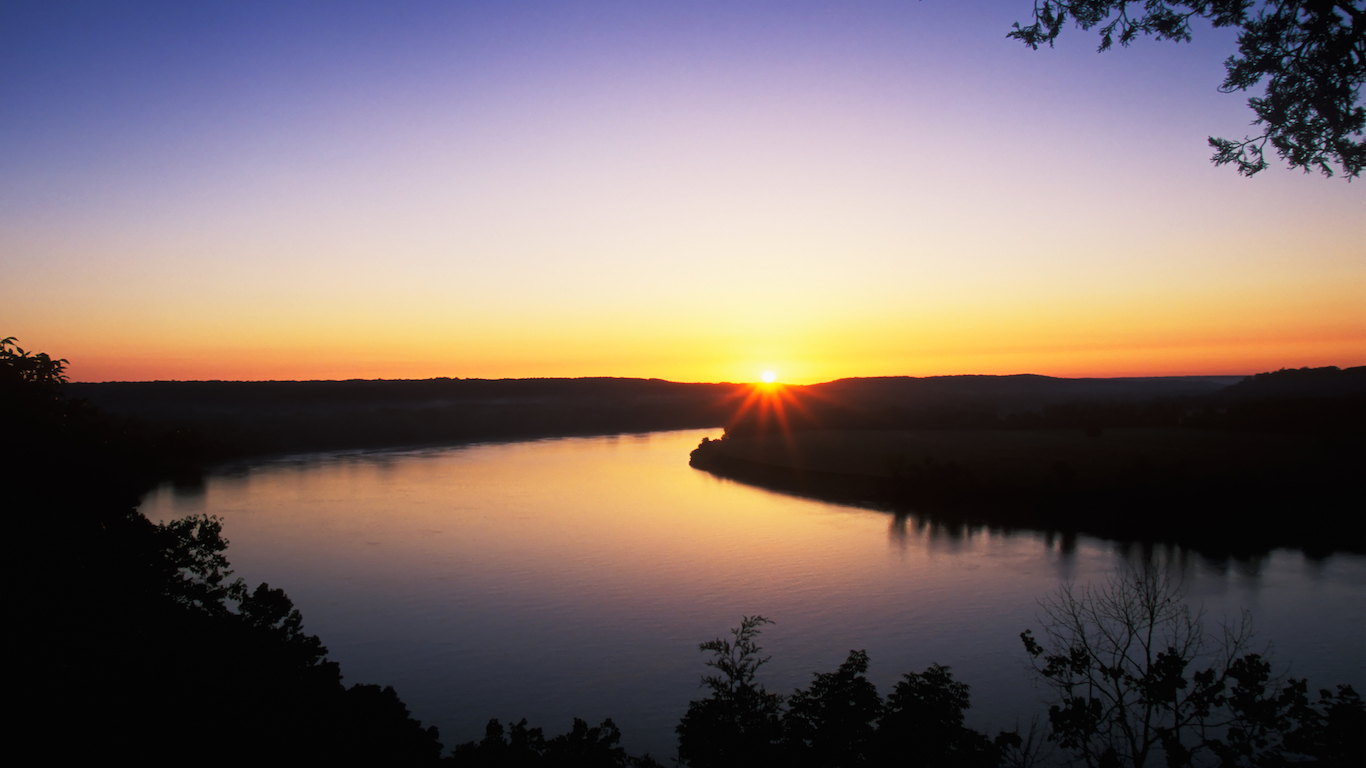
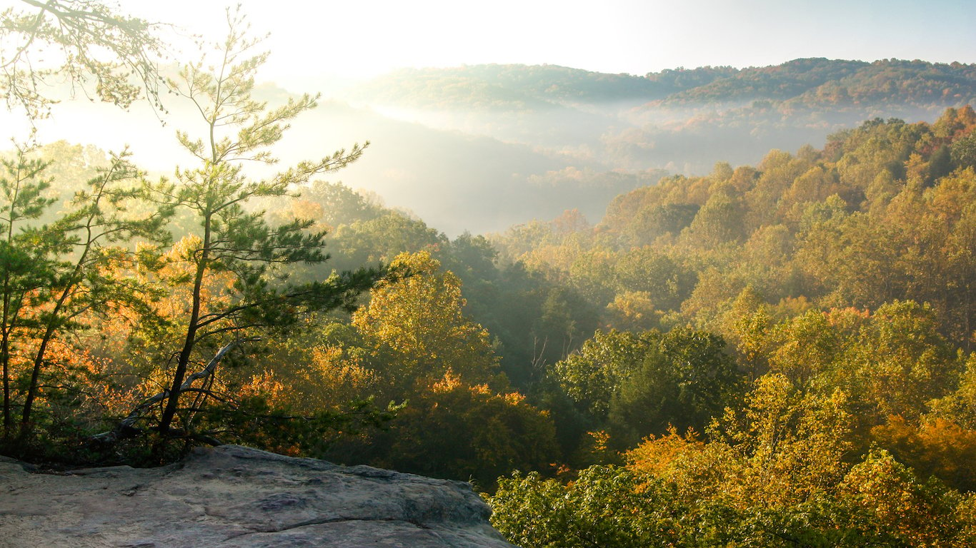
17. Kentucky
> Middle of nowhere: 2 miles southwest of Route 1112
> Time to nearest city: 2 hours, 59 minutes
> GPS coordinates: 37°41’45″N, 82°27’15″W
 24/7 Wall St.
Source: jon chica parada / iStock
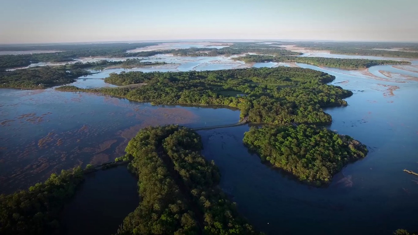
18. Louisiana
> Middle of nowhere: Avoca Island Cutoff
> Time to nearest city: 6 hours, 51 minutes
> GPS coordinates: 29°29’15″N, 91°04’15″W
Source: Nick Gallop / Flickr
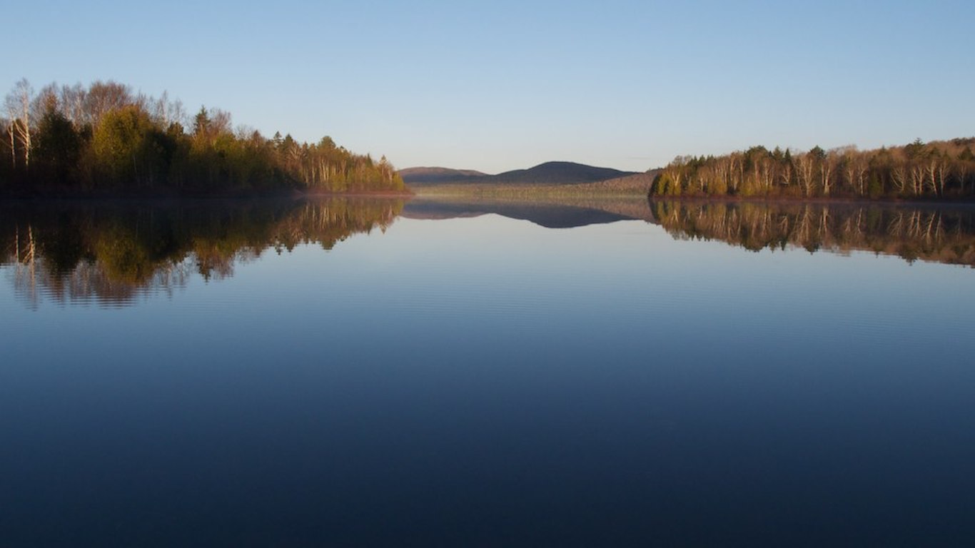
19. Maine
> Middle of nowhere: Shoreline of Munsungan Lake
> Time to nearest city: 6 hours, 56 minutes
> GPS coordinates: 46°22’15″N, 68°59’15″W
[in-text-ad-2]
Source: U.S. Fish and Wildlife Service Northeast Region / Flickr
20. Maryland
> Middle of nowhere: Shoreline of Smith Island
> Time to nearest city: 2 hours, 56 minutes
> GPS coordinates: 38°01’45″N, 76°00’45″W
Source: IndiaBlake / iStock
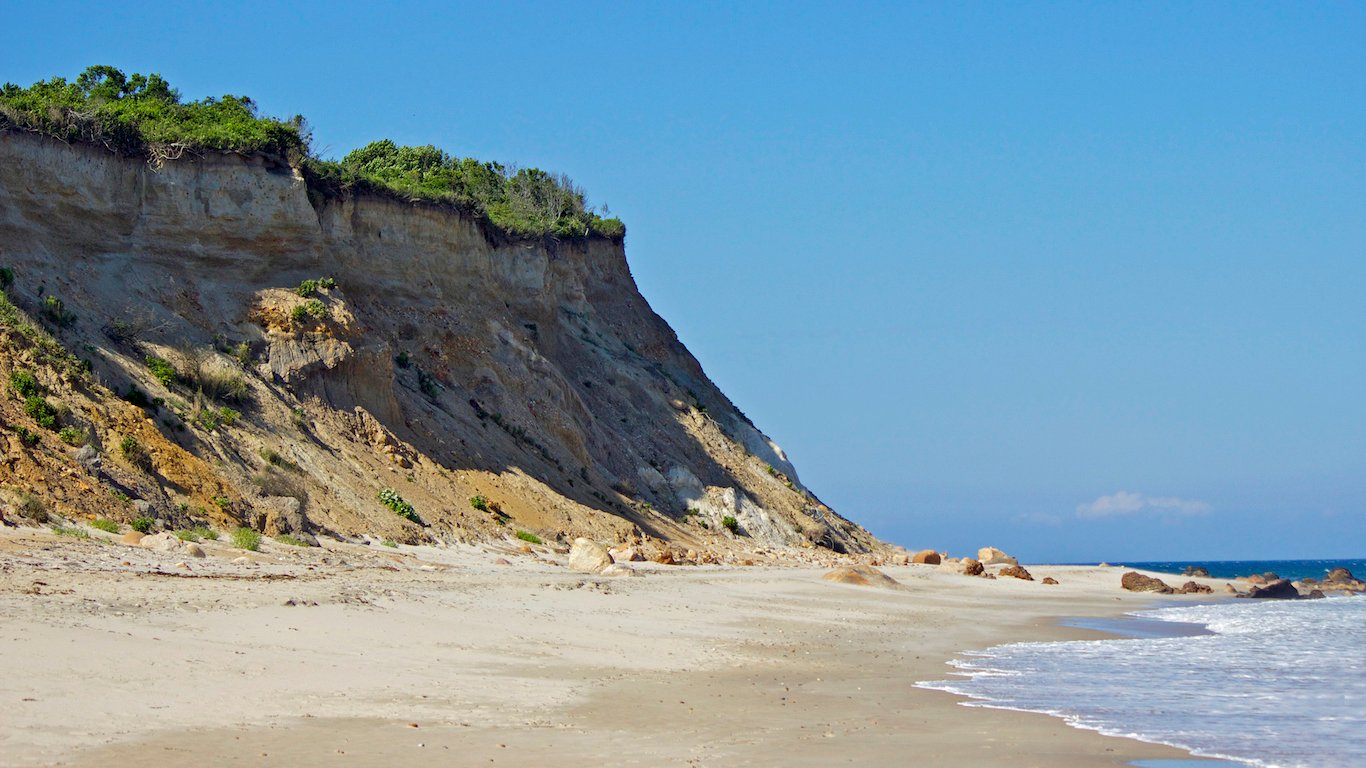
21. Massachusetts
> Middle of nowhere: Forked Pond Valley, Nantucket
> Time to nearest city: 3 hours, 5 minutes
> GPS coordinates: 41°14’15″N, 70°01’15″W
[in-text-ad]
Source: Posnov / iStock
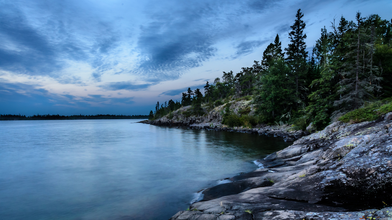
22. Michigan
> Middle of nowhere: West of Newt Lake, Isle Royale
> Time to nearest city: 11 hours, 41 minutes
> GPS coordinates: 48°03’45″N, 88°37’15″W
 24/7 Wall St.
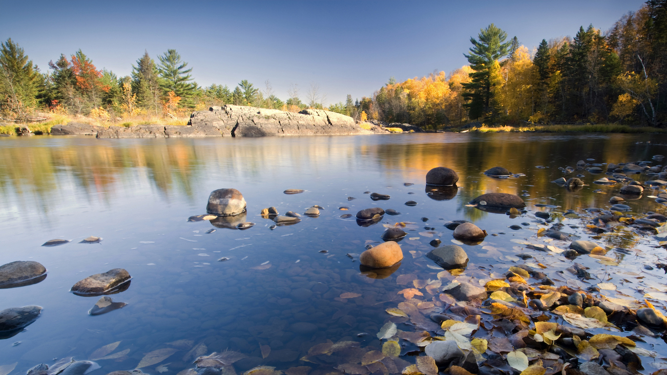
Source: 7Michael / iStock
23. Minnesota
> Middle of nowhere: Coleman Island, Canadian border
> Time to nearest city: 10 hours, 40 minutes
> GPS coordinates: 48°18’45″N, 92°01’15″W
Source: U.S. Fish and Wildlife Service Headquarters / Flickr
24. Mississippi
> Middle of nowhere: Panther Swamp Wildlife Refuge
> Time to nearest city: 4 hours, 2 minutes
> GPS coordinates: 32°49’15″N, 90°33’15″W
[in-text-ad-2]
Source: zrfphoto / iStock
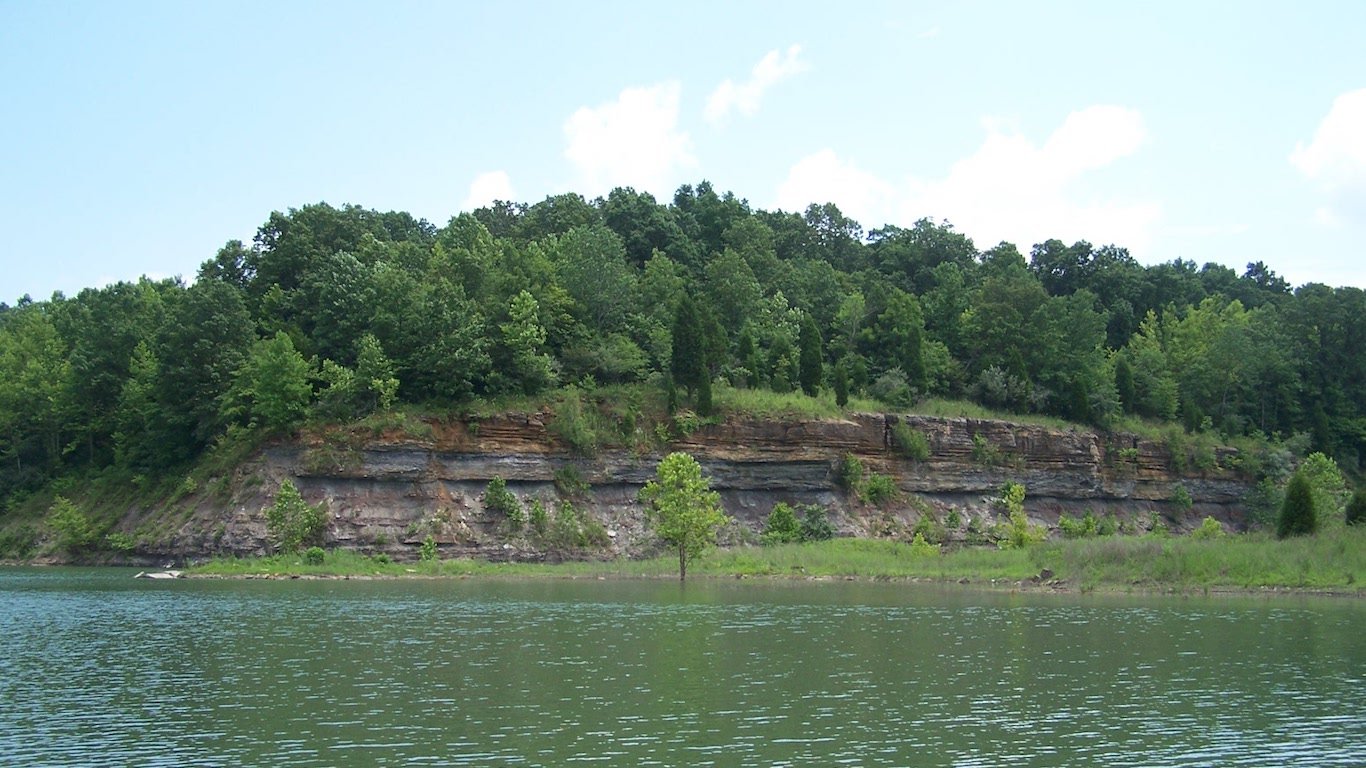
25. Missouri
> Middle of nowhere: 3 miles South of Wilderness
> Time to nearest city: 3 hours, 36 minutes
> GPS coordinates: 36°44’45″N, 91°10’45″W
Source: Troy Smith / Flickr
26. Montana
> Middle of nowhere: 3.5 miles West of Gordon Mountain
> Time to nearest city: 16 hours, 7 minutes
> GPS coordinates: 47°25’15″N, 113°15’15″W
[in-text-ad]
Source: ablokhin / iStock
27. Nebraska
> Middle of nowhere: West of Samuel R. McKelvie National Forest
> Time to nearest city: 7 hours, 49 minutes
> GPS coordinates: 42°35’15″N, 101°29’15″W
Source: GOWESTFOTO / iStock
28. Nevada
> Middle of nowhere: Black Rock Desert Wilderness
> Time to nearest city: 10 hours, 21 minutes
> GPS coordinates: 41°15’45″N, 118°45’15″W
Source: JosephJacobs / iStock
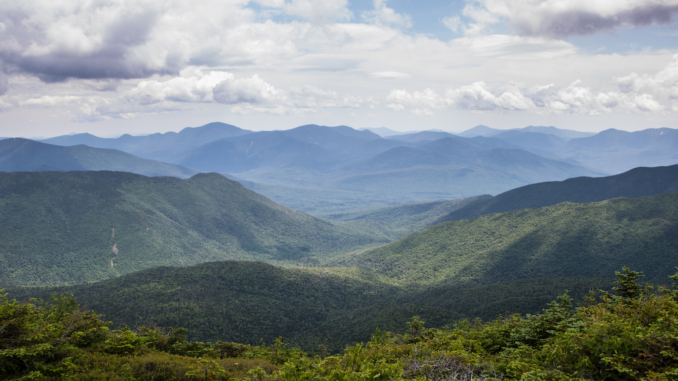
29. New Hampshire
> Middle of nowhere: 5 miles Northwest of Mount Cabot
> Time to nearest city: 3 hours, 10 minutes
> GPS coordinates: 44°32’15″N, 71°26’45″W
[in-text-ad-2]
Source: Courtesy of NJ Division of Fish & Wildlife
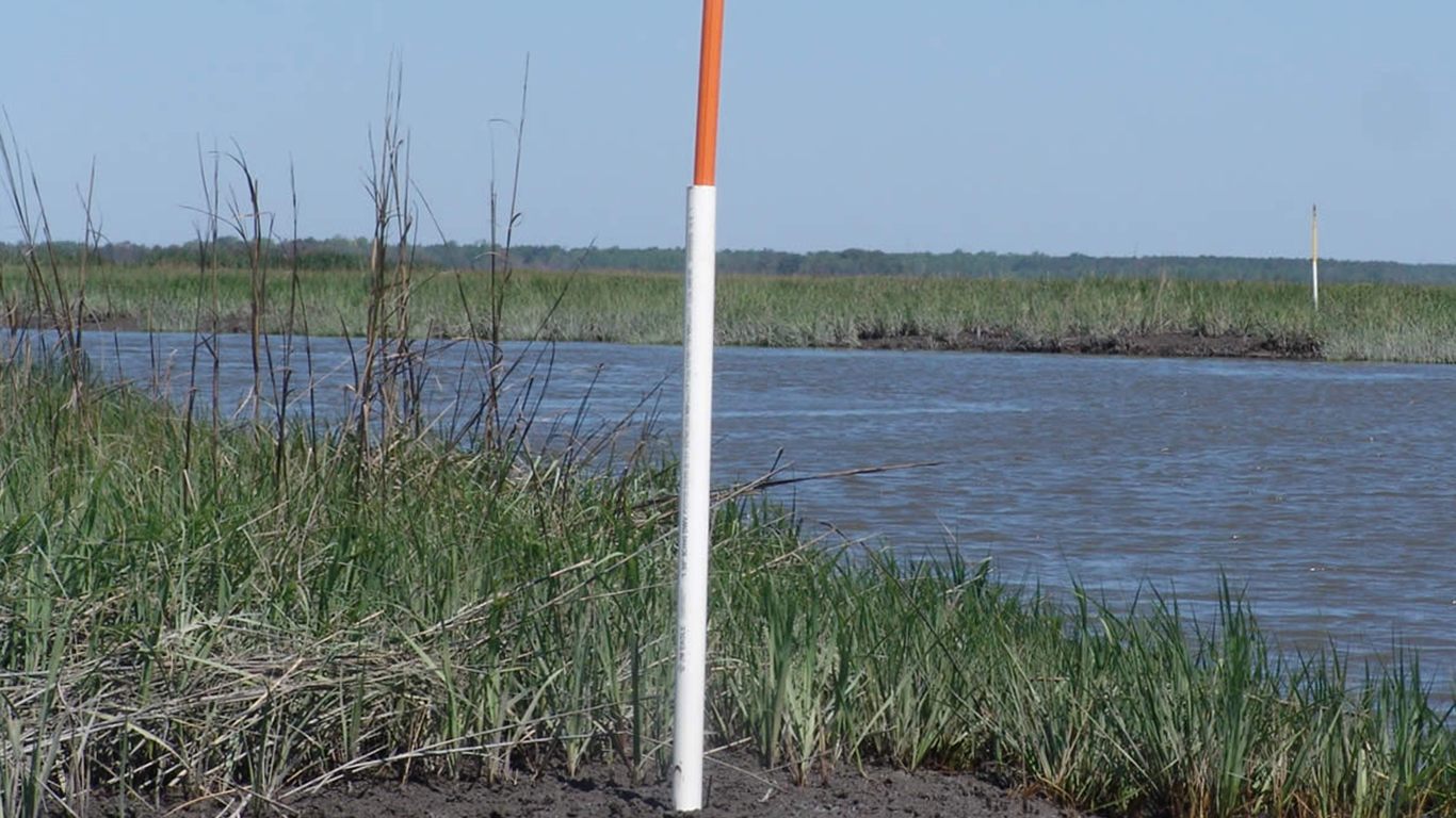
30. New Jersey
> Middle of nowhere: Eastern shoreline of Egg Island Fish and Wildlife
> Time to nearest city: 1 hours, 22 minutes
> GPS coordinates: 39°11’44.0″N 75°07’41.7″W
Source: jerryhopman / iStock
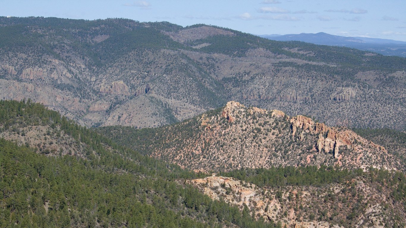
31. New Mexico
> Middle of nowhere: About 1 mile southwest of Milligan Mountain
> Time to nearest city: 6 hours, 58 minutes
> GPS coordinates: 33°40’15″N, 108°39’45″W
[in-text-ad]
Source: Posnov / iStock
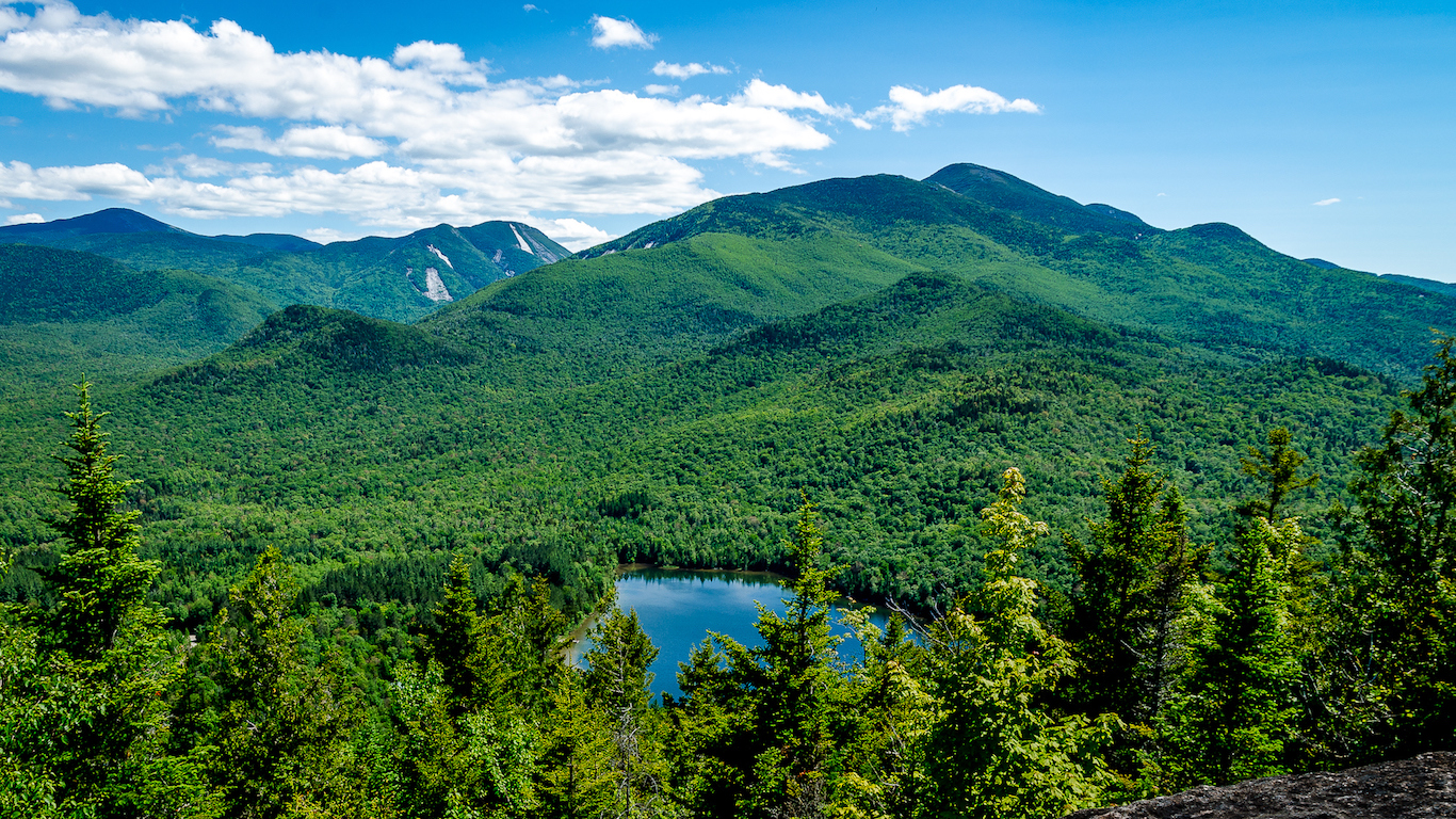
32. New York
> Middle of nowhere: Five Ponds Wilderness, Adirondack Mountains
> Time to nearest city: 4 hours, 58 minutes
> GPS coordinates: 43°59’15″N, 74°56’15″W
Source: Wildnerdpix / iStock
33. North Carolina
> Middle of nowhere: Ocracoke
> Time to nearest city: 3 hours, 12 minutes
> GPS coordinates: 35°05’45″N, 75°58’15″W
Source: cliffordpugliese / iStock
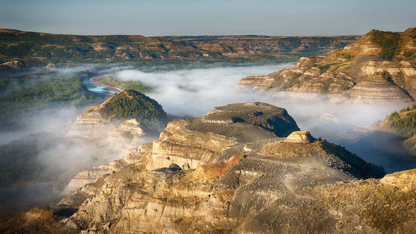
34. North Dakota
> Middle of nowhere: Less than 1 mile south of Devil’s Pass
> Time to nearest city: 6 hours, 53 minutes
> GPS coordinates: 47°17’15″N, 103°31’45″W
[in-text-ad-2]
Source: bryanakers / iStock
35. Ohio
> Middle of nowhere: North of Paddle Creek Horse Camp, Wayne National Forest
> Time to nearest city: 2 hours, 7 minutes
> GPS coordinates: 38°38’15″N, 82°35’15″W

Source: GracedByTheLight / iStock
36. Oklahoma
> Middle of nowhere: South of Kansas-Oklahoma border, by Cimarron River
> Time to nearest city: 3 hours, 47 minutes
> GPS coordinates: 36°59’15″N, 99°51’15″W
[in-text-ad]
Source: tristanbnz / iStock
37. Oregon
> Middle of nowhere: About 4 miles east of Big Craggies, Rogue River-Siskiyou National Forest
> Time to nearest city: 8 hours, 51 minutes
> GPS coordinates: 42°21’45″N, 123°58’45″W
 24/7 Wall St.
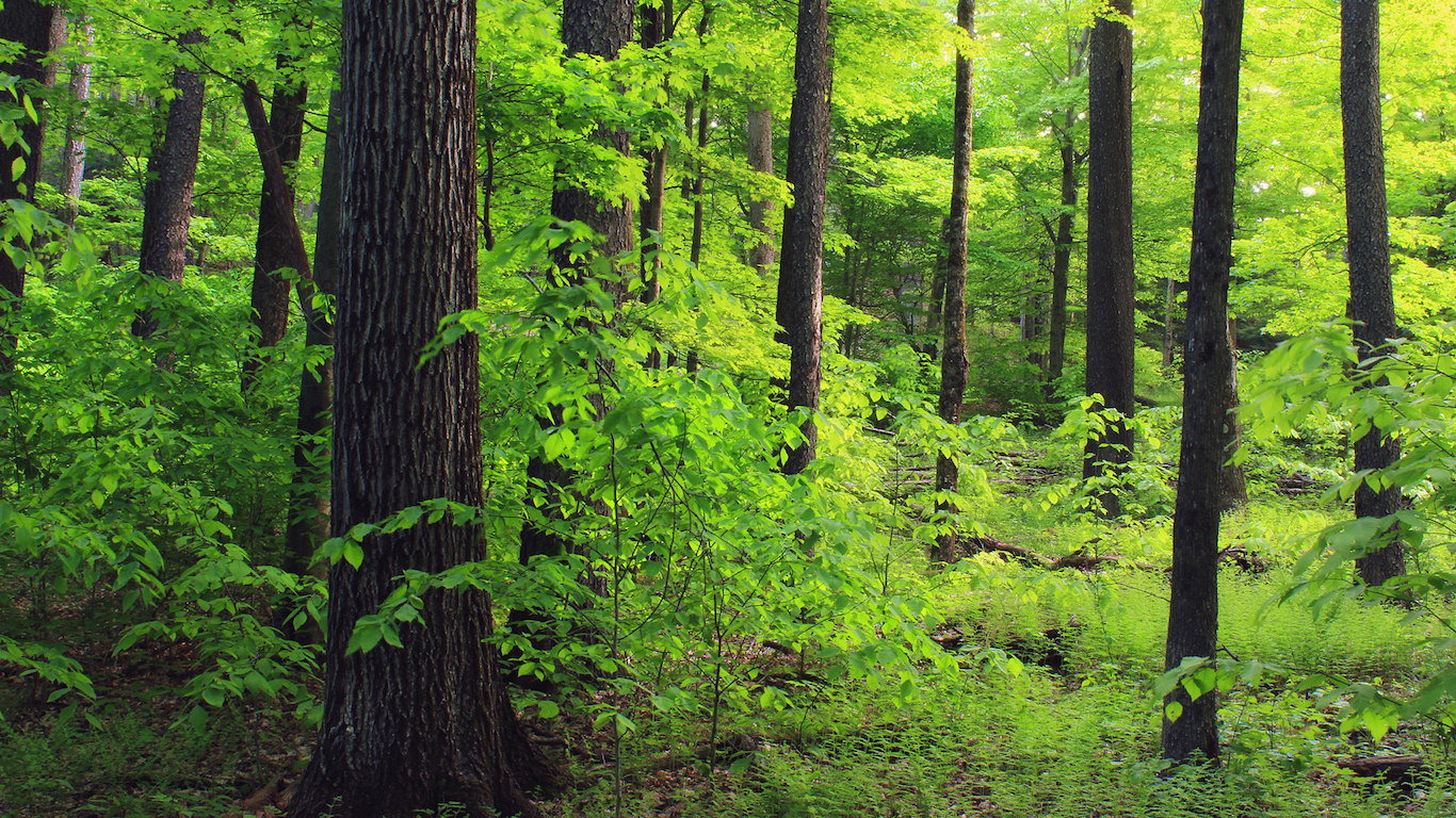
Source: Nicholas A. Tonelli / Flickr
38. Pennsylvania
> Middle of nowhere: About 1 mile south of Hailstone Hollow, Hammersley Wild Area
> Time to nearest city: 2 hours, 47 minutes
> GPS coordinates: 41°31’45″N, 77°52’15″W
Source: suefeldberg / iStock
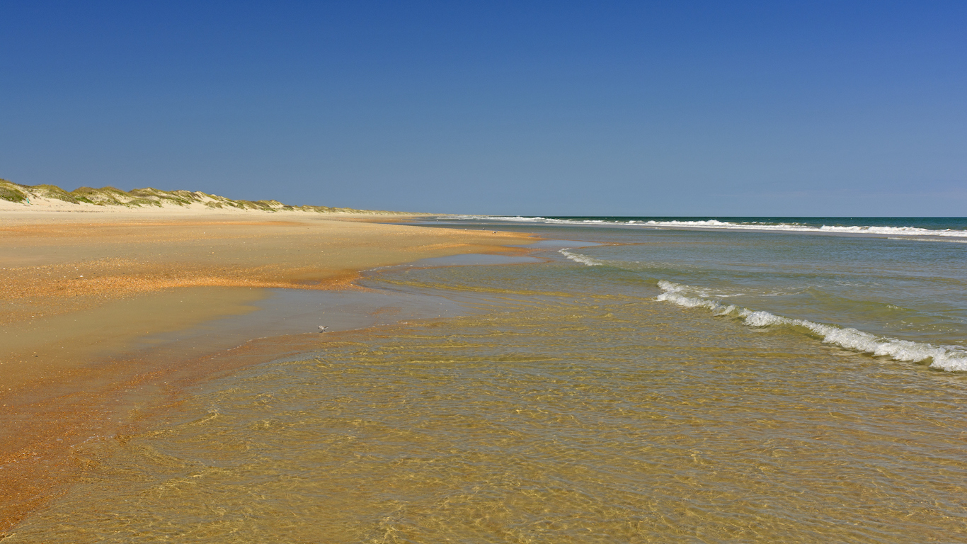
39. Rhode Island
> Middle of nowhere: Schooner Point, Block Island
> Time to nearest city: 1 hours, 35 minutes
> GPS coordinates: 41°09’15″N, 71°36’45″W
[in-text-ad-2]
Source: Keen Eye Marketing / YouTube
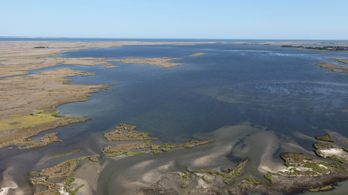
40. South Carolina
> Middle of nowhere: Cane Island, Santee Coastal Reserve
> Time to nearest city: 2 hours, 47 minutes
> GPS coordinates: 33°09’45″N, 79°15’45″W
Source: PatrickZiegler / iStock
41. South Dakota
> Middle of nowhere: Unnamed road, about 3 miles south of Bradley Bauer Ranch
> Time to nearest city: 8 hours, 11 minutes
> GPS coordinates: 44°42’15″N, 102°55’15″W
[in-text-ad]

Source: WerksMedia / iStock
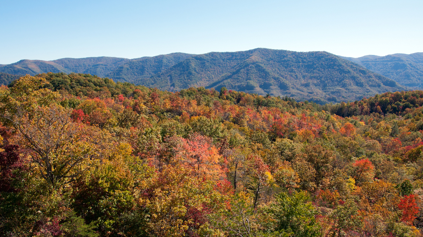
42. Tennessee
> Middle of nowhere: Clark Creek terminus, Rocky Fork State Park
> Time to nearest city: 3 hours, 8 minutes
> GPS coordinates: 36°05’15″N, 82°35’15″W

Source: Dean_Fikar / iStock
43. Texas
> Middle of nowhere: Southeastern-most edge of Big Bend National Park, on border of U.S. and Mexico
> Time to nearest city: 8 hours, 1 minutes
> GPS coordinates: 28°59’05.1″N 103°07’01.5″W
Source: ablokhin / iStock
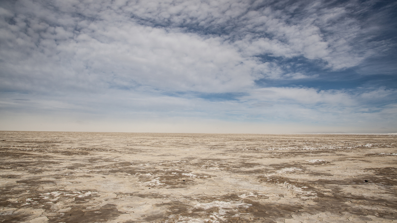
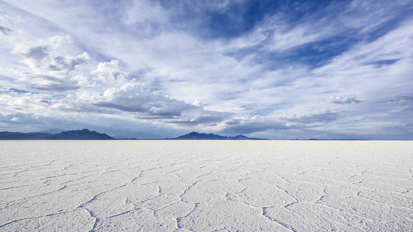
44. Utah
> Middle of nowhere: Great Salt Lake Desert, Northwest Utah
> Time to nearest city: 12 hours, 41 minutes
> GPS coordinates: 40°23’15″N, 113°35’45″W
[in-text-ad-2]
Source: ErikaMitchell / iStock
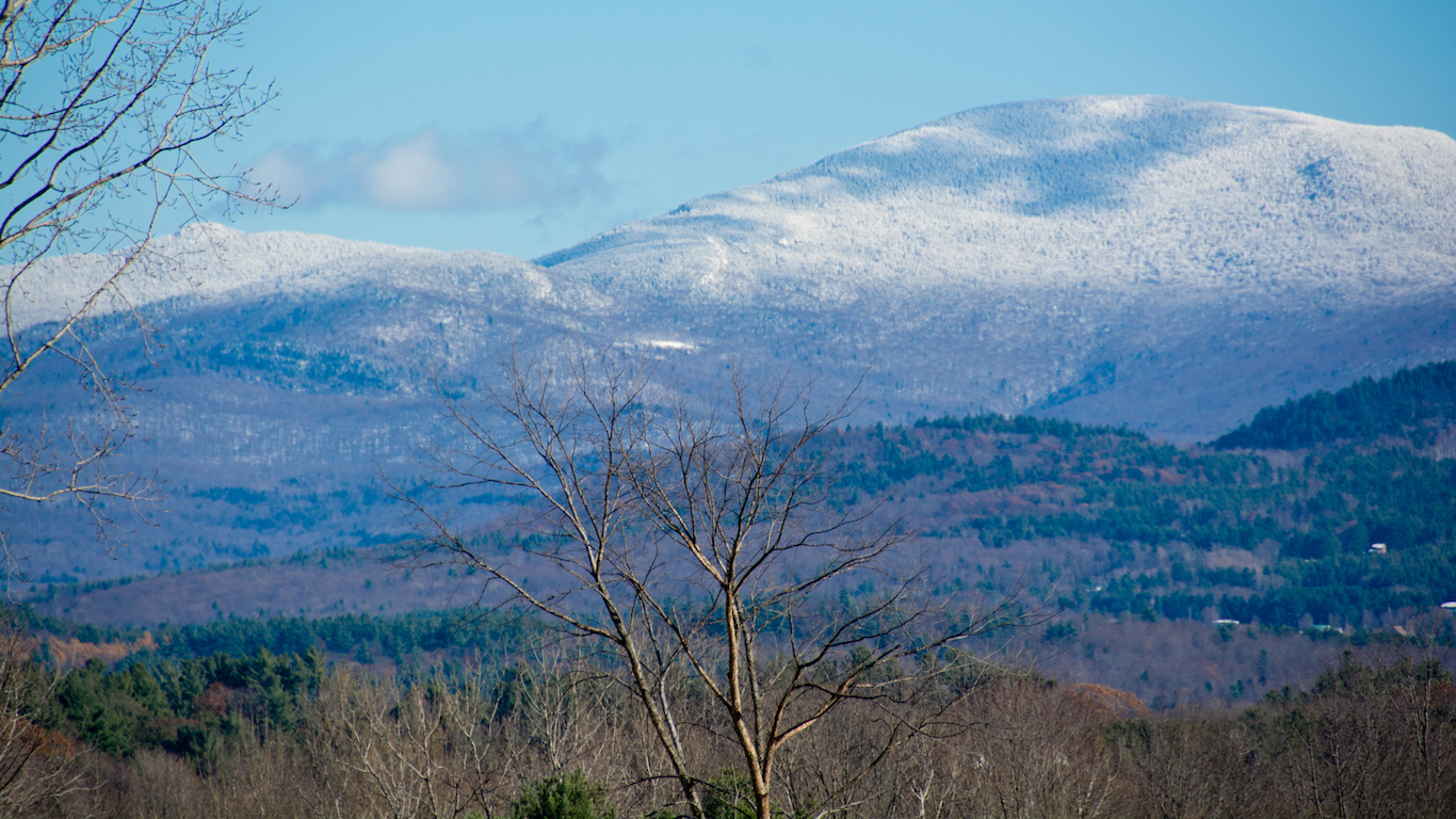
45. Vermont
> Middle of nowhere: Hunger Mountain, CC Putnam State Forest
> Time to nearest city: 3 hours, 29 minutes
> GPS coordinates: 44°26’15″N, 72°36’15″W
Source: tristanbnz / iStock
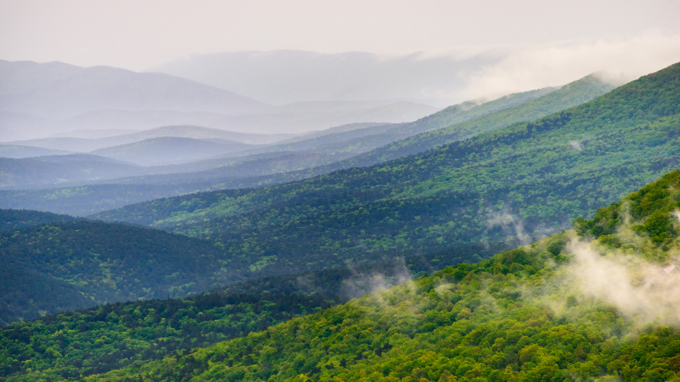
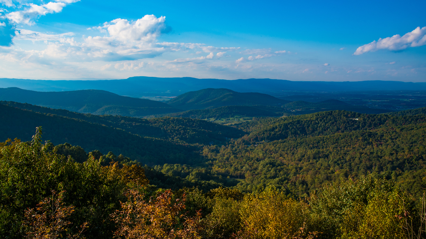
46. Virginia
> Middle of nowhere: Red Creek terminus
> Time to nearest city: 2 hours, 58 minutes
> GPS coordinates: 36°55’45″N, 81°53’15″W
[in-text-ad]
Source: Stan Shebs / Wikimedia Commons
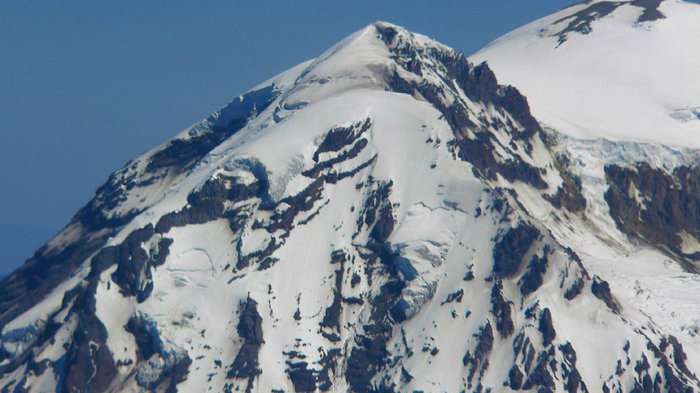
47. Washington
> Middle of nowhere: Liberty Cap, Mt Rainier National Park
> Time to nearest city: 15 hours, 52 minutes
> GPS coordinates: 46°52’15″N, 121°46’15″W
Source: Mingo County Commission
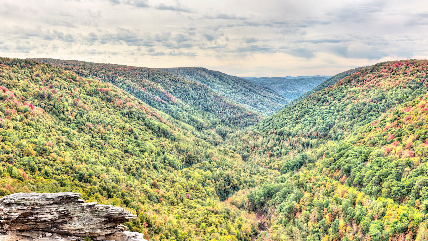
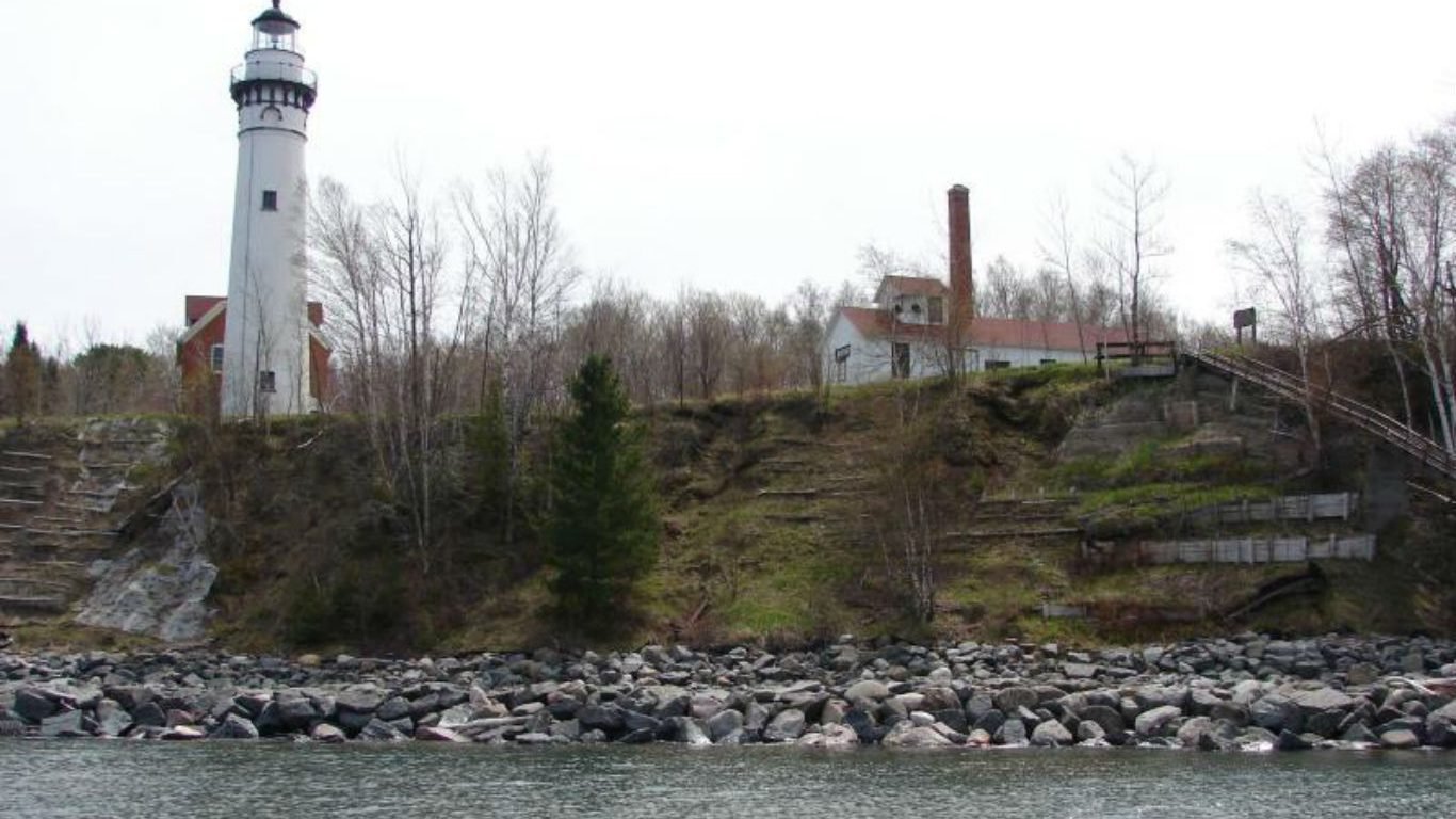
48. West Virginia
> Middle of nowhere: ½ mile south of of East Fork and Mc Cloud
> Time to nearest city: 3 hours, 10 minutes
> GPS coordinates: 37°56’15″N, 82°12’15″W
Source: National Park Service
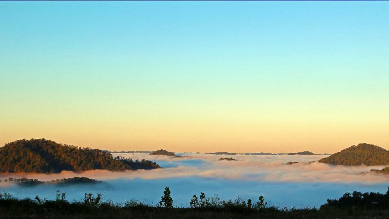
49. Wisconsin
> Middle of nowhere: Outer Island, Lake Superior
> Time to nearest city: 7 hours, 36 minutes
> GPS coordinates: 47°03’15″N, 90°25’15″W
[in-text-ad-2]
Source: U.S. Forest Service
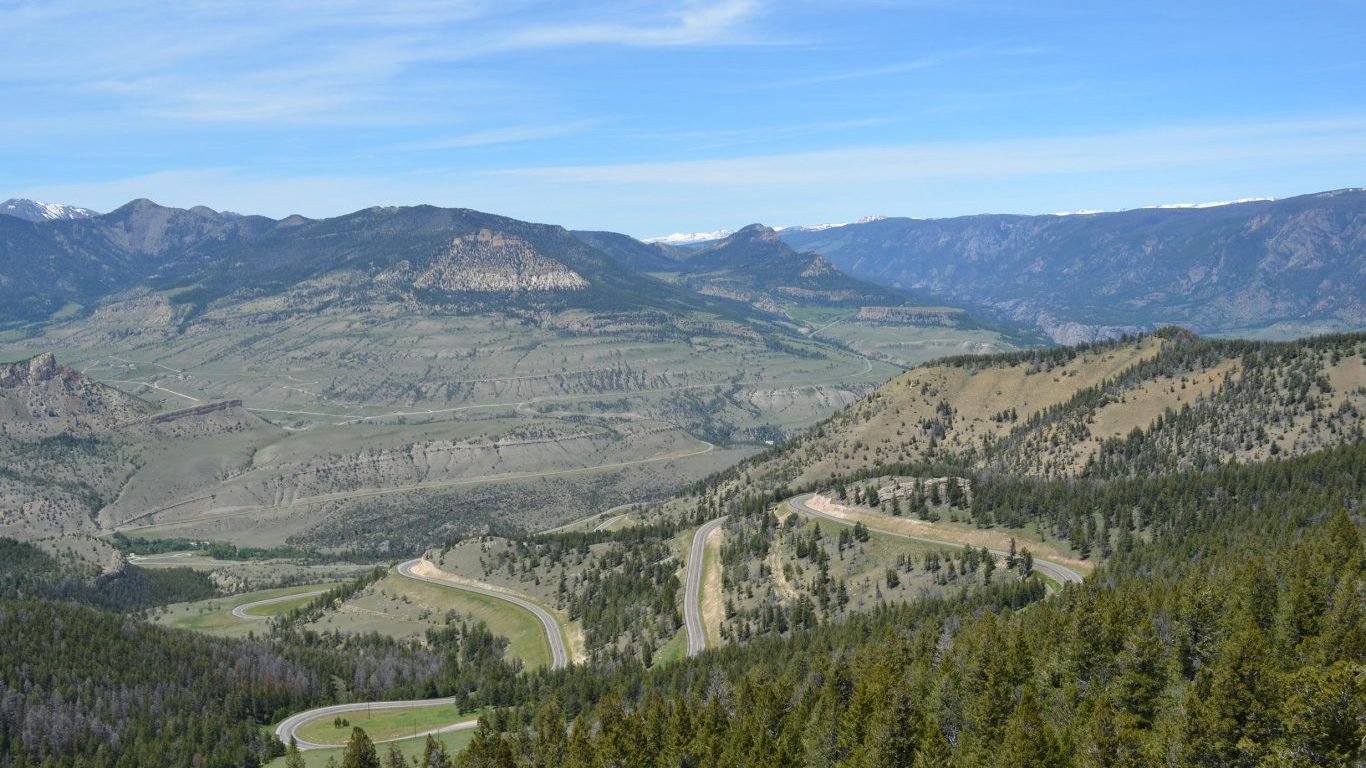
50. Wyoming
> Middle of nowhere: Hardluck Mountain, Shoshone National Forest
> Time to nearest city: 14 hours, 44 minutes
> GPS coordinates: 43°59’45″N, 109°40’15″W
Detailed Findings
The middle of nowhere is harder to find in the Eastern United States, the oldest-settled part of the country. Three of the smallest states — Connecticut, New Jersey, and Rhode Island — have the shortest travel time from their most remote area to the nearest city. Connecticut’s travel time — measured by foot, boat, car, or plane — is the shortest, 52 minutes.
Because of technological advances such as global positioning systems and multi-dimensional maps, remote areas are getting more difficult to find in the United States. According to data compiled by online statistics portal Statista, the population density of the United States in 1790 — when Daniel Boone roamed the American frontier — was 4.5 people per square mile. In 2017, the nation’s population density was about 92.2 people per square mile.
The last two states admitted to the Union — Alaska and Hawaii — have the longest travel time of any state in the country from their middle of nowhere to a city. The time to travel from Alaska’s Amatignak Island in the Aleutian Islands to the nearest city is more than 84 hours. Laysan in Hawaii is more than 80 hours from the closest city.
Many of the areas on this list are in mountainous or desert regions, whose terrain has to be traversed on foot and where there are few roads. These regions create challenges for adventurous hikers, but they most likely cannot sustain human habitation.
Other remote areas in the United States are in forests, wildlife preserves, swamps, shorelines, and wetlands. Most of these areas remain unspoiled because of government land-use dictates, and therefore they will likely stay remote.
To identify the middle of nowhere in every state, 24/7 Wall St. reviewed the predicted travel time in minutes to the nearest city from millions of locations across the United States. The data were obtained from “A Global Map of Travel Time to Cities to Assess Inequalities in Accessibility in 2015”, published Jan. 10, 2018 in the International Journal of Science Nature.
Researchers used a geospatial model that estimated travel times from points around the world to urban centers, taking into account various modes of transportation, terrain, the quality of transportation infrastructure, and other factors affecting human movement rates.
Take This Retirement Quiz To Get Matched With A Financial Advisor (Sponsored)
Take the quiz below to get matched with a financial advisor today.
Each advisor has been vetted by SmartAsset and is held to a fiduciary standard to act in your best interests.
Here’s how it works:
1. Answer SmartAsset advisor match quiz
2. Review your pre-screened matches at your leisure. Check out the
advisors’ profiles.
3. Speak with advisors at no cost to you. Have an introductory call on the phone or introduction in person and choose whom to work with in the future
Take the retirement quiz right here.
Thank you for reading! Have some feedback for us?
Contact the 24/7 Wall St. editorial team.
Editors' Picks