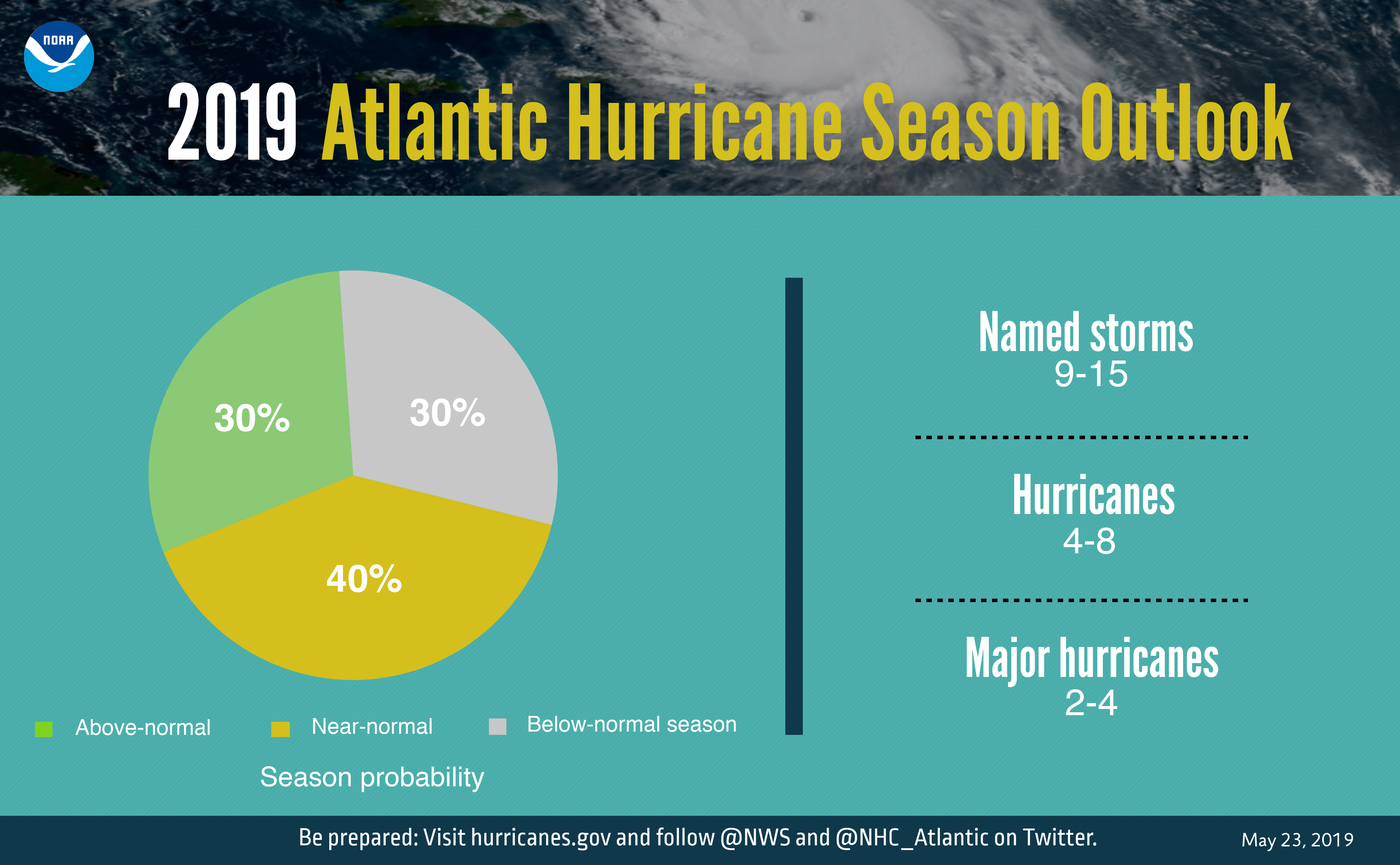
“An ‘active to extremely active’ hurricane season is expected for the Atlantic Basin this year according to the seasonal outlook issued today by NOAA’s Climate Prediction Center – a division of the National Weather Service.”… That is what the service reported this morning. The hurricane season officially starts on June 1, and NOAA is assigning a 70% probability of these ranges:
- 14 to 23 Named Storms (39 MPH or higher, names up N to W), including 8 to 14 Hurricanes (74 MPH or higher) with a range of 3 to 7 of those hurricanes being major hurricanes at a Cat-3, 4, or 5 (winds of at least 111 MPH).
Cited for the higher hurricane season prediction is that El Niño has dissipated in the Pacific, sea surface temperatures are expected to return to above average, and the high activity era is expected to stay on. While the current state of La Niña is neutral, the report noted that the chances of conditions are becoming increasingly favorable for La Niña to develop.
In short, you better at least start finding your old checklist of to-do items and to-buy items for hurricane season if you live on the coastal areas. I went out immediately after Hurricane Ike and took many photos of the damage that inside the 610 Loop in Houston, and that damage is minimal compared to what happens in towns and cities right on the coast such as Galveston.
The good news is that the offshore oil platforms have not had issues like BP’s Deepwater Horizon well that is trashing the Gulf of Mexico right now. The bad news is that if BP does not permanently seal that well then the Gulf Oil spill mixed with a hurricane is apt to leave the coastline painted from ground to roofs with crude oil.
JON C. OGG
Contact [email protected] for any questions or corrections.