The United Nations reports that the world’s population is now about 7.6 billion, and it is growing constantly. According to projections by the Population Research Bureau (PRB), an 80-year old non-profit organization that collects and analyzes data about population, health, and the environment, that figure will reach 9.9 billion by 2050.
An estimated 71% — 40,825,000 square miles — of the Earth’s dry land is considered habitable. This works out to an average, today, of about 186 people per square mile. That’s not bad as density goes. It’s just a slightly higher concentration than what you’d find in the Seychelles or Andorra, neither of which is particularly overrun with people. (The U.S. is much less dense, with about 92 people per square mile.)
Of course, population is hardly evenly distributed. Anyone who has ever tried to ride a subway car in Tokyo at rush hour or, at the other extreme, trekked across the vacant gypsum dunes at White Sands in New Mexico knows that first-hand.
24/7 Wall St. has calculated which countries around the world have the highest population densities. The majority of these, we learned, are in Asia, followed closely by Europe and the Caribbean. Some places commonly thought of as countries are not included here. Among these are Hong Kong and Macau, both Special Administrative Regions of China; Bermuda, which is a British overseas territory; and Puerto Rico, which, though often referred to as a U.S. territory, is actually classified by the American government as one of two U.S. commonwealths, along with the Northern Mariana Islands in the Pacific.
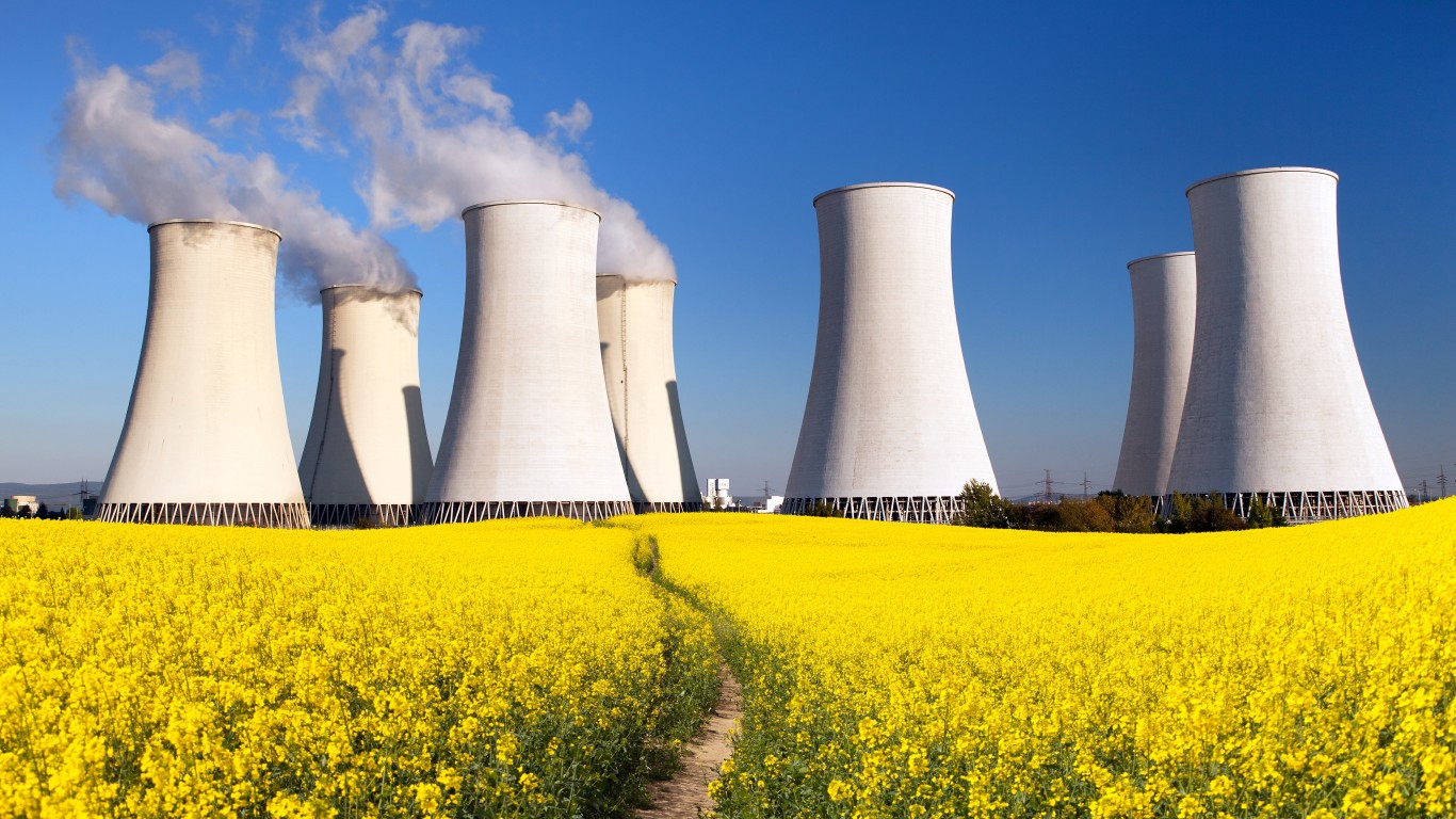
Click here to see the most crowded countries in the world.
Click here to see the least crowded countries in the world.
Click here to read detailed findings and methodology.
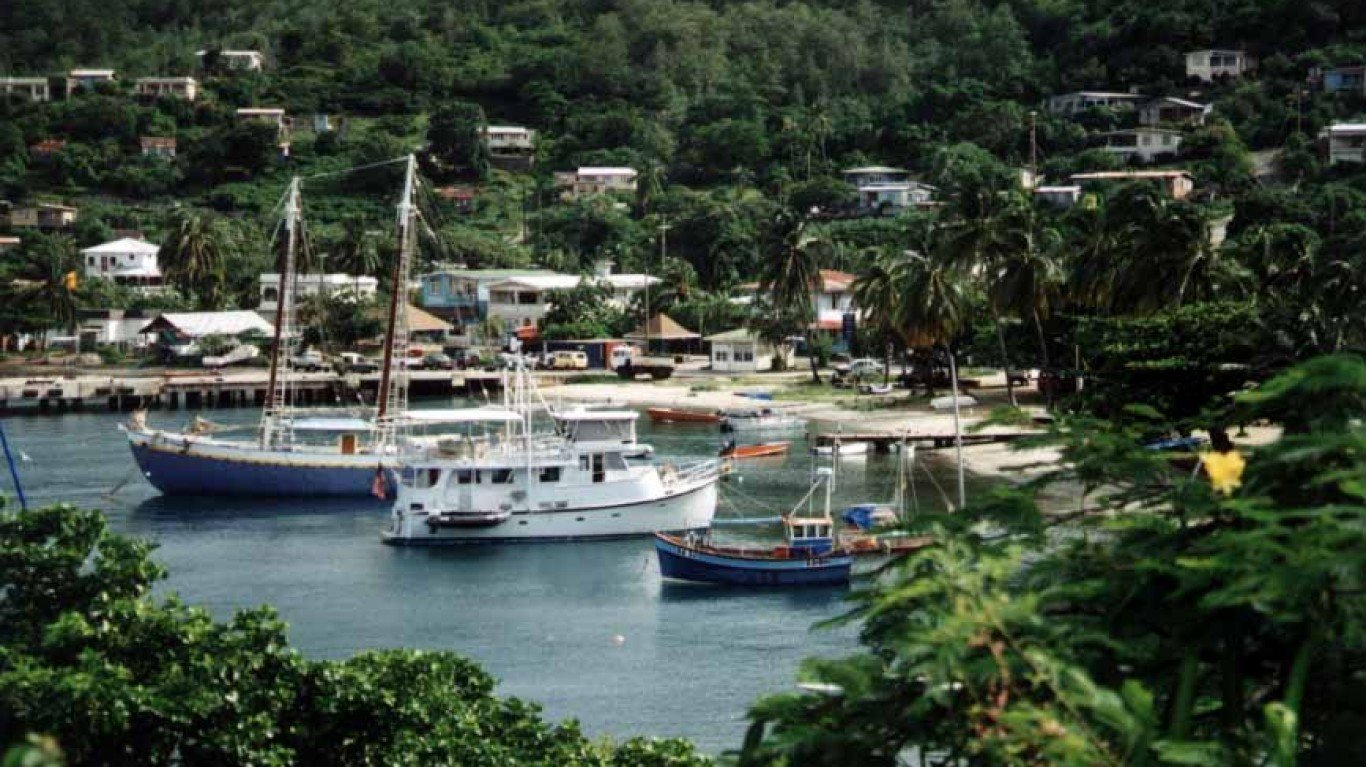
30. St. Vincent and the Grenadines
> Population density: 729.8 people per square mile
> Population: 109,897
> Land area: 151 square miles
> Population growth (1990-2017): 2.2%
The population of this string of 32 islands and cays stretching between St. Lucia and Grenada in the southern Caribbean has changed little since 1990, though the fertility rate has declined noticeably, from 3.10 to 1.99 births per woman. The majority of the population is concentrated in and around Kingstown, the capital.
[in-text-ad]
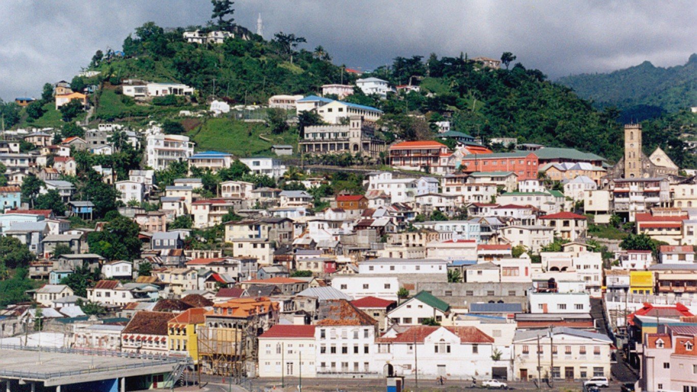
29. St. Lucia
> Population density: 759.4 people per square mile
> Population: 178,844
> Land area: 236 square miles
> Population growth (1990-2017): 29.4%
Though many decide to leave this southern Caribbean island, mainly to the U.K. and the U.S., St. Lucia’s population continues to grow at the rate of about 1.2% annually. St. Lucia boasts the most Nobel Prize-winners per capita of any country in the world — 1 per 89,422 inhabitants. (They are Derek Walcott for literature and Sir Arthur Lewis for economics.)
[recirclink id=488456]
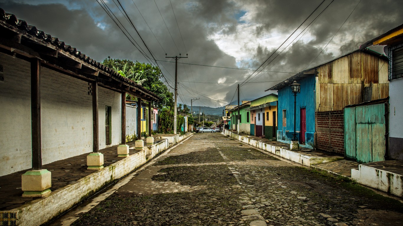
28. El Salvador
> Population density: 797.2 people per square mile
> Population: 6,377,853
> Land area: 8,000 square miles
> Population growth (1990-2017): 21.4%
Both the smallest country in Central America and the most densely populated, El Salvador is experiencing a decline in population growth and the gradual aging of its citizenry. About 72% of the total population lives in urban areas, mostly in the capital city of San Salvador.
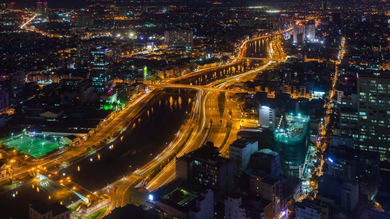
27. Vietnam
> Population density: 798.0 people per square mile
> Population: 95,540,800
> Land area: 119,719 square miles
> Population growth (1990-2017): 40.1%
Vietnam’s population is widely dispersed, with the majority living along the Mekong Delta in the south and the Red River Valley in the north. Ho Chi Minh City — the former Saigon — is by far the largest urban area, with a population about eight times as large as that of Hanoi, the capital city.
[in-text-ad-2]
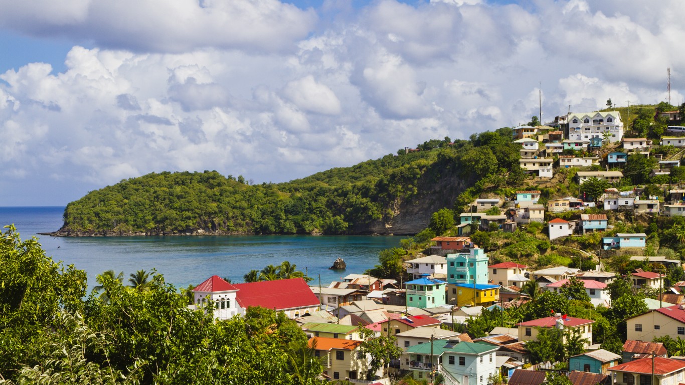
26. Grenada
> Population density: 821.4 people per square mile
> Population: 107,825
> Land area: 131 square miles
> Population growth (1990-2017): 12.0%
Consisting of the island of Grenada and several smaller islands in the Southern Grenadines, this country is a member of The Commonwealth, a voluntary association of independent sovereign states. Many of them — including Canada, India, and Australia, as well as Grenada — were formerly part of the British Empire. About a third of Grenada’s population lives in the capital, St. George’s.
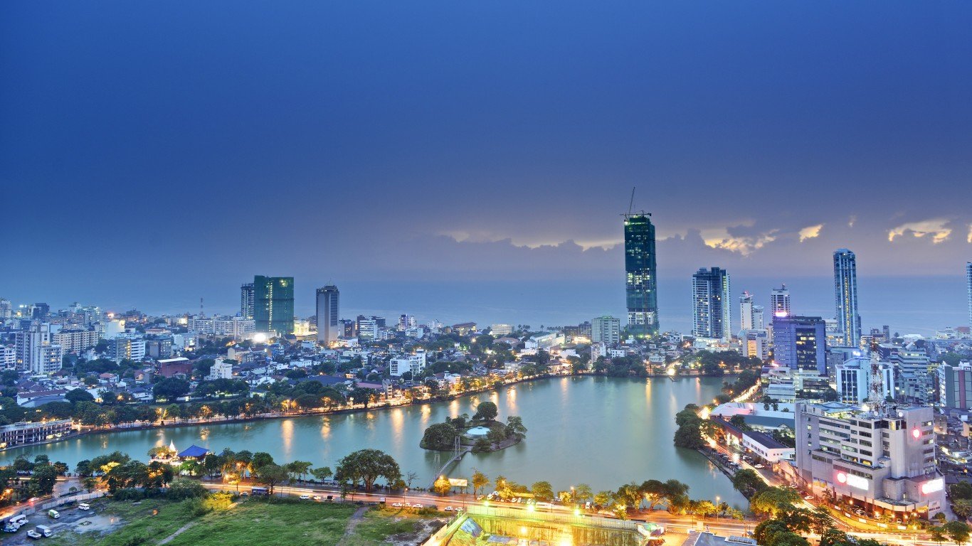
25. Sri Lanka
> Population density: 885.7 people per square mile
> Population: 21,444,000
> Land area: 24,212 square miles
> Population growth (1990-2017): 23.7%
This island off the southeastern coast of India, formerly known as Ceylon, conducted its last census in 2001, and it could be carried out completely in only 18 of its 25 districts due to what the government calls “disturbances” in parts of the country. These “disturbances” were in fact an ongoing conflict with a separatist group seeking a homeland for the ethnic Tamil state. Even this incomplete accounting reflected a dramatic increase in population, from about 3.6 million in 1901 to about 18.8 million a century later. The growth rate was particularly strong between 1946 and 1953, though the rate has been declining since then.
[in-text-ad]
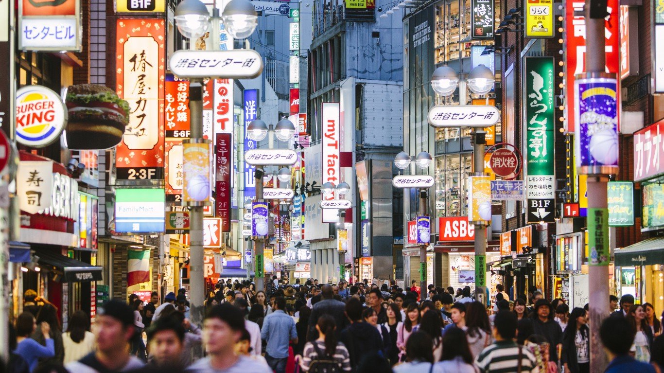
24. Japan
> Population density: 900.7 people per square mile
> Population: 126,785,797
> Land area: 140,757 square miles
> Population growth (1990-2017): 2.6%
Now one of the world’s most populous countries, Japan is experiencing a decline in population. According to the Statistics Bureau of Japan’s Ministry of Internal Affairs and Communications, the number of inhabitants is expected to decline from the current level to about 102 million by 2050. The bureau also reports that both the birth and death rates have been shrinking noticeably. Today, about a quarter of the population is over the age of 65.
[recirclink id=488594]
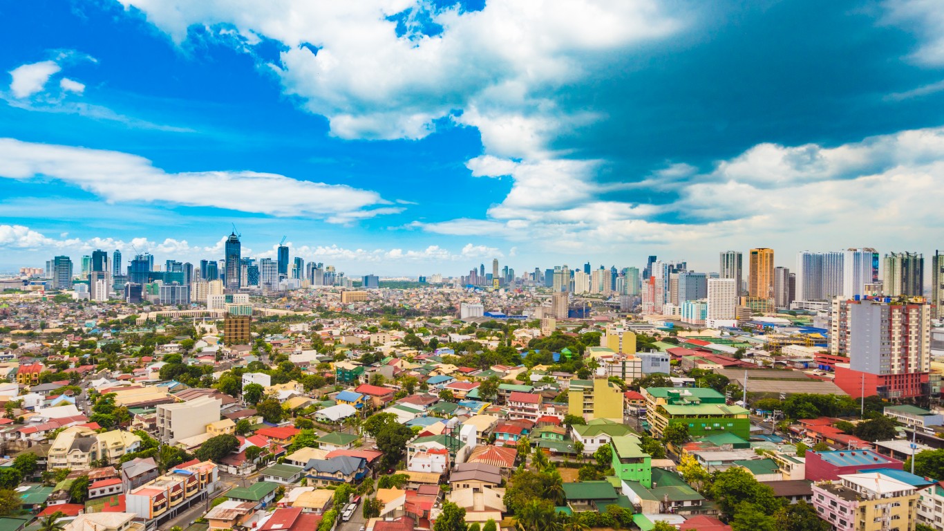
23. Philippines
> Population density: 911.3 people per square mile
> Population: 104,918,090
> Land area: 115,124 square miles
> Population growth (1990-2017): 69.4%
While the Philippine capital of Manila is home to an eighth of the country’s population, the majority of the population lives in rural areas, near prime farmland. Controversial Philippine president Rodrigo Duterte predicted earlier this year that Manila would be a “dead city” in 25 years, with much of the population relocated to New Clark City, a $1 billion project 62 miles from the capital.
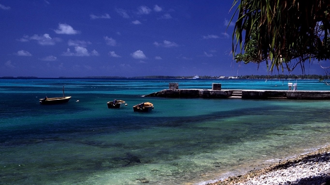
22. Tuvalu
> Population density: 966.2 people per square mile
> Population: 11,192
> Land area: 12 square miles
> Population growth (1990-2017): 24.3%
The United Nations has said that Tuvalu, an archipelago of nine tiny, low-lying islands north of Fiji, could be the first country in the world to be completely submerged by rising seawater. The highest point on the islands is only 16.5 feet above sea level, and much of the landmass is closer to 6.5 feet above sea level. More than half the country’s small population lives on the coral atoll of Funafuti.
[in-text-ad-2]
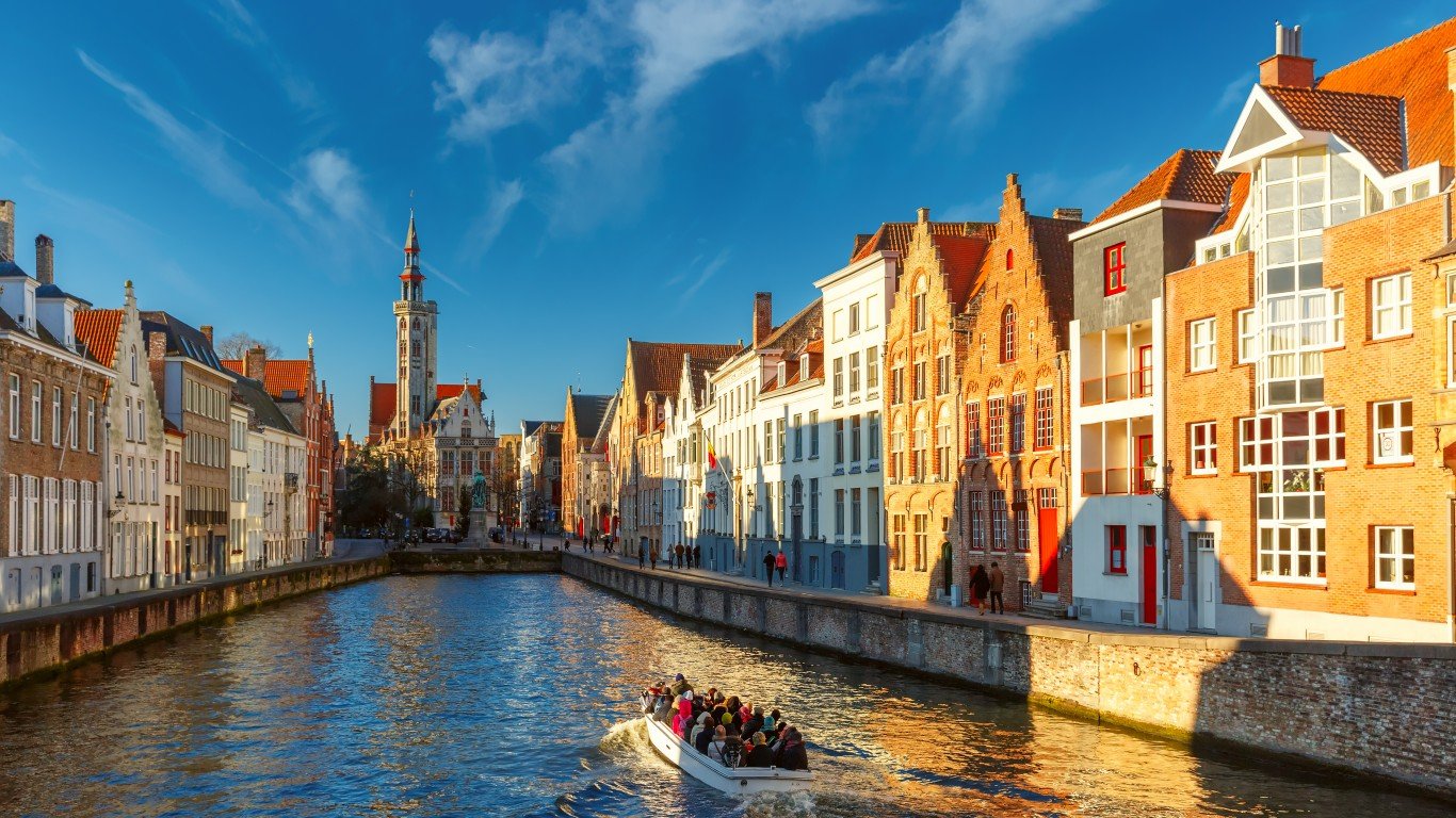
21. Belgium
> Population density: 972.7 people per square mile
> Population: 11,372,068
> Land area: 11,691 square miles
> Population growth (1990-2017): 14.1%
The population of this bilingual nation is roughly divided into two halves — the Dutch-speaking Flemish majority in the northern part of the country and the French-speaking Walloons in the south. About two-thirds of the populace lives in the north. Belgium was the birthplace of the Industrial Revolution on the European continent, and agriculture has long been a minority endeavor here. About 97% of the population lives in urban areas.
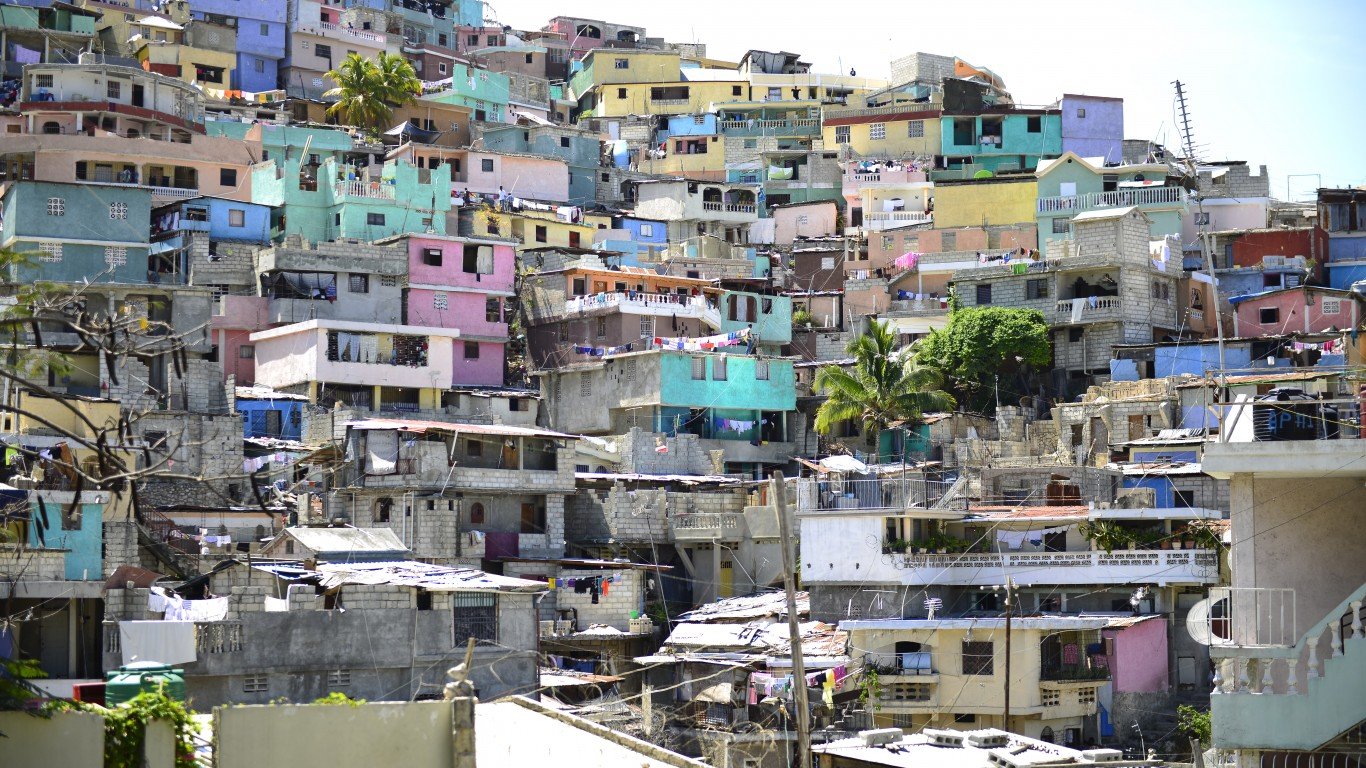
20. Haiti
> Population density: 1,032.0 people per square mile
> Population: 10,981,229
> Land area: 10,641 square miles
> Population growth (1990-2017): 54.7%
Approximately 95% of the population of this Caribbean country, which shares the island of Hispaniola with the Dominican Republic, is descended from African slaves — primarily from Congo, Nigeria, and Benin. They were brought to Haiti by French colonists to work on sugar plantations. Population numbers in Haiti have been impacted by an excessive mortality rate due to AIDS and by the massive earthquake that struck the island in 2010, killing more than 300,000 people.
[in-text-ad]

19. Israel
> Population density: 1,042.7 people per square mile
> Population: 8,712,400
> Land area: 8,355 square miles
> Population growth (1990-2017): 87.0%
Population figures for Israel include residents of East Jerusalem and the Golan Heights — Israel’s ownership of both areas is disputed. The country’s population is concentrated in and around the capital, Tel Aviv and the area surrounding the Sea of Galilee. In the sparsely populated south, the exception is the coastline of the Gulf of Aqaba.
[recirclink id=488561]
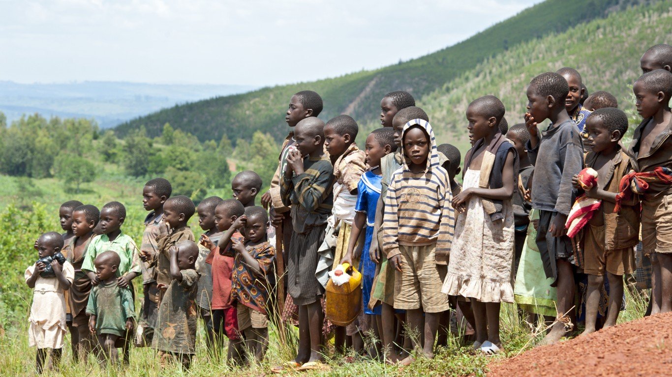
18. Burundi
> Population density: 1,095.7 people per square mile
> Population: 10,864,245
> Land area: 9,915 square miles
> Population growth (1990-2017): 100.6%
Burundi has one of the world’s highest birth rates at about 6 children per woman. The country’s population size ebbs and flows due to migration into and out of the country by refugees from violence-torn neighboring nations. About two-thirds of the population is under 25.
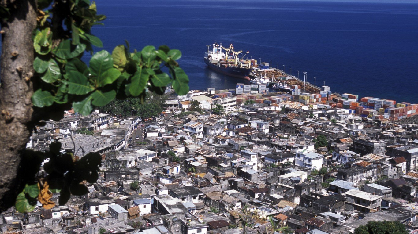
17. Comoros
> Population density: 1,132.7 people per square mile
> Population: 813,912
> Land area: 719 square miles
> Population growth (1990-2017): 97.7%
Moroni, on the island of Grande Comore, is the country’s capital and largest city, but the population is concentrated on another of Comoros’s three islands, Anjouan. Widespread poverty in the country prompts thousands of Comorans annually to attempt illegal migration to the nearby island of Mayotte, a French territory. It is estimated that as many as 200,000 people of Comoran citizenship or descent live in France or elsewhere abroad.
[in-text-ad-2]
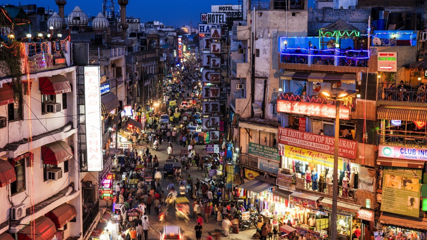
16. India
> Population density: 1,166.6 people per square mile
> Population: 1,339,180,127
> Land area: 1,147,955 square miles
> Population growth (1990-2017): 53.9%
The world’s second most populous country after China, India boasts five cities with populations of more than 10 million. Almost every corner of India is densely populated, with the exception of the mountains in the north and the Thar and other deserts in the northwest. The largest population concentrations are along the Ganges River in the northeast as well as other river valleys and the coastal regions of the south.
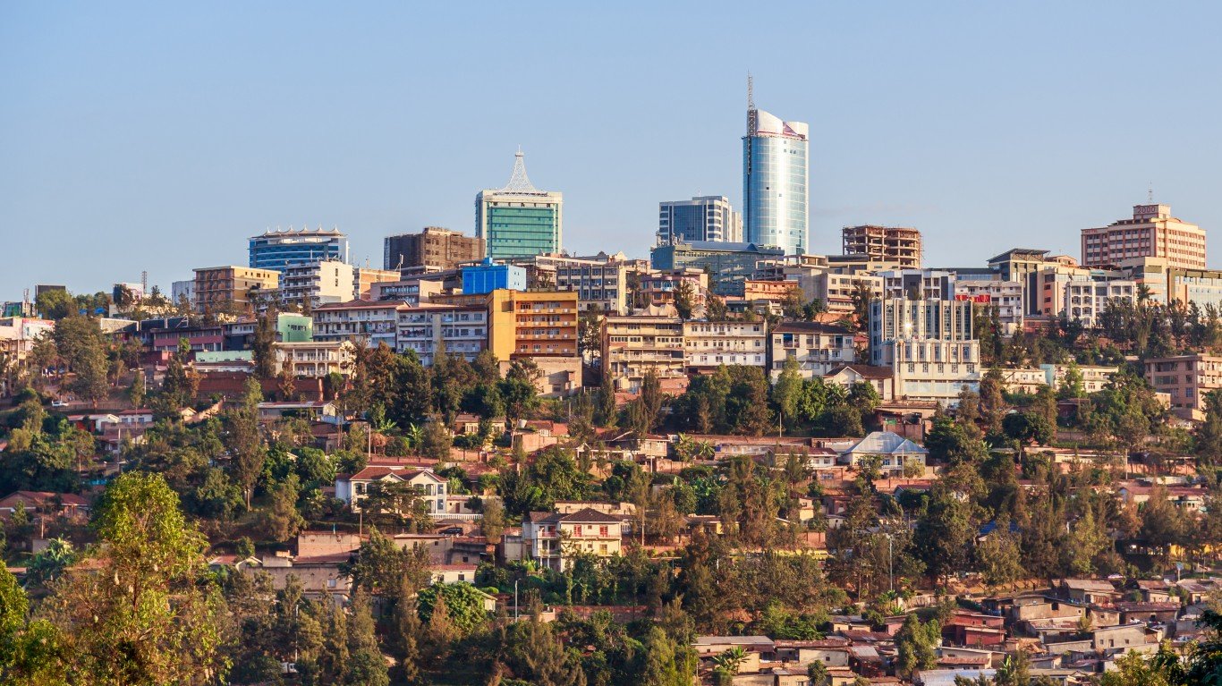
15. Rwanda
> Population density: 1,281.7 people per square mile
> Population: 12,208,407
> Land area: 9,525 square miles
> Population growth (1990-2017): 68.7%
The Rwandan capital of Kigali, in the center of the country, has a population of over a million, and much of Rwanda’s population is concentrated in the region. The rest is primarily found along the shore of Lake Kivu, which forms part of the country’s western border with the Democratic Republic of the Congo. Due to government family planning initiatives, the birth rate in Rwanda declined from 5.6 to 4.5 per woman between 2005 and 2016.
[in-text-ad]
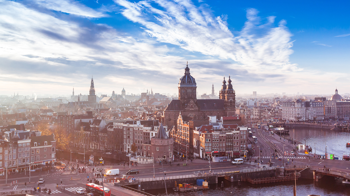
14. Netherlands
> Population density: 1,317.1 people per square mile
> Population: 17,132,854
> Land area: 13,008 square miles
> Population growth (1990-2017): 14.6%
Despite the fact that the government encouraged emigration after the devastation of World War II — some 500,000 Dutch left the country between the late 1940s and the 1970s — and the continuing efforts of the government to reclaim land from the sea (such land now accounts for roughly 20% of the total land mass), the Netherlands is the fourth most densely populated country in Europe. The population is concentrated primarily in the region of Randstad, in the west-central part of the country, an area including Amsterdam, Rotterdam, the Hague, and Utrecht.
[recirclink id=488514]
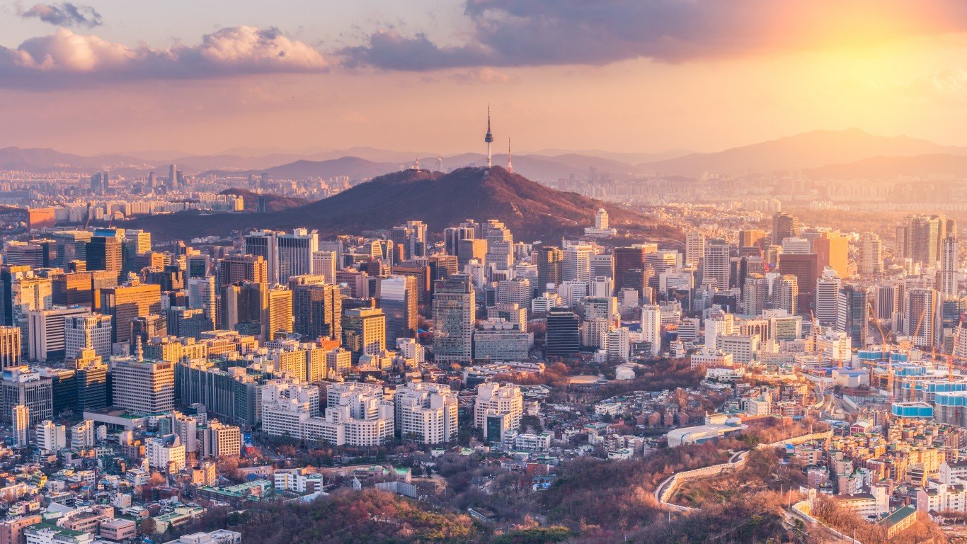
13. Republic of Korea (South Korea)
> Population density: 1,367.4 people per square mile
> Population: 51,466,201
> Land area: 37,637 square miles
> Population growth (1990-2017): 20.1%
Much of South Korea is mountainous, and the population tends to be concentrated in lowland areas, primarily the northwestern province of Gyeonggi, which includes the capital city, Seoul, and the port of Incheon. Forecasts predict a slight decline in the country’s population over the next 30 years.
12. San Marino
> Population density: 1,441.8 people per square mile
> Population: 33,400
> Land area: 23 square miles
> Population growth (1990-2017): 38.9%
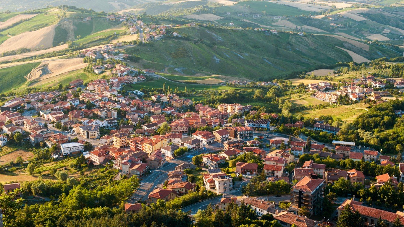
The third smallest country in Europe (after Monaco and Vatican City) and the world’s oldest republic (it claims 301 A.D. as its founding year), this microstate is completely surrounded by Italy. San Marino’s population is concentrated along the route between the capital, the City of San Marino — known locally as Città, the Italian word for city — and the corner of the country closest to the Italian seacoast city of Rimini, encompassing the capital as well as the towns of Borgo Maggiore and Serravalle-Dogana.
[in-text-ad-2]
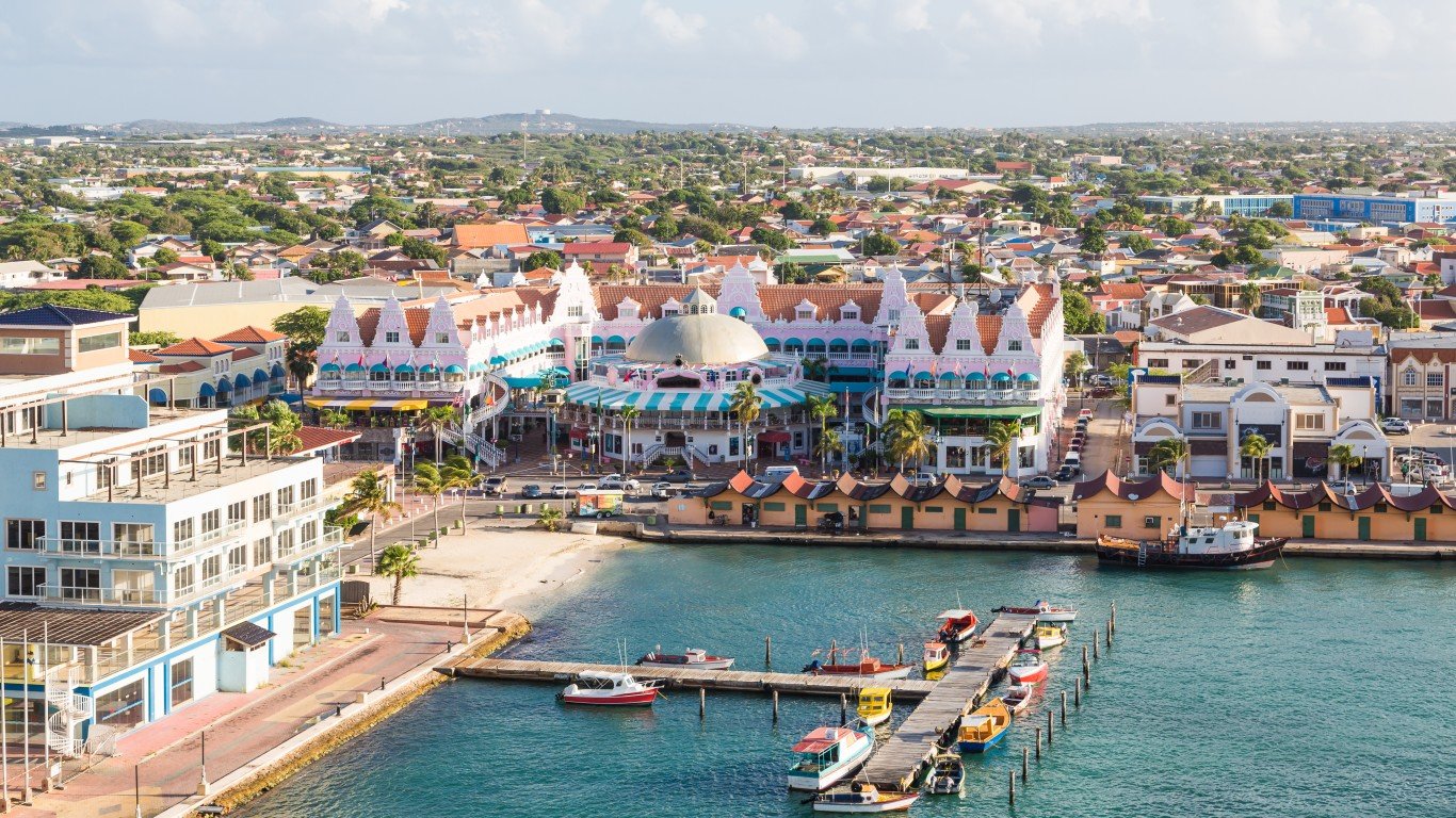
11. Aruba
> Population density: 1,514.6 people per square mile
> Population: 105,264
> Land area: 69 square miles
> Population growth (1990-2017): 69.4%
The population on this small Caribbean island is concentrated in or around the capital, Oranjestad, or the town of San Nicolas (or San Nicolaas) on the island’s southern tip. Aruba has set a goal of obtaining 100% of its energy from renewable sources, primarily wind farms and solar parks, within the next 10 years.
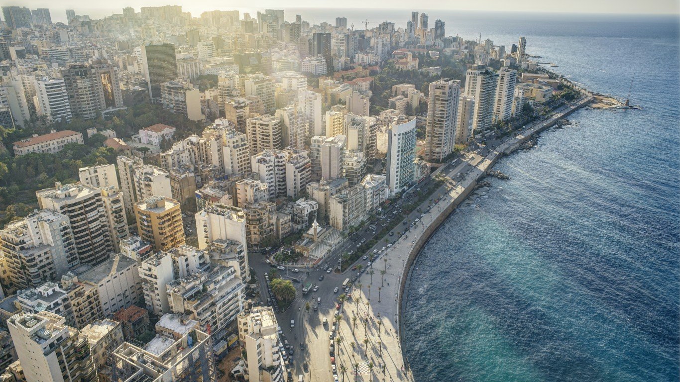
10. Lebanon
> Population density: 1,539.9 people per square mile
> Population: 6,082,357
> Land area: 3,950 square miles
> Population growth (1990-2017): 125.0%
There hasn’t been an official census in this Middle Eastern nation, bordered by Syria and Israel (including the disputed Golan Heights), since 1932 due to issues raised by religious tensions. There are 18 recognized religious sects in the country, with Muslims in the majority, closely followed by Christians of various denominations. However, estimates suggest that the population has increased by about 1.66 million just since 2013.
[in-text-ad]
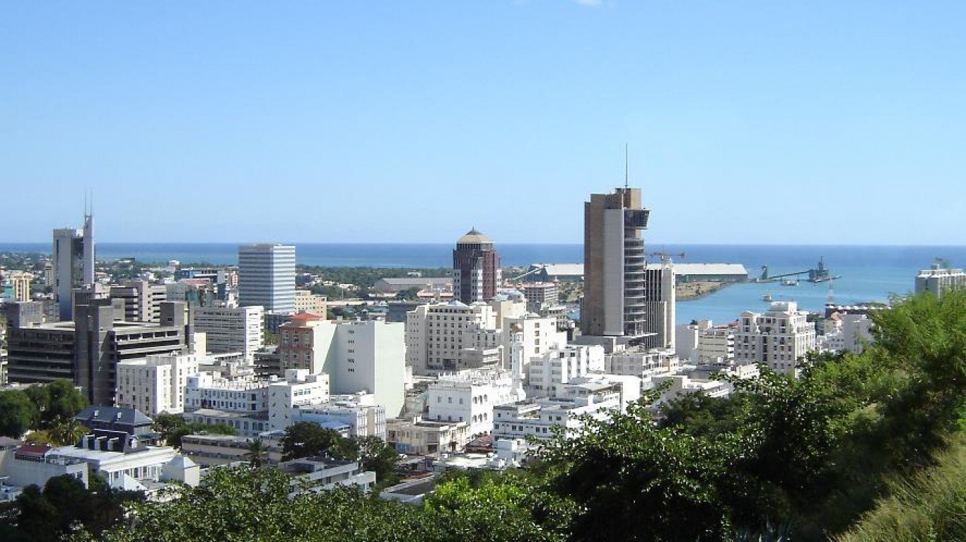
9. Mauritius
> Population density: 1,613.5 people per square mile
> Population: 1,264,613
> Land area: 784 square miles
> Population growth (1990-2017): 19.4%
In the mid-20th century, this island nation in the Indian Ocean had a high fertility rate of 6.2 children per woman. As a result of government family planning programs and a cultural shift to later marriage, that rate has almost halved, to 3.2. The population is mainly clustered on the main island, in and around the capital of Port Louis.
[recirclink id=488498]
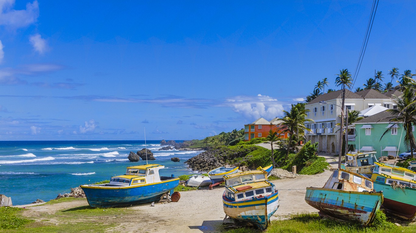
8. Barbados
> Population density: 1,721.0 people per square mile
> Population: 285,719
> Land area: 166 square miles
> Population growth (1990-2017): 9.7%
The population of Barbados, the Caribbean’s most densely populated island, has risen only slightly from 1990, when it numbered 260,374. The capital, Bridgetown, the island’s only city, is home to about 89,000 people, but the the count is decreasing as citizens move increasingly to the suburbs. In the 1600s, the island was demographically 97% white; Spanish slave-raiders had kidnapped most of the indigenous population and transported them to labor elsewhere in the Caribbean. Following the development of sugar plantations on the island in the mid-17th century, slave traders imported thousands of slaves from West Africa, and today, more than 90% of the inhabitants are of African or Afro-Caribbean descent.
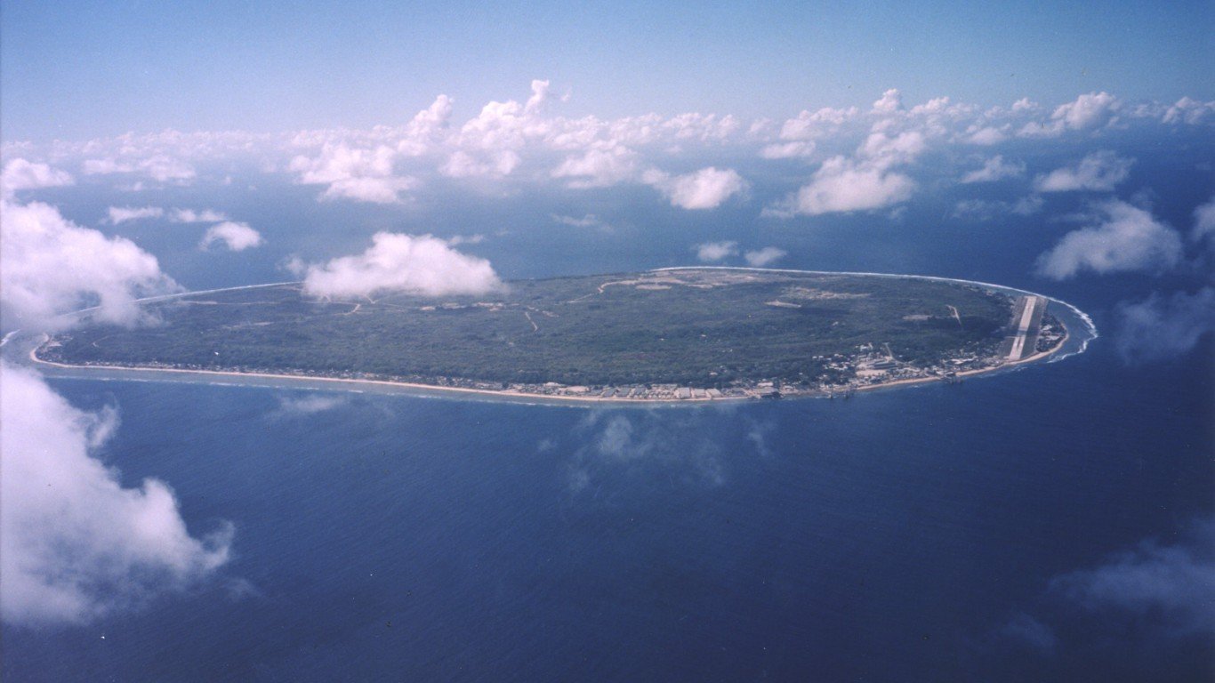
7. Nauru
> Population density: 1,767.5 people per square mile
> Population: 13,649
> Land area: 8 square miles
> Population growth (1990-2017): 49.1%
The Micronesian island of Nauru had the misfortune of being a prized source of high-quality phosphate, a mineral used in industrial chemicals and fertilizer. Beginning in the early 20th century, phosphate was mined extensively here, contaminating the water table and leaving about 80% of the landmass destroyed by strip-mining. In the 1990s, the island was declared uninhabitable, and the Australian government developed a plan to relocate Nauruans to another island. They refused to leave, and today the island is largely a wasteland where agriculture is impossible. Dependent entirely on imported food, much of it highly processed (like white rice and soda), the island’s inhabitants have the highest obesity rate in the world.
[in-text-ad-2]
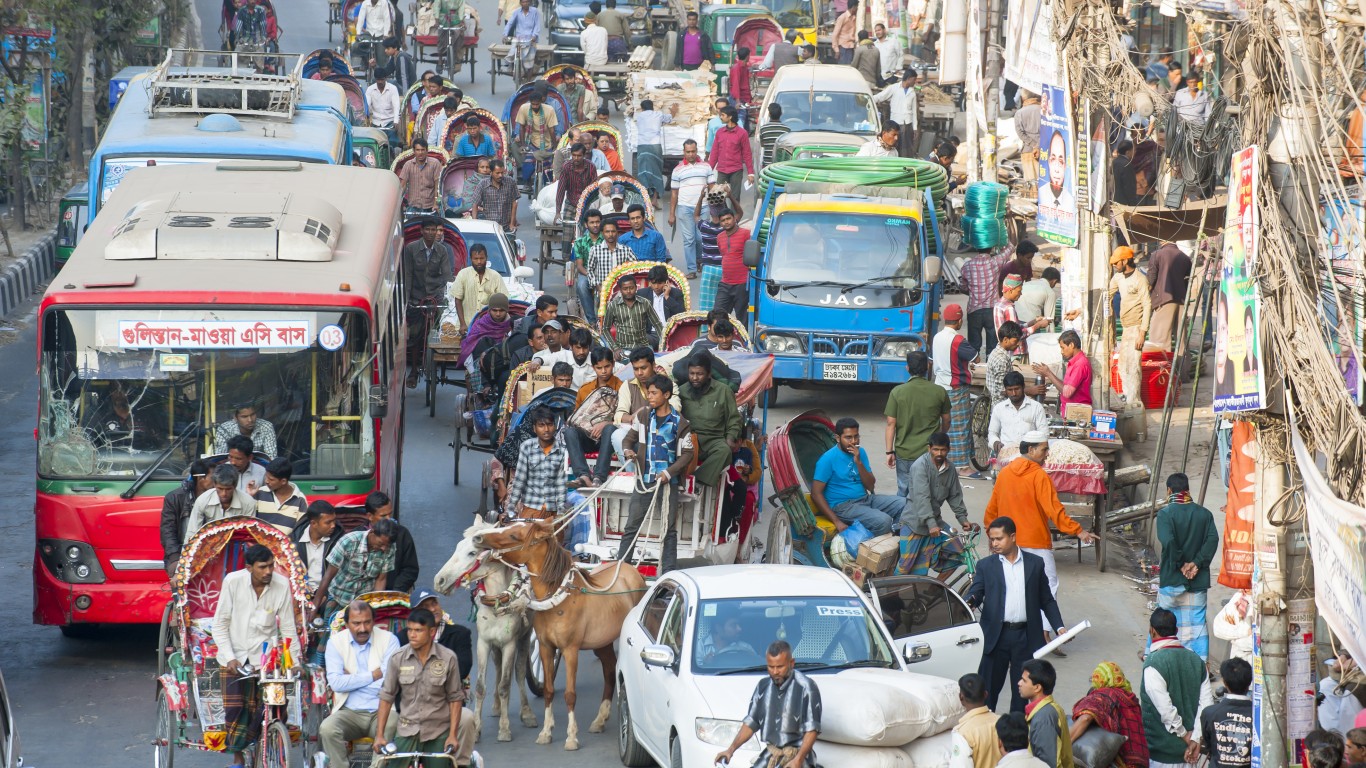
6. Bangladesh
> Population density: 3,276.4 people per square mile
> Population: 164,669,751
> Land area: 50,259 square miles
> Population growth (1990-2017): 55.1%
The eighth largest country in the world, Bangladesh is home to 27 officially recognized ethnic groups — though some sources claim there are as many as 75. The main population center is Dhaka, the capital, and overall population growth since independence in 1971 has averaged 6% per year.
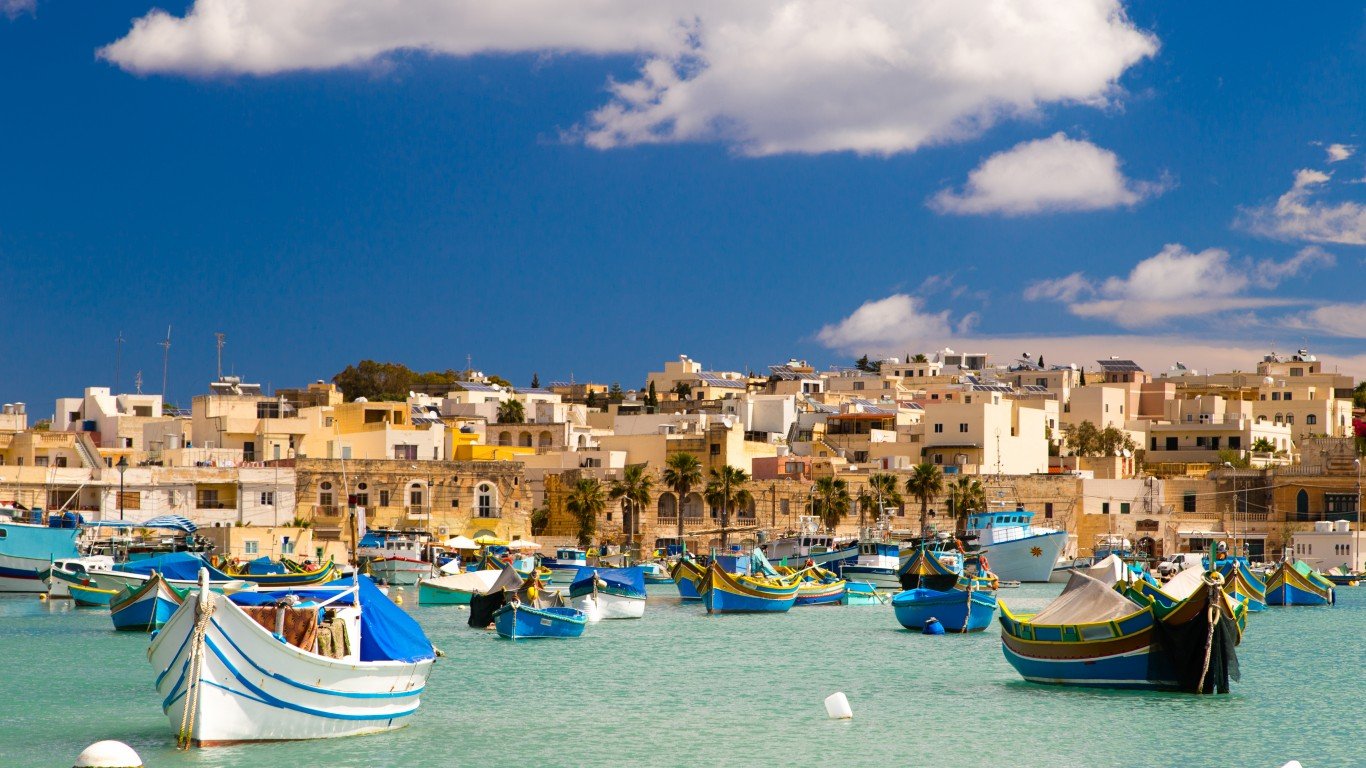
5. Malta
> Population density: 3,765.9 people per square mile
> Population: 465,292
> Land area: 124 square miles
> Population growth (1990-2017): 31.4%
This archipelago in the central Mediterranean south of Sicily consists of three main islands: Malta, Gozo (called Ghawdex in the Maltese language), and Comino (Kemmuna). Most of the inhabitants live on the eastern side of the island of Malta, by far the largest of the three. While the indigenous population has only grown by only about 55,000 since 1995, human ecology and sustainability researcher David Marinelli, director and CEO of the accounting and business advisory company DM Europe, told the Times of Malta in June that the island’s population density could rise to as much as 9,753 people per square mile over the next decade.
[in-text-ad]
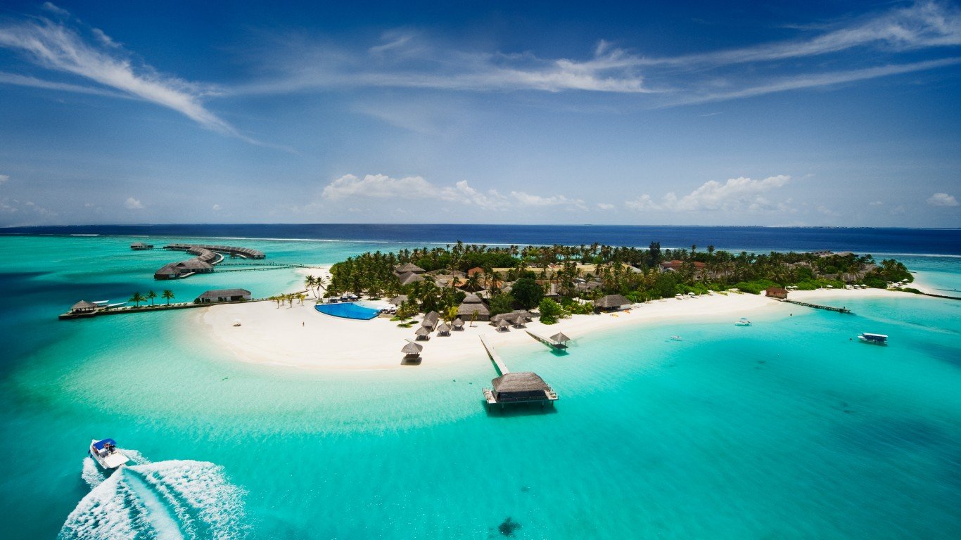
4. Maldives
> Population density: 3,767.0 people per square mile
> Population: 436,330
> Land area: 116 square miles
> Population growth (1990-2017): 95.5%
Maldives, a chain of 1,190 coral islands in the Indian Ocean — about 200 of them inhabited by locals and another 80 given over to tourist resorts — is the smallest country in Asia. A third of the population lives in Male, the capital.
[recirclink id=488094]
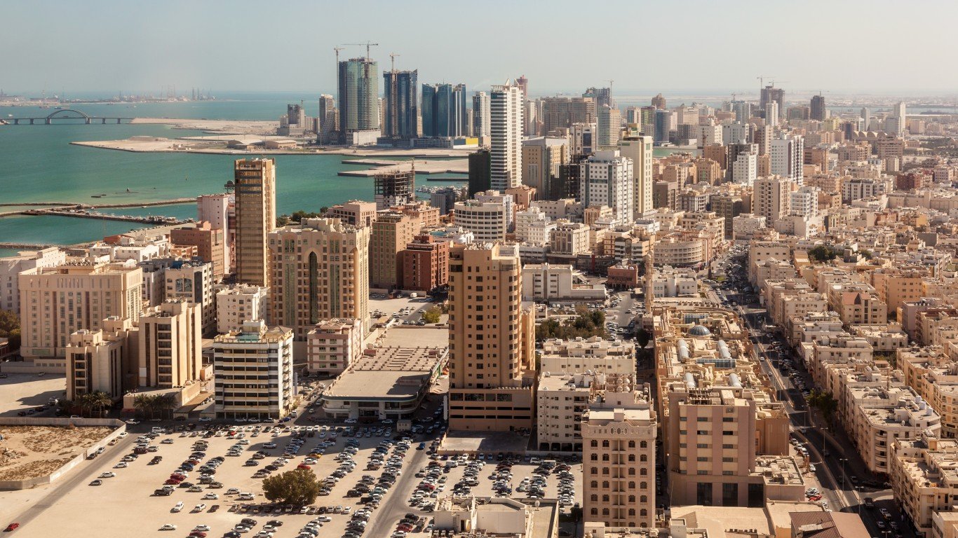
3. Bahrain
> Population density: 5,014.0 people per square mile
> Population: 1,492,584
> Land area: 298 square miles
> Population growth (1990-2017): 201.0%
Bahrain, located in the Persian Gulf between Qatar and Saudi Arabia, has the smallest population of any of the Gulf States but also the highest population density. The urbanization rate exceeds 90%, and slightly more than a third of the inhabitants live in the capital, Manama, in the northeastern corner of the country.
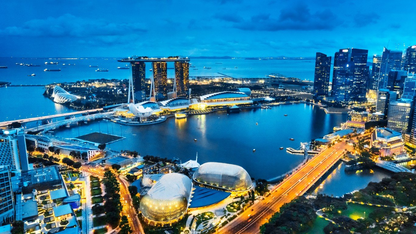
2. Singapore
> Population density: 20,501.7 people per square mile
> Population: 5,612,253
> Land area: 274 square miles
> Population growth (1990-2017): 84.2%
An independent city-state since 1965, Singapore is one of the world’s most prosperous nations as well as one of the most densely populated. Its population has almost tripled in its 53 years of existence. However, the country’s population is rapidly aging, and the birth rate dropped 4% between 2016 and 2017, while the fertility rate last year was 1.16 children per woman, far short of the 2.1 needed for the population to replace itself. According to Josephine Teo, in charge of population matters for the government as Minister for Manpower and Second Minister for Home Affairs, maintaining current rates of immigration will make up for the shortfall.
[in-text-ad-2]
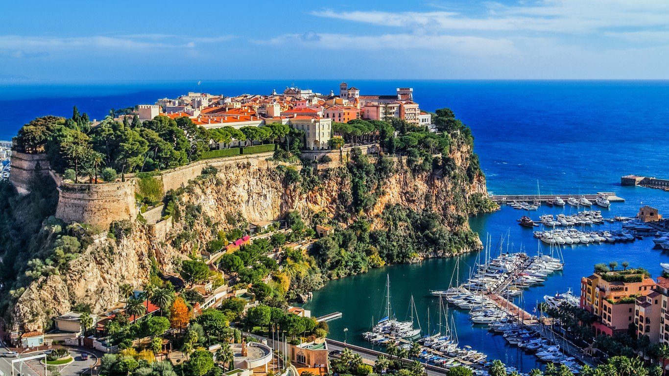
1. Monaco
> Population density: 50,109.8 people per square mile
> Population: 38,695
> Land area: 1 square mile
> Population growth (1990-2017): 31.4%
Bordered by France on three sides and the Mediterranean on the other, this tiny principality — it covers just over three-quarters of a square mile — is the most densely populated country on Earth. (The Chinese Special Administrative Region of Macau has greater density but it is not an independent country.) Also the world’s second-smallest independent state, after Vatican City, Monaco has no natural resources and no agriculture. Among the attractions here are Monaco’s famous casino, its annual Grand Prix auto race, and the fact that only French nationals pay income tax. It is also known for being very safe — it has the world’s largest police force per capita and a 24-hour video surveillance system covering every corner of the country.
Detailed findings
Why do populations concentrate more intensely in some places than others? Both natural and human factors are involved. Low-lying flatlands are more hospitable to habitation, for instance, than mountains. Climate plays a key role as well — for example, the Mediterranean basin is more densely populated than the Sahara Desert or the Arctic — as does the availability of natural resources such as minerals, wood, fish, etc.
Proximity to a coastline is also a major factor: Almost half of the world’s population lives within 125 miles of a shoreline, and that number is projected to double by 2025. Fourteen of the world’s 17 largest cities — 11 of them in Asia — are along seacoasts. According to the PRB, benefits of coastal living include “improved transportation links, industrial and urban development, revenue from tourism, and food production.”
A healthy job market also encourages density. The population of Mumbai, for instance, has more than doubled since 1991, with employment opportunities a major draw for immigration from elsewhere in India. Some sources also cite social factors, positing that some groups of people enjoy isolation, while others prefer close company.
Methodology
To determine the most crowded countries in the world, 24/7 Wall St. reviewed the population density of 215 countries with data from the World Bank. Data on population and land area also came from the World Bank. Population density and land area was converted from square kilometers to square miles. A country’s land area is its total geographic area minus areas covered by inland bodies of water bodies such as major rivers and lakes. Population change was calculated using World Bank population estimates for 1990 and 2017. All data is for the most recent year available.
Contact [email protected] for any questions or corrections.