Tropical Storm Dorian formed way out in the Atlantic Ocean on Wednesday, and so far its projected cone path from the National Hurricane Center has not really changed. The storm is still way out there, but its path puts the storm as a risk to the Caribbean and ultimately to the United States.
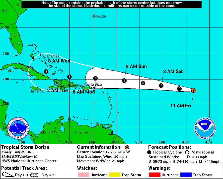
As of mid-day Friday the storm is projected to be northeast of Puerto Rico by early on Monday morning, on the northern side of the Dominican Republic and Haiti by Tuesday morning, and on the northern side of the eastern part of Cuba on Wednesday morning.
The good news right now is that Dorian is currently projected to remain a tropical storm the entire time between now and then. The bad news is that we have seen through time that some storms strengthen (or dissipate) much differently than multi-day projections.
Dorian’s current path on mid-Friday is west-by-northwest, moving at 21 miles per hour, but with maximum sustained winds of 50 miles per hour.
Here is the latest image from NOAA on the projected cone path for Tropical Storm Dorian. We then have an Accuweather image showing the strength and projected paths.

Contact [email protected] for any questions or corrections.