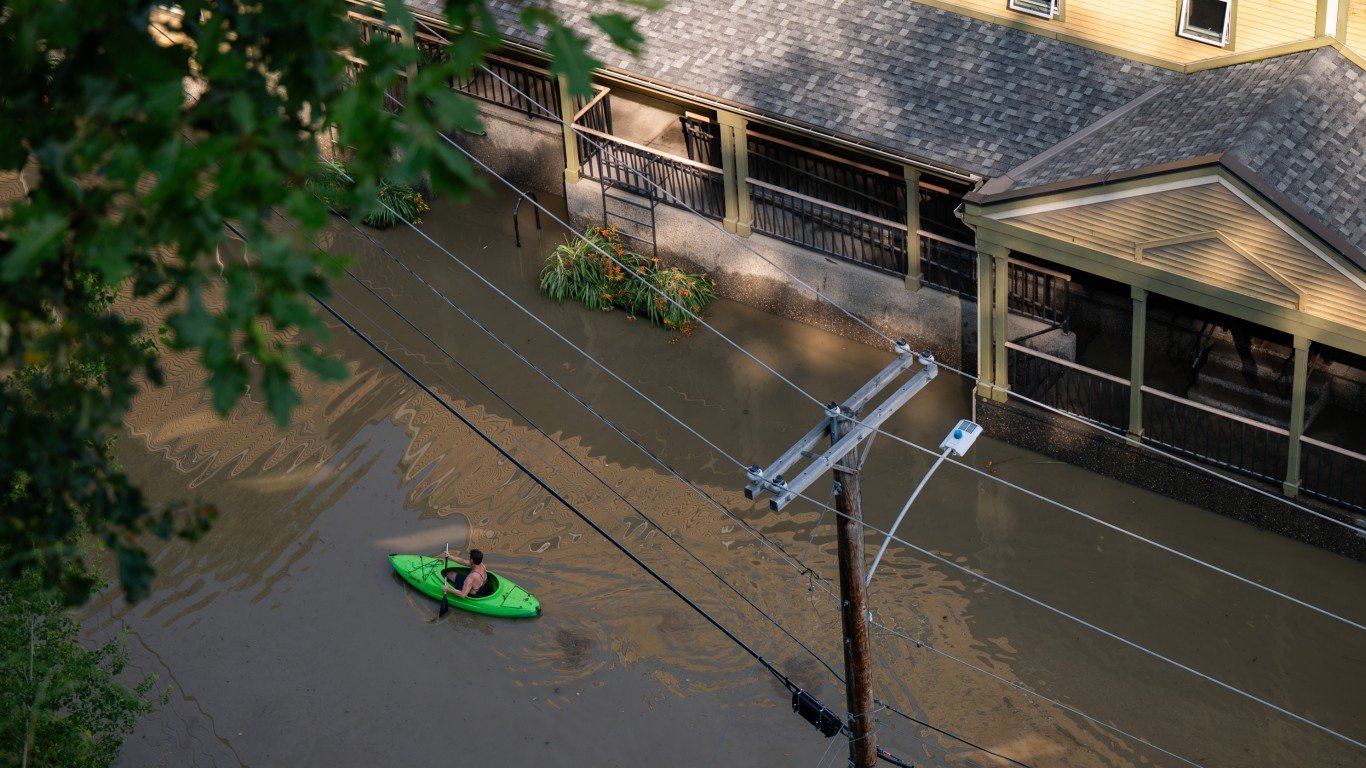
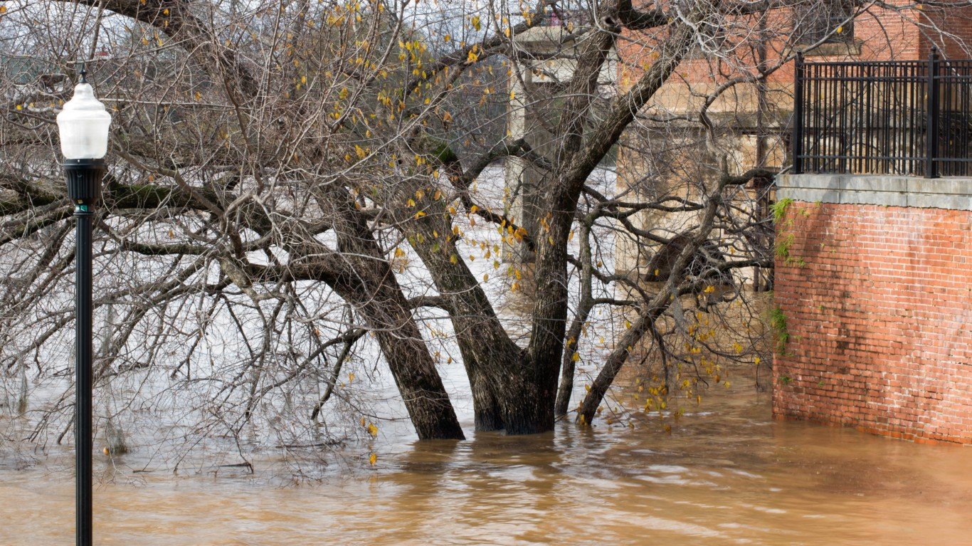
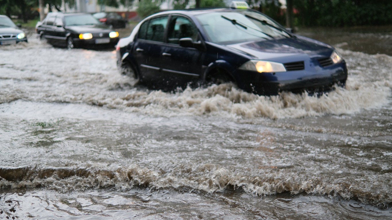
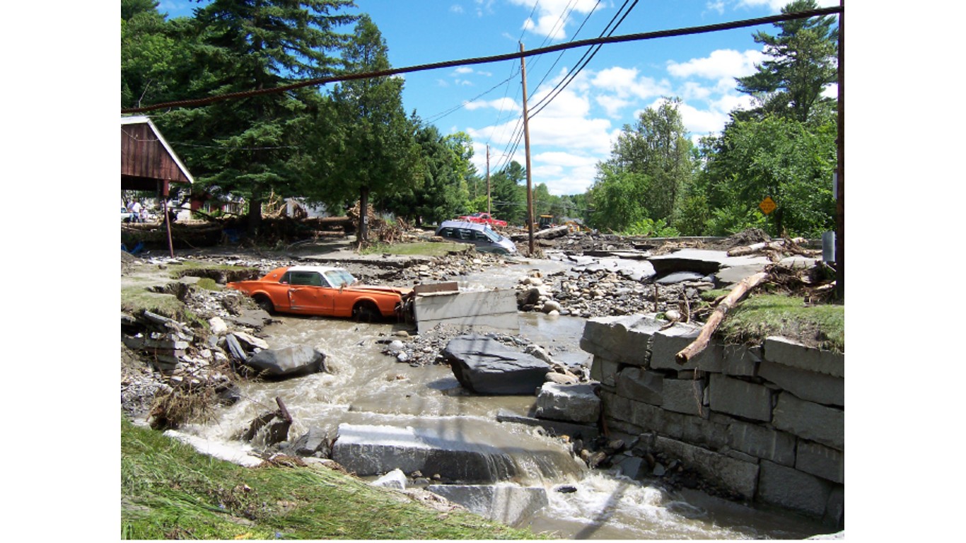
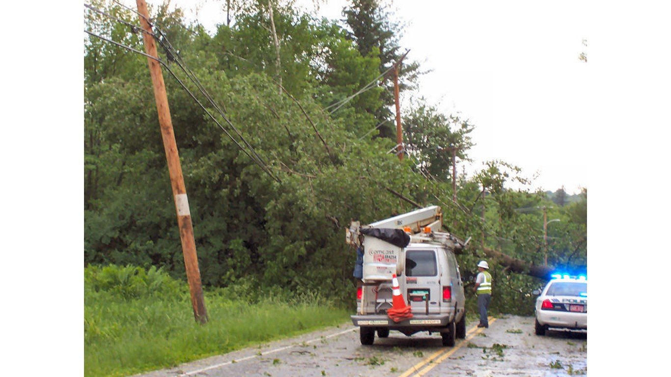
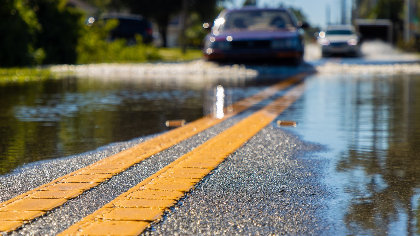
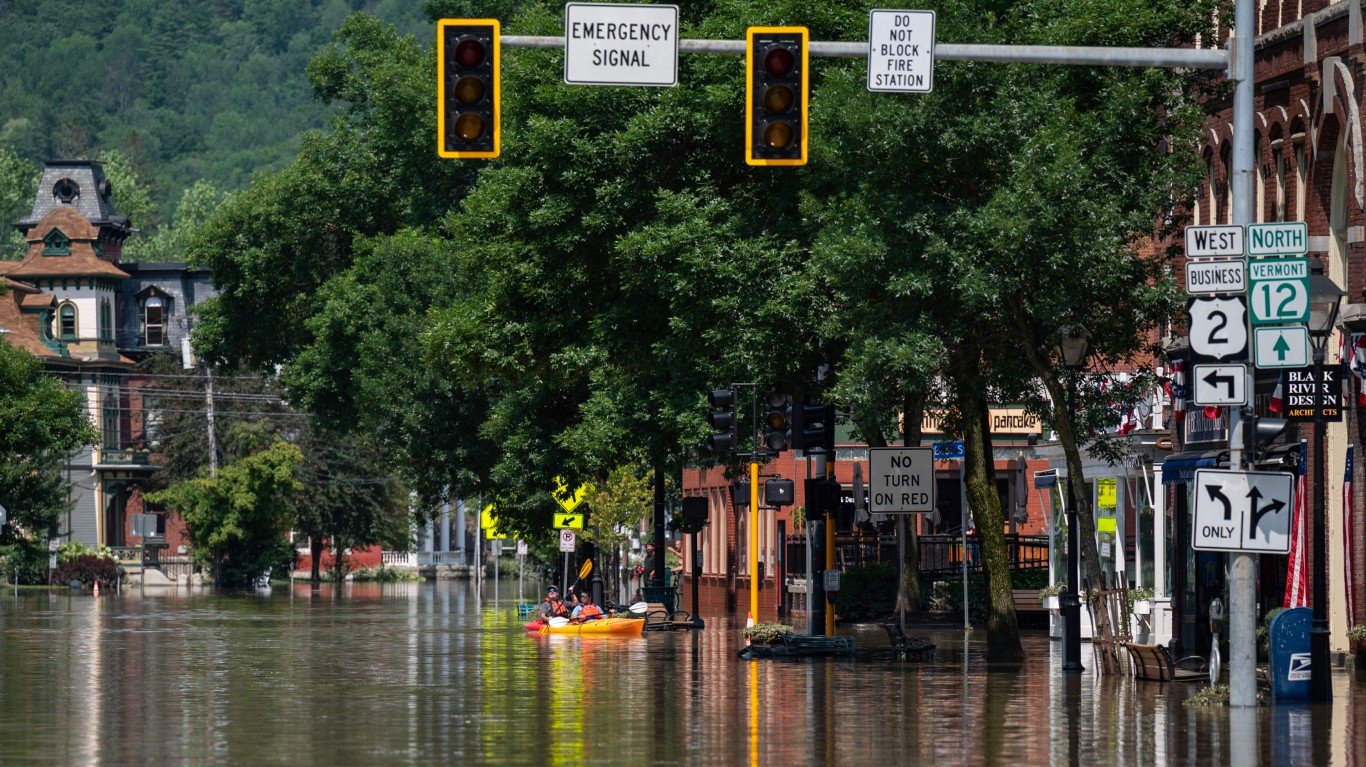
On Friday, July 14, 2023, President Joe Biden declared a major disaster for the state of Vermont as a result of severe storms and flooding that hit the state starting on July 7, 2023, and continued since.
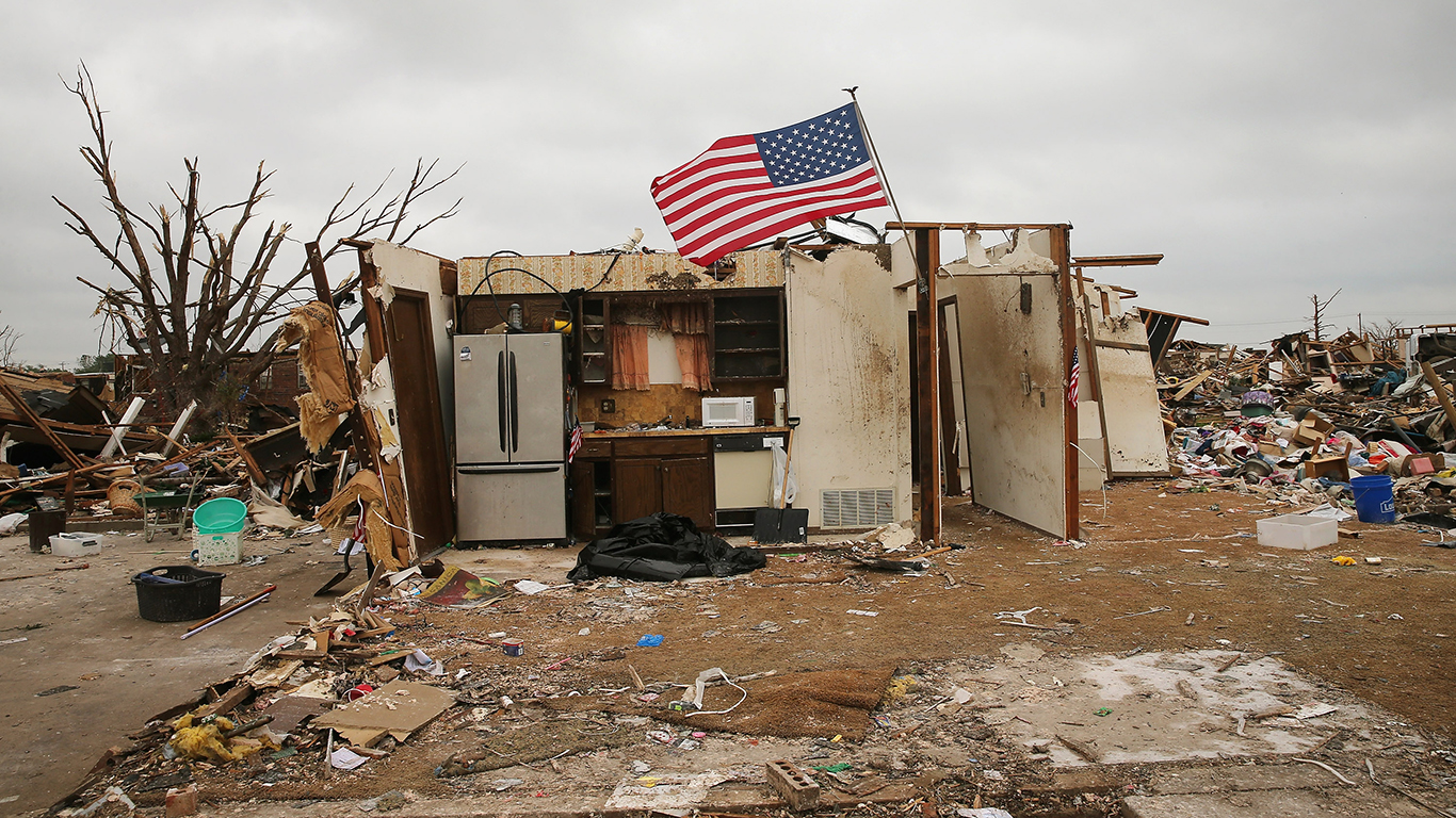
The storm brought nearly 6 inches of rain to Vermont Monday, July 10. From July 8 to July 12, between 8 and 10 inches fell in parts of Woodbury, Middlesex, Woodbury, Worcester, St. Johnsbury, Berlin, Moretown, and Randolph. For reference, Vermont gets around 40 inches of rain in an average year. One death linked to the flooding has been reported. Property damage could reach the tens of millions of dollars. (These are the worst floods in American history).
This declaration makes federal funding available to affected residents of Chittenden, Lamoille, Rutland, Washington, Windham, and Windsor counties. Vermont homeowners and renters affected by the recent flooding could be eligible for help from the Federal Emergency Management Agency. (Click here to see the worst natural disaster in every state).
To put the disaster into perspective, 24/7 Wall St. reviewed 14 of Vermont’s historic flooding disasters. We focused on statewide flood events in the past 100 years, using information from the Two-Rivers-Ottauquechee Regional Commission, the National Weather Service, and local news reports. We listed the events in chronological order.
Click here to see the worst flood events in Vermont history.
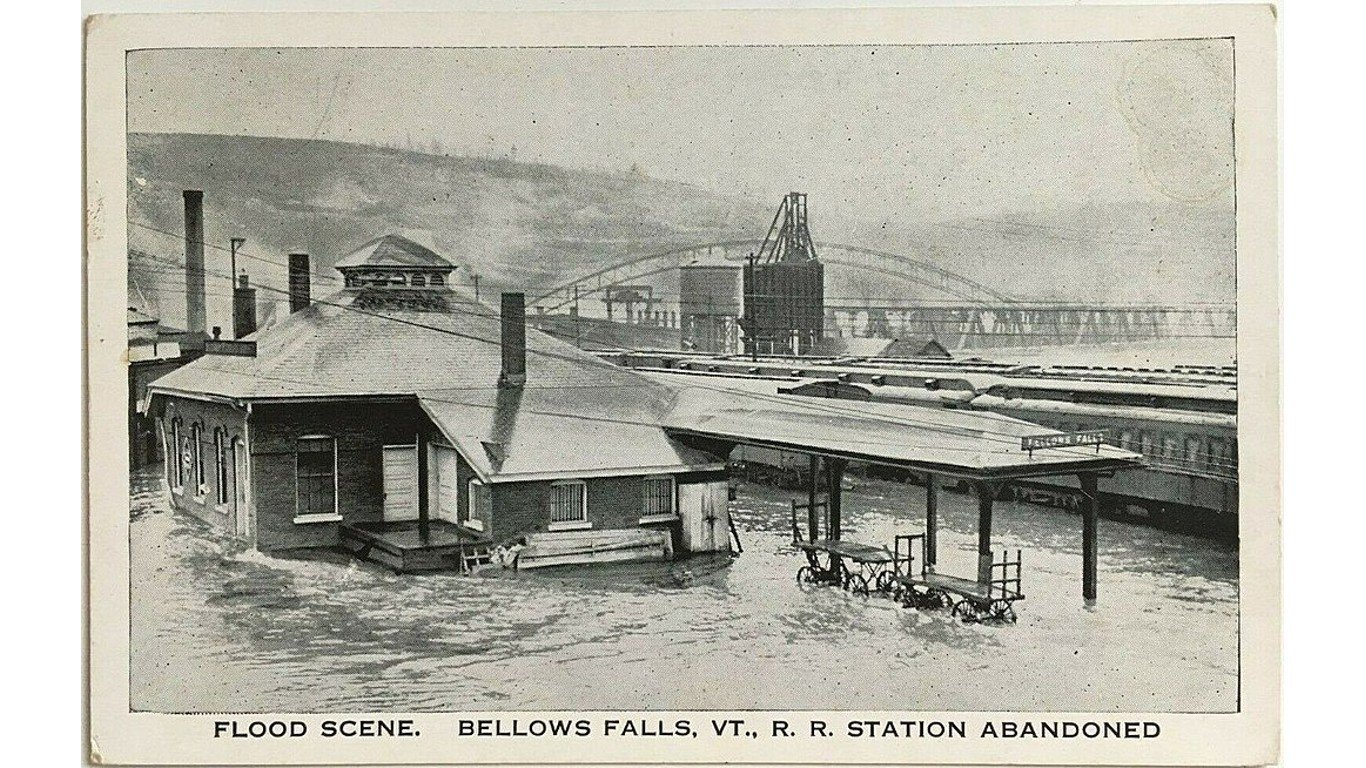
The Great Vermont Flood of 1927, Nov. 3-4, 1927
> Location: Statewide, significant rainfall in the Central Vermont region
On November 3 and 4, 1927, heavy rains on frozen ground caused flooding in Vermont’s White River and Winooski Valleys. Eighty-four people were killed, including then Lt. Gov. S. Hollister Jackson, and 10,000 people were left homeless. Hundreds of miles of road and railroad track were wiped out, and 1,285 bridges were destroyed.
In response, the U.S. Army Corps of Engineers built three flood retention reservoirs and dams — on the Winooski River basin at East Barre, Wrightsville, and Waterbury.
[in-text-ad]
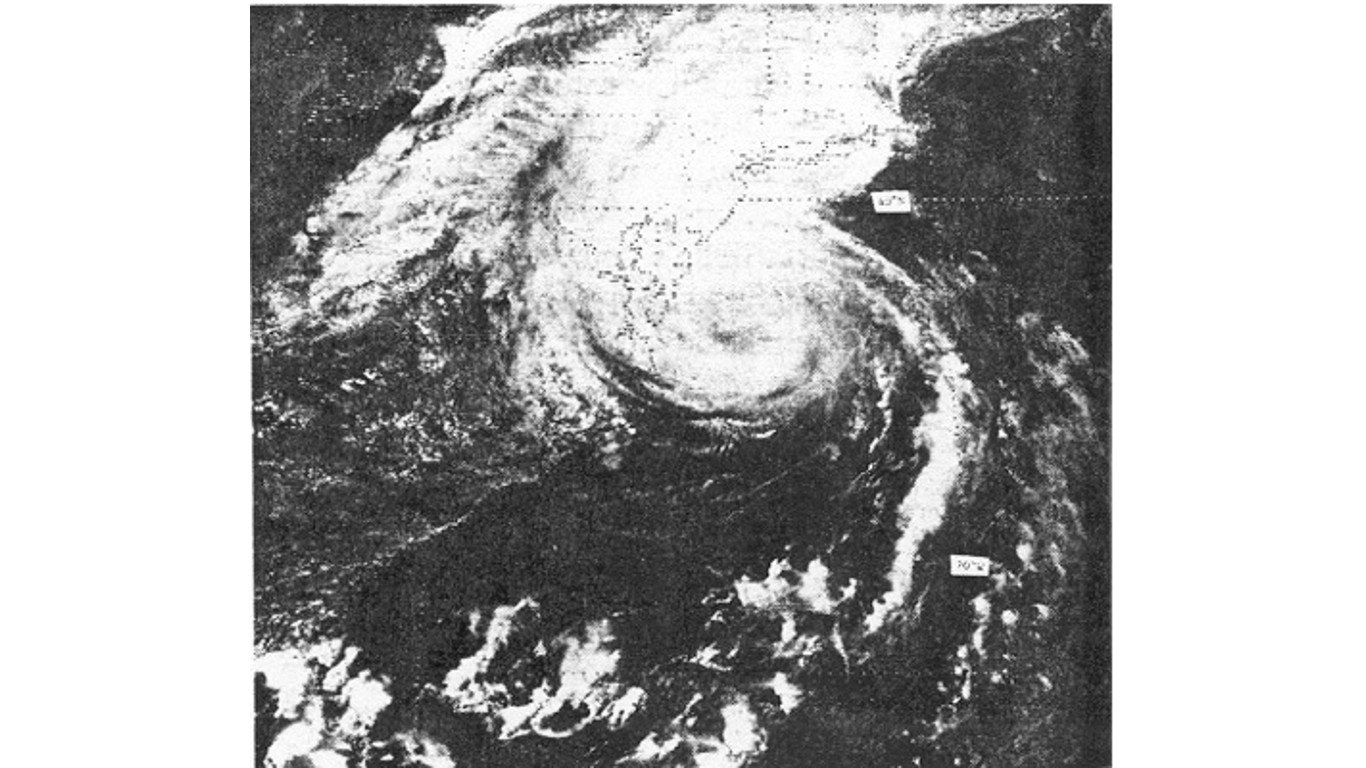
Rainfall, Sept. 21, 1938
> Location: Vermont; New England, New York
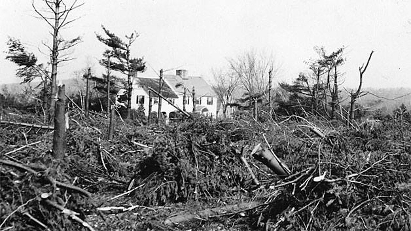
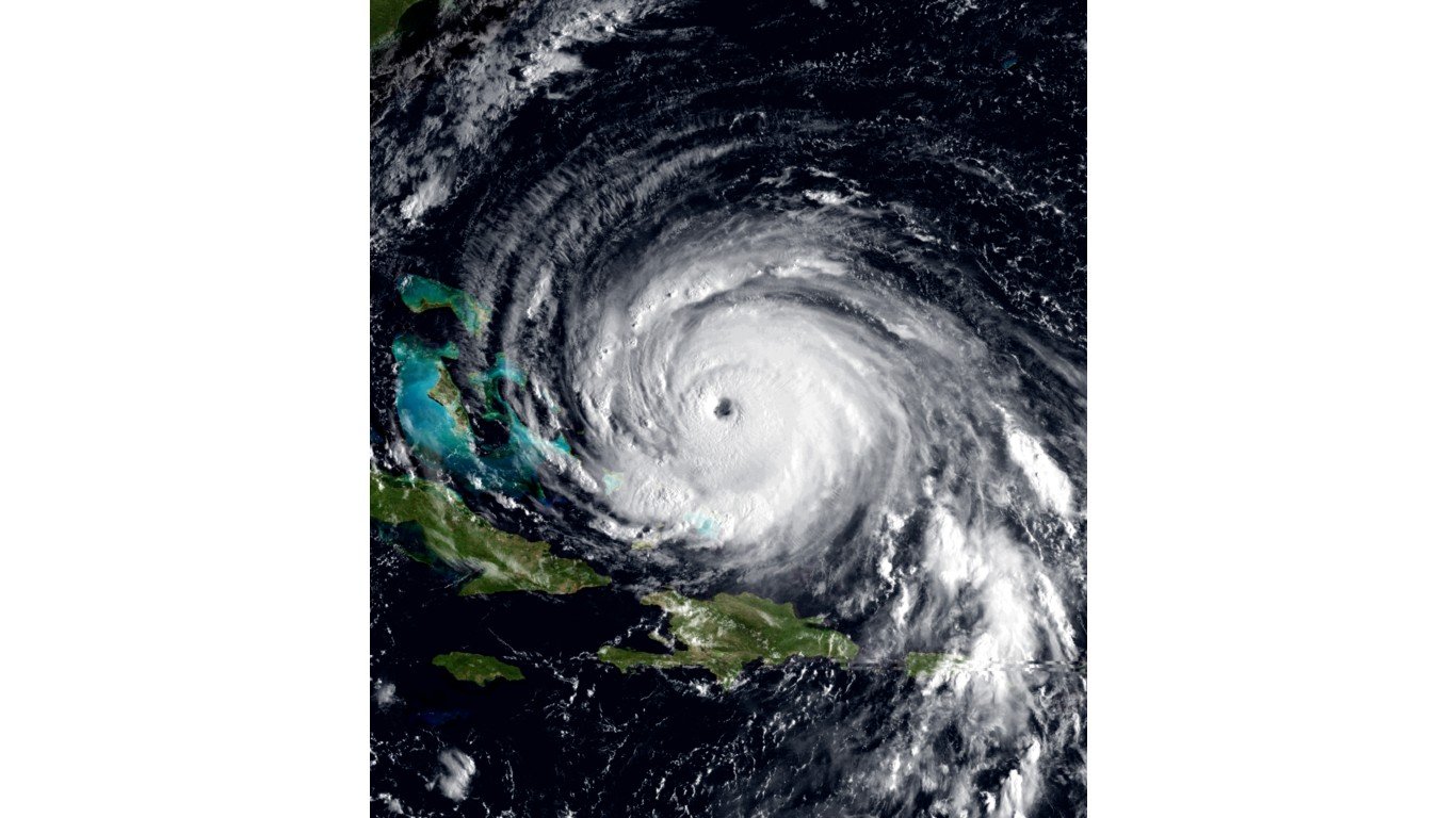
Hurricanes are rare in Vermont as they generally weaken the further they travel inland, developing into tropical storms. But the tempest that devastated Vermont in 1938 is the only storm in the state’s history to arrive as a hurricane. The Great New England Hurricane of 1938 made landfall on Long Island as a Category 3, and hit Vermont as a Category 1.
Nearly 700 people died, tens of thousands of homes were destroyed, and approximately 2 billion trees were lost in New York and New England. Total damage was estimated at $6.6 billion (2023 dollars). In Vermont, five people died. Flooding and high winds destroyed buildings, power lines and trees.
[recirclink id=1244295]
Rainfall, July 6, 1973
> Location: Town of Plymouth; Windsor County; statewide
A combination of a west-moving frontal system and a moist, southeasterly flow from the Atlantic Ocean resulted in heavy rainfall in some parts of Vermont that was not seen since 1927. Windsor County reported 5-8 inches of rain, while the Connecticut River at Wells River was flowing at 57,100 cubic feet per second, and the Wells River was flowing at 5,970 cfs, each flowing several times above normal.
Damage to the state was estimated at $64 million — approximately $460 million in today’s dollars — including extensive damage to crop land and $10 million in state highway damage. Four deaths were reported across the state.
Remnants of Hurricane Belle, Aug. 9-10, 1976
> Location: Town of Plymouth; statewide
In 1976, Long Island was struck by a Category 1 hurricane, which skirted the Vermont/New Hampshire border. Initially considered to be a minor storm, it caused extensive flooding in some areas of Vermont, resulting in road, culvert, and bridge damage. Ten Vermonters perished, and the storm caused an estimated $100 million in damages ($548 million in 2023 dollars).
[in-text-ad-2]
Spring storms, April 4-6, 1987
> Location: Statewide
On April 4 to 6, 1987, snowmelt and rainfall caused reservoirs in the Winooski River basin at East Barre, Wrightsville, and Waterbury to spill over for the first time in their history, leading to record-breaking flooding in Vermont. These reservoirs were built by the U.S. Army Corps of Engineers after the flood of 1927 to subvert further flooding. The storm caused extensive damage to roads, bridges, and other infrastructure across the state.
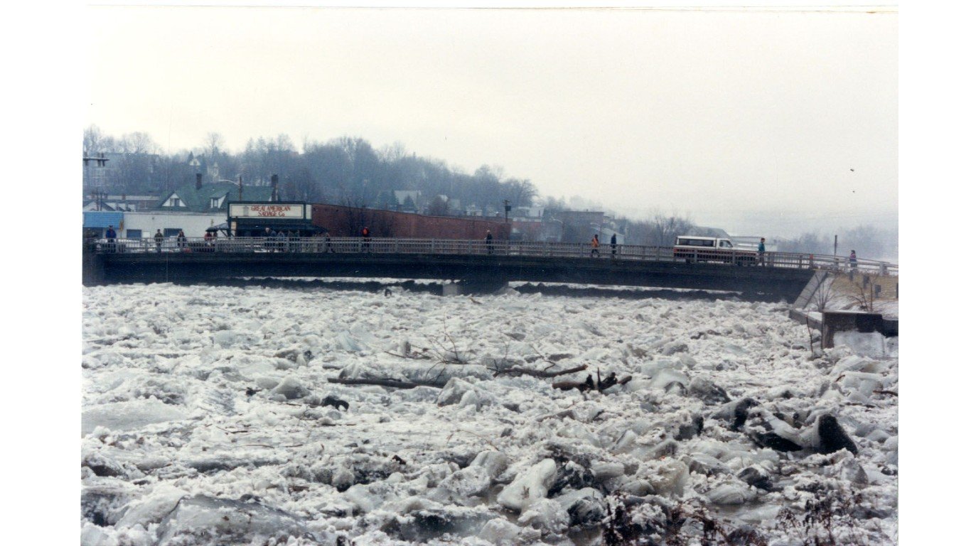
Ice Jam, March 11, 1992
> Location: Montpelier
The flooding on March 11, 1992, was caused by a massive ice jam on the Winooski River. Blocking the flow and raising the river into the city, downtown Montpelier was inundated to a depth of 2-5 feet within less than an hour. The governor of Vermont declared a state of emergency by 9 a.m., and evacuations continued through the morning hours.
The storm caused an estimated $4 million in damage. The president of the United States declared the flood-affected counties a disaster area. No deaths or serious injuries were reported.
[in-text-ad]

Rainfall, June 27-July 13, 1998
> Location: Towns of Randolph and Hartford; Orange and Windsor Counties; Upper Connecticut River Valley; northern and central parts of Vermont and New Hampshire
On June 27, 1998, heavy rainfall of 3-6 inches fell in Vermont, causing flash flooding along the Connecticut River basins in central Vermont. The Town of Randolph was particularly hard hit, with the Ayers Brook peaking at 4,200 cfs – a 100-year record flow level – and the White River at 34,500 cfs. The average rate of flow for those rivers is around 200 cfs and 2,361 cfs, respectively. The Wells River and Ottauquechee River also flowed at high levels, leading to major flood damage.
That summer brought a new rainfall record to Vermont, with Burlington recording 50.42″ for the season.
[recirclink id=1261223]
Tropical Storm Floyd, Sept. 16-21, 1999
> Location: Windsor Rutland and Orange Counties; Statewide
Vermont endured major flooding and damage from heavy rain and strong winds from September 16 to 21, 1999, when Hurricane Floyd struck the East Coast and developed into a tropical storm over the state. One death was reported, caused by a tree falling on a camper in Orange. The state declared the event a disaster, which triggered the distribution of $1.33 million to most counties in the state ($2.43 million in 2023 dollars).
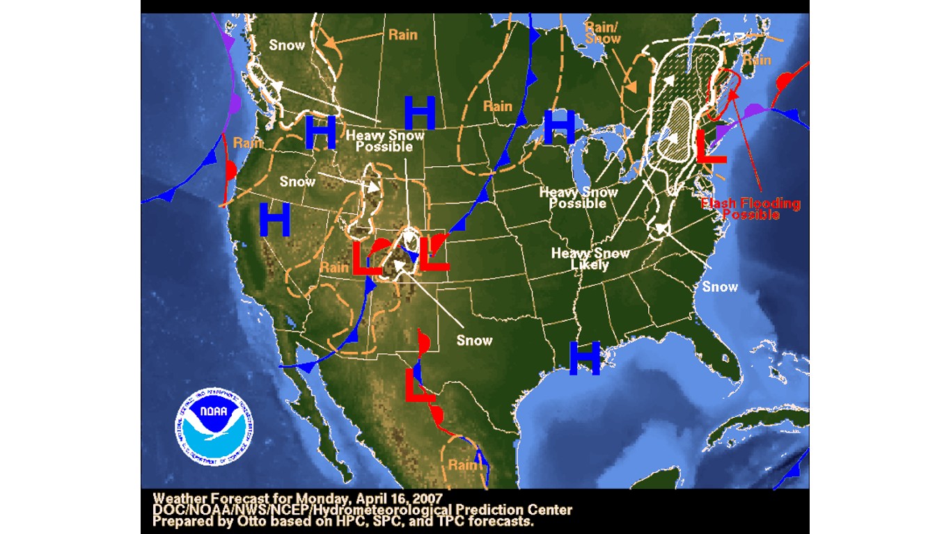
Severe storms, April 15-21, 2007
> Location: Windsor, Rutland, and Orange Counties; Statewide
Severe storms caused heavy rain, snow, and high winds in Vermont on April 15-21, 2007, leading to flooding in the region due to combined rain and snowmelt. Snowfall of 4 to 7 inches was reported in valleys throughout the county, with 13 inches falling in Randolph. The event caused an estimated $3.6 million in public infrastructure damages.
[in-text-ad-2]
Rainfall flash flood, July 9-11, 2007
> Location: Orange and Windsor Counties. Specific towns referenced include: Braintree, Randolph, Bethel, Stockbridge, Brookfield, Hartland, and Norwich
From July 9 to July 11, 2007, a major storm system swept through Orange and Windsor Counties, resulting in high winds, lightning, hail, and heavy rains. Flash flooding was reported in Bethel, with 5.27 inches of precipitation. The storm caused significant damage to roads throughout the area, including Routes 12 and 14 in Randolph, Lilliesville Road, River Road, Routes 100 and 107 in Stockbridge and Bethel. Additionally, camp structures were damaged in the area off of Lilliesville Road. With relief funds totalling $4,905,985, it is the sixth costliest of 35 declared disasters in Vermont’s history.
Rainfall flash flood, June 14, 2008
> Location: Addison, Rutland counties
Localized heavy rainfall up to 7 inches occurred in Ripton, which is located in Addison County, and 3-5 inches in Rutland. Most of the damage occurred in Rutland, with an estimated $2 million worth of damage to the County.
[in-text-ad]
Rainfall, July 24- Aug 12, 2008
> Location: Addison, Orange and Windsor Counties; statewide
Widespread rainfall of 1-2 inches occurred during the afternoon and evening of July 24, with localized amounts that exceeded 3 inches, causing flooding in Washington, Lamoille, Orleans, and Caledonia counties.
On Aug. 6, 2008, roads and bridges were washed out, with the Town of Hancock particularly hard hit due to the failure of the Killooleet Dam. Flash flooding was seen in Rochester, Stockbridge, Corinth, Chelsea, Sharon, and West Norwich. In total, after the state declared the storm an emergency, nearly $4,570,663 was obligated for relief and recovery.
[recirclink id=1261247]
Snowmelt & rainfall, April, May, 2011
> Location: Orange County; Central and northern Vermont
2011 was an especially bad year for flooding in Vermont. Four disaster declarations were issued over the course of the year, all attributed to flooding. The first wave hit the northern half of the State, resulting in over $1.8 million in FEMA assistance, in April and early May. River flooding brought Lake Champlain well over the 500-year flood elevation.
On May 26, a combination of a surface low and upper atmospheric energy traveled along a quasi-stationary boundary across northern New York and Vermont. This atmospheric effect caused damaging winds and very large hail (up to 2.5 inches in diameter). The hail caused 25,000+ customers to lose power. Orange County experienced straight-line winds, more than 3-5 inches of rainfall, severe flash flooding, and major flood damage.
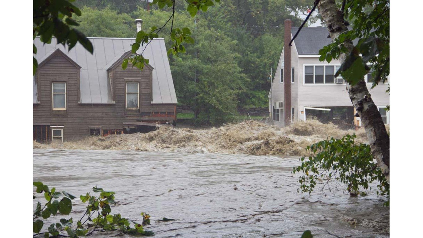
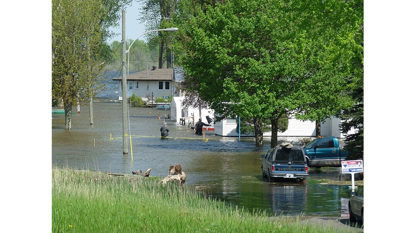
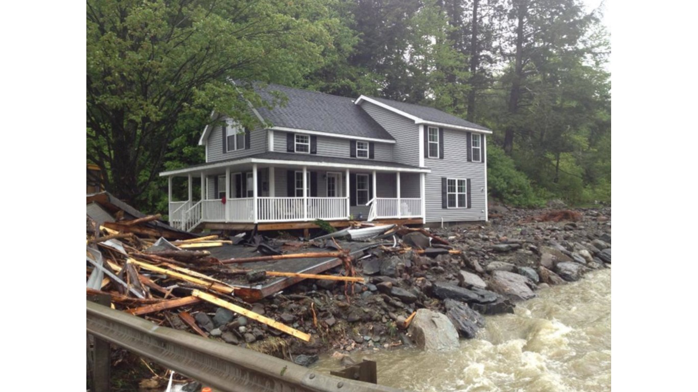
Tropical Storm Irene, Aug. 28-Sept. 2, 2011
> Location: Addison, Rutland, Orange and Windsor Counties; statewide
As of the beginning of the 2023 storm season, Tropical Storm Irene was by far the most devastating weather event in Vermont’s history, and 2011 was among the worst storm years. FEMA relief funds totalled over $20 million, dwarfing the two next largest state-declared disasters, which occurred earlier that year in June ($13.4 million) and July ($10.7 million).
Irene brought extensive flooding and destruction throughout New England and New York on Aug. 28, with the worst impacts in Vermont. Widespread rainfall of 3-5 inches was reported in the state, with some areas receiving 7 inches or more. Wells River Village was completely isolated due to flooding, as were many other towns along the White and Ottauquechee Rivers and their tributaries. Countless homes, businesses, roads, bridges and railroad tracks were destroyed in the disaster, with estimated monetary damages reaching $500 million statewide. In the central Vermont region, Routes 4, 12, 12A, 100, 107, 110, and 125 were all significantly damaged.
[in-text-ad-2]
Memorial Day Storms, May 22-26, 2013
> Location: Orange, Rutland and Windsor Counties; Statewide
Flash flooding on Memorial Day Weekend in 2013 caused approximately $1.5 million in damage across Chittenden, Lamoille, and Essex Counties. The weather pattern extended from June 25 to July 11, when heavy rains over the course of two weeks caused localized flooding across the Granville Gulf area, resulting in severe damage to Route 100. FEMA obligated $2.8 million in Public Assistance funding to help with the recovery efforts in the region. This funding was earmarked to cover the cost of repairs and other costs associated with the disaster declaration period.
July 9-11, 2023
> Location: Statewide
A storm brought nearly 6 inches of rain to Vermont Monday, July 10. From July 8 to July 12, between 8 and 10 inches fell in parts of Woodbury, Middlesex, Woodbury, Worcester, St. Johnsbury, Berlin, Moretown, and Randolph. For reference, Vermont gets around 40 inches of rain in an average year. One death was linked to the flooding. Property damage could reach the tens of millions of dollars.
Contact [email protected] for any questions or corrections.