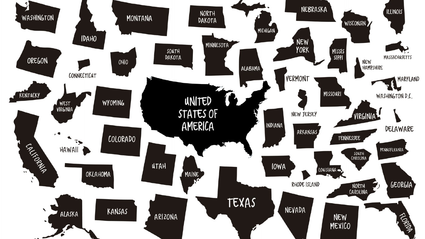
Each of the 50 states that comprise the United States of America has its own shape. How their shapes were determined provides insight into how the United States became a nation like no other.
24/7 Tempo has taken a look at how each state got its shape. We reviewed materials such as Mark Stein’s book “How the States Got Their Shapes” to find out how each state’s contours fit into the grand puzzle that is the United States of America.
According to Stein, the most important influences that determined the shapes of the states were the American Revolution, the construction of railroads, the proposal for the Erie Canal, and the issue of slavery.
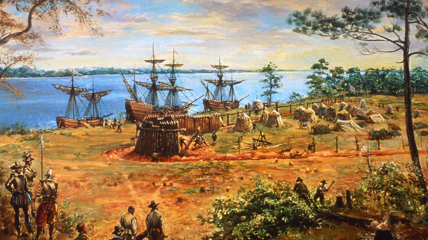
The American Revolution helped to define the shapes of the original 13 colonies. The outlines of the earliest states were often shaped by geographic boundaries, such as rivers. These are the oldest historic towns in every state.
The original 13 colonies vary in shape and size. This did not please Thomas Jefferson, who suggested that Congress create future states equal in size based upon latitude and longitude coordinates.
The construction of cross-country railroads and the Erie Canal helped dictate the contours of states where those modes of transport traversed.
The issue of slavery also helped shape states in the territory that was included in the Louisiana Purchase of 1803. The Missouri Compromise of 1818 solidified the practice of determining state boundaries in the region based on where slavery was legal.
The two largest contiguous states, California and Texas, determined their own borders because of the political power they wielded and the concern that they might secede from the U.S. if a territorial dispute arose. As it turned out, Texas did end up seceding from the Union. Here’s how your state was founded.
Click here to read how each state got its shape

Source: tampatra / iStock via Getty Images
1. Alabama
> Population: 4,887,871
> Size (square miles): 50,645
> Capital: Montgomery
> Founded: Dec. 14, 1819 (22nd state to join)
> Famous landmarks: Edmund Pettus Bridge
Alabama’s boundaries were created in colonial times. In March 1663, King Charles II of England created the Carolina colony out of the larger colony of Virginia and placed the southern limit of the new colony at the 31st parallel, now Alabama’s southern boundary with Florida. Georgia was created out of the Carolina colony, and Alabama would emerge from Georgia. Alabama got access to the Gulf of Mexico in 1804, the year after the Louisiana Purchase. That was when the U.S. announced that the area between the Mississippi River and the Perdido River in what was part of what had been called West Florida — and was owned by Spain — was claimed by the United States. That area that bordered the Gulf of Mexico would become part of southern Alabama.
[in-text-ad]
Source: usgao / Flickr
2. Alaska
> Population: 737,438
> Size (square miles): 570,641
> Capital: Juneau
> Founded: Jan. 3, 1959 (49th state to join)
> Famous landmarks: Denali (formerly Mount McKinley)
Alaska and Hawaii are the only two states that do not share a border with any other part of the U.S. Alaska is surrounded by the Arctic and Pacific oceans on its North, South, and West sides. Alaska’s 1,538-mile eastern border runs along Canada’s Yukon territory and British Columbia province. Russia sold Alaska to the U.S. in 1867. Russia and the British were engaged in a proto-Cold War at the time, and Russia decided to sell the territory that became Alaska to the U.S., which supported the Russian cause, instead of Canada, which was under British control at that time. The border between Alaska and Canada runs along the 141st Meridian.
Source: viking75 / iStock via Getty Images
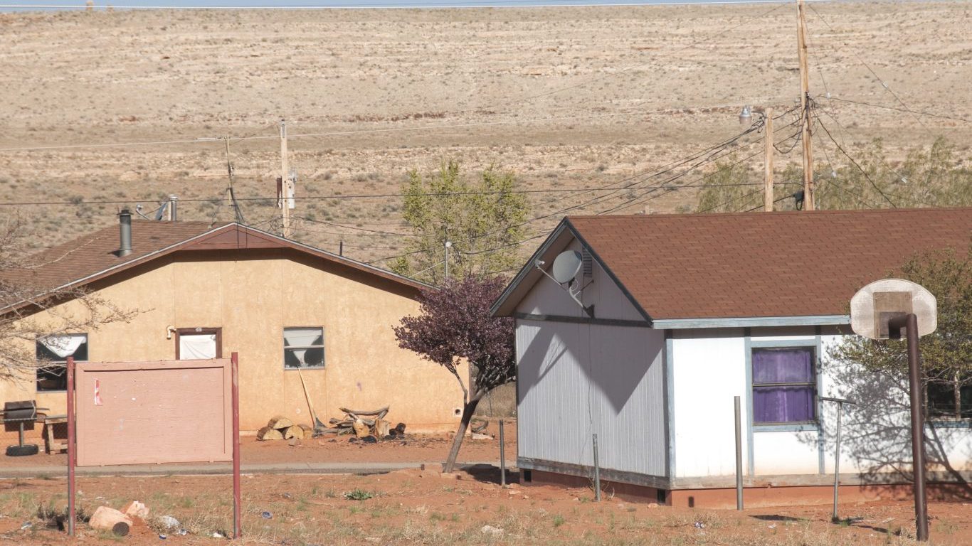
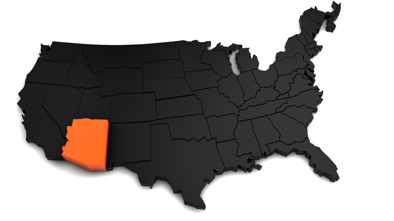
3. Arizona
> Population: 7,171,646
> Size (square miles): 113,594
> Capital: Phoenix
> Founded: Feb. 14, 1912 (48th state to join)
> Famous landmarks: Grand Canyon
Arizona’s current shape came to be in 1863, nearly 50 years before the area became a state. Arizona and New Mexico were split into separate territories when President Abraham Lincoln signed the Arizona Organic Act during the Civil War as a way to outlaw slavery in the new western areas the U.S. controlled. Its western border is marked by the Colorado River and its southern border was determined a decade earlier by the 1853 Gadsden Purchase in which the U.S. purchased a vast swath of land from Mexico.
Source: omersukrugoksu / iStock via Getty Images
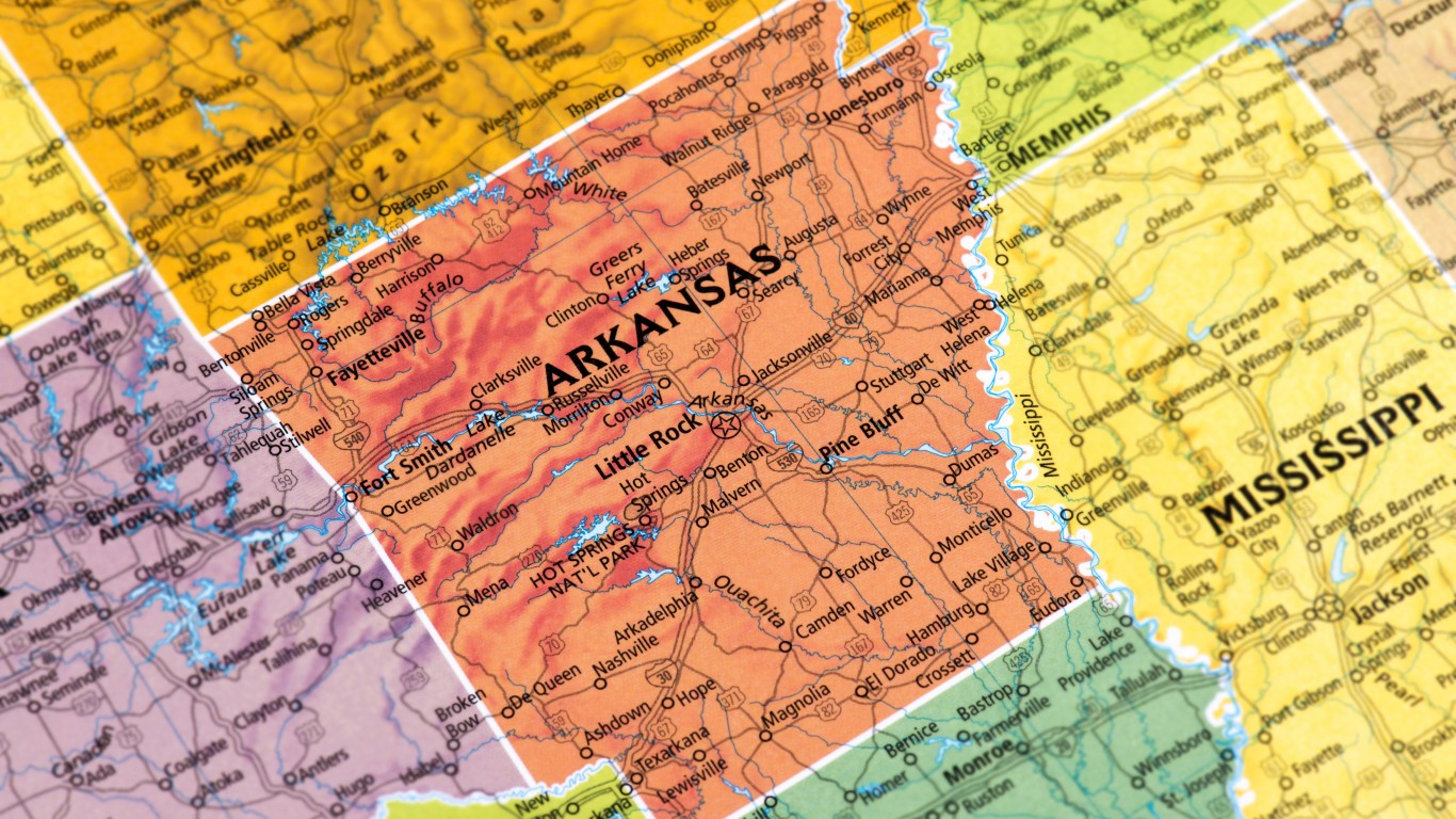
4. Arkansas
> Population: 3,013,825
> Size (square miles): 52,035
> Capital: Little Rock
> Founded: June 15, 1836 (25th state to join)
> Famous landmarks: Hot Springs National Park
Arkansas borders Missouri to the north, Tennessee and Mississippi to the east, Louisiana to the south, and Texas and Oklahoma to the west. An act of Congress in 1819 created the state’s northern boundary along the 36 parallel from the Mississippi River to the St. Francis River, then up the river to create the Missouri bootheel.
Arkansas’ boundary between Tennessee and Mississippi was established after independence from England in 1795. Arkansas’ boundary with Louisiana was also established when the Louisiana Purchase was divided in 1804 between the District of Orleans and the District of Louisiana. The 1819 treaty with Spain established Arkansas’ western boundary after the Louisiana Purchase, and the border between Arkansas and Texas was set as running north from the Sabine River in Louisiana to the south bank of the Red River.
[in-text-ad-2]
Source: omersukrugoksu / iStock via Getty Images
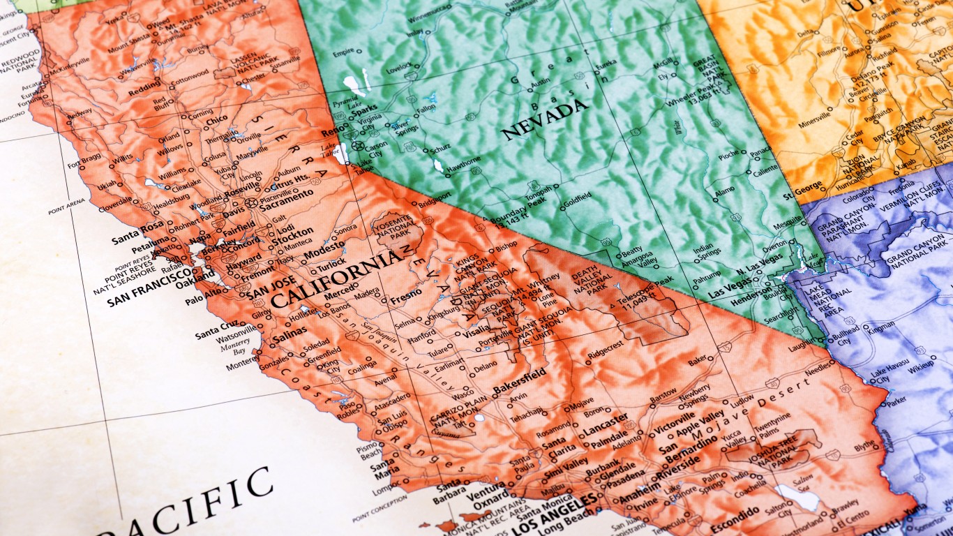
5. California
> Population: 39,557,045
> Size (square miles): 155,779
> Capital: Sacramento
> Founded: Sept. 9, 1850 (31st state to join)
> Famous landmarks: Hollywood sign
Aside from its western border, which is the Pacific Ocean, California set its northern border along the 42nd parallel and the southern border was settled by the Treaty of Guadalupe-Hidalgo with Mexico. There was some sentiment among Californians to set the eastern boundary east of Salt Lake City, but others believed the federal government would not allow a state of that size. The northeast corner of the state was determined as where the 42nd parallel meets the 120th meridian, which includes the Sierra Mountains. California also could not extend eastward because Mormon settlers were already looking to establish their own territory.
Source: omersukrugoksu / iStock via Getty Images
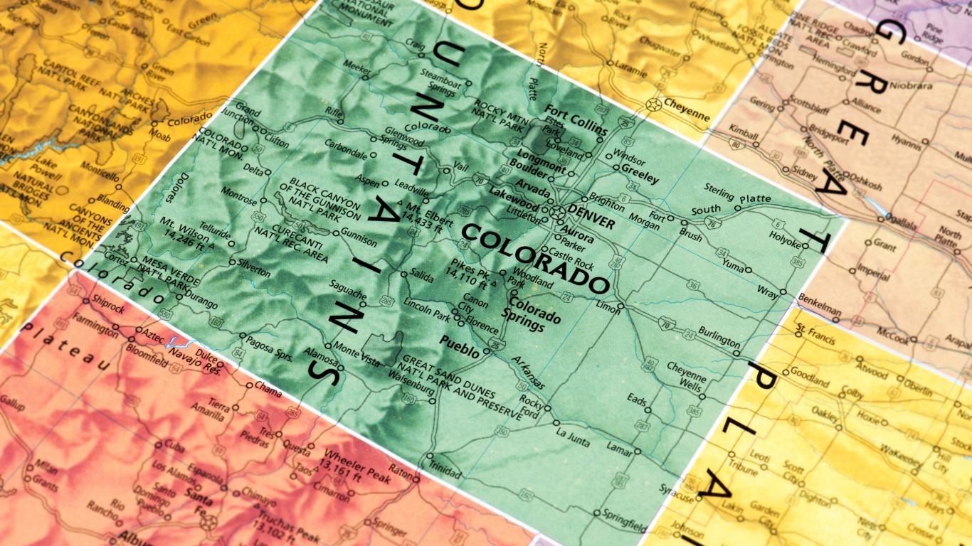
6. Colorado
> Population: 5,695,564
> Size (square miles): 103,641
> Capital: Denver
> Founded: Aug. 1, 1876 (38th state to join)
> Famous landmarks: Pikes Peak
Colorado began as a rectangular state when Congress created its territorial boundaries in 1861. The borders were established between 37th and 41st parallels, and the 25th and 32nd longitudes. The area was taken from what would become Kansas, Utah, Nebraska, and New Mexico. The state became less of a rectangle later because of errors by surveyors.
[in-text-ad]
Source: omersukrugoksu / iStock via Getty Images
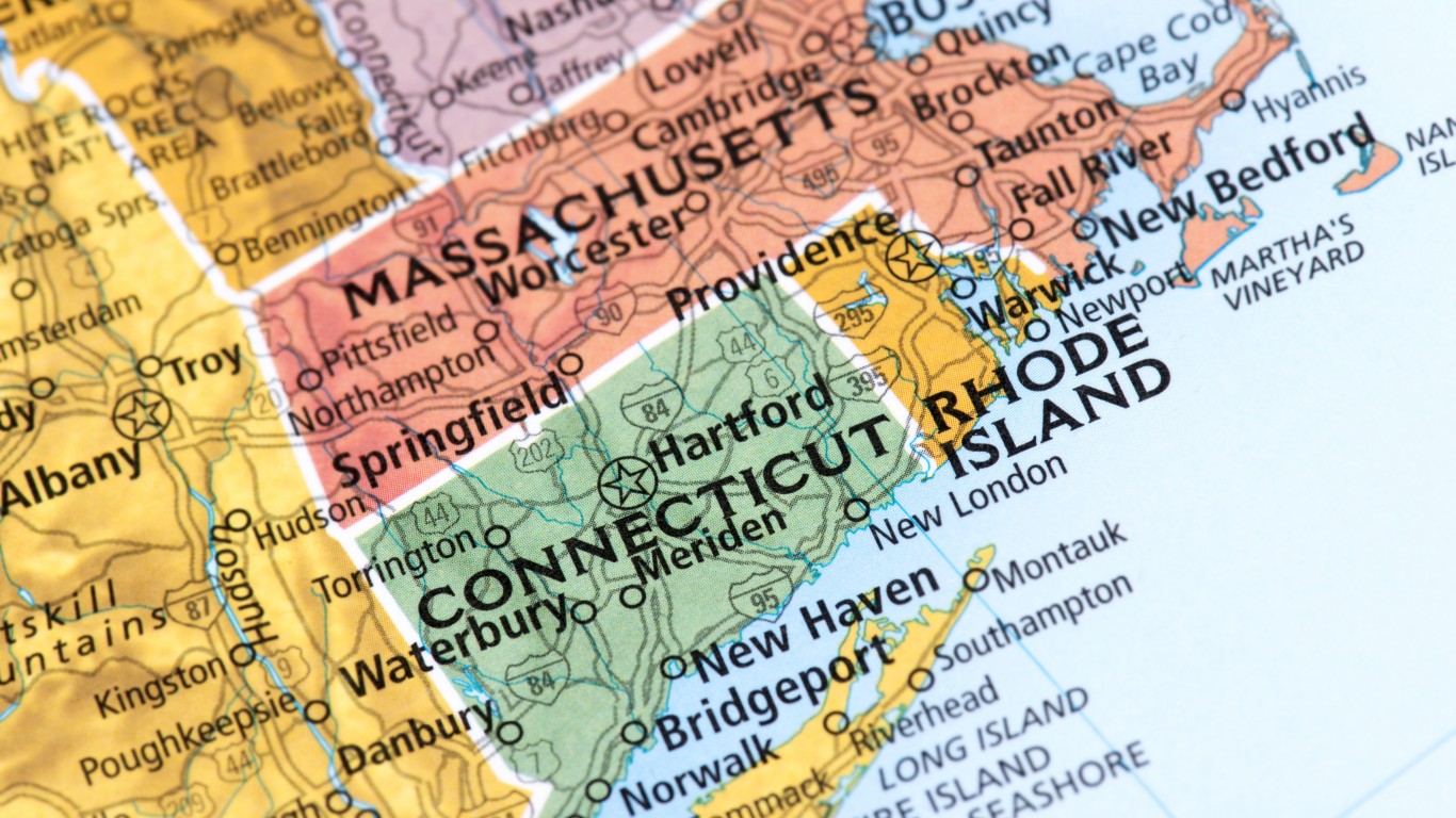
7. Connecticut
> Population: 3,572,665
> Size (square miles): 4,842
> Capital: Hartford
> Founded: Jan. 9, 1788 (5th state to join)
> Famous landmarks: Mark Twain House
The original charter creating Connecticut’s border issued by King Charles II in 1662 would have allowed Connecticut to claim most of Rhode Island, eastern Long Island, and all territory west to the Pacific Ocean. That was until New York was established by a patent to the Duke of York in 1664 and Connecticut lost claim to Long Island as a result. The western of the state border was settled in 1682, and Connecticut and Massachusetts resolved their border in 1826.
 24/7 Wall St.
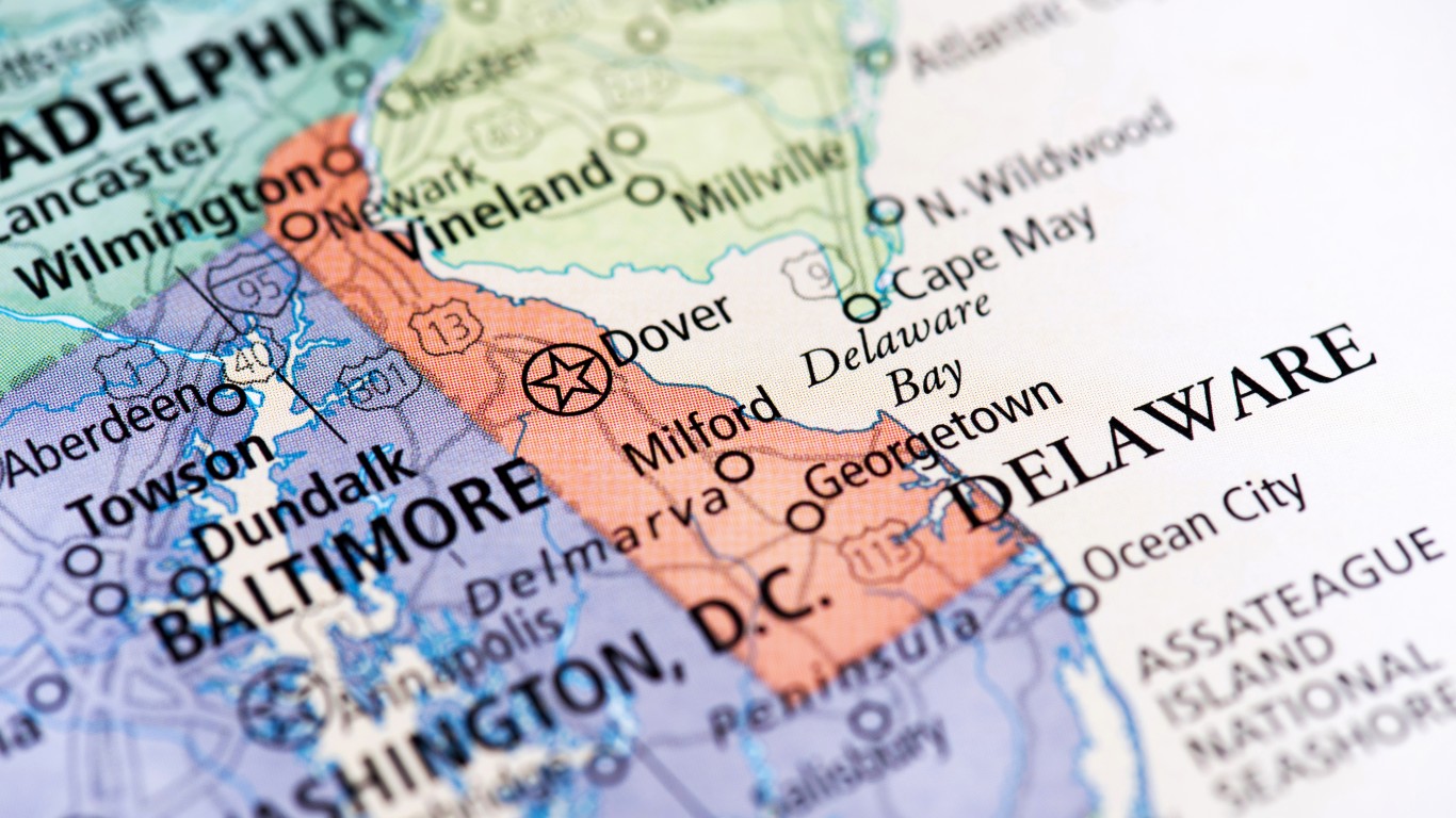
Source: omersukrugoksu / iStock via Getty Images
8. Delaware
> Population: 967,171
> Size (square miles): 1,948
> Capital: Dover
> Founded: Dec. 7, 1787 (1st state to join)
> Famous landmarks: Mason Dixon Marker
The borders of Delaware, the nation’s first state, were created as a result of the resolution of disputes between the state and with Pennsylvania, Maryland, and New Jersey. Delaware was deeded to William Penn from the Duke of York in 1682. Penn was granted all the lands west of the Delaware River within a 12-mile circle beginning in New Castle. The southern border was created by Maryland and Pennsylvania surveyors in 1751. The western border was determined by surveys by Charles Mason and Jeremiah Dixon of Mason-Dixon boundary fame in 1765. The Delaware River, Delaware Bay, and the Atlantic Ocean form the eastern border.
Source: klenger / iStock via Getty Images
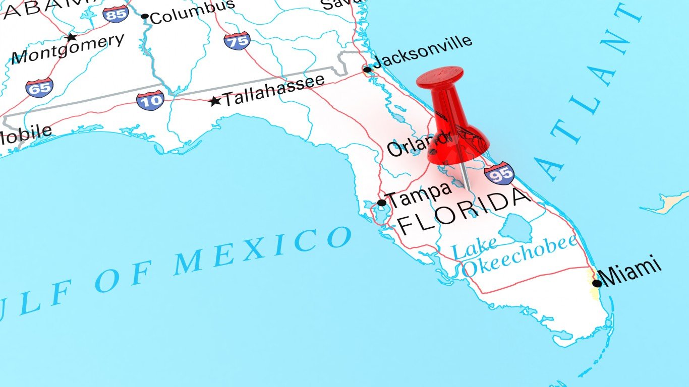
9. Florida
> Population: 21,299,325
> Size (square miles): 53,624
> Capital: Tallahassee
> Founded: March 3, 1845 (27th state to join)
> Famous landmarks: Castillo de San Marcos
Spanish explorers first came to Florida in the 16th century, and the Florida Panhandle once stretched to the Mississippi River. Spain claimed to own the territories around New Orleans, but the U.S. also claimed ownership because of the 1803 Louisiana Purchase. By 1819, most of this disputed land with Spain was in American possession via the Adams-Onis Treaty, making Florida part of the U.S. Over time, the border of the panhandle shifted eastward. Florida’s northern boundary with Georgia is marked by a large mound of dirt called Ellicott’s Mound, near the headwaters of the St. Mary’s River. In 1859, Georgia and Florida appointed surveyors Gustavus J. Orr and B. F. Whitner to complete a survey of the border, and the Orr-Whitner line was accepted by Florida in 1861 and Georgia in 1866 as the boundary.
[in-text-ad-2]
Source: yorkfoto / iStock via Getty Images
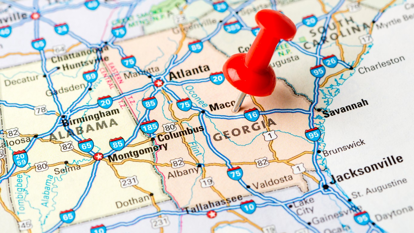
10. Georgia
> Population: 10,519,475
> Size (square miles): 57,513
> Capital: Atlanta
> Founded: Jan. 2, 1788 (4th state to join)
> Famous landmarks: Ebenezer Baptist Church
Georgia, founded by James Oglethorpe in 1732, defined its northeastern boundary as the beginning of the headwaters of the Savannah River. Georgia’s southern boundary with Florida is marked by a large mound of dirt called Ellicott’s Mound, near the headwaters of the St. Mary’s River. In 1859, Georgia and Florida appointed Gustavus J. Orr and B. F. Whitner to complete a survey of the border. The Orr-Whitner line was accepted by Florida in 1861 and Georgia in 1866 as the boundary. Georgia’s western boundary was established following an agreement over a land fraud dispute in the early 19th century.
Source: britishlibrary / Flickr
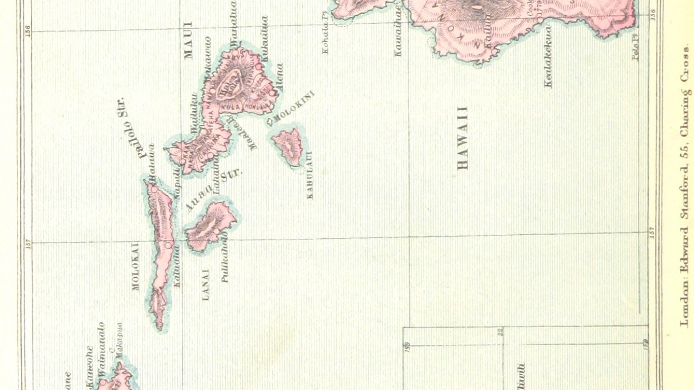
11. Hawaii
> Population: 1,420,491
> Size (square miles): 6,423
> Capital: Honolulu
> Founded: Aug. 21, 1959 (50th state to join)
> Famous landmarks: Diamond Head
Hawaii was shaped by nature, in this case volcanic activity. The Hawaiian Islands were formed by a hot spot — where Earth’s tectonic plates come together and sometimes create a volcano — in the middle of the Pacific Plate. British explorer James Cook arrived in Hawaii in 1778, and just over 100 years later, the U.S. made Hawaii a territory in 1898. The islands became the 50th state to join the Union.
[in-text-ad]
Source: omersukrugoksu / iStock via Getty Images
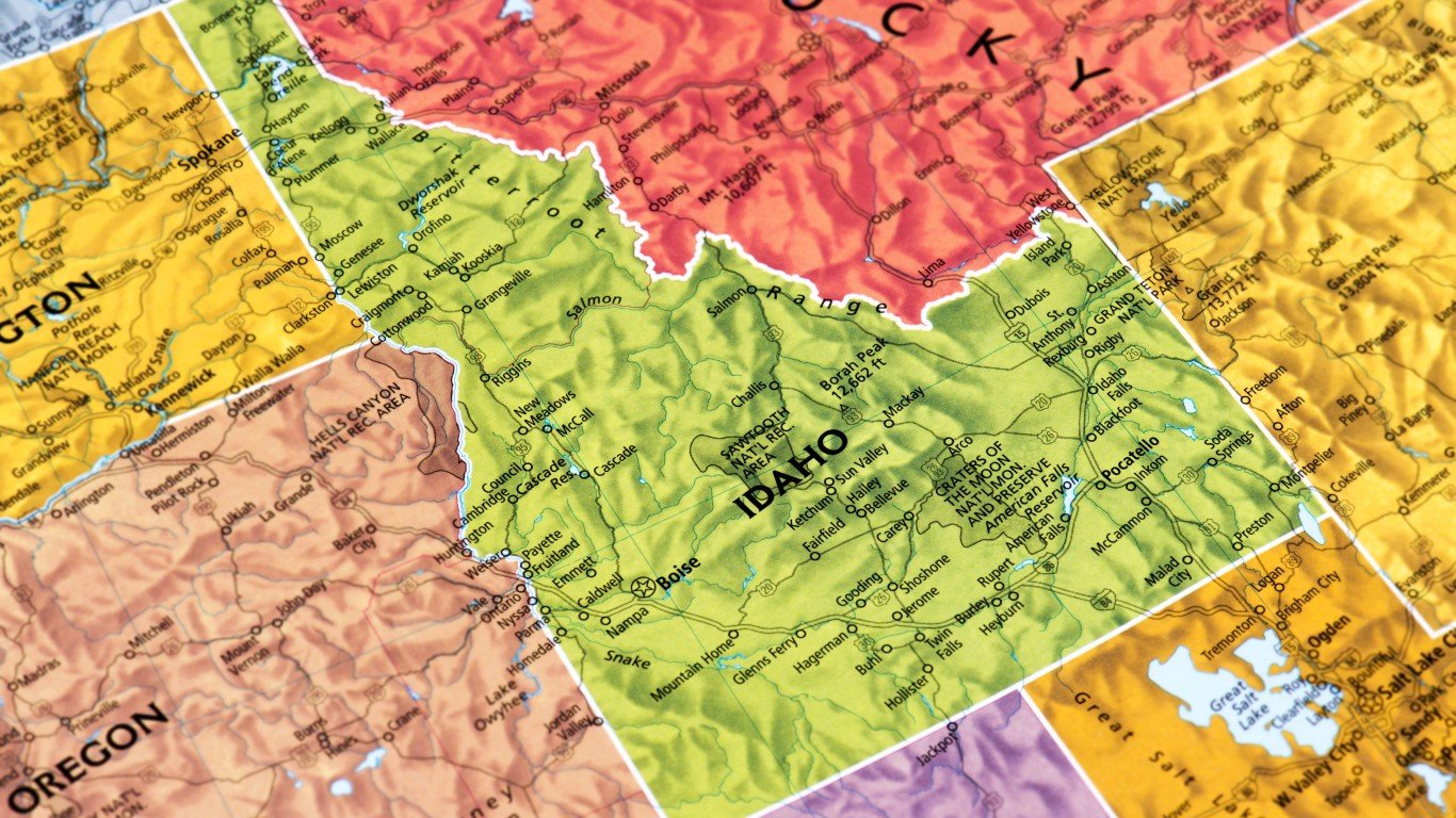
12. Idaho
> Population: 1,754,208
> Size (square miles): 82,643
> Capital: Boise
> Founded: July 3, 1890 (43rd state to join)
> Famous landmarks: Silver City
Idaho’s borders changed many times throughout the mid-1800s before finally giving the state its distinctive shape we know today. The land that makes up present-day Idaho was part of the Oregon Territory that was established in 1848 (the territory also included present-day Oregon, Washington, and parts of Montana and Wyoming). Five years later, Idaho’s panhandle became part of the newly-designated Washington Territory. When Oregon became a state in 1859, it had the same borders as it does today, giving Idaho much of its western border.
After gold was discovered in Idaho in 1860, miners began moving east to the area. Concerned about the growing mining country, Washington Territory managed to create the Idaho Territory in 1863, and its western border was established along the 117th Meridian. Idaho eventually obtained its current shape after losing some of its land when the Montana Territory was established in 1864, and it used the Bitterroot Mountains as a boundary, and the Wyoming Territory was formed in 1868.
 24/7 Wall St.
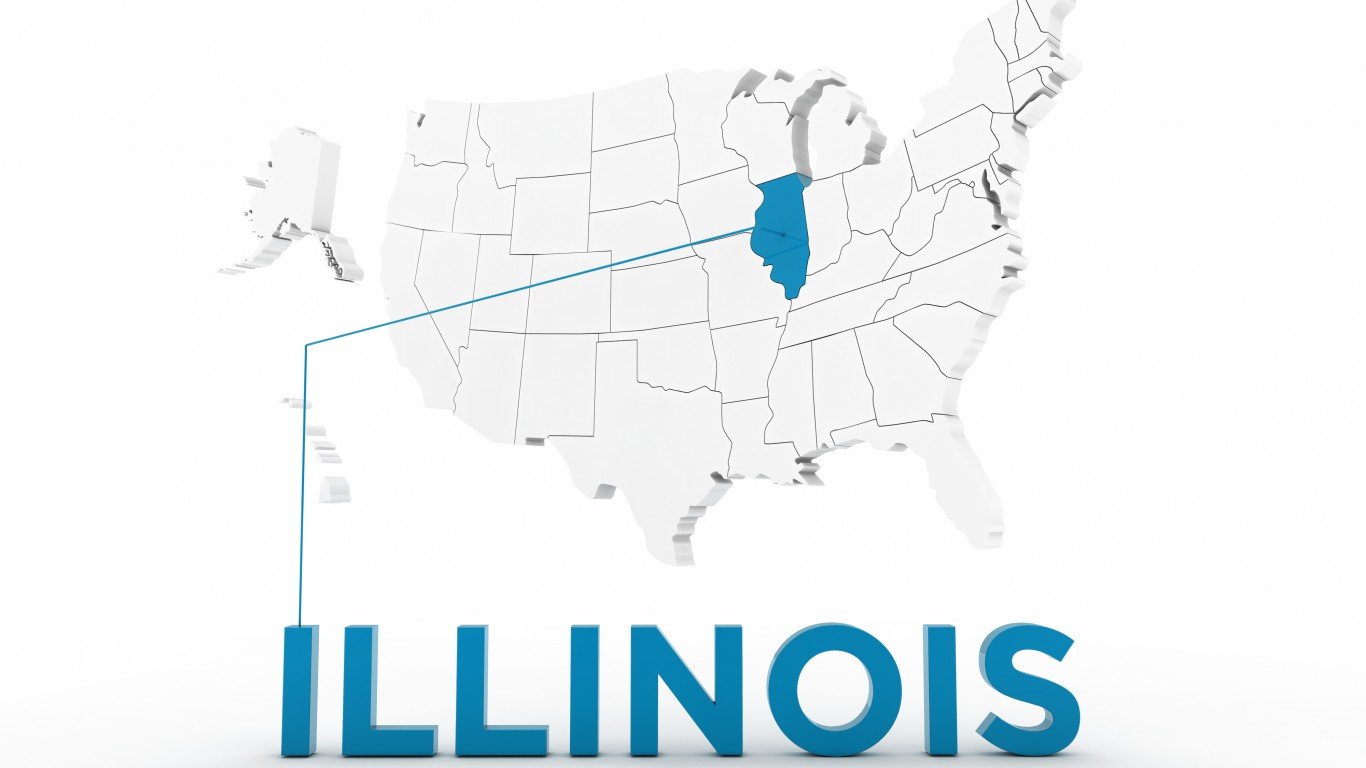
Source: -Iznogood- / iStock via Getty Images
13. Illinois
> Population: 12,741,080
> Size (square miles): 55,518
> Capital: Springfield
> Founded: Dec. 3, 1818 (21st state to join)
> Famous landmarks: Wrigley Field
Illinois’ shape was determined by the issue of slavery. When it was a territory, the northern border of Illinois went east-west from Lake Michigan to the Mississippi River. Nathaniel Pope, the Illinois Territory congressional delegate, introduced an amendment to the act of statehood that would eventually move the boundary farther north, adding 8,500 square miles. Pope wanted to keep Chicago in Illinois to strengthen links with eastern states and said a planned canal connecting the Illinois River to Lake Michigan could bring commercial opportunities to Illinois. In 1825, the Erie Canal opened, linking Lake Erie and all the Great Lakes to the Hudson River and New York. Congress accepted Pope’s amendment, changing Illinois’ destiny forever. Moving the borders farther north would also diminish the state’s connection with slave states.
Source: omersukrugoksu / iStock via Getty Images
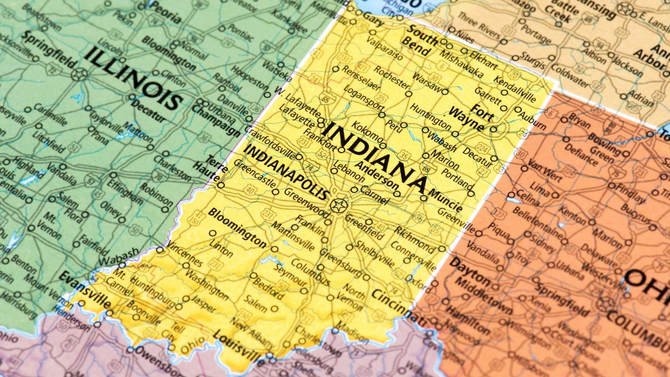
14. Indiana
> Population: 6,691,878
> Size (square miles): 35,826
> Capital: Indianapolis
> Founded: Dec. 11, 1816 (19th state to join)
> Famous landmarks: Madame C.J. Walker Manufacturing Company
Indiana’s northern boundary was created by the Enabling Act of 1816 that moved the state’s border 10 miles north of the southernmost tip of Lake Michigan. This provided access to the Great Lake. Indiana would continue to have boundary disputes with Ohio and Michigan until the latter became a state in 1837. The Ohio River forms the boundary between Indiana and Kentucky, though the exact border was up for dispute until the Supreme Court settled the matter in 1980. The Wabash River forms the western border of Indiana.
[in-text-ad-2]
Source: internetarchivebookimages / Flickr
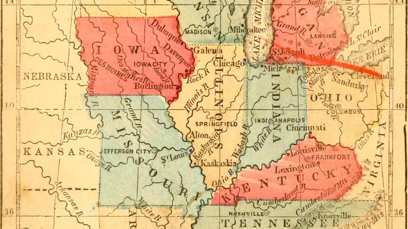
15. Iowa
> Population: 3,156,145
> Size (square miles): 55,857
> Capital: Des Moines
> Founded: Dec. 28, 1846 (29th state to join)
> Famous landmarks: Terrace Hill
Iowa was originally supposed to be much larger than it ended up being. As Missouri was already a state, Iowa’s southern border was fixed. Its original border proposal would have extended the state up to what is now the Twin Cities of Minnesota and set its eastern edge along the Mississippi River and its western edge along the Missouri River.
The territory, like many others in the mid-1800s, was forever changed by the fight over slavery. Northerners wanted Iowa and other states in the area to be small and numerous to increase the number of anti-slavery senators from new states, while Southerners wanted the opposite. Eventually, the two sides compromised, moving Iowa’s northern border farther south and allowing the rivers to serve as the longitudinal boundaries.
Source: mattjeacock / iStock via Getty Images
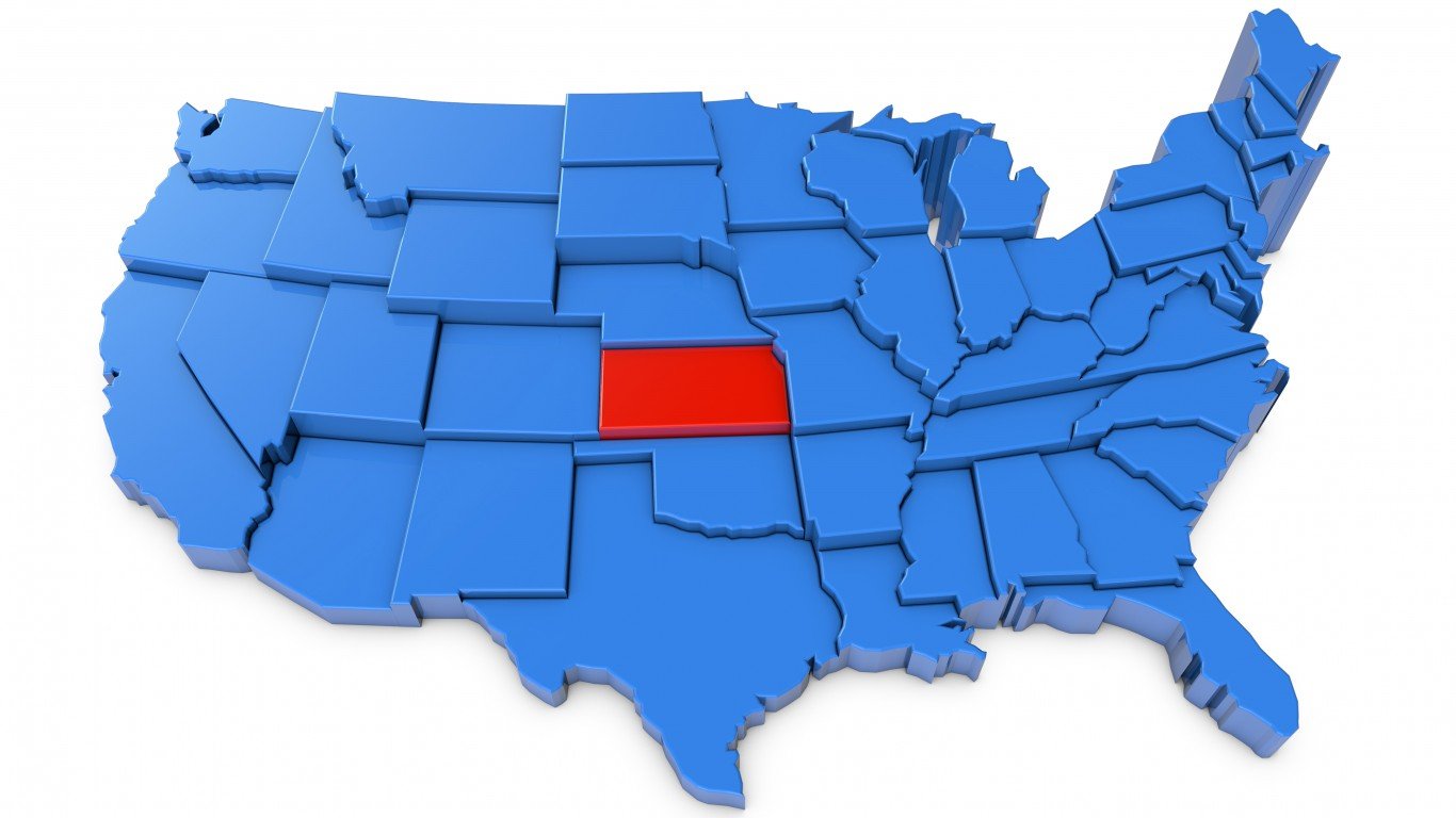
16. Kansas
> Population: 2,911,505
> Size (square miles): 81,758
> Capital: Topeka
> Founded: Jan. 29, 1861 (34th state to join)
> Famous landmarks: Monument Rocks National Natural Landmark
Kansas might have been much bigger than its current size had the proposed larger territory gotten congressional approval. Its western boundary would have extended to the Rocky Mountains in the middle of what is now Colorado, and the northern boundary would be set at the Platte River. The battle between “Big Kansas” and “Little Kansas” supporters was eventually decided in “Little Kansas” favor as a result of the Wyandotte Constitution, which created the state of Kansas.
[in-text-ad]
Source: TARIK KIZILKAYA / iStock via Getty Images
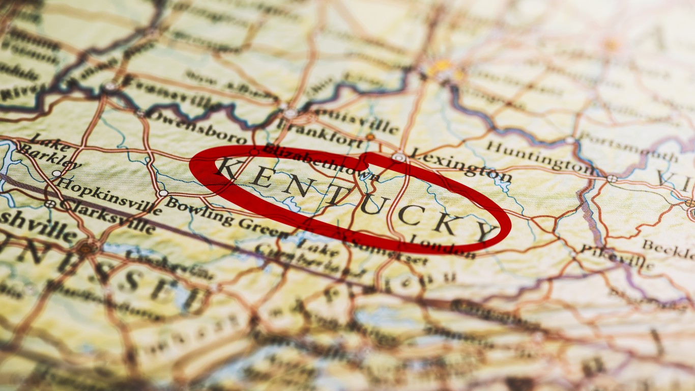
17. Kentucky
> Population: 4,468,402
> Size (square miles): 39,486
> Capital: Frankfort
> Founded: June 1, 1792 (15th state to join)
> Famous landmarks: Churchill Downs
Kentucky broke away from Virginia in 1792 and became the 15th state in the Union. The original border between Virginia and North Carolina was set by the British in the colonial era at 36’30” north latitude and extended to the Mississippi River. However, subsequent surveying teams placed the boundary north by as many as 12 miles. This led to disputes between the two states that were resolved in 1820.
A funky part of Kentucky’s geography is The “Kentucky Bend.” Also called “New Madrid Bend,” it is part of Kentucky encircled on the north, east, and west by the Mississippi River, with the southern part bordering Tennessee. These 30 square miles of Kentucky were cut off from the rest of the state because of surveyor errors and earthquakes that shifted the river.
 24/7 Wall St.
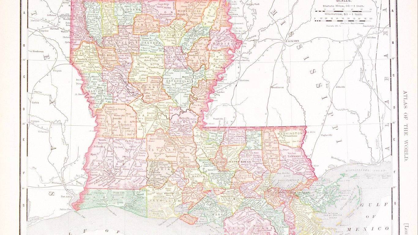
Source: qingwa / iStock via Getty Images
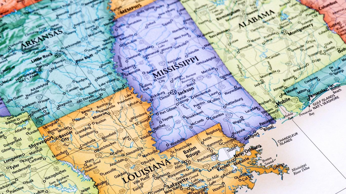
18. Louisiana
> Population: 4,659,978
> Size (square miles): 43,203
> Capital: Baton Rouge
> Founded: April 30, 1812 (18th state to join)
> Famous landmarks: Bourbon Street
Louisiana became part of the U.S. as the result of the Louisiana Purchase in 1803. At the time, its territory spanned from the Gulf of Mexico to part of present-day Canada and from the Mississippi River to the Rocky Mountains. The River Sabine was set as the western boundary between Louisiana and Texas as outlined in the Louisiana Constitution of 1812. The Mississippi River forms Louisiana’s eastern border with Mississippi. The northern border with Arkansas starts at 33 degrees north latitude and the south borders the Gulf of Mexico.
Source: omersukrugoksu / iStock via Getty Images
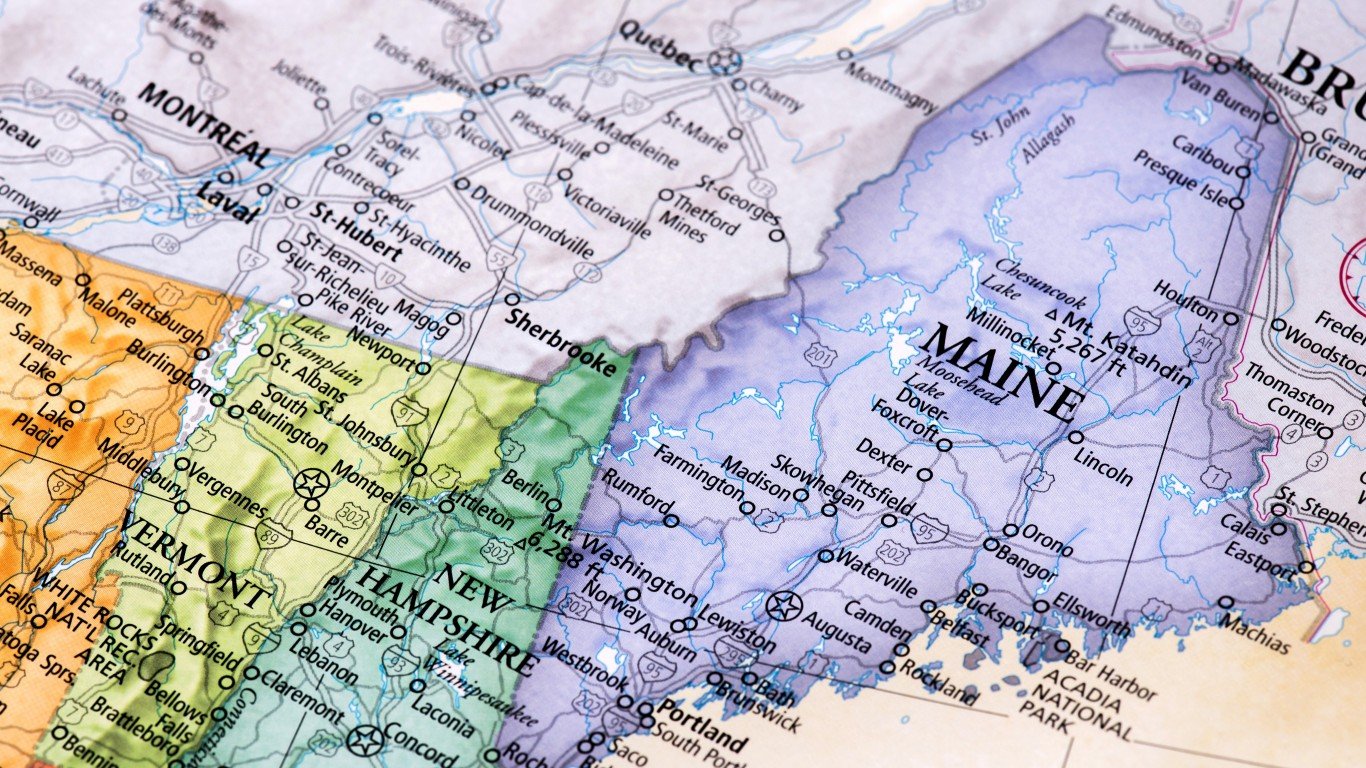
19. Maine
> Population: 1,338,404
> Size (square miles): 30,842
> Capital: Augusta
> Founded: March 15, 1820 (23rd state to join)
> Famous landmarks: Portland Head Lighthouse
Maine was split off from Massachusetts and admitted as a state in 1820 to offset the admission of slaveholding Missouri. Its border with Canada was heavily disputed for decades. The border was not well-defined in the treaty that ended the Revolutionary War, so the U.S. and the British compromised on the state’s current boundary in 1842.
With most of its border running along Canada or the Atlantic Ocean, Maine’s only American neighbor is New Hampshire. Though a 1740 decree from King George II supposedly set the border between them in the middle of the Piscataqua River, New Hampshire claimed that all of Portsmouth Harbor belonged to it and not Maine, forcing the Supreme Court to settle the dispute in 2001 in Maine’s favor.
[in-text-ad-2]
Source: Hey Darlin / Getty Images
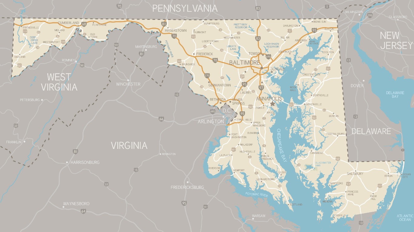
20. Maryland
> Population: 6,042,718
> Size (square miles): 9,707
> Capital: Annapolis
> Founded: April 28, 1788 (7th state to join)
> Famous landmarks: Fort McHenry National Monument
Maryland has one of the most unusual shapes of any state. Though the state is small, it stretches 352 miles from Ocean City on the Atlantic Ocean to the Appalachian Mountains. A unique feature is the state’s panhandle, which in some parts is 1 mile wide, separating Pennsylvania from West Virginia. The Mason-Dixon line, drawn by English surveyors Charles Mason and Jeremiah Dixon, created the 233-mile boundary between Maryland and Pennsylvania. The Potomac River splits Virginia and Maryland. The borders of the two were determined in colonial times by various charters, agreements, and several Supreme Court rulings.
Source: omersukrugoksu / iStock via Getty Images
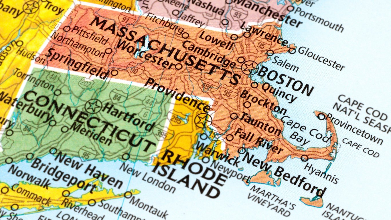
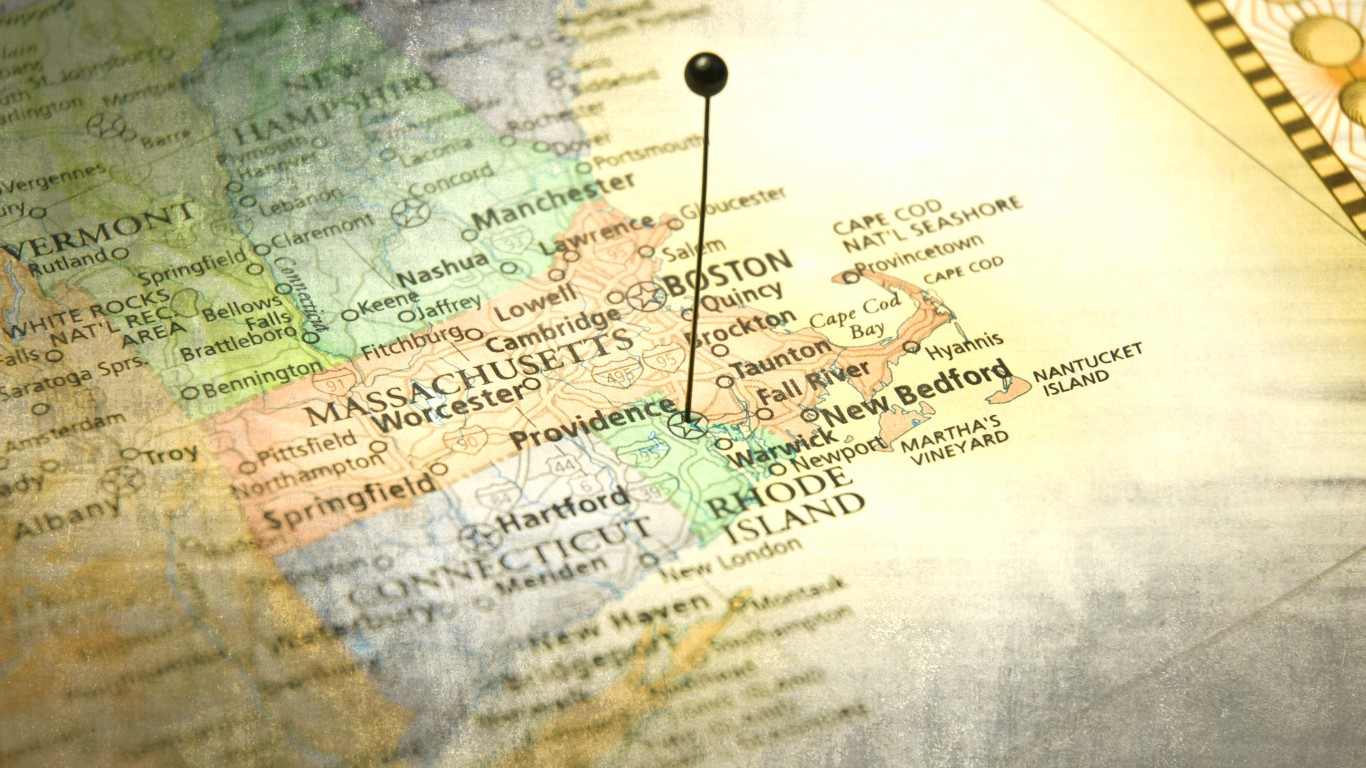
21. Massachusetts
> Population: 6,902,149
> Size (square miles): 7,800
> Capital: Boston
> Founded: Feb. 6, 1788 (6th state to join)
> Famous landmarks: Faneuil Hall
The boundary between Massachusetts and Rhode Island is a part of the original delineation of the territory granted to Sir Henry Roswell during the reign of King Charles I in the late 17th century. It has been a source of dispute for more than 200 years and has gone to the Supreme Court twice. Massachusetts’ current northern boundary with New Hampshire was surveyed in 1741. The state’s border with Connecticut was set by a joint commission authorized by acts passed by both states in 1905. The state’s present boundary with New York was approved by Massachusetts in 1901 and New York nine years later.
[in-text-ad]
Source: Rainer Lesniewski / Getty Images
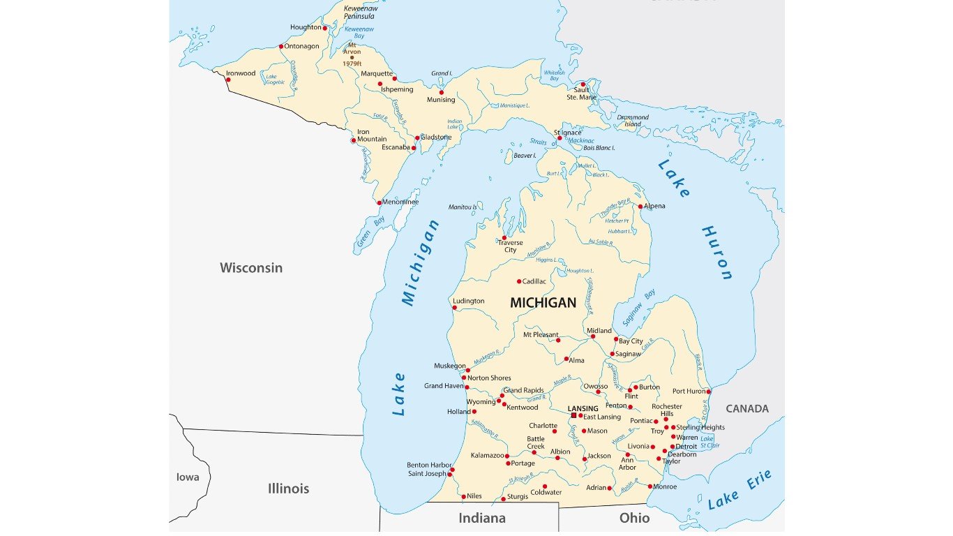
22. Michigan
> Population: 9,995,915
> Size (square miles): 56,538
> Capital: Lansing
> Founded: Jan. 26, 1837 (26th state to join)
> Famous landmarks: Michigan Stadium
Michigan joined the United States as part of the larger territory America gained from Great Britain after the American Revolution. Eventually Congress created the Indiana Territory, of which Michigan became a part, and then it became its own territory in 1805. Before it became a state, Michigan’s legal boundary was established in an 1836 Act.
Since then, Michigan has been involved in boundary disputes with Minnesota, Wisconsin, and Ohio but gained territory from Canada. Among the most notable disputes was a clash with Ohio in the 1830s over the Toledo Strip. Michigan hoped to gain Toledo and get access to Lake Erie. The federal government ruled in favor of Ohio. As part of the settlement, Michigan received the western portion of the Upper Peninsula, which had been part of Wisconsin Territory.
 24/7 Wall St.
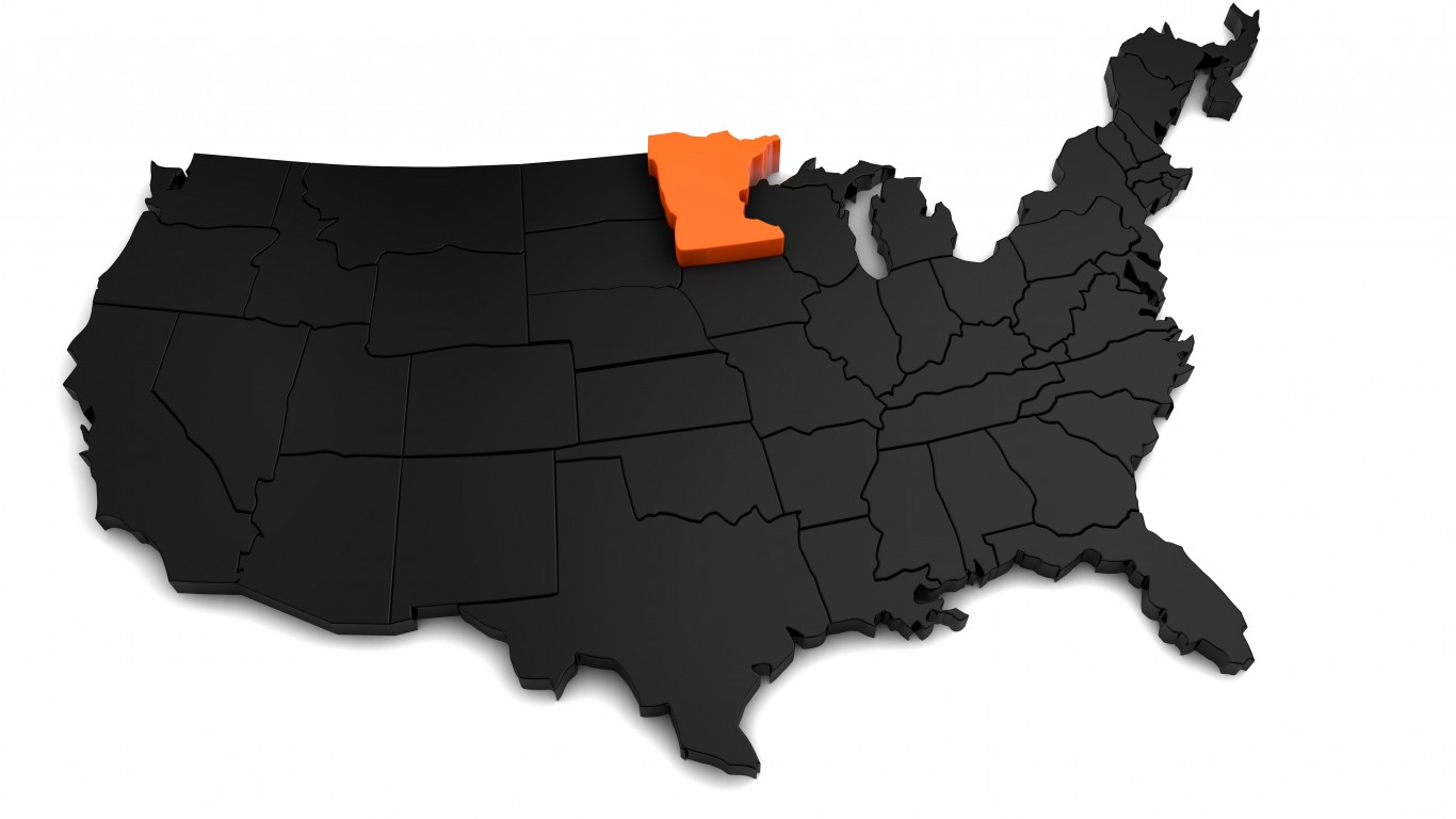
Source: viking75 / iStock via Getty Images
23. Minnesota
> Population: 5,611,179
> Size (square miles): 79,626
> Capital: St. Paul
> Founded: May 11, 1858 (32nd state to join)
> Famous landmarks: Mall of America
Minnesota’s first boundary was formed before it was even a territory, when the 1783 Treaty of Paris established the border between the U.S. and Canada. The state’s southern border was determined by the northern border of Iowa, which was decided in 1846, over a decade before Minnesota’s statehood.
The state’s eastern border runs along the Mississippi River, while the northern section of the western partition runs along the Red River. Where the river splits to form the Minnesota River, the boundary begins to run due south to the border with Iowa.
Source: omersukrugoksu / iStock via Getty Images
24. Mississippi
> Population: 2,986,530
> Size (square miles): 46,923
> Capital: Jackson
> Founded: Dec. 10, 1817 (20th state to join)
> Famous landmarks: Vicksburg National Military Park
In 1798, Congress created the Mississippi Territory. Its original boundaries consisted of the area between the Mississippi River in the west and Chattahoochee River in the east; the 31st parallel in the south; and the region where the Yazoo River empties into the Mississippi River in the north. In 1804, the northern boundary was extended to the Tennessee state line. Eight years later, the U.S. annexed more land along the Gulf of Mexico Coast. Mississippi shares a long eastern border with Alabama. When Mississippi joined the Union in 1817, Congress used the northwest corner of Washington County in Alabama as the main reference point for setting Mississippi’s eastern boundary.
[in-text-ad-2]
Source: omersukrugoksu / iStock via Getty Images
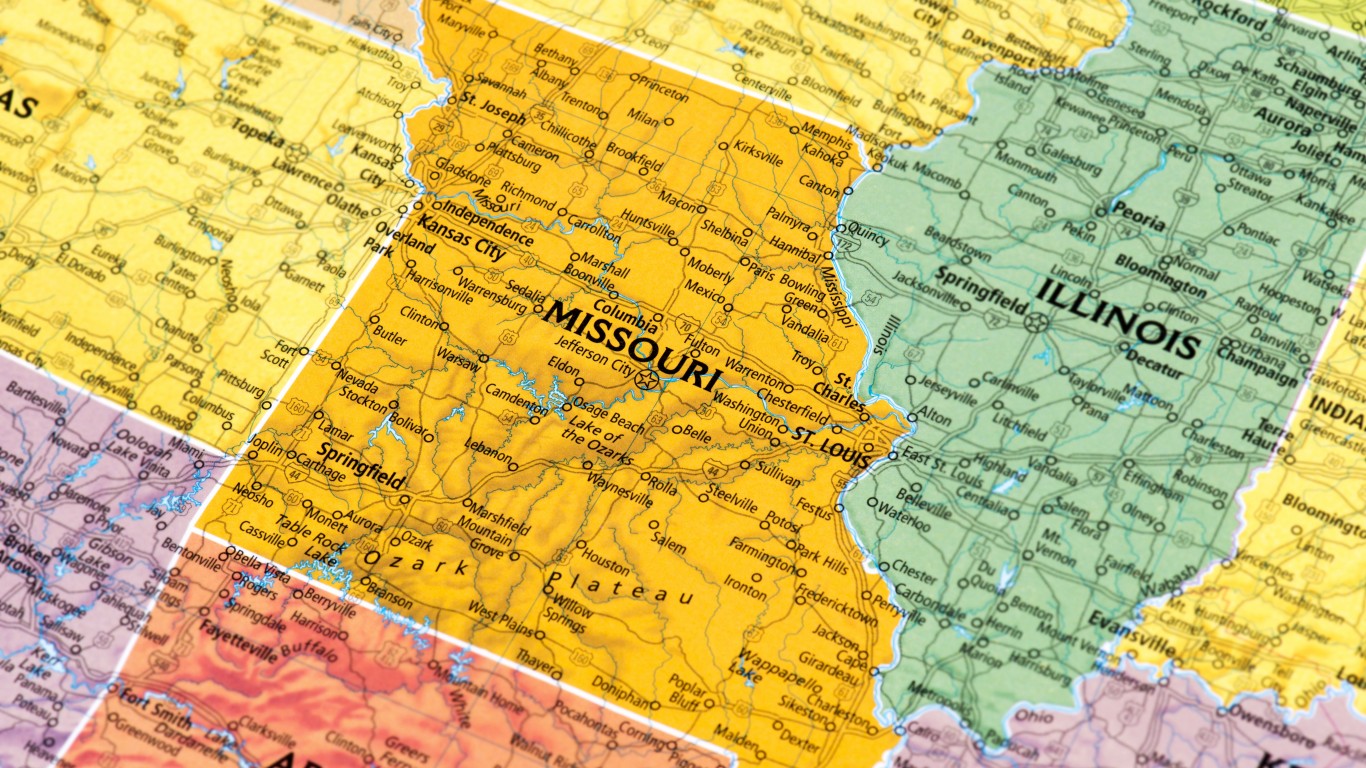
25. Missouri
> Population: 6,126,452
> Size (square miles): 68,741
> Capital: Jefferson City
> Founded: Aug. 10, 1821 (24th state to join)
> Famous landmarks: Gateway Arch
Missouri became part of the United States as part of the Louisiana Purchase in 1803. The state borders eight states, and its current shape is the result of treaties, wars, and a Supreme Court ruling. The Mississippi River is Missouri’s eastern border. The state’s southern border is noted for the bootheel in the southeast, the result of lobbying by businessman John Hardeman Walker who wanted a small section of the border shifted farther south for commercial reasons and stay in the new state of Missouri and not in Arkansas Territory. Missouri’s western border was put at Fort Osage on the Missouri River as part of a treaty with Native Americans. The northern boundary was a subject of dispute with the Iowa Territory and was not resolved until 1849 by the Supreme Court.
Source: omersukrugoksu / iStock via Getty Images
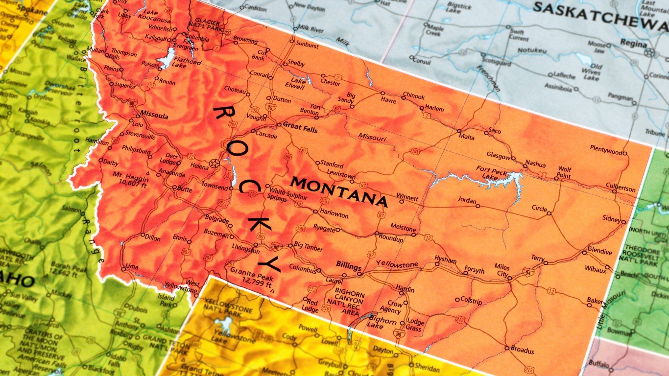
26. Montana
> Population: 1,062,305
> Size (square miles): 145,545
> Capital: Helena
> Founded: Nov. 8, 1889 (41st state to join)
> Famous landmarks: Glacier National Park
Montana owes its contours to Sidney Edgerton, the state’s first territorial governor. Montana was split from the massive Idaho Territory that included what is now Idaho, Montana, and part of Wyoming. Lincoln chose Edgerton as chief justice of the Idaho Territory Supreme Court, and Edgerton was picked to make Montana’s case to become its own territory. Edgerton proposed making Montana’s western boundary along the Bitterroot Mountains, and as a result Montana, gained the riches of the Bitterroot Valley as well as the eventual wealth of Butte.
[in-text-ad]
Source: viking75 / iStock via Getty Images
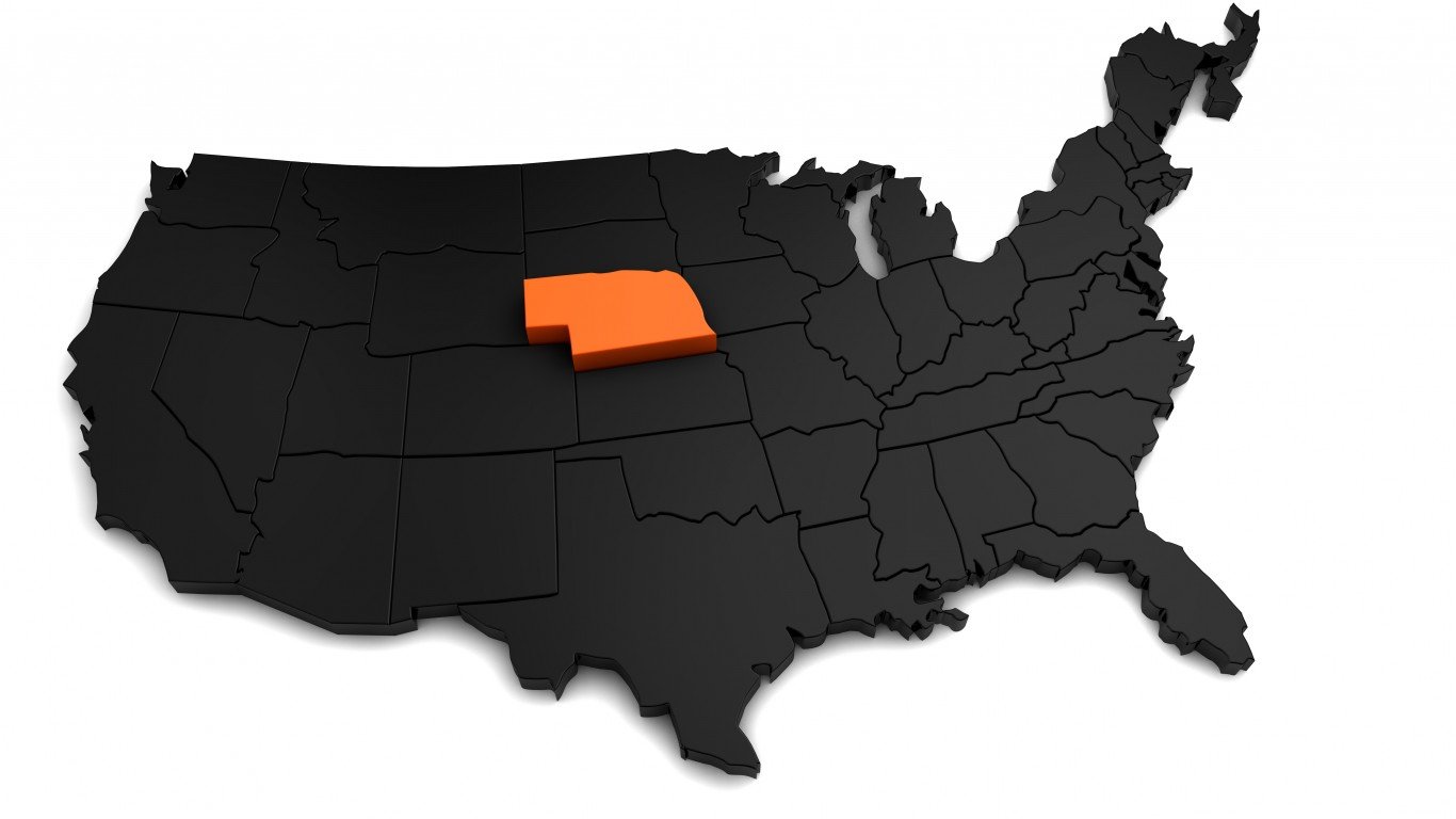
27. Nebraska
> Population: 1,929,268
> Size (square miles): 76,824
> Capital: Lincoln
> Founded: March 1, 1867 (37th state to join)
> Famous landmarks: Scotts Bluff National Monument
The current area that comprises the state of Nebraska is just a fraction of what the Nebraska Territory used to be. After being organized in 1854, the Nebraska Territory stretched from the Canadian border to present-day Kansas’ northern boundary, in between the Rocky Mountains and the Missouri River. This area contained parts of modern Colorado, Wyoming, Montana, North Dakota, South Dakota, and Nebraska. The territory was gradually whittled down as the federal government introduced the Dakota, Idaho, and Colorado Territories. Nebraska actually grew after becoming a state in 1867, acquiring land from the Sioux Tribe in 1889.
Source: yorkfoto / iStock via Getty Images
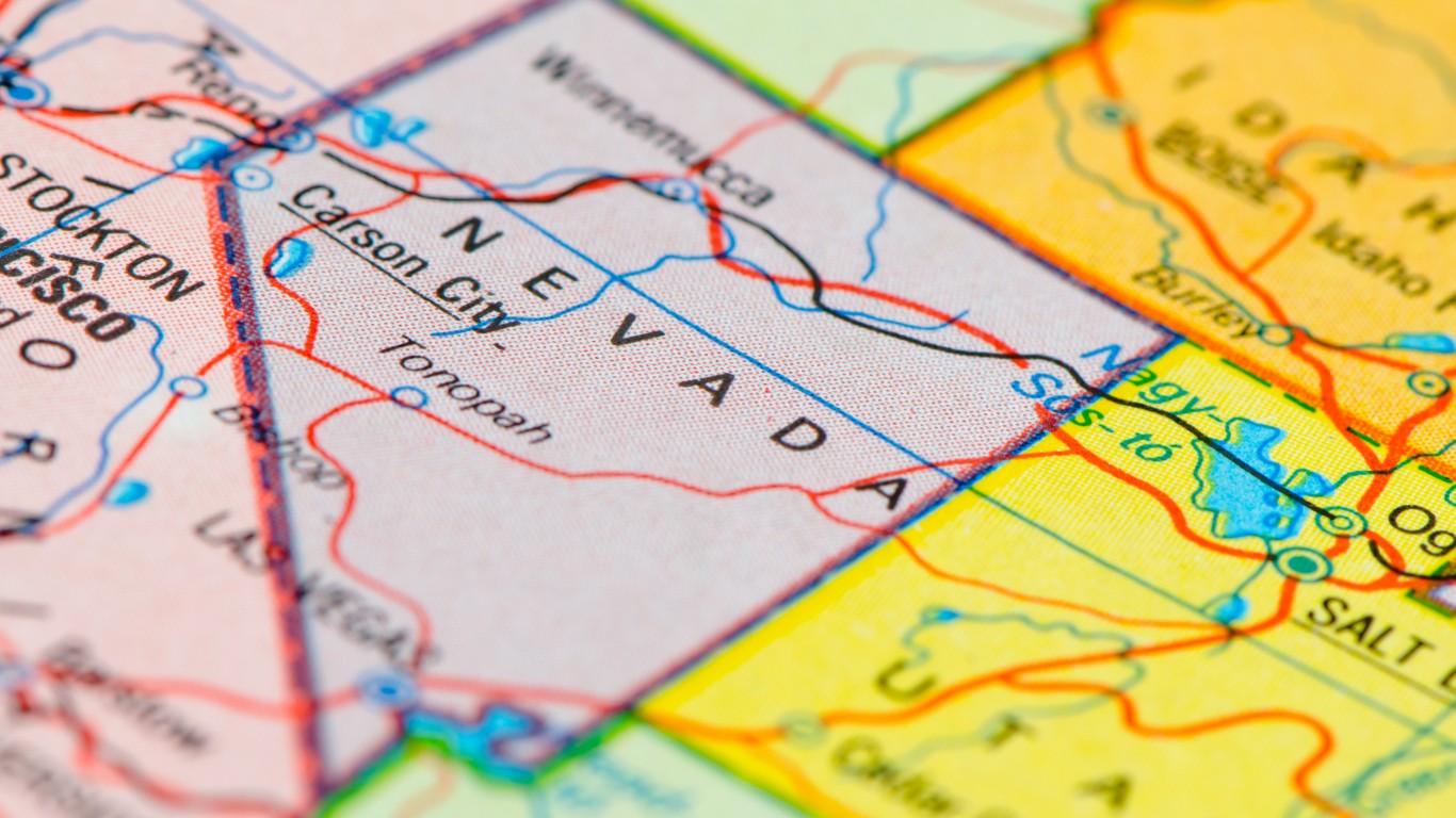
28. Nevada
> Population: 3,034,392,
> Size (square miles): 109,781
> Capital: Carson City
> Founded: Oct. 31, 1864 (36th state to join)
> Famous landmarks: Hoover Dam
Nevada’s borders have expanded since it joined the Union in 1864. The northern border where Nevada meets Idaho and Oregon is the oldest boundary in the West. The first southern boundary of the Nevada Territory was the 37th parallel, about 60 miles north of where Las Vegas is today. Nevada reached this southern point in 1867, when it took a section of the Arizona Territory. The northern section of the western border of Utah Territory, from which Nevada would be created, had been first established shortly after California’s entry into the Union in 1850 at the 120th degree of longitude. The diagonal line with California is described by California’s constitution as a straight line from the intersection of longitude 120 degrees with latitude 39 degrees down to the Colorado River at latitude 35 degrees.
Source: FrankRamspott / Getty Images
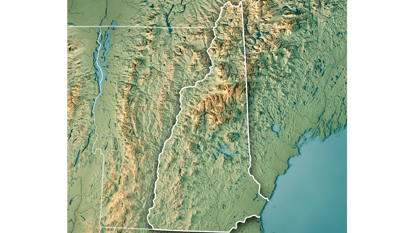
29. New Hampshire
> Population: 1,356,458
> Size (square miles): 8,952
> Capital: Concord
> Founded: June 21, 1788 (9th state to join)
> Famous landmarks: Mount Washington
New Hampshire’s shape traces its history back to the 1620s, when it was made a colonial settlement through a series of grants from the British Monarchy. It was initially smaller, running between the Piscataqua and Merrimack Rivers.
New Hampshire and Massachusetts engaged in a series of disputes about the size and control of the region throughout the 1600s and early 1700s that were finally settled in the 18th century by a royal decree from King George II. The state’s eastern border with Maine was decreed to run through the middle of the Piscataqua River in 1740, but it was in dispute until a 2001 Supreme Court ruling settled it. New Hampshire’s border to the west with Vermont was decided in 1790, when the state agreed to allow Vermont to have all lands to the west of the Connecticut River as Vermont was considering whether to join the United States, remain independent, or become a British colony.
[in-text-ad-2]
Source: crossroadscreative / Getty Images
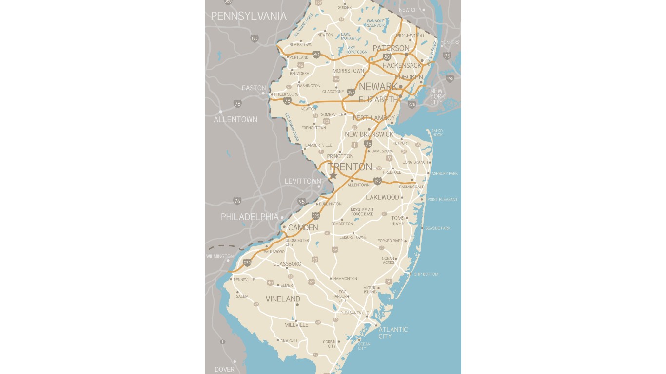
30. New Jersey
> Population: 8,908,520
> Size (square miles): 7,354
> Capital: Trenton
> Founded: Dec. 18, 1787 (3rd state to join)
> Famous landmarks: Washington’s Crossing
New Jersey was originally a Dutch colony founded by Henry Hudson and called New Netherlands. Then the British took over in 1664. They divided the colony in half and gave control of the eastern portion to George Carteret and the western side to John Berkley. The land was renamed New Jersey after the Isle of Jersey of which Carteret had been governor. The Delaware River separates New Jersey from Pennsylvania in the west; the Hudson River provides the eastern border with New York; and the Delaware Bay divides New Jersey from Delaware.
Source: omersukrugoksu / iStock via Getty Images
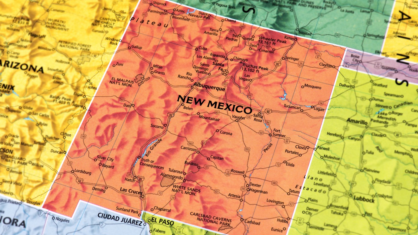
31. New Mexico
> Population: 2,095,428
> Size (square miles): 121,298
> Capital: Santa Fe
> Founded: Jan. 6, 1912 (47th state to join)
> Famous landmarks: Palace of the Governors
The southern border of New Mexico with Mexico was established following the Treaty of Guadalupe Hidalgo in 1848 that ended the Mexican-American War. To organize the lands the U.S. got from Mexico, Congress passed The Compromise of 1850. This established a straight line at 37 degrees latitude north as the territory’s northern border. Part of the western border of the New Mexico Territory was the Colorado River. The border in the east between New Mexico and Texas was established by The Compromise of 1850.
[in-text-ad]
Source: JosephJacobs / iStock via Getty Images
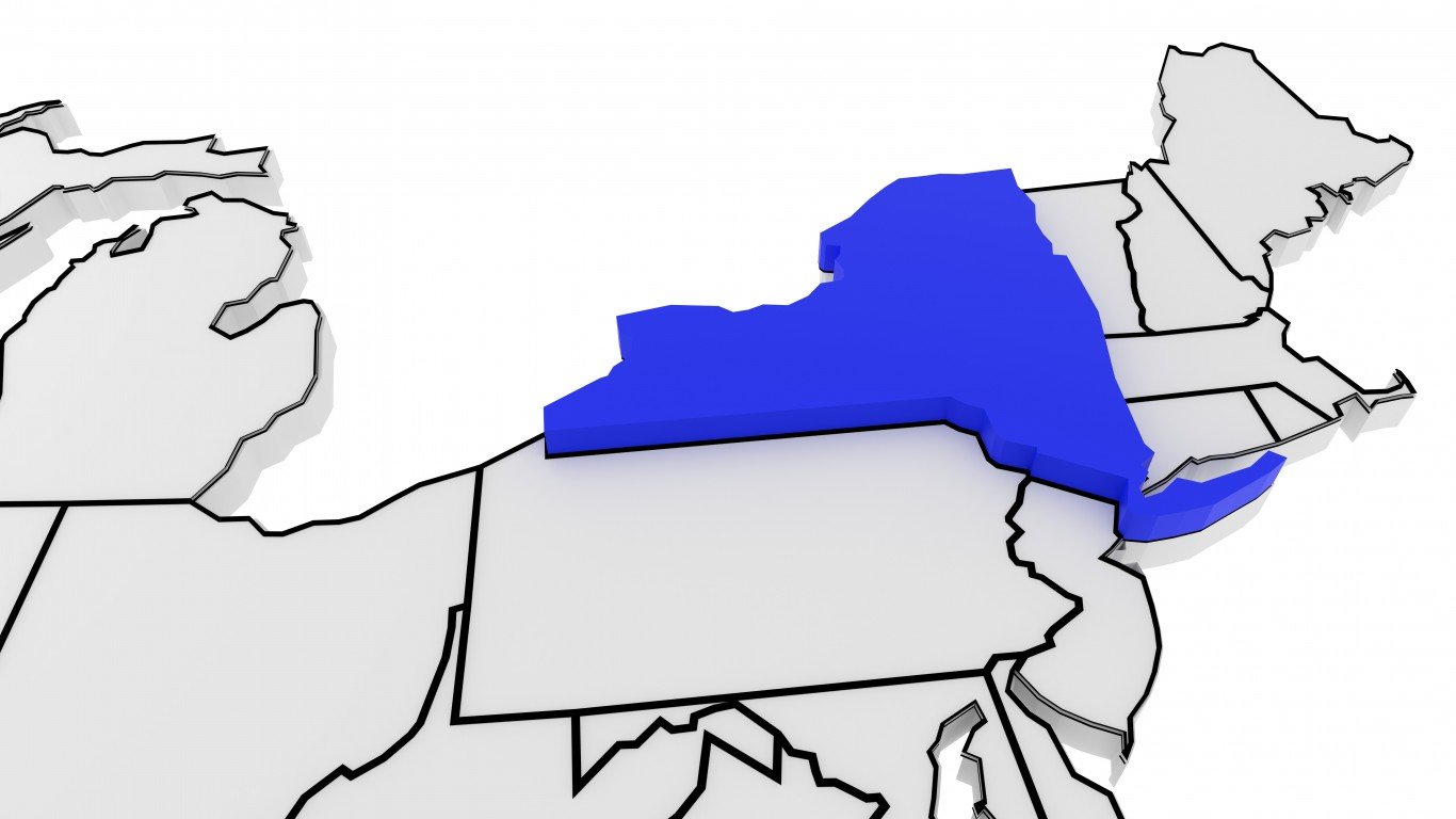
32. New York
> Population: 19,542,209
> Size (square miles): 47,126
> Capital: Albany
> Founded: July 26, 1788 (11th state to join)
> Famous landmarks: Times Square
After the British took the colony of New York from the Dutch, they controlled a region that included present-day New York state, the western half of Connecticut and Massachusetts, and all of Vermont. Present-day New York took shape after Vermont became its own state in 1789 and Connecticut and Massachusetts expanded west. The state has mostly natural river and lake borders to its west and north. New York had a dispute along its southern border with Pennsylvania, which wanted the 43rd parallel latitude as the boundary instead of the 42nd. That would have put Buffalo in Pennsylvania. However, New York prevailed.
Source: ymgerman / iStock via Getty Images
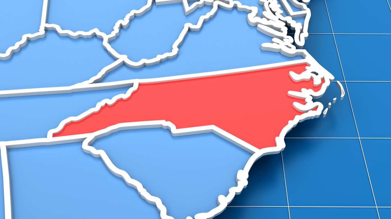
33. North Carolina
> Population: 10,383,620
> Size (square miles): 48,617
> Capital: Raleigh
> Founded: Nov. 21, 1789 (12th state to join)
> Famous landmarks: Kitty Hawk
An Atlantic Coastal state, North Carolina’s northern and southern boundaries were determined even before the U.S. declared independence. The Carolina Province was split from Virginia by Charles II in 1663 along the 36th parallel. The border was adjusted in 1665 and again in 1728.
North and South Carolina were considered to be separate territories before the 1700s, but the dividing line was not made official until 1737. That border was adjusted several times throughout the late 1700s and early 1800s.
Source: omersukrugoksu / iStock via Getty Images
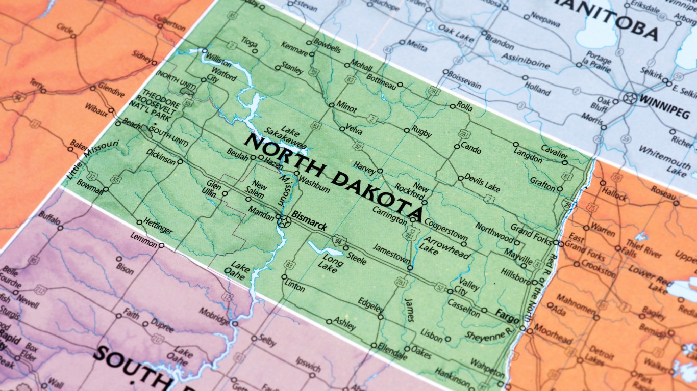
34. North Dakota
> Population: 760,077
> Size (square miles): 69,000
> Capital: Bismarck
> Founded: Nov. 2, 1889 (39th state to join)
> Famous landmarks: Border monuments on Dakotas border
The western part of what is now North Dakota was part of the Louisiana Purchase. Its northern boundary with Canada was set at the 49th parallel as determined by the Treaty of Peace in 1818. The Red River comprises the eastern border of North Dakota and separates the state from Minnesota. The western boundary is based on longitudinal measurements and the line is the 27th meridian. The southern boundary split the Dakota Territory into North and South Dakota and is almost 362 miles long.
[in-text-ad-2]
Source: risamay / Getty Images
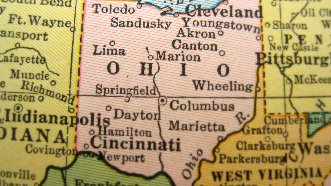
35. Ohio
> Population: 11,689,442
> Size (square miles): 40,860
> Capital: Columbus
> Founded: March 1, 1803 (17th state to join)
> Famous landmarks: Rock ‘n’ Roll Hall of Fame
Ohio was the first state created out of the Northwest Territory, so its shape was largely determined by its southern and western neighbors and surrounding bodies of water. Its entire southern border as well as much of its eastern edge run along the Ohio River. The portion of the state border that runs north-south was set by the preexisting border of Pennsylvania. The western border extends north from where the Great Miami and Ohio Rivers meet.
Ohio’s northern boundary mostly runs across Lake Erie. The rest was supposed to be delineated by an “east-and-west line drawn through the southerly bend or extreme of Lake Michigan,” according to Congress in 1787, but lawmakers were using an inaccurate map, so Ohio extends a bit farther north than it was supposed to.
Source: viking75 / iStock via Getty Images
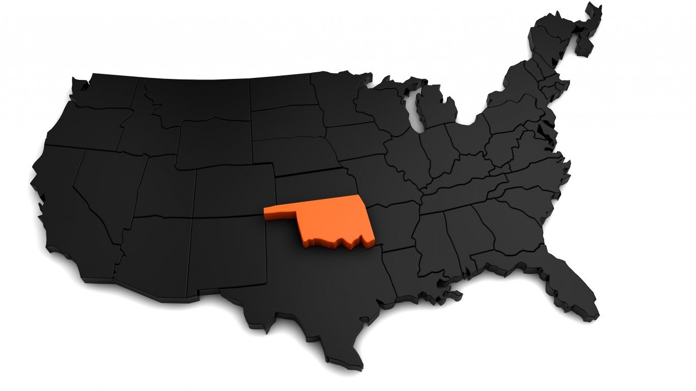
36. Oklahoma
> Population: 3,943,079
> Size (square miles): 68,594
> Capital: Oklahoma City
> Founded: Nov. 16, 1907 (46th state to join)
> Famous landmarks: Price Tower
The borders of Oklahoma, one of the last states to join the Union, were determined by the issue of slavery and relations with Native Americans. The state affixed its western boundary on the 100th meridian in 1930 after a series of failed attempts to find the meridian. The northern border was settled in 1861, when Kansas became a state and lawmakers set the boundary at 37 degrees latitude. The panhandle of Oklahoma — one of its distinguishing characteristics — was sold to the federal government in 1850 by Texas. Texas did this because as a slave state, it did not want its northern border to go above the 36 1/2 parallel, which would have violated the Missouri Compromise. Until 1890, when it was attached to Oklahoma Territory, the panhandle was a lawless land. Oklahoma’s southern boundary, the south bank of the Red River, was not officially settled until 2000 with the signing of the Red River Boundary Compact.
[in-text-ad]

37. Oregon
> Population: 4,190,713
> Size (square miles): 95,988
> Capital: Salem
> Founded: Feb. 14, 1859 (33rd state to join)
> Famous landmarks: Mount Hood
With tensions rising between the U.S. and Britain, the two countries in 1846 signed a treaty that gave the U.S. all the territory from the 42nd parallel to the 49th parallel and as far east as the Continental Divide. The geographical region was named the Oregon Territory in 1848 and included what are now the states of Oregon, Washington, Idaho, and western Montana. Oregon joined the Union in 1859 with its current boundaries. Some wanted to limit Oregon’s eastward boundary to the Cascade Mountains, but that proposal was rejected.
 24/7 Wall St.
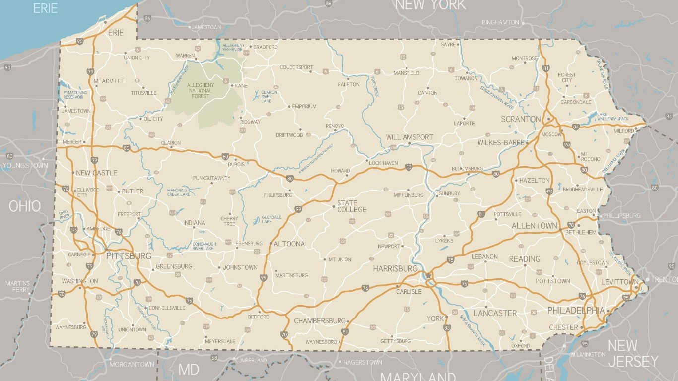
Source: Hey Darlin / Getty Images
38. Pennsylvania
> Population: 12,807,060
> Size (square miles): 44,742
> Capital: Harrisburg
> Founded: Dec. 12, 1787 (2nd state to join)
> Famous landmarks: Independence Hall
One of the 13 original colonies, Pennsylvania’s borders consistently expanded for about a century after the land was chartered to William Penn in 1681. The Delaware River still separates it from its eastern neighbors New York and New Jersey, as it did in the 1600s. Pennsylvania added vast swaths of land throughout the 1700s, expanding westward until finally acquiring the northwestern part of the state that runs across Lake Erie in 1792.
Pennsylvania was involved in an eight-year border dispute with its southern neighbor Maryland. The dispute was finally settled with the establishment of the Mason-Dixon line, which would go on to become the dividing line between North and South in the Civil War.
Source: JonGorr / iStock via Getty Images
39. Rhode Island
> Population: 1,057,315
> Size (square miles): 1,033
> Capital: Providence
> Founded: May 29, 1790 (13th state to join)
> Famous landmarks: The Flying Horse Carousel
Rhode Island was created after the Puritans in Massachusetts Bay Colony banished Roger Williams, who set up a colony founded on religious tolerance. The Connecticut-Rhode Island border was disputed all through the 17th and 18th centuries. Both states’ legislatures ratified a survey taken in 1840. Another survey begun in 1940 and interrupted by World War II was not ratified by either state’s lawmakers, though Rhode Island has long observed it. Connecticut continues to honor the 1840 survey. The border of the Ocean State was originally established by surveyors Nathaniel Woodward and Solomon Saffery, who had been tasked with marking Massachusetts Bay Colony’s southern border, a straight line west from a point three miles south of the southernmost branch of the Charles River. Block Island Sound is on Rhode Island’s southern border.
[in-text-ad-2]
Source: ymgerman / iStock via Getty Images
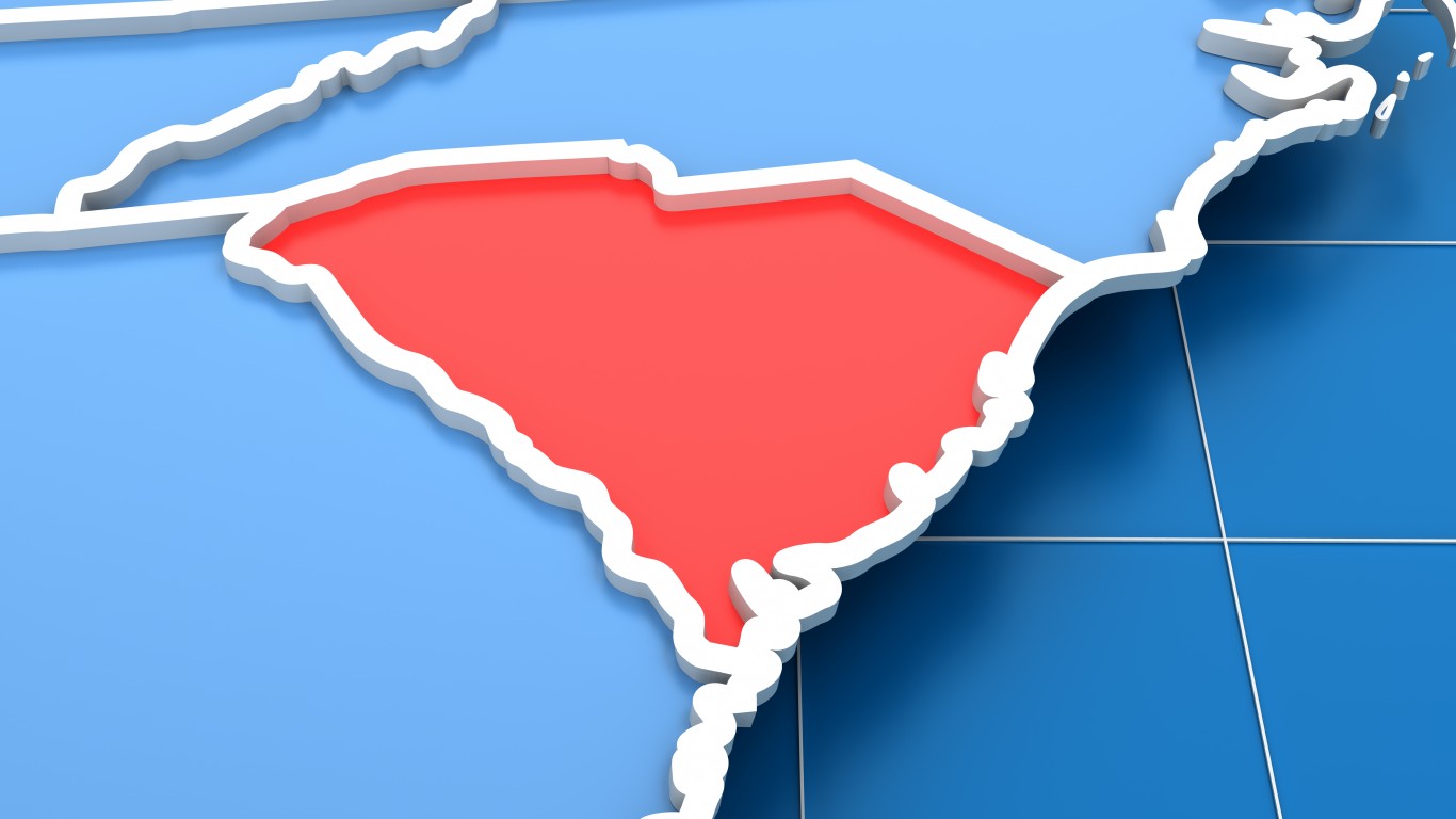
40. South Carolina
> Population: 5,084,127
> Size (square miles): 30,060
> Capital: Columbia
> Founded: May 23, 1788 (8th state to join)
> Famous landmarks: Fort Sumter
South Carolina and North Carolina were one colony until 1729, when they separated and became their own colonies. Border disputes arose, and the two colonies created a commission to settle the dispute. They agreed that the boundary should begin 30 miles south of Cape Fear and a straight line should run northwest until it reached the 35th parallel and then go west to the Pacific Ocean. Surveying errors forced a correction and the boundary was moved 17 miles north of the 35th parallel and west to the Saluda Mountains. The southern boundary had been established by the second Carolina charter in 1665, placing that border near where Daytona Beach, Florida, is today. The Atlantic Ocean is to the east of South Carolina.The Savannah River comprise the western border between South Carolina and Georgia.
Source: klenger / iStock via Getty Images
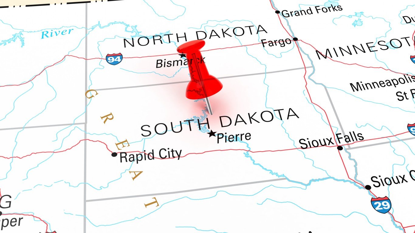
41. South Dakota
> Population: 882,235
> Size (square miles): 75,811
> Capital: Pierre
> Founded: Nov. 2, 1889 (40th state to join)
> Famous landmarks: Mount Rushmore
South Dakota’s eastern boundaries were set by the states that came before it. The northern section of its eastern border runs along the Bois de Sioux River, then goes due south and meets up with the Big Sioux River. Its southern border was determined by the northern border of Nebraska, which was set at the 43rd parallel to the Missouri River.
The dividing line of the Dakotas is set at the northern tip of the Coteau des Prairies plateau.
South Dakota’s western edge was set at the 104th meridian back when it was part of the Dakota Territories.
[in-text-ad]
Source: omersukrugoksu / iStock via Getty Images
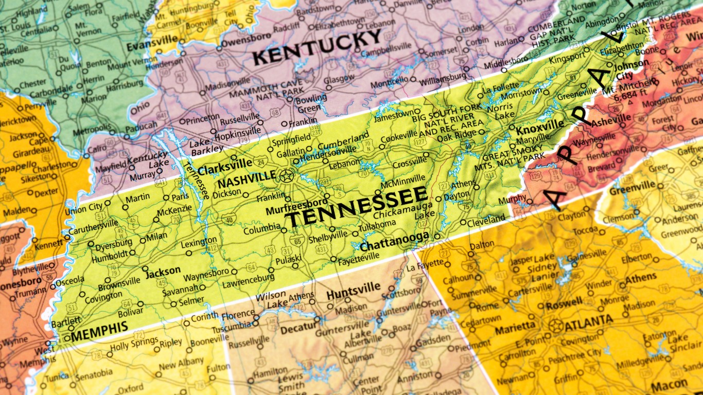
42. Tennessee
> Population: 6,770,010
> Size (square miles): 41,234
> Capital: Nashville
> Founded: June 1, 1796 (16th state to join)
> Famous landmarks: Graceland
Landlocked Tennessee borders eight states. At one time, the Mississippi River was its western border. But the river has meandered, causing confusion with neighboring states Missouri and Arkansas. The Supreme Court has ruled that the western border of Tennessee can’t be shifted because of geographic changes caused by river movements.
As for the southern border, in 1818 Georgia and Tennessee appointed University of Georgia professor James Camak and Tennessee mathematician James Gaines to survey the border of their respective states. When Congress voted to make Tennessee a state in 1796, it set the boundary between Georgia and Tennessee at 35 degrees north latitude. Camak and Gaines put the border about a mile south of 35 degrees north. That border continues west to the Mississippi River.
To the east is North Carolina, from which northeast Tennessee separated in the 18th century. Its northern border was created during the colonial era when the British Crown declared that the border between North Carolina and Virginia would be 36 degrees, 30 minutes north latitude. That line continued west when Kentucky and Tennessee were established.
 24/7 Wall St.
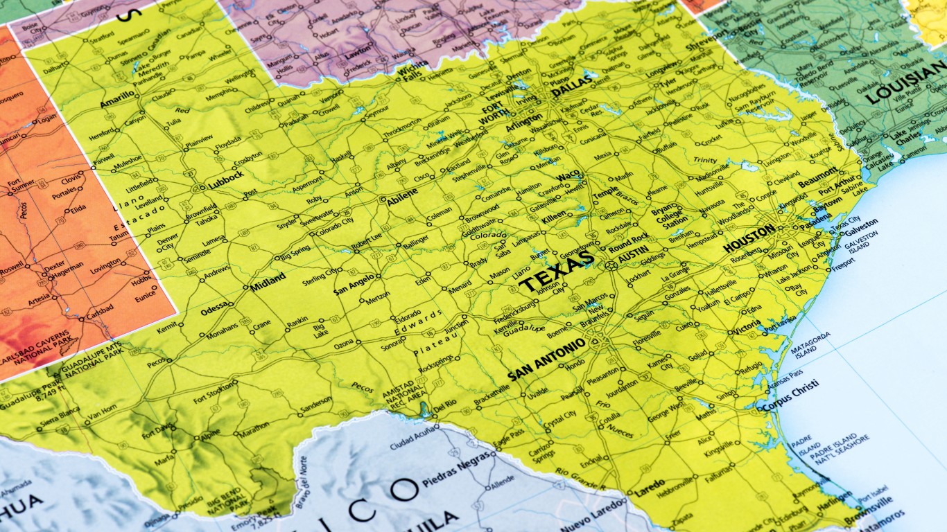
Source: omersukrugoksu / iStock via Getty Images
43. Texas
> Population: 28,701,845
> Size (square miles): 261,231
> Capital: Austin
> Founded: Dec. 29, 1845 (28th state to join)
> Famous landmarks: The Alamo
The independent Republic of Texas once stretched into present-day Wyoming before it was pared down for statehood. A treaty with Spain mandated that Texas’ eastern border traces the path of the Sabine River until the 32nd parallel, then due north to the Red River, west to the 100th meridian, then north again.
Texas’ southern boundary was set along the Rio Grande after the land was acquired through the Treaty of Velasco in 1836 after Texas won the war for its independence. After nine years of independence, Texas began the process of becoming a U.S. state. It got its distinctive shape after the Compromise of 1850, when it sold some of its northwestern land area in exchange for the U.S. taking on its massive debt load.
Source: omersukrugoksu / iStock via Getty Images
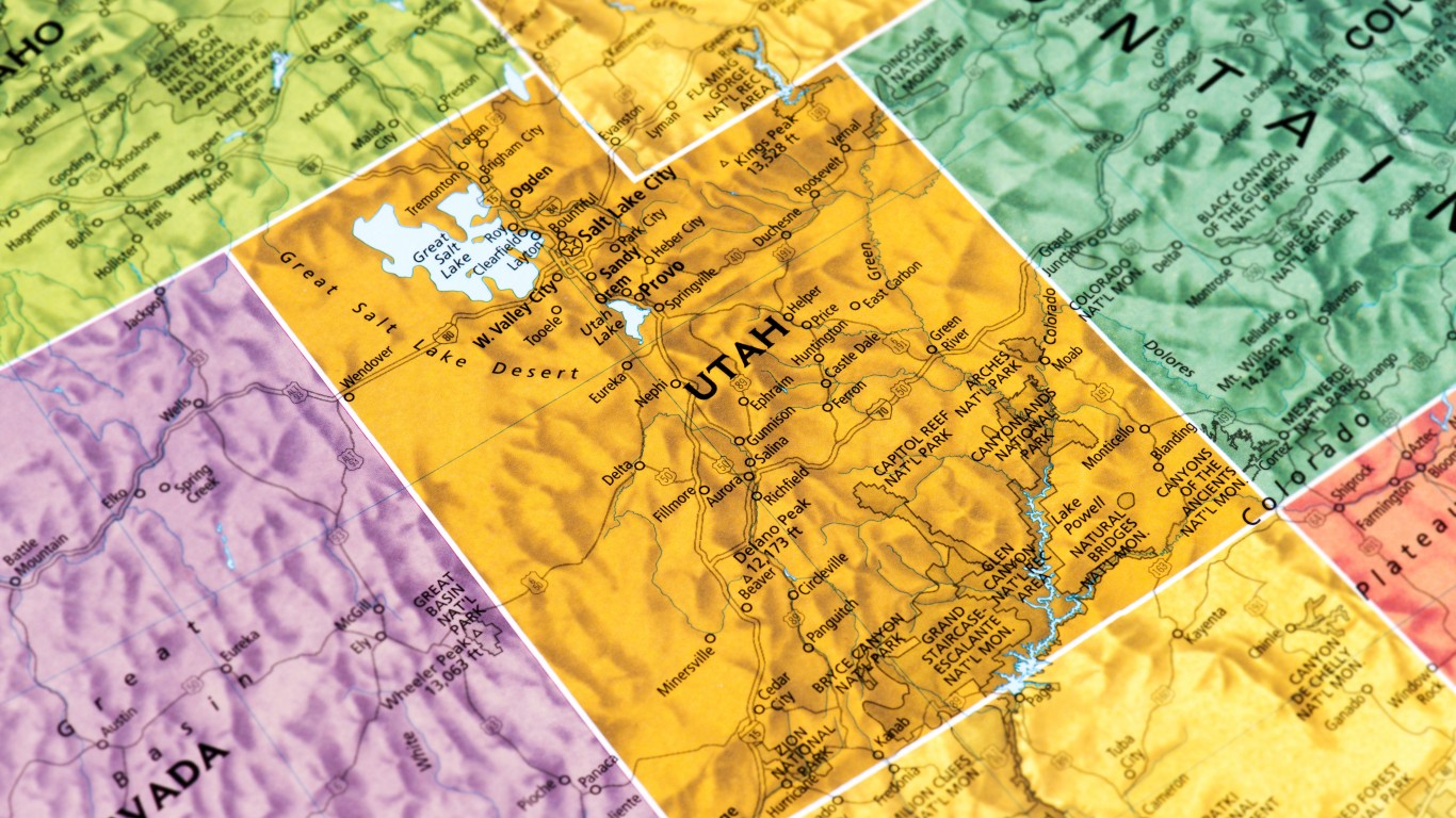
44. Utah
> Population: 3,161,105
> Size (square miles): 82,169
> Capital: Salt Lake City
> Founded: Jan. 4, 1896 (45th state to join)
> Famous landmarks: Monument Valley
The land where Utah is now located was ceded from Mexico in 1848. Mormon settlers moved there from New York years before to try to leave the relatively new U.S. The Mormons wanted to form their own state, called Deseret, but Congress shrunk the land and named it Utah. From 1850 to 1861, the Utah Territory included all of present-day Utah, as well as parts of Nevada, Wyoming, and Colorado.
After silver was discovered in Nevada, it became its own state. The same happened when gold was discovered in Colorado and in Wyoming. Utah’s border with Wyoming was established along the 111th meridian, giving Utah its distinctive shape and the borders it now has to this day.
[in-text-ad-2]
Source: FrankRamspott / Getty Images
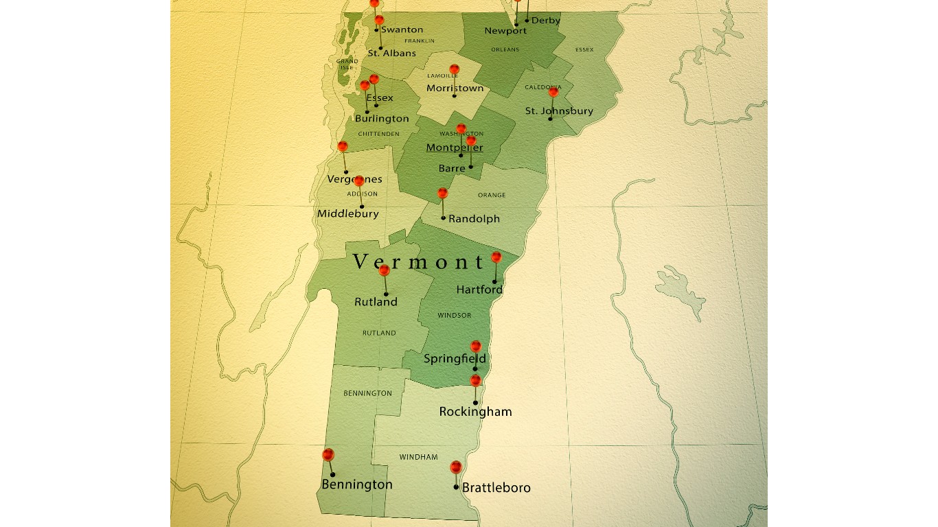
45. Vermont
> Population: 626,299
> Size (square miles): 9,216
> Capital: Montpelier
> Founded: March 4, 1791 (14th state to join)
> Famous landmarks: Rudyard Kipling House-Naulakha
Vermont had been part of the colony of New York, but when the king of England ruled in favor of New York over land disputes, Vermonters declared themselves a republic in 1777. Led by Ethan Allen, the fledgling nation even tried to join the province of Quebec during the Revolution but was rejected. After the war ended, Vermont paid New York money to settle land claims, and it was admitted to the Union in 1791. The Vermont-New Hampshire border meanders along the Connecticut River that forms a major part of Vermont’s eastern border. Vermont’s southern border with Massachusetts is basically a straight line on the 42nd latitude and its shortest boundary.
Source: PBFloyd / iStock via Getty Images
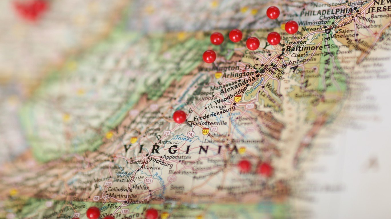
46. Virginia
> Population: 8,517,685
> Size (square miles): 39,490
> Capital: Richmond
> Founded: June 25, 1788 (10th state to join)
> Famous landmarks: Arlington National Cemetery
Virginia was the first colony settled by the English in 1607, and since that time, its size has changed. In 1792, nine counties called the Kentucky District of Virginia broke away from Virginia and became their own state. In 1863, the western counties of Virginia split to become the state of West Virginia. The Potomac River divides Virginia and Maryland. The borders between the two were determined in colonial times by various charters, agreements, and several Supreme Court rulings. Virginia also has territory on the southern part of the Delmarva peninsula because of aggressive claims by Surveyor General of Virginia Edmund Scarborough in the late 17th century. The Virginia-North Carolina border was delineated in 1665 as the 36° 30″ parallel of latitude and was resolved in two major joint survey efforts in 1728 and 1749. The Atlantic Ocean is to the east of Virginia.
[in-text-ad]
Source: klenger / iStock via Getty Images
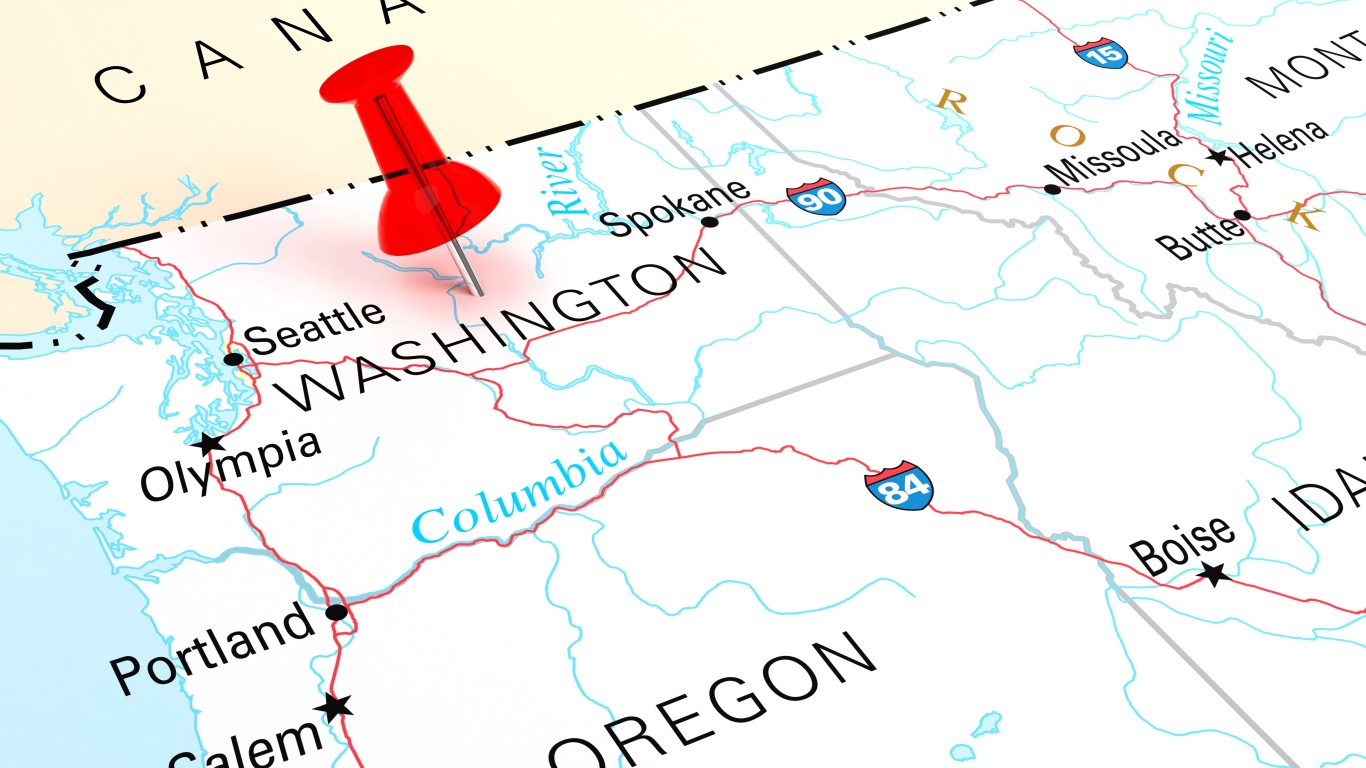
47. Washington
> Population: 7,535,591
> Size (square miles): 66,455
> Capital: Olympia
> Founded: Nov. 11, 1889 (42nd state to join)
> Famous landmarks: Space Needle
Sitting at the northwestern tip of the contiguous U.S., Washington’s northern border with Canada and western boundary with the Pacific Ocean were in place well before it became a state. The area that is now Washington joined America as part of the Oregon Territory in 1848.
In just a few years, people in the northern part of the Oregon Territory felt neglected by their legislators, and in 1853, Congress allowed for the creation of the Washington Territory, which includes present-day Washington, Idaho’s panhandle, and part of western Montana. Washington was reshaped to its current borders in 1863, when the Idaho Territory was established, though it would have to wait more than 25 more years as a territory before gaining statehood.
 24/7 Wall St.
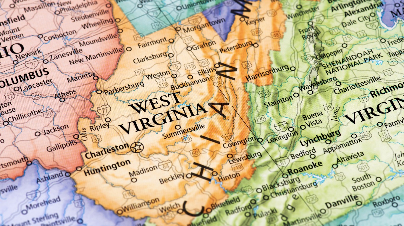
Source: omersukrugoksu / iStock via Getty Images
48. West Virginia
> Population: 1,805,832
> Size (square miles): 24,038
> Capital: Charleston
> Founded: June 20, 1863 (35th state to join)
> Famous landmarks: The Greenbriar
In 1863, the western counties of Virginia split to become the state of West Virginia. The state’s eastern border runs along the Mason-Dixon Line. The state has two panhandles. The Northern Panhandle was formed by the Ohio River along West Virginia’s western border. The southern section of the Eastern Panhandle was created after West Virginia separated from Virginia. To the north, the Potomac River and the North Branch of the Potomac River create a natural border.
Source: omersukrugoksu / iStock via Getty Images
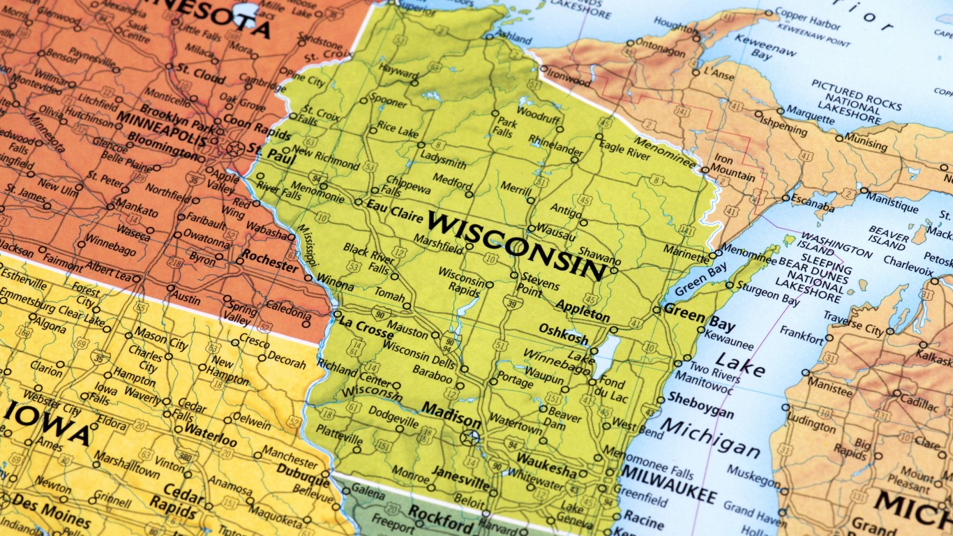
49. Wisconsin
> Population: 5,813,568
> Size (square miles): 54,157
> Capital: Madison
> Founded: May 29, 1848 (30th state to join)
> Famous landmarks: Lambeau Field
Wisconsin was included in the Louisiana Purchase of 1803 and it used to make up a vast landmass in the Midwest when it was called the Wisconsin Territory. That area included present-day states of Wisconsin, Minnesota, Iowa, and the eastern half of the Dakotas. The Upper Peninsula was part of the Wisconsin Territory, but the federal government took that away from Wisconsin in 1836 and gave it to Michigan to help resolve a dispute with Ohio. Chicago would have been in Wisconsin had not Illinois lobbied to move its border northward. The Mississippi River forms a section of Wisconsin’s western border, while Great Lakes Superior and Michigan border Wisconsin to the north and east, respectively.
[in-text-ad-2]
Source: klenger / iStock via Getty Images
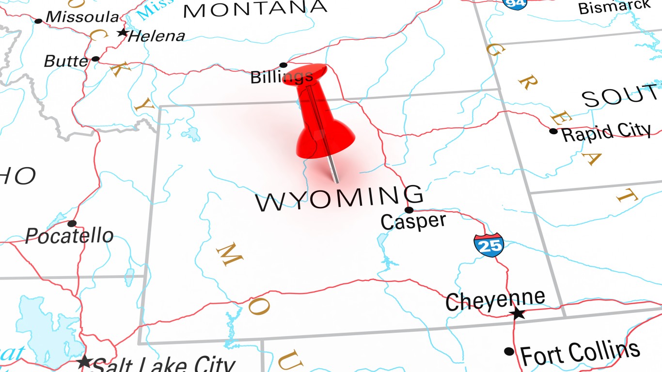
50. Wyoming
> Population: 577,737
> Size (square miles): 97,093
> Capital: Cheyenne
> Founded: July 10, 1890 (44th state to join)
> Famous landmarks: Old Faithful
Unlike many territories that later became states, Wyoming’s shape never changed throughout its time as a territory. The rectangular state was made from parts of the Dakota, Idaho, and Utah territories and used longitudinal and latitudinal lines to mark its borders. The state’s borders run along the 104 and 111 degrees west longitude lines and 41 and 45 degrees north latitude lines.
Smart Investors Are Quietly Loading Up on These “Dividend Legends” (Sponsored)
If you want your portfolio to pay you cash like clockwork, it’s time to stop blindly following conventional wisdom like relying on Dividend Aristocrats. There’s a better option, and we want to show you. We’re offering a brand-new report on 2 stocks we believe offer the rare combination of a high dividend yield and significant stock appreciation upside. If you’re tired of feeling one step behind in this market, this free report is a must-read for you.
Click here to download your FREE copy of “2 Dividend Legends to Hold Forever” and start improving your portfolio today.
Thank you for reading! Have some feedback for us?
Contact the 24/7 Wall St. editorial team.
Editors' Picks